Cinder Hill

Hill, Mountain in Somerset South Somerset

England

Cinder Hill

Newhaven Bridge Over the River Yarty, it is named on old maps. The new A303 has made it into a massive structure.
See <span class="nowrap"><a title="https://maps.nls.uk/view/101724922" rel="nofollow ugc noopener" href="https://maps.nls.uk/view/101724922">Link</a><img style="margin-left:2px;" alt="External link" title="External link - shift click to open in new window" src="https://s1.geograph.org.uk/img/external.png" width="10" height="10"/></span>  Thanks to Jon Alexander for locating the bridge via Speculative Upload.
This photo appeared among family photos from my deceased father, Alfred W. Wills, seen on the left, my uncle E. George Wills, on right, with third person unknown.  Taken on trip to North Tawton in 1938.
Newhaven Bridge Credit: Unknown. Photo from Wills family archives

Cinder Hill is a prominent hill located in Somerset, England. With an elevation of approximately 296 meters (971 feet), it is classified as a hill rather than a mountain. The hill is situated near the village of Priddy, which lies within the Mendip Hills Area of Outstanding Natural Beauty.

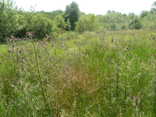
Cinder Hill is renowned for its distinctive appearance, characterized by its steep slopes covered in rough grassland and heather. The name "Cinder Hill" originates from the numerous fragments of small coal, known as cinder, that can be found scattered across the terrain. These fragments are remnants of the coal mining activities that took place in the area during the 19th and early 20th centuries.

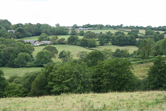
The hill offers breathtaking panoramic views of the surrounding countryside, making it a popular destination for hikers, nature enthusiasts, and photographers. On a clear day, visitors can enjoy sweeping vistas of the Mendip Hills, the Somerset Levels, and even as far as the Bristol Channel.

The area surrounding Cinder Hill is also rich in biodiversity. The hill is home to a variety of plant species, including heather, gorse, and bracken. It provides habitat for several bird species, such as skylarks and stonechats, as well as various insects and small mammals.

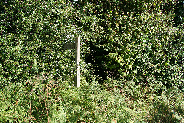
Cinder Hill is easily accessible, with several footpaths and trails leading to its summit. It offers a peaceful and tranquil setting for those seeking to escape the hustle and bustle of everyday life and immerse themselves in the beauty of the Somerset countryside.

If you have any feedback on the listing, please let us know in the comments section below.
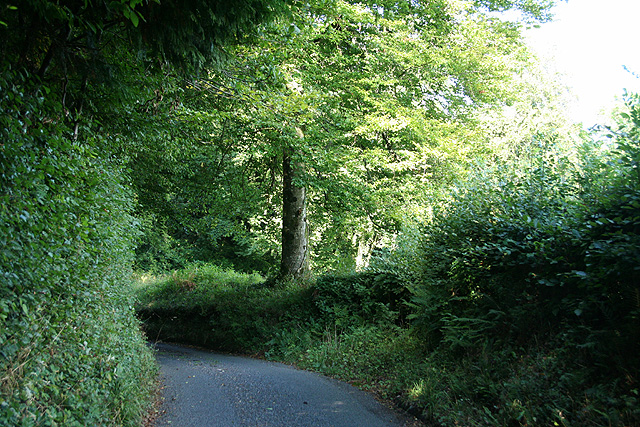
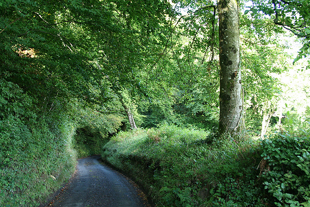
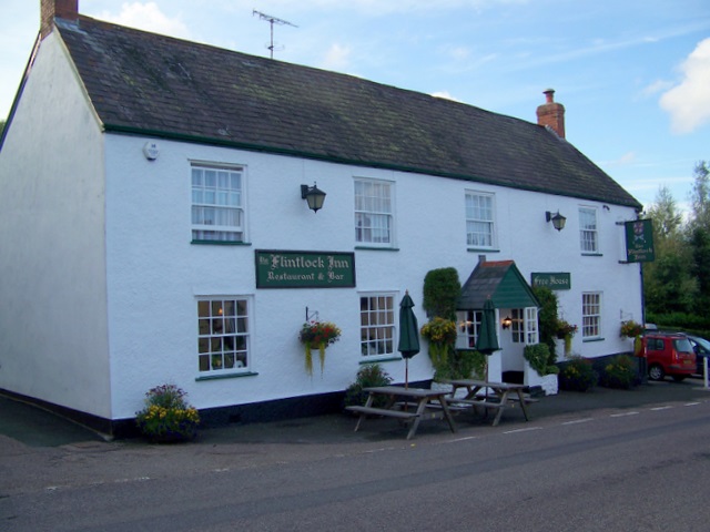
Cinder Hill Images

Images are sourced within 2km of 50.896337/-3.0427186 or Grid Reference ST2611. Thanks to Geograph Open Source API. All images are credited.

Newhaven Bridge Over the River Yarty, it is named on old maps. The new A303 has made it into a massive structure.
See <span class="nowrap"><a title="https://maps.nls.uk/view/101724922" rel="nofollow ugc noopener" href="https://maps.nls.uk/view/101724922">Link</a><img style="margin-left:2px;" alt="External link" title="External link - shift click to open in new window" src="https://s1.geograph.org.uk/img/external.png" width="10" height="10"/></span>  Thanks to Jon Alexander for locating the bridge via Speculative Upload.
This photo appeared among family photos from my deceased father, Alfred W. Wills, seen on the left, my uncle E. George Wills, on right, with third person unknown.  Taken on trip to North Tawton in 1938.
Newhaven Bridge
Over the River Yarty, it is named on old maps. The new A303 has made it into a massive structure. See LinkExternal link Thanks to Jon Alexander for locating the bridge via Speculative Upload. This photo appeared among family photos from my deceased father, Alfred W. Wills, seen on the left, my uncle E. George Wills, on right, with third person unknown. Taken on trip to North Tawton in 1938.
Yarcombe: Keats Mill, Bishopswood By the river Yarty, its leat was blocked off in 1968 to prevent flooding. The mill building is hidden above farm buildings, to the left of the gate, under trees. Reputedly the smallest watermill in Somerset
Yarcombe: Keats Mill, Bishopswood
By the river Yarty, its leat was blocked off in 1968 to prevent flooding. The mill building is hidden above farm buildings, to the left of the gate, under trees. Reputedly the smallest watermill in Somerset
View near Belcombe, Blackdown Hills Looking west-north-west across the valley of a tributary of the Yarty. The wooded area beyond the road is Freshmoor, an SSSI, consisting of bog habitat with scrub.
View near Belcombe, Blackdown Hills
Looking west-north-west across the valley of a tributary of the Yarty. The wooded area beyond the road is Freshmoor, an SSSI, consisting of bog habitat with scrub.
Freshmoor SSSI Looking south-west across part of Freshmoor Site of Special Scientific Interest on a slope in the Blackdown Hills, a bog habitat in decline. Prominent here is Cirsium palustre, the Marsh Thistle.
Freshmoor SSSI
Looking south-west across part of Freshmoor Site of Special Scientific Interest on a slope in the Blackdown Hills, a bog habitat in decline. Prominent here is Cirsium palustre, the Marsh Thistle.
Combe St Nicholas: Lower Beetham The road ahead leads to Higher Beetham and on to Bishopswood; the left turn runs to Whitestaunton. Street Ash is reached by turning right. Looking north west across a staggered crossroads
Combe St Nicholas: Lower Beetham
The road ahead leads to Higher Beetham and on to Bishopswood; the left turn runs to Whitestaunton. Street Ash is reached by turning right. Looking north west across a staggered crossroads
Combe St Nicholas: house at Higher Beetham Looking north-north-east by the entrance
Combe St Nicholas: house at Higher Beetham
Looking north-north-east by the entrance
Whitestaunton: St Andrew’s church Looking west-north-west. The cross seen by the south porch was restored after the first world war and serves to commemorate the men of the parish who died in that conflict. Incorporated into the gable of the south porch is a sundial, above a statue in a niche. Near the church the site of a Roman villa was discovered in the mid 1840s
Whitestaunton: St Andrew’s church
Looking west-north-west. The cross seen by the south porch was restored after the first world war and serves to commemorate the men of the parish who died in that conflict. Incorporated into the gable of the south porch is a sundial, above a statue in a niche. Near the church the site of a Roman villa was discovered in the mid 1840s
Whitestaunton: towards Waldron’s Farm Looking west-north-west over a valley
Whitestaunton: towards Waldron’s Farm
Looking west-north-west over a valley
Otterford: Bishopswood The house by the milestone is ‘Valley View’. Looking north west
Otterford: Bishopswood
The house by the milestone is ‘Valley View’. Looking north west
Otterford: The Candlelight Inn At Bishopswood. Looking north-north-east
Otterford: The Candlelight Inn
At Bishopswood. Looking north-north-east
Buckland St Mary: The Old Smithy, Newtown The property extends down to the A30 Trunk Road. William Stone, a wheelwright and carpenter, operated here from at least 1836 until his death sometime before 1851. The smithy itself stood in the fork of the main road and this lane. The business continued in existence until the 1940s. 
[Source: Derrick Warren. Under the Spreading Chestnut Tree. Article in Bulletin 78, of the Somerset Industrial Archaeological Society, August 1998]
Buckland St Mary: The Old Smithy, Newtown
The property extends down to the A30 Trunk Road. William Stone, a wheelwright and carpenter, operated here from at least 1836 until his death sometime before 1851. The smithy itself stood in the fork of the main road and this lane. The business continued in existence until the 1940s. [Source: Derrick Warren. Under the Spreading Chestnut Tree. Article in Bulletin 78, of the Somerset Industrial Archaeological Society, August 1998]
Buckland St Mary: footpath to Higher Beetham Seen by Giants Grave Road, looking east-south-east. The footpath is through the gap in the hedge, where a stile leads into a field
Buckland St Mary: footpath to Higher Beetham
Seen by Giants Grave Road, looking east-south-east. The footpath is through the gap in the hedge, where a stile leads into a field
Whitestaunton: by Cinder Hill Looking east-north-east on a lane which runs to Northay
Whitestaunton: by Cinder Hill
Looking east-north-east on a lane which runs to Northay
Whitestaunton: by Cinder Hill Copse Looking northeast on a lane to Northay
Whitestaunton: by Cinder Hill Copse
Looking northeast on a lane to Northay
Whitestaunton: near Woodhayes Farm Looking south east over a valley west from the village
Whitestaunton: near Woodhayes Farm
Looking south east over a valley west from the village
Whitestaunton: near Southcroft Looking north-north-west across the Yarty valley towards the roofs of Elscombe Farm. The A303 London – Exeter Trunk Road lies hidden in the valley below
Whitestaunton: near Southcroft
Looking north-north-west across the Yarty valley towards the roofs of Elscombe Farm. The A303 London – Exeter Trunk Road lies hidden in the valley below
Yarcombe: Marsh The cottage on the left offers bed and breakfast and also provides cream teas. This was clearly on the old London – Exeter road, with an inn and a garage nearby, but the hamlet had already been bypassed by the 1940s and is now bypassed by a dual-carriageway nearby in the Yarty valley. Looking north east in the London direction
Yarcombe: Marsh
The cottage on the left offers bed and breakfast and also provides cream teas. This was clearly on the old London – Exeter road, with an inn and a garage nearby, but the hamlet had already been bypassed by the 1940s and is now bypassed by a dual-carriageway nearby in the Yarty valley. Looking north east in the London direction
Yarcombe: the Yarty valley Looking north east over the valley towards Buckland St Mary church which stands on the wooded hill beyond
Yarcombe: the Yarty valley
Looking north east over the valley towards Buckland St Mary church which stands on the wooded hill beyond
Show me another place!

Cinder Hill is located at Grid Ref: ST2611 (Lat: 50.896337, Lng: -3.0427186)

Administrative County: Somerset

District: South Somerset

Police Authority: Avon and Somerset

What 3 Words

///crops.reseller.conveys. Near Chard, Somerset

Nearby Locations

Hill Copse Cinder Hill

Related Wikis

Long Lye Meadow

Long Lye Meadow (grid reference ST267119) is a 3.3 hectare biological Site of Special Scientific Interest at Buckland St Mary in the Blackdown Hills, Somerset...

Long Lye

Long Lye (grid reference ST265122) is an 11.7 hectare (29.0 acre) biological Site of Special Scientific Interest at Buckland St Mary in the Blackdown Hills...

Marsh, Devon

Marsh is a village in the Blackdown Hills, Devon, England. It is part of the East Devon district, and close to the River Yarty and border with Somerset...
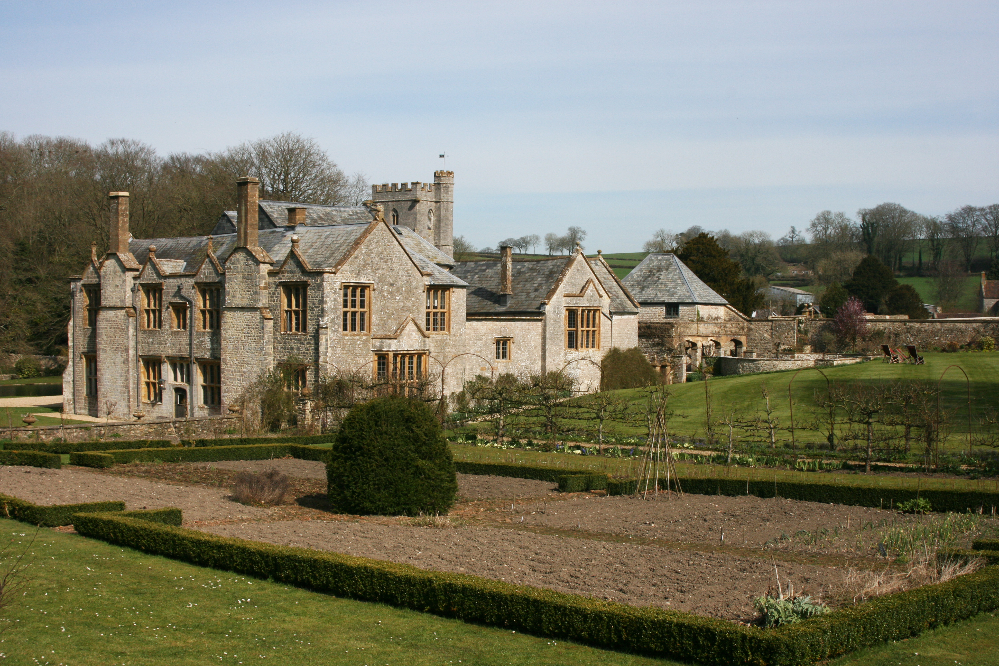
Whitestaunton Manor

Whitestaunton Manor in the village of Whitestaunton, Somerset, England was built in the 15th century as a Hall house and has been designated as a Grade...

Whitestaunton

Whitestaunton is a village and civil parish in the South Somerset district of Somerset, England. The parish includes the hamlet of Northay. It was known...

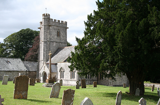
St Andrew's Church, Whitestaunton

The Church of St Andrew in Whitestaunton, Somerset, England, dates from the 13th century and has been designated as a Grade I listed building.The Perpendicular...

Freshmoor

Freshmoor (grid reference ST280125) is an 11.2 hectare (27.7 acre) biological Site of Special Scientific Interest in Somerset, notified in 1989. Freshmoor...

Buckland St Mary

Buckland St Mary is a village and parish in Somerset, England, situated 6 miles (9.7 km) to the west of Ilminster and 8 miles (12.9 km) south of Taunton...

Nearby Amenities

Located within 500m of 50.896337,-3.0427186
Power: pole
Source: bing
Lat/Long: 50.8964051/-3.0453908
Power: pole
Source: bing
Lat/Long: 50.89747/-3.0425558
Power: pole
Source: bing
Lat/Long: 50.8974954/-3.0403952
Power: pole
Source: bing
Lat/Long: 50.8974869/-3.0415915
Power: pole
Source: bing
Lat/Long: 50.8975064/-3.038967
Power: pole
Source: bing
Transformer: distribution
Lat/Long: 50.8975149/-3.037418
Power: pole
Source: bing
Lat/Long: 50.8973482/-3.0363746
The data included in this document is from www.openstreetmap.org. The data is made available under ODbL.

Have you been to Cinder Hill?

Leave your review of Cinder Hill below (or comments, questions and feedback).