Back Hill

Hill, Mountain in Morayshire

Scotland

Back Hill

Barley, Innes Another wide verge designed to improve visibility at a crossroads. It would have been taken from the field growing barley in the background.
Barley, Innes Credit: Richard Webb

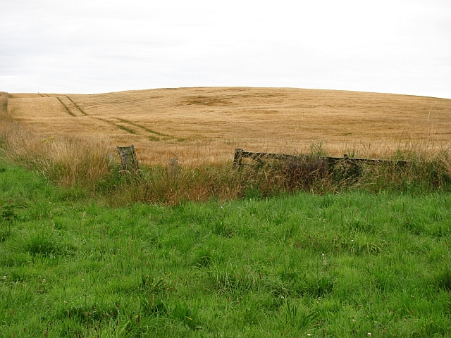
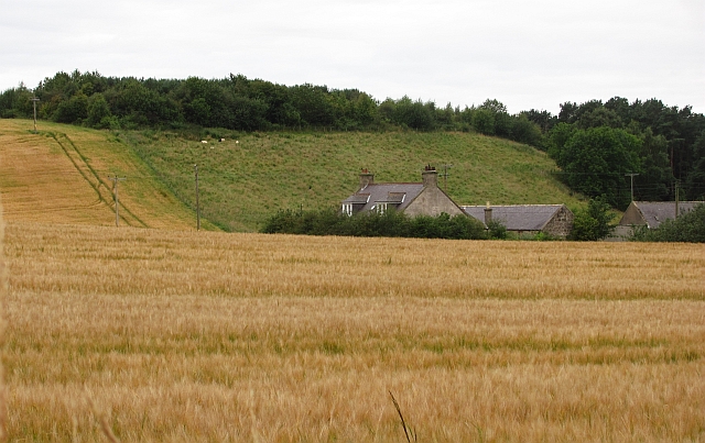
Back Hill is a prominent hill located in the county of Morayshire, Scotland. It is situated near the village of Dallas, approximately 15 miles southwest of the town of Elgin. With an elevation of around 1,237 feet (377 meters), it is considered a hill rather than a mountain.

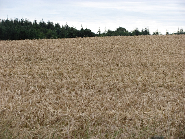
The hill is part of the larger Dallas Hill range, which stretches across the surrounding countryside. Back Hill is characterized by its gently sloping sides and a prominent summit that offers stunning panoramic views of the surrounding landscape. The terrain primarily consists of grassy slopes with scattered patches of heather and rocky outcrops.

Back Hill is a popular destination for outdoor enthusiasts, hikers, and nature lovers. Its relatively accessible location and well-maintained paths make it a favorite spot for those seeking a moderate hiking challenge. The summit provides breathtaking vistas of the Moray Firth and the rolling hills of Morayshire, offering an opportunity for visitors to appreciate the natural beauty of the region.

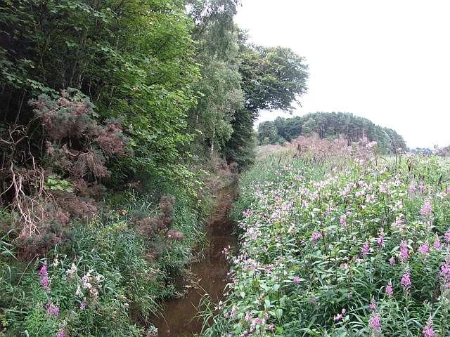
The hill is also home to a diverse range of flora and fauna, including various species of birds, small mammals, and wildflowers. It provides an important habitat for wildlife and contributes to the biodiversity of the area.

Overall, Back Hill is a picturesque and accessible hill in Morayshire, offering visitors a chance to connect with nature, enjoy breathtaking views, and explore the stunning Scottish countryside.

If you have any feedback on the listing, please let us know in the comments section below.
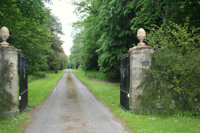
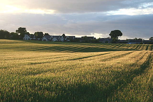
Back Hill Images

Images are sourced within 2km of 57.659471/-3.2310254 or Grid Reference NJ2663. Thanks to Geograph Open Source API. All images are credited.

Barley, Innes Another wide verge designed to improve visibility at a crossroads. It would have been taken from the field growing barley in the background.
Barley, Innes
Another wide verge designed to improve visibility at a crossroads. It would have been taken from the field growing barley in the background.
Barley, Nether Meft Nether Meft is on the other side of the barley field.
Barley, Nether Meft
Nether Meft is on the other side of the barley field.
Field of barley Barley, usually grown for malting is the big crop in this area, as with all of low lying land along the East of Scotland and northeastern England.
Field of barley
Barley, usually grown for malting is the big crop in this area, as with all of low lying land along the East of Scotland and northeastern England.
Longhill Burn Most watercourses in the low lying land behind the dunes have been turned into straight and deep drains. This one is infested with Himalayan Balsam, a rapidly spreading invasive weed.
Longhill Burn
Most watercourses in the low lying land behind the dunes have been turned into straight and deep drains. This one is infested with Himalayan Balsam, a rapidly spreading invasive weed.
Roadside woodland A small oakwood beside the B9103.
Roadside woodland
A small oakwood beside the B9103.
River Lossie Looking downstream from the bridge at Calcots.
River Lossie
Looking downstream from the bridge at Calcots.
Innes House Built between 1640 and 1651, Innes House is situated amidst 3000 acres of decideous and coniferous woodlands. The estate is well managed with spectacular gardens and a true feeling of yester days.
Innes House
Built between 1640 and 1651, Innes House is situated amidst 3000 acres of decideous and coniferous woodlands. The estate is well managed with spectacular gardens and a true feeling of yester days.
That's what I would call an Oak! This Lucombe Oak was planted in the grounds of Innes House in 1744, a year prior to "The Forty Five" or the Jacobite Rebellion.
That's what I would call an Oak!
This Lucombe Oak was planted in the grounds of Innes House in 1744, a year prior to "The Forty Five" or the Jacobite Rebellion.
Old, old, Larch by Innes House Planted in the early 18th Century this larch tree is awesome to behold with its cumbersome horizontal boughs and giant girth.
Old, old, Larch by Innes House
Planted in the early 18th Century this larch tree is awesome to behold with its cumbersome horizontal boughs and giant girth.
Walled in the garden for over 200 years! What stories this Lucombe Oak could tell; planted during the Jacobite Rising of 1745 it has thrived in the grounds of Innes House ever since.
Walled in the garden for over 200 years!
What stories this Lucombe Oak could tell; planted during the Jacobite Rising of 1745 it has thrived in the grounds of Innes House ever since.
Innes House viewed from the avenue.
Gateway to Innes House
A Lucombe Oak by Innes House planted in 1744 This magnificent specimen was planted in 1744, the year before the Jacobite Rebellion.
A Lucombe Oak by Innes House planted in 1744
This magnificent specimen was planted in 1744, the year before the Jacobite Rebellion.
The Lucombe Oak of Innes House
No ordinary tree At a glance it's just another tree but how wrong you are! This is the Handkerchief or Pocket handkerchief tree or Dove tree which was once the Holy Grail of exotic flora. The Handkerchief tree (Davidiaceae involucrata) was first seen in China in 1868 and introduced to Europe in 1904.
No ordinary tree
At a glance it's just another tree but how wrong you are! This is the Handkerchief or Pocket handkerchief tree or Dove tree which was once the Holy Grail of exotic flora. The Handkerchief tree (Davidiaceae involucrata) was first seen in China in 1868 and introduced to Europe in 1904.
From the far East; Where else? The bark of the Handkerchief tree just oozes oriental mystique. Just look at the scaley dragon-like limbs or the dancing white bracts of the foliage which flutter in silky fluency during their brief earthly appearance. <a href="https://www.geograph.org.uk/photo/2984158">NJ2764 : Handkerchiefs aflutter....</a>
From the far East; Where else?
The bark of the Handkerchief tree just oozes oriental mystique. Just look at the scaley dragon-like limbs or the dancing white bracts of the foliage which flutter in silky fluency during their brief earthly appearance. NJ2764 : Handkerchiefs aflutter....
Handkerchiefs aflutter.... The most striking feature of the Handkerchief Tree is its flowers, or more accurately, the bracts, or protective leaf, outside the flowers. The flowers themselves are small and purple but are literally overshadowed by two thin white bracts, one of which is twice the size of the other. These delicate bracts flutter in the breeze providing the tree with its common names, the Handkerchief Tree, the Pocket Handkerchief Tree or the Dove Tree. The leaves of Davidia involucrata are a vivid green and are heart-shaped with a fine point at the tip. The flowers emerge in May, followed by dark green fruit in the form of a hard nut, which turns purple when ripe.
Handkerchiefs aflutter....
The most striking feature of the Handkerchief Tree is its flowers, or more accurately, the bracts, or protective leaf, outside the flowers. The flowers themselves are small and purple but are literally overshadowed by two thin white bracts, one of which is twice the size of the other. These delicate bracts flutter in the breeze providing the tree with its common names, the Handkerchief Tree, the Pocket Handkerchief Tree or the Dove Tree. The leaves of Davidia involucrata are a vivid green and are heart-shaped with a fine point at the tip. The flowers emerge in May, followed by dark green fruit in the form of a hard nut, which turns purple when ripe.
The lure of the Orient The tree can reach a height of 20m (65ft) in the wild but does not produce its signature flowers until it is about ten years old. The leaves of Davidia involucrata are a vivid green and are heart-shaped with a fine point at the tip. The flowers emerge in May, followed by dark green fruit in the form of a hard nut, which turns purple when ripe
The lure of the Orient
The tree can reach a height of 20m (65ft) in the wild but does not produce its signature flowers until it is about ten years old. The leaves of Davidia involucrata are a vivid green and are heart-shaped with a fine point at the tip. The flowers emerge in May, followed by dark green fruit in the form of a hard nut, which turns purple when ripe
Show me another place!

Back Hill is located at Grid Ref: NJ2663 (Lat: 57.659471, Lng: -3.2310254)

Unitary Authority: Moray

Police Authority: North East

What 3 Words

///inviting.tinsel.apes. Near Lhanbryde, Moray

Related Wikis

Calcots railway station

Calcots railway station was a railway station in the parish of St Andrews-Lhanbryd, Moray. The railway station was opened by the Great North of Scotland...

RAF Milltown

Royal Air Force Milltown or RAF Milltown is a former Royal Air Force station located south of the Moray Firth and 3.6 miles (5.8 km) north east of Elgin...

Urquhart railway station

Urquhart railway station was a railway station serving the village of Urquhart, parish of Urquhart, Moray. The railway station was opened by the Great...

Urquhart, Moray

Urquhart ( ; Scottish Gaelic: Urchard) is a small village in Moray, Scotland. It is approximately 5 miles (8 km) east of Elgin, between the villages of...

Urquhart Priory

Urquhart Priory was a Benedictine monastic community in Moray; the priory was dedicated to the Holy Trinity. It was founded by King David I of Scotland...

Lhanbryde

Lhanbryde (Gaelic: Lann Brìghde) is a village that lies 4 miles (6.4 km) east of Elgin in Moray, Scotland. Previously bisected by the A96, it was bypassed...

Battle of Pitgaveny

The Battle of Pitgaveny, also called the Battle of Bothnagowan, was fought between the forces of Duncan I of Scotland and Macbeth, at the time the ruler...

Lhanbryde railway station

Lhanbryde railway station served the village of Lhanbryde, Moray, Scotland from 1858 to 1964 on the Inverness and Aberdeen Junction Railway. == History... ==

Nearby Amenities

Located within 500m of 57.659471,-3.2310254
Power: pole
Lat/Long: 57.6638083/-3.2329145
Power: pole
Lat/Long: 57.66328/-3.2333091
Power: pole
Lat/Long: 57.6635378/-3.2342685
Power: pole
Lat/Long: 57.6630221/-3.23226
Power: pole
Lat/Long: 57.6627655/-3.2312202
Power: pole
Lat/Long: 57.6625052/-3.2301758
Power: pole
Lat/Long: 57.6622347/-3.2291384
Power: pole
Lat/Long: 57.661968/-3.2281058
Power: pole
Lat/Long: 57.6616987/-3.2270424
Power: pole
Lat/Long: 57.6608999/-3.2239729
Power: pole
Lat/Long: 57.6603639/-3.2244998
Power: pole
Lat/Long: 57.659857/-3.224963
Power: pole
Lat/Long: 57.6593324/-3.2254592
Power: pole
Lat/Long: 57.6587029/-3.2260618
Power: pole
Lat/Long: 57.6580746/-3.2266715
Power: pole
Lat/Long: 57.657435/-3.2272787
Power: pole
Lat/Long: 57.6568876/-3.2278151
Power: pole
Lat/Long: 57.6561683/-3.2284862
Power: pole
Lat/Long: 57.6558497/-3.2288123
Power: pole
Lat/Long: 57.6554274/-3.2292211
Power: pole
Lat/Long: 57.6557448/-3.2280373
Power: pole
Lat/Long: 57.6556436/-3.2272338
Power: pole
Lat/Long: 57.6628768/-3.2344788
Power: pole
Lat/Long: 57.6628578/-3.235717
The data included in this document is from www.openstreetmap.org. The data is made available under ODbL.

Have you been to Back Hill?

Leave your review of Back Hill below (or comments, questions and feedback).