Silver Hill
Hill, Mountain in Fife
Scotland
Silver Hill
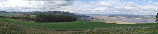
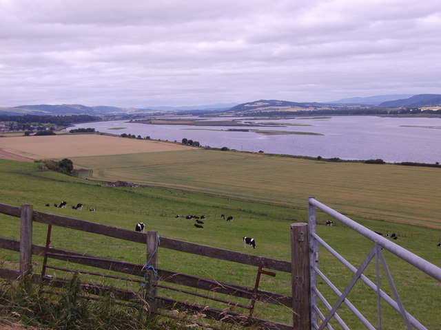
Silver Hill is a prominent landmark located in the region of Fife, Scotland. It is situated near the small village of Strathmiglo, approximately 11 kilometers northwest of Glenrothes. As its name suggests, Silver Hill is a notable hill or mountain, with an elevation of 355 meters (1,165 feet) above sea level.
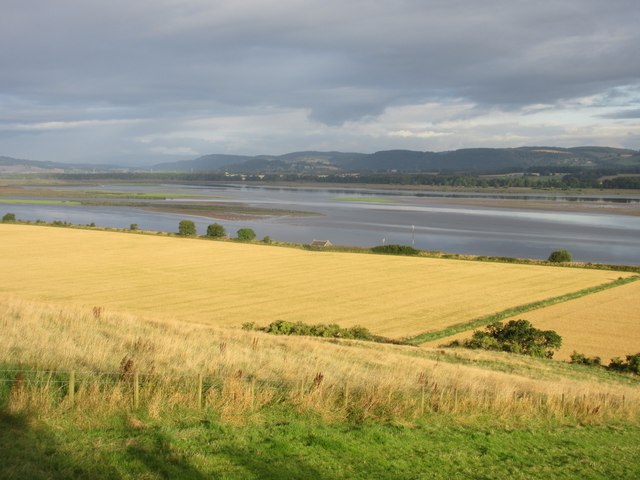
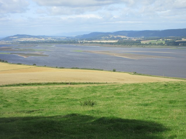
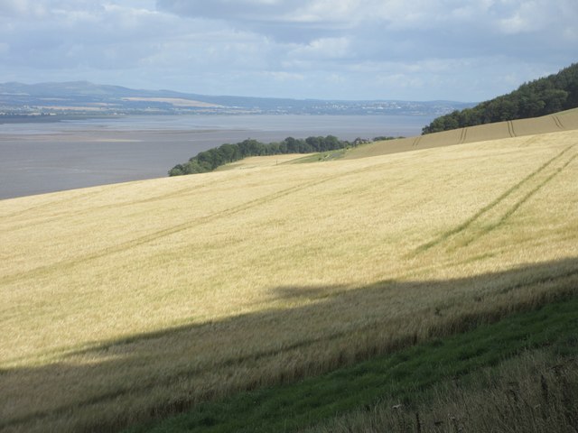
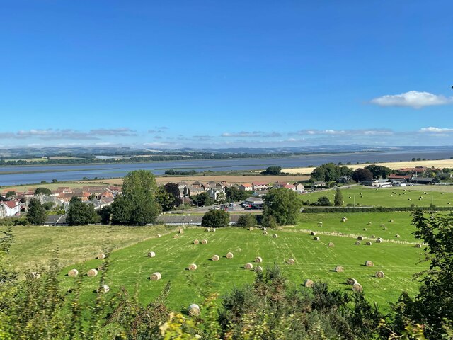
The hill offers stunning panoramic views of the surrounding countryside, making it a popular spot for outdoor enthusiasts and nature lovers. The summit provides an excellent vantage point from which to admire the picturesque landscapes of Fife and beyond, including the Lomond Hills and the Howe of Fife.
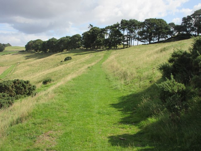
Silver Hill is characterized by its gentle slopes, covered in lush grass and heather, which make it relatively easy to traverse for hikers of all levels. The hill is accessible by a well-maintained footpath that winds its way up the slopes, offering a pleasant and scenic ascent.
The area surrounding Silver Hill is rich in wildlife, with various bird species, such as kestrels and buzzards, frequently spotted soaring overhead. The hill itself is home to a diverse range of flora and fauna, including wildflowers and small mammals.
Silver Hill holds historical significance as well, with remnants of ancient forts and settlements found in its vicinity. These archaeological sites provide a glimpse into the area's rich past and offer an interesting exploration opportunity for history enthusiasts.
Overall, Silver Hill in Fife is a captivating natural landmark, blending stunning vistas, abundant wildlife, and historical intrigue, making it a must-visit destination for those seeking an enriching outdoor experience in Scotland.
If you have any feedback on the listing, please let us know in the comments section below.
Silver Hill Images
Images are sourced within 2km of 56.353096/-3.2011478 or Grid Reference NO2518. Thanks to Geograph Open Source API. All images are credited.


Silver Hill is located at Grid Ref: NO2518 (Lat: 56.353096, Lng: -3.2011478)
Unitary Authority: Fife
Police Authority: Fife
What 3 Words
///rocker.sounds.skate. Near Newburgh, Fife
Nearby Locations
Related Wikis
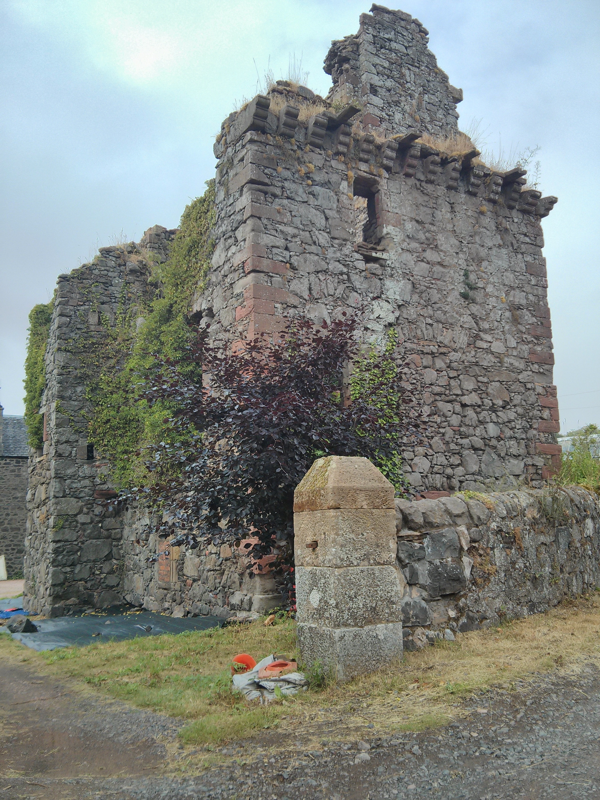
Denmylne Castle
Denmylne Castle is a ruined 16th-century tower house, about 1 mile (1.6 km) south east of Newburgh, Fife, Fife, Scotland, and 1 mile (1.6 km) north west...

Lindores Abbey distillery
Lindores Abbey distillery is a Scotch whisky distillery in Newburgh in the Lowlands whisky region in Scotland and is directly opposite the Abbey. It started...

Glenburnie railway station
Glenburnie railway station was a temporary terminus that served the area of Glenburnie, Fife, Scotland from 1847 to 1848 on the Edinburgh and Northern...

Clatchard Craig
The fort of Clatchard Craig was located on a hill of the same name by the Tay. A human presence on the site has been identified from the neolithic period...

Lindores Abbey
Lindores Abbey was a Tironensian abbey on the outskirts of Newburgh in Fife, Scotland. Now a reduced ruin, it lies on the southern banks of the River Tay...

Lindores
Lindores is a small village in Fife, Scotland, in the parish of Abdie, about 2 miles south-east of Newburgh. It is situated on the north-east shore of...

Lindores railway station
Lindores railway station served the village of Lindores, Fife, Scotland from 1909 to 1951 on the Newburgh and North Fife Railway. == History == The station...
Abdie stone
The Abdie stone is a Class I Pictish stone that stands in Abdie Churchyard, Lindores, Fife, Scotland. == Location == The stone originally stood on the...
Nearby Amenities
Located within 500m of 56.353096,-3.2011478Have you been to Silver Hill?
Leave your review of Silver Hill below (or comments, questions and feedback).