Hulme

Settlement in Staffordshire Staffordshire Moorlands

England

Hulme

Park Hall, Pine Forest
Park Hall, Pine Forest Credit: Brian Deegan

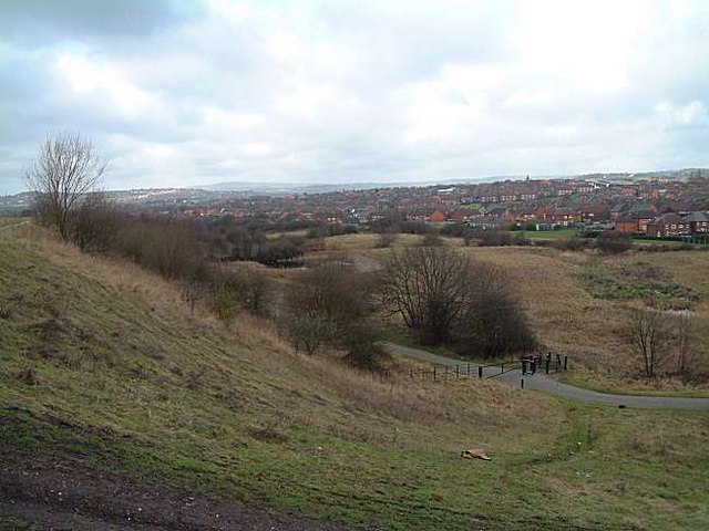
Hulme is a small village located in the county of Staffordshire, England. Situated approximately 4 miles northeast of the bustling market town of Stoke-on-Trent, Hulme is surrounded by picturesque countryside and offers a tranquil setting for its residents.

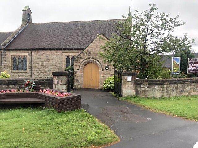
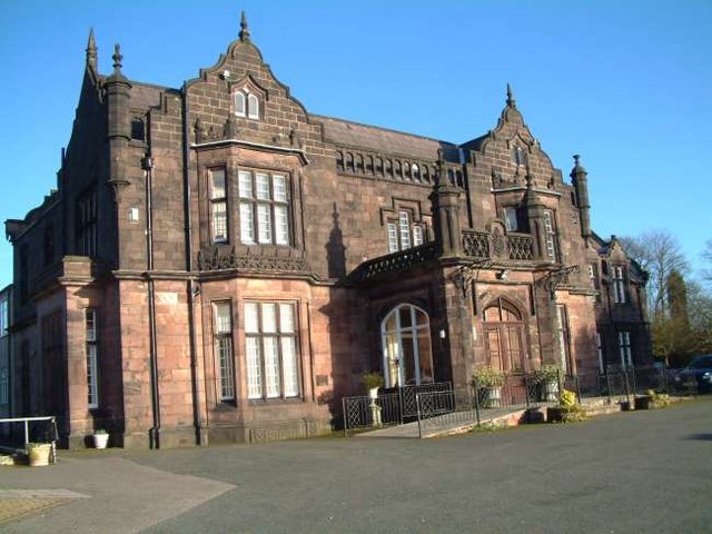
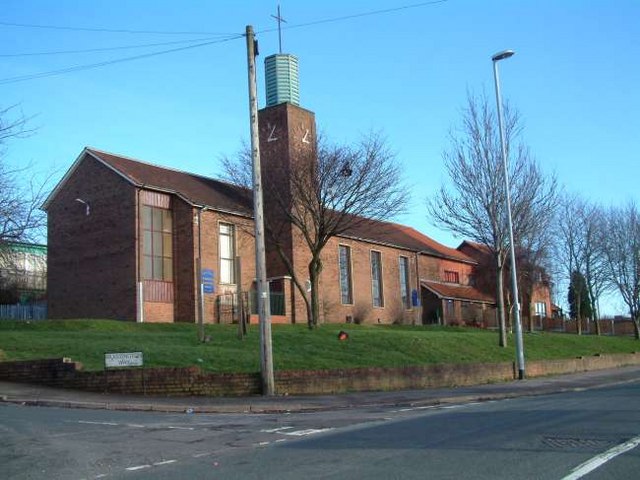
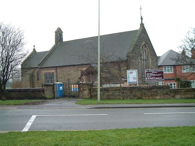
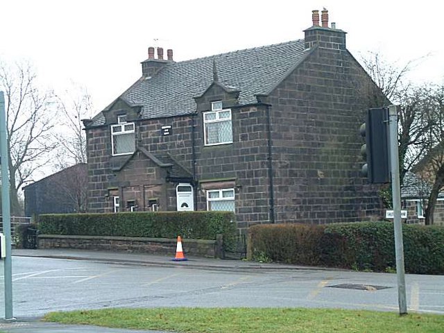
The village is known for its rich history, dating back to the medieval period. It is home to several historic buildings, including St. Giles Church, a Grade II listed building with architectural features from the 12th century. The church serves as a focal point for the community and hosts regular services and events.

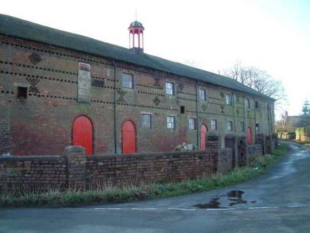
Hulme is primarily a residential area, consisting of a mix of traditional stone-built cottages and more modern housing developments. The village has a close-knit community with a population of around 500 people. Local amenities include a village hall, a small convenience store, and a primary school providing education for the younger residents.

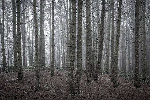
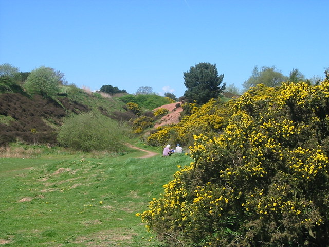
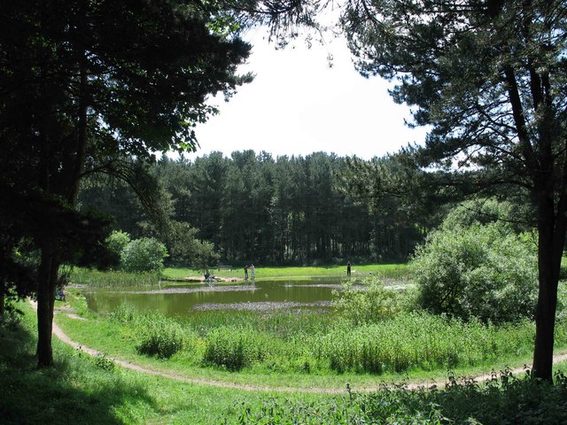
The surrounding countryside offers ample opportunities for outdoor activities such as hiking, cycling, and horse riding. Hulme is also within close proximity to the popular Peak District National Park, which attracts visitors from near and far.

Although Hulme is a peaceful village, it benefits from its close proximity to Stoke-on-Trent, which provides a wider range of amenities, including shopping centers, restaurants, and cultural attractions.

In summary, Hulme is a charming village in Staffordshire, offering a peaceful and picturesque setting for its residents, with a rich history, community spirit, and easy access to both the countryside and nearby urban areas.

If you have any feedback on the listing, please let us know in the comments section below.

Hulme Images

Images are sourced within 2km of 53.0098/-2.110406 or Grid Reference SJ9345. Thanks to Geograph Open Source API. All images are credited.

Park Hall, Pine Forest
Stoniers bus in Bentilee estate – 1979 Bentilee estate was a large post-WW2 council estate built primarily for the local mining community. Surprisingly, the main service into the estate was not provided exclusively by the main large operator in the area, Potteries Motor Traction, but shared with the family firm of Stoniers, based at Goldenhill to the north of the Five Towns. Like many small operators, most of the fleet consisted of second-hand vehicles, this example having originated with Nottingham City Transport in 1965. It is a Daimler Fleetline with Northern Counties bodywork to a Nottingham-specific design.

This is one of a series of views featuring buses in the 60s, 70s, and 80s. <a title="https://www.geograph.org.uk/search.php?i=137652761" href="https://www.geograph.org.uk/search.php?i=137652761">Link</a>
Stoniers bus in Bentilee estate – 1979
Bentilee estate was a large post-WW2 council estate built primarily for the local mining community. Surprisingly, the main service into the estate was not provided exclusively by the main large operator in the area, Potteries Motor Traction, but shared with the family firm of Stoniers, based at Goldenhill to the north of the Five Towns. Like many small operators, most of the fleet consisted of second-hand vehicles, this example having originated with Nottingham City Transport in 1965. It is a Daimler Fleetline with Northern Counties bodywork to a Nottingham-specific design. This is one of a series of views featuring buses in the 60s, 70s, and 80s. Link
St Philip's Church, Werrington
The Ashbank Pizza and carvery at Werrington
The Ashbank
Pizza and carvery at Werrington
Picnic at Park Hall Park Hall Country Park is Stoke on Trent's only National Nature Reserve comprising woodland, heathland & ponds. Gravel was extracted between 1939 & 1970 but nature has now taken over and the area is a haven for natural wildlife & fanua.
Picnic at Park Hall
Park Hall Country Park is Stoke on Trent's only National Nature Reserve comprising woodland, heathland & ponds. Gravel was extracted between 1939 & 1970 but nature has now taken over and the area is a haven for natural wildlife & fanua.
Gas Holder, Adderley Green One of only two remaining gas holders in Stoke on Trent. This one when full is a landmark for miles around.
Gas Holder, Adderley Green
One of only two remaining gas holders in Stoke on Trent. This one when full is a landmark for miles around.
Weston Coyney Park Hall, great place to walk among the trees
Weston Coyney
Park Hall, great place to walk among the trees
Timber Gateway panel by Anthony Hammond Location:  at Berryhill Greenway - at one of the entrances to the park nearest to Uffington Parade
Installed: 2000                         
Commissioned by:  Stoke on Trent City Council

Three gateways were constructed (Stone, timber and metal). The Timber Gateway is the central Gateway and commemorates agriculture and early mining in the area before it became heavily industrialised. 

The use of timber was part of the brief, in that it used a material that reflected the level of human development on the site at that time. 

The wooden panel consists of six wooden planks supported between two upright wooden poles, with a circular roundel of a bird on the front face at the top. The bird is flanked by a flower and a bird. Below is a butterfly, flanked by a dragonfly and a flower. Beneath is an owl, another bird, and a heron. Below are several animals, including a rabbit, a hedgehog, a lizard and another bird. At the bottom of the panel are two working men, one a farm labourer with a scythe, the other a miner with pick and shovel.

The panel is intended both to commemorate the past history of the site and to celebrate the variety of wildlife found there today.
Timber Gateway panel by Anthony Hammond
Location: at Berryhill Greenway - at one of the entrances to the park nearest to Uffington Parade Installed: 2000 Commissioned by: Stoke on Trent City Council Three gateways were constructed (Stone, timber and metal). The Timber Gateway is the central Gateway and commemorates agriculture and early mining in the area before it became heavily industrialised. The use of timber was part of the brief, in that it used a material that reflected the level of human development on the site at that time. The wooden panel consists of six wooden planks supported between two upright wooden poles, with a circular roundel of a bird on the front face at the top. The bird is flanked by a flower and a bird. Below is a butterfly, flanked by a dragonfly and a flower. Beneath is an owl, another bird, and a heron. Below are several animals, including a rabbit, a hedgehog, a lizard and another bird. At the bottom of the panel are two working men, one a farm labourer with a scythe, the other a miner with pick and shovel. The panel is intended both to commemorate the past history of the site and to celebrate the variety of wildlife found there today.
Colliery pithead Wheels at Berryhill Fields Location:  Berryhill fields - top of pathway at entrance to park nearest to Hall Hill Drive 
Installed: 2000        
Inscription: (concrete circle - surrounded by cobblestones) 

"THERE'S BLACK ASH BENEATH
THE GREEN
GOB FIRES BURNING UNDER GAS HILL
AND BENEATH IT ALL
BONES OF MINERS BURIED
STILL"

Description: 

Four pithead winding wheels, half set into the ground. Pointing in four different direction. The wheels are painted black and have nameplates which depict the local seams mined and some of the collieries in the area. 

The wheels are set on the levelled off spoil heap of Mossfield Colliery. 


The inscription commemorates a fatal accident at Mossfield colliery in 1889.
The Cockshead seam (which was mined at Mossfield) was subject to gob fires (an area that has been left void after the coal has been extracted and fires are caused by spontaneous combustion). 
A series of explosions began on the 12th September , probably due to the access of air to the gob fire and the crushing of the extremely thin pillars of coal separating the two workings. On October 16th 1889 there was a massive explosion, resulting in the death of 64 miners at Mossfield Colliery.
Colliery pithead Wheels at Berryhill Fields
Location: Berryhill fields - top of pathway at entrance to park nearest to Hall Hill Drive Installed: 2000 Inscription: (concrete circle - surrounded by cobblestones) "THERE'S BLACK ASH BENEATH THE GREEN GOB FIRES BURNING UNDER GAS HILL AND BENEATH IT ALL BONES OF MINERS BURIED STILL" Description: Four pithead winding wheels, half set into the ground. Pointing in four different direction. The wheels are painted black and have nameplates which depict the local seams mined and some of the collieries in the area. The wheels are set on the levelled off spoil heap of Mossfield Colliery. The inscription commemorates a fatal accident at Mossfield colliery in 1889. The Cockshead seam (which was mined at Mossfield) was subject to gob fires (an area that has been left void after the coal has been extracted and fires are caused by spontaneous combustion). A series of explosions began on the 12th September , probably due to the access of air to the gob fire and the crushing of the extremely thin pillars of coal separating the two workings. On October 16th 1889 there was a massive explosion, resulting in the death of 64 miners at Mossfield Colliery.
Ash Hall Job Meigh (a local potter) became the owner of the Ash Estate on 27th of March 1837. Construction of the house must have begun almost immediately because the date “1837” appears on the rainwater heads on the front of the building.

1840 account of the hall: "The exterior is of hard stone, (gotten on the estate,) of an Ash colour, giving the building an air of antiquity which harmonizes with the stile (sic.) of the architecture, being that of the manor house or Tudor era, with oriel windows, surmounted with pediments or pointed gables. An elegant portico, composed of three Gothic arches, turreted and embattled, adorns the front. The adjoining lawn is tastefully laid out and planted; and altogether, we must characterize Ash Hall as one of the most beautiful seats we have had occasion to notice.”
Ash Hall
Job Meigh (a local potter) became the owner of the Ash Estate on 27th of March 1837. Construction of the house must have begun almost immediately because the date “1837” appears on the rainwater heads on the front of the building. 1840 account of the hall: "The exterior is of hard stone, (gotten on the estate,) of an Ash colour, giving the building an air of antiquity which harmonizes with the stile (sic.) of the architecture, being that of the manor house or Tudor era, with oriel windows, surmounted with pediments or pointed gables. An elegant portico, composed of three Gothic arches, turreted and embattled, adorns the front. The adjoining lawn is tastefully laid out and planted; and altogether, we must characterize Ash Hall as one of the most beautiful seats we have had occasion to notice.”
Stonehouse Farm, Hulme
St. Stephens Church, Bentilee Bentilee is situated approximately 2 miles east of Stoke-upon-Trent city centre. 
The church is in Dawlish Drive just off the A5272 (B5040)
St. Stephens Church, Bentilee
Bentilee is situated approximately 2 miles east of Stoke-upon-Trent city centre. The church is in Dawlish Drive just off the A5272 (B5040)
Willfield Conference Centre Was part of Willfield School - Lauder Place North, Off Beverley Drive Bentilee.

Now houses: Willfield Neighbourhood College; Willfield Conference Centre; Willfield Youth Club; Bentilee Volunteers Office.
Willfield Conference Centre
Was part of Willfield School - Lauder Place North, Off Beverley Drive Bentilee. Now houses: Willfield Neighbourhood College; Willfield Conference Centre; Willfield Youth Club; Bentilee Volunteers Office.
Smallbrook Farm, Staffordshire Moorlands on the A520 Leek Road from Weston Coyney to Cellarhead
Smallbrook Farm, Staffordshire Moorlands
on the A520 Leek Road from Weston Coyney to Cellarhead
Methodist Church, Werrington Methodist Church, Ash Bank, Werrington, Staffordshire Moorlands
Methodist Church, Werrington
Methodist Church, Ash Bank, Werrington, Staffordshire Moorlands
St. Philip's Church, Werrington Corner of Ash bank Road and Salters Lane
St. Philip's Church, Werrington
Corner of Ash bank Road and Salters Lane
Cottages at Salters Lane, Werrington Ash Estate cottages on the corner of Ashbank road and Salters Lane

In 1854 Job Meigh (a famous potter) built a pair of labourers cottages at the corner of Salters Lane and Ash Bank Road. 

One of the occupiers was William Bonnell who was probably employed as the estate carpenter between about 1841 and 1871. He originally lived at Lawsons Farm on Brookhouse Lane but by 1871 was living in one of the new cottages.

See Job Meigh's hall:- <a title="https://www.geograph.org.uk/photo/335671" href="https://www.geograph.org.uk/photo/335671">Link</a>
Cottages at Salters Lane, Werrington
Ash Estate cottages on the corner of Ashbank road and Salters Lane In 1854 Job Meigh (a famous potter) built a pair of labourers cottages at the corner of Salters Lane and Ash Bank Road. One of the occupiers was William Bonnell who was probably employed as the estate carpenter between about 1841 and 1871. He originally lived at Lawsons Farm on Brookhouse Lane but by 1871 was living in one of the new cottages. See Job Meigh's hall:- Link
Bentilee Bentilee and Ubberly housing estates - seen from Mossfield
Bentilee
Bentilee and Ubberly housing estates - seen from Mossfield
Show me another place!

Hulme is located at Grid Ref: SJ9345 (Lat: 53.0098, Lng: -2.110406)

Administrative County: Staffordshire

District: Staffordshire Moorlands

Police Authority: Staffordshire

What 3 Words

///chair.hers.broker. Near Longton, Staffordshire

Nearby Locations

Hulme

Related Wikis

Discovery Academy, Stoke-on-Trent

Discovery Academy is a mixed secondary school located in the Bentilee area of Stoke-on-Trent in the English county of Staffordshire.The school was formed...

Hulme, Staffordshire

Hulme is a hamlet on the outskirts of the city of Stoke-on-Trent, in the English county of Staffordshire. Unlike Hulme End and Upper Hulme, Hulme village...

Bentilee

Bentilee is a housing estate in Stoke-on-Trent, Staffordshire, England, between Hanley and Longton, and parallel with Fenton. == History == Built in the...

Armshead

Armshead is a village in Staffordshire, England. Population details for the 2011 census can be found under Cheddleton.

Ash Bank

Ash Bank is a small village in Stoke-on-Trent near to Werrington. Located in the village is Ash Hall, an 1830s mansion built by Broad Street Pottery Works...

Abbey Hulton

Abbey Hulton is an area of Stoke-on-Trent, Staffordshire, England, named after the abbey that existed between the 13th and 16th centuries. == History... ==

Hanley High School, Stoke-on-Trent

Hanley High School founded in 1894 was originally a co-educational grammar school based in the centre of Stoke on Trent. In 1938, the girls moved to Thistley...

Mitchell High School, Stoke-on-Trent

Mitchell High School was a comprehensive school located in Bucknall, Stoke on Trent, England. == Admissions == Situated in the east of Stoke-on-Trent in...

Nearby Amenities

Located within 500m of 53.0098,-2.110406
Power: pole
Lat/Long: 53.0135327/-2.1135029
Power: pole
Lat/Long: 53.0131567/-2.1124595
Power: pole
Lat/Long: 53.0128614/-2.1113518
Power: pole
Lat/Long: 53.0121287/-2.1080151
Power: pole
Lat/Long: 53.011898/-2.1063361
Power: pole
Lat/Long: 53.0121271/-2.1043566
Generator Method: photovoltaic
Generator Output Electricity: yes
Generator Source: solar
Generator Type: solar_photovoltaic_panel
Location: roof
Power: generator
Lat/Long: 53.0086768/-2.1163327
Generator Method: photovoltaic
Generator Output Electricity: yes
Generator Source: solar
Generator Type: solar_photovoltaic_panel
Location: roof
Power: generator
Lat/Long: 53.0088672/-2.1166196
Generator Method: photovoltaic
Generator Output Electricity: yes
Generator Source: solar
Generator Type: solar_photovoltaic_panel
Location: roof
Power: generator
Lat/Long: 53.0088866/-2.1166894
Bench
Lat/Long: 53.0057947/-2.1096625
Generator Method: photovoltaic
Generator Output Electricity: yes
Generator Source: solar
Generator Type: solar_photovoltaic_panel
Location: roof
Power: generator
Lat/Long: 53.0097177/-2.1172473
Generator Method: photovoltaic
Generator Output Electricity: yes
Generator Source: solar
Generator Type: solar_photovoltaic_panel
Location: roof
Power: generator
Lat/Long: 53.0095321/-2.1176107
Generator Method: photovoltaic
Generator Output Electricity: yes
Generator Source: solar
Generator Type: solar_photovoltaic_panel
Location: roof
Power: generator
Lat/Long: 53.0086348/-2.1173023
The data included in this document is from www.openstreetmap.org. The data is made available under ODbL.

Have you been to Hulme?

Leave your review of Hulme below (or comments, questions and feedback).