Ramsey Knowe

Hill, Mountain in Selkirkshire

Scotland

Ramsey Knowe

Southern Upland Way nr St Mary's Loch Path leading down to Riskenhope Hope before heading up to Pikestone Rig.
Southern Upland Way nr St Mary's Loch Credit: Graham Hewitt

Ramsey Knowe is a prominent hill located in the historical county of Selkirkshire, in the Scottish Borders region of Scotland. Standing at an elevation of approximately 1,312 feet (400 meters), it offers breathtaking panoramic views of the surrounding countryside. The hill is situated near the small village of Ettrickbridge, about 7 miles (11 kilometers) southeast of the town of Selkirk.

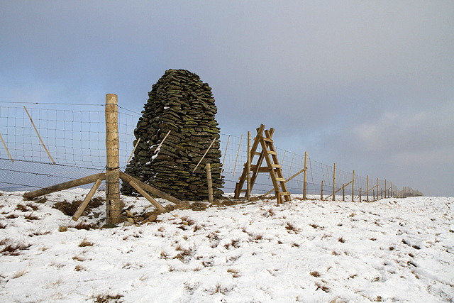
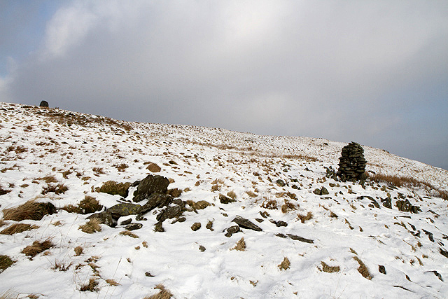
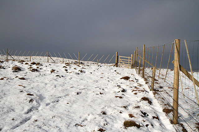
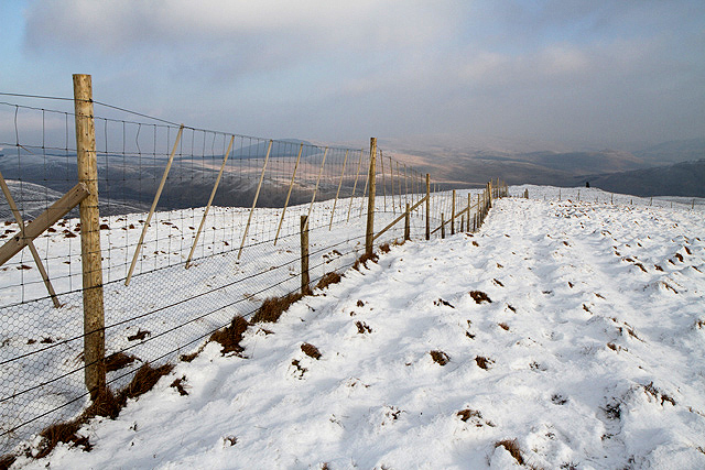
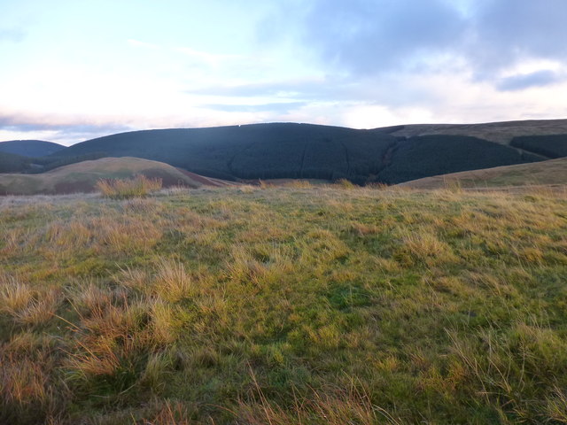
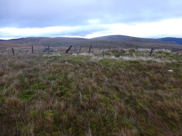
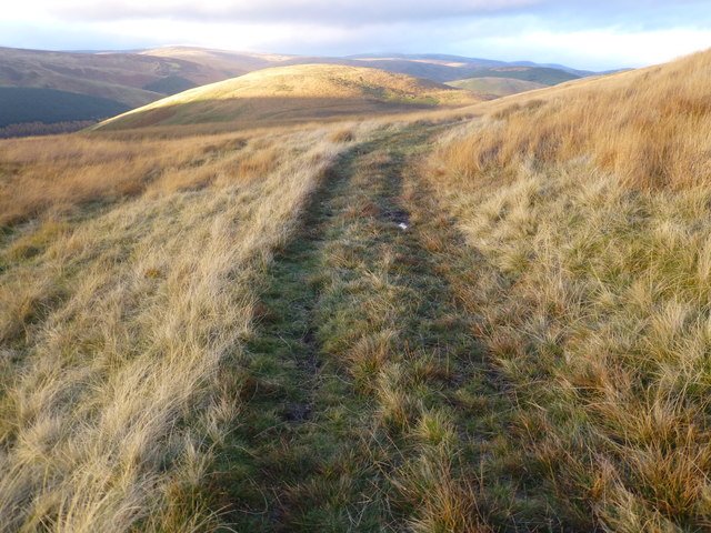
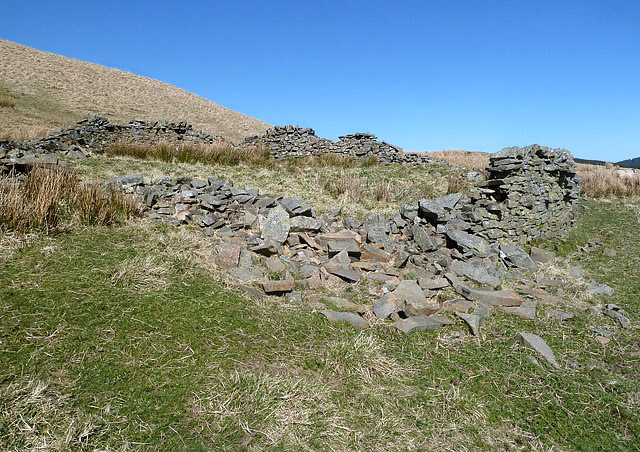
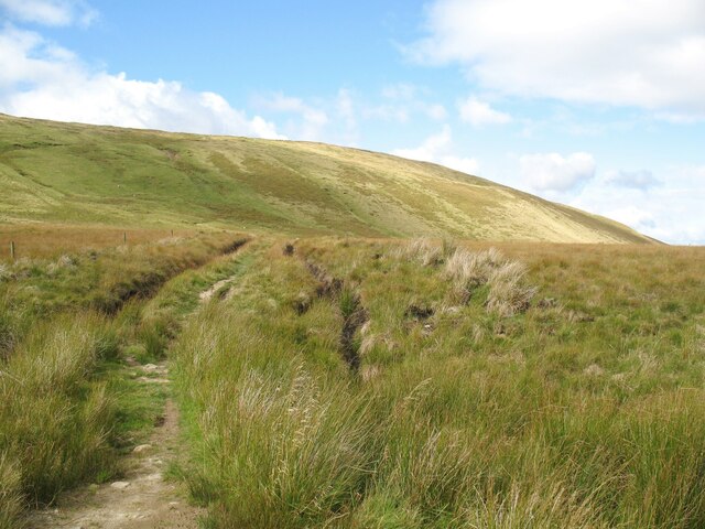
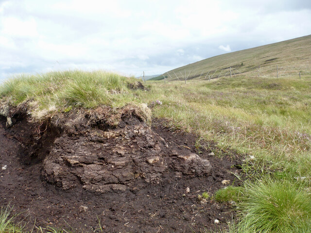
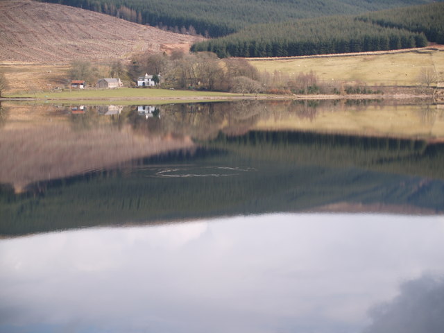
Ramsey Knowe is characterized by its rugged terrain, featuring steep slopes covered in heather and grasses. The hill is part of the Southern Uplands range, which stretches across southern Scotland. It is a popular destination for hikers and outdoor enthusiasts, who are drawn to its natural beauty and peaceful atmosphere.

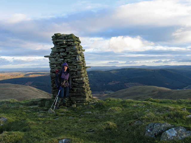
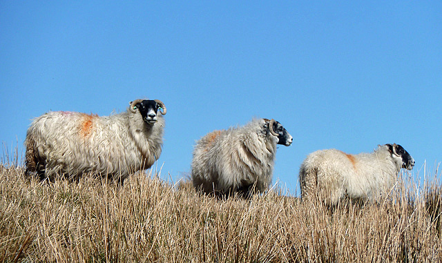
The summit of Ramsey Knowe provides a commanding view of the Ettrick Valley and the rolling hills that define the landscape. On a clear day, it is possible to see as far as the Moffat Hills to the northwest and the Cheviot Hills to the southeast. The hill is also home to a variety of wildlife, including birds of prey such as buzzards and kestrels.

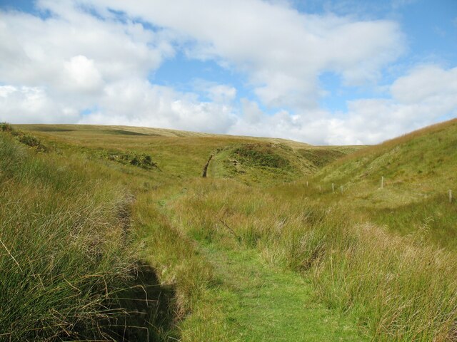
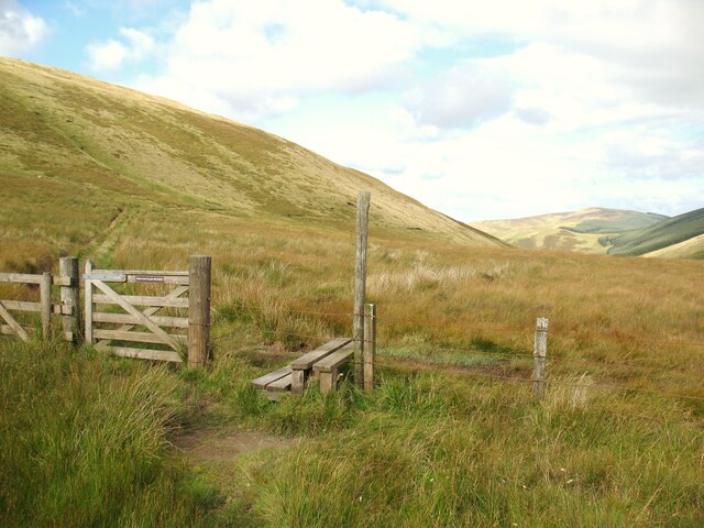
Access to Ramsey Knowe is relatively straightforward, with several paths and trails leading to the summit. These routes vary in difficulty, catering to both experienced hikers and those seeking a more leisurely stroll. Visitors are advised to wear appropriate footwear and be prepared for changing weather conditions, as the hill can be exposed to the elements.

Overall, Ramsey Knowe is a picturesque hill in Selkirkshire, offering visitors a chance to immerse themselves in the natural beauty of the Scottish Borders.

If you have any feedback on the listing, please let us know in the comments section below.
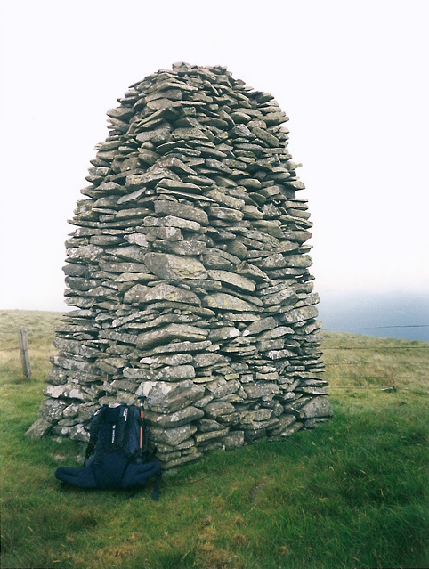
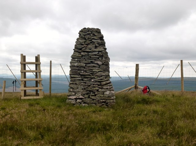
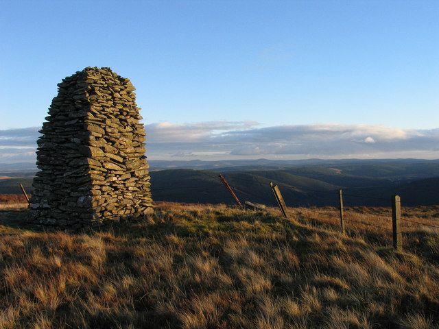
Ramsey Knowe Images

Images are sourced within 2km of 55.439712/-3.1828572 or Grid Reference NT2516. Thanks to Geograph Open Source API. All images are credited.

Southern Upland Way nr St Mary's Loch Path leading down to Riskenhope Hope before heading up to Pikestone Rig.
Southern Upland Way nr St Mary's Loch
Path leading down to Riskenhope Hope before heading up to Pikestone Rig.
The Jubilee Cairn on Ward Law This substantial cairn is very close to the 594m summit of the hill. The old fence over the hill has been replaced with a new fence which is 1.7m high to the top wire and this was the only stile I noticed on my walk.
The Jubilee Cairn on Ward Law
This substantial cairn is very close to the 594m summit of the hill. The old fence over the hill has been replaced with a new fence which is 1.7m high to the top wire and this was the only stile I noticed on my walk.
A cairn on Ward Law This cairn is at the 580m contour with the top of the Jubilee Cairn showing on the far left.
A cairn on Ward Law
This cairn is at the 580m contour with the top of the Jubilee Cairn showing on the far left.
A fence on Ward Law The old fence that was easy to climb over has been replaced with this new fence. The height to the top wire is 1.7m.
A fence on Ward Law
The old fence that was easy to climb over has been replaced with this new fence. The height to the top wire is 1.7m.
A fence on Ward Law The old fence that was easy to climb over has been replaced with this new fence. The height to the top wire is 1.7m.
A fence on Ward Law
The old fence that was easy to climb over has been replaced with this new fence. The height to the top wire is 1.7m.
The Jubilee Cairn on Ward Law It is likely that this huge cairn was built to commemorate the jubilee of Queen Victoria. A new high fence has recently replaced the old stob and wire fence by the cairn – see <a href="https://www.geograph.org.uk/photo/2813769">NT2615 : The Jubilee Cairn on Ward Law</a>.
The Jubilee Cairn on Ward Law
It is likely that this huge cairn was built to commemorate the jubilee of Queen Victoria. A new high fence has recently replaced the old stob and wire fence by the cairn – see NT2615 : The Jubilee Cairn on Ward Law.
Ward Law Parked near George V post box of old post office which shut in 1990 to SE of summit. Relatively easy ascent up track and longish grass + bracken at times. Summit fence has been upgraded.
Name: Ward Law
Hill number: 1916
Height: 594m / 1949ft
Area: 28B: The River Tweed to the English Border
Class: Ma,5D
Grid ref: NT 26236 15950
Summit feature: ground by very large cairn
Drop: 158m
Col: 436m  NT241162
Ward Law
Parked near George V post box of old post office which shut in 1990 to SE of summit. Relatively easy ascent up track and longish grass + bracken at times. Summit fence has been upgraded. Name: Ward Law Hill number: 1916 Height: 594m / 1949ft Area: 28B: The River Tweed to the English Border Class: Ma,5D Grid ref: NT 26236 15950 Summit feature: ground by very large cairn Drop: 158m Col: 436m NT241162
Cairn north-east of summit of Ward Law A well built, (if now leaning), cairn which lies north-east of the highest point of Ward Law, where there's a more impressive and more upright cairn. The valley beyond is that of the Hopehouse Burn and its tributaries.
Cairn north-east of summit of Ward Law
A well built, (if now leaning), cairn which lies north-east of the highest point of Ward Law, where there's a more impressive and more upright cairn. The valley beyond is that of the Hopehouse Burn and its tributaries.
Jubilee Cairn on Ward Law Low angled sunshine reddens the vegetation at the summit of Ward Law and the cairn which was built, (or at least named), presumably, to commemorate the Jubilee of Queen Victoria.
Jubilee Cairn on Ward Law
Low angled sunshine reddens the vegetation at the summit of Ward Law and the cairn which was built, (or at least named), presumably, to commemorate the Jubilee of Queen Victoria.
Peat Hill Last P30 of our linear walk with Minto. Parked near Capplegill then used track to Bodesbeck Farm. Track towards col then Bodesbeck Law, Nowtrig Head, Mid Rig, Bell Craig, Andrewhinney Hill, Trowgrain Middle and Herman's Law before Chris Watson went to collect the car while I pressed on with Minto to bag TuMPs Peniestone Knowe and Peat Hill.
Name: Peat Hill
Hill number: 105801
Height: 461m / 1512ft
Area: 28B: The River Tweed to the English Border
Class: 4
Grid ref: NT242185 (est)
Drop: 39m
Col: 422m
Peat Hill
Last P30 of our linear walk with Minto. Parked near Capplegill then used track to Bodesbeck Farm. Track towards col then Bodesbeck Law, Nowtrig Head, Mid Rig, Bell Craig, Andrewhinney Hill, Trowgrain Middle and Herman's Law before Chris Watson went to collect the car while I pressed on with Minto to bag TuMPs Peniestone Knowe and Peat Hill. Name: Peat Hill Hill number: 105801 Height: 461m / 1512ft Area: 28B: The River Tweed to the English Border Class: 4 Grid ref: NT242185 (est) Drop: 39m Col: 422m
Peniestone Knowe Parked near Capplegill then used track to Bodesbeck Farm. Track towards col then Bodesbeck Law, Nowtrig Head, Mid Rig, Bell Craig, Andrewhinney Hill, Trowgrain Middle and Herman's Law before Chris Watson went to collect the car while I pressed on with Minto to bag TuMPs Peniestone Knowe and Peat Hill.
Name: Peniestone Knowe
Hill number: 7380
Height: 551m / 1808ft
Area: 28B: The River Tweed to the English Border
Class: 5D
Grid ref: NT236164 (est)
Drop: 53m
Col: 498m  NT228158
Peniestone Knowe
Parked near Capplegill then used track to Bodesbeck Farm. Track towards col then Bodesbeck Law, Nowtrig Head, Mid Rig, Bell Craig, Andrewhinney Hill, Trowgrain Middle and Herman's Law before Chris Watson went to collect the car while I pressed on with Minto to bag TuMPs Peniestone Knowe and Peat Hill. Name: Peniestone Knowe Hill number: 7380 Height: 551m / 1808ft Area: 28B: The River Tweed to the English Border Class: 5D Grid ref: NT236164 (est) Drop: 53m Col: 498m NT228158
View Towards Peat Hill Name: Peat Hill
Hill number: 105801
Height: 461m / 1512ft
Area: 28B: The River Tweed to the English Border
Class: 4
Grid ref: NT242185 (est)
Drop: 39m
Col: 422m
View Towards Peat Hill
Name: Peat Hill Hill number: 105801 Height: 461m / 1512ft Area: 28B: The River Tweed to the English Border Class: 4 Grid ref: NT242185 (est) Drop: 39m Col: 422m
Sheep on Peat Hill These sheep were grazing by a ruined sheepfold on Peat Hill.
Sheep on Peat Hill
These sheep were grazing by a ruined sheepfold on Peat Hill.
A ruined sheepfold on Peat Hill
The Southern Upland Way near Shiel Sike The Southern Upland Way climbs beside Scabcleuch Burn towards Scabcleuch Moss.
The Southern Upland Way near Shiel Sike
The Southern Upland Way climbs beside Scabcleuch Burn towards Scabcleuch Moss.
Track on Scabcleuch Moss The track, bounded by drainage ditches, is part of the Southern Upland Way between Scabcleuch and Riskinhope Hope.
Track on Scabcleuch Moss
The track, bounded by drainage ditches, is part of the Southern Upland Way between Scabcleuch and Riskinhope Hope.
Gate and Stile Near Scabcleuch Moss and below the ridge of Peniestone Knowe, this gate and stile are on the route of the Southern Upland Way between Scabcleuch and Riskinhope Hope.
Gate and Stile
Near Scabcleuch Moss and below the ridge of Peniestone Knowe, this gate and stile are on the route of the Southern Upland Way between Scabcleuch and Riskinhope Hope.
Peat hags between Ramsey Knowe and Ward Law An area of eroded peat in the col between these two rounded Borders hills.
Peat hags between Ramsey Knowe and Ward Law
An area of eroded peat in the col between these two rounded Borders hills.
Show me another place!

Ramsey Knowe is located at Grid Ref: NT2516 (Lat: 55.439712, Lng: -3.1828572)

Unitary Authority: The Scottish Borders

Police Authority: The Lothians and Scottish Borders

What 3 Words

///loaders.magnets.mend. Near Ettrick, Scottish Borders

Nearby Locations

Ramsey Knowe

Related Wikis

Ettrick, Scotland

Ettrick (Scottish Gaelic: Eadaraig, IPA: [ˈet̪əɾɪkʲ]) is a small village and civil parish in the Scottish Borders area of Scotland. It is located on the...
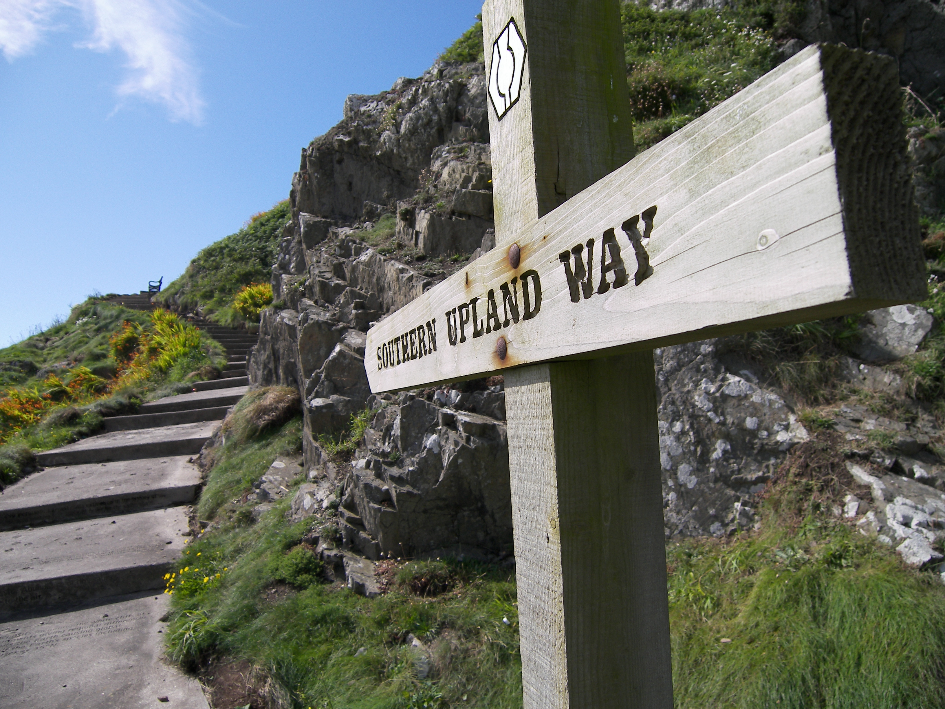
Southern Upland Way

The Southern Upland Way is a 344-kilometre (214 mi) coast-to-coast long-distance footpath in southern Scotland. The route links Portpatrick in the west...

Bowerhope

Bowerhope is a village off the A708, in the Scottish Borders area of Scotland, on the banks of St Mary's Loch in Ettrick Forest. == See also == List of...

Tushielaw Tower

Tushielaw Tower is a 16th-century tower house, about 2.5 miles (4.0 km) north and east of Ettrick, Scottish Borders, Scotland, and west of Ettrick Water...

Have you been to Ramsey Knowe?

Leave your review of Ramsey Knowe below (or comments, questions and feedback).