Earl's Hill
Hill, Mountain in Selkirkshire
Scotland
Earl's Hill

Earl's Hill is a prominent hill located in the historic county of Selkirkshire, Scotland. It is situated in the southern part of the county, near the town of Selkirk, and forms part of the Southern Uplands range. Standing at an elevation of approximately 376 meters (1,234 feet), Earl's Hill offers stunning panoramic views of the surrounding countryside.
The hill is characterized by its distinct conical shape, making it a notable landmark in the area. It is covered in grass and heather, creating a picturesque landscape that changes with the seasons. Earl's Hill is also home to a variety of plant and animal species, including birds of prey such as kestrels and buzzards.
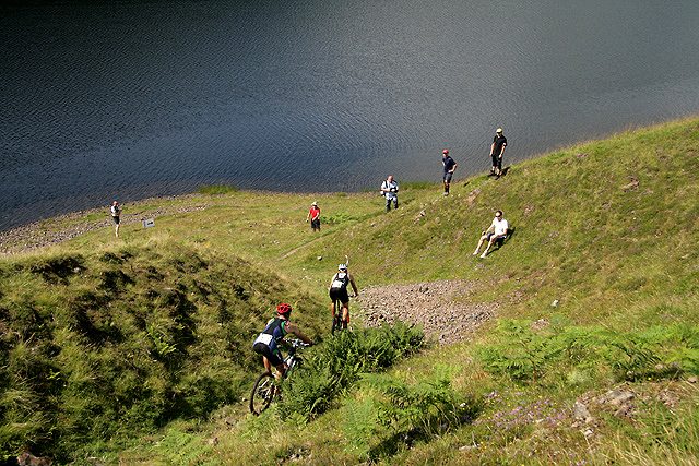
Due to its relatively low elevation, Earl's Hill is a popular destination for hikers and nature enthusiasts of all ages and abilities. Several well-marked trails lead to the summit, offering visitors the opportunity to enjoy a leisurely walk while taking in the breathtaking scenery.
At the peak of Earl's Hill, there is a trig point, which serves as a marker for mapping and surveying purposes. This feature adds to the hill's allure and is often used as a reference point by local residents and visitors alike.
Overall, Earl's Hill in Selkirkshire is a beautiful natural landmark that attracts outdoor enthusiasts seeking to immerse themselves in the tranquility of the Scottish countryside. Its accessibility, stunning views, and diverse wildlife make it a must-visit destination for anyone exploring the region.
If you have any feedback on the listing, please let us know in the comments section below.
Earl's Hill Images
Images are sourced within 2km of 55.456644/-3.1835379 or Grid Reference NT2518. Thanks to Geograph Open Source API. All images are credited.


Earl's Hill is located at Grid Ref: NT2518 (Lat: 55.456644, Lng: -3.1835379)
Unitary Authority: The Scottish Borders
Police Authority: The Lothians and Scottish Borders
What 3 Words
///spelling.received.unusable. Near Ettrick, Scottish Borders
Nearby Locations
Related Wikis
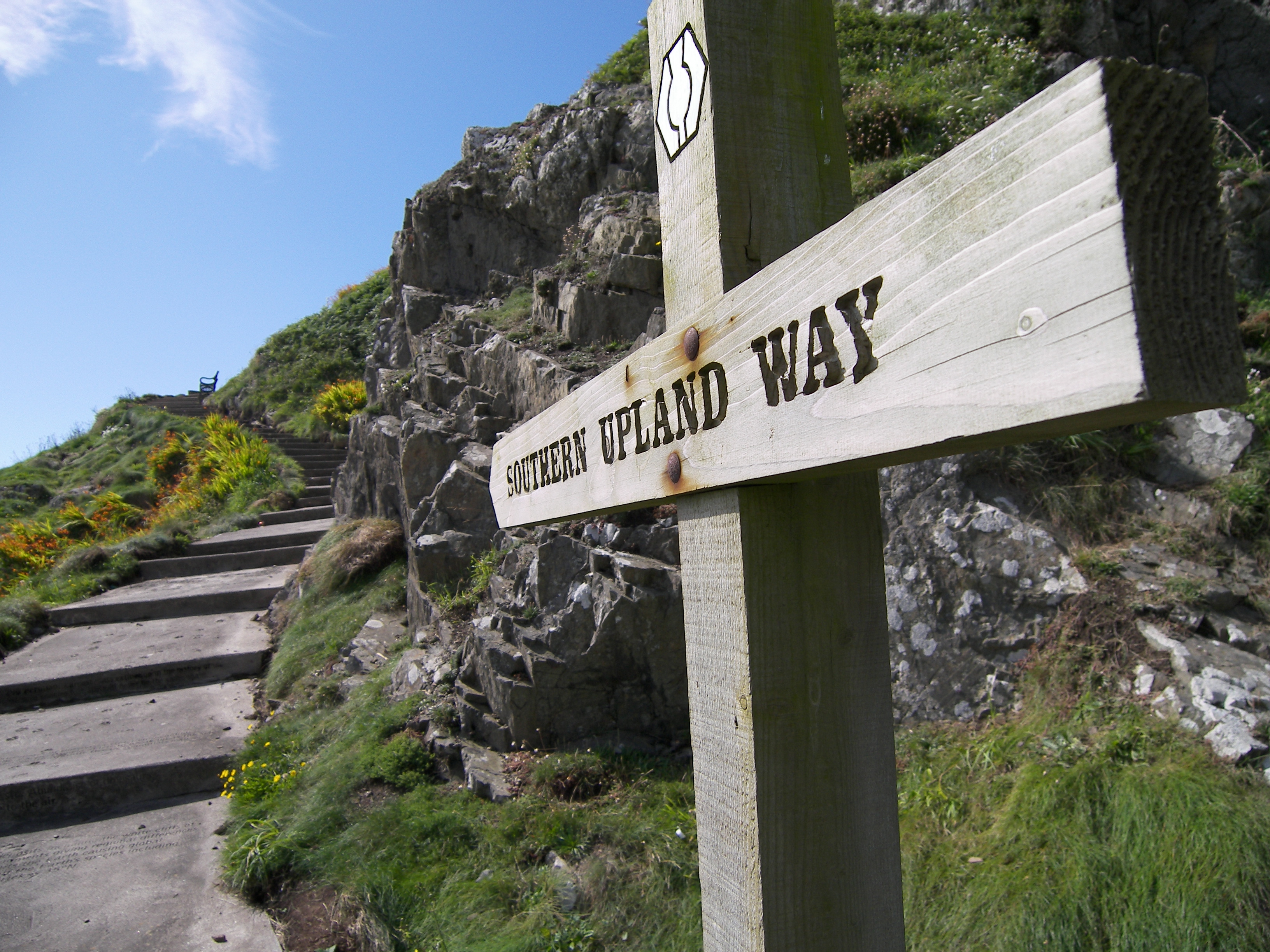
Southern Upland Way
The Southern Upland Way is a 344-kilometre (214 mi) coast-to-coast long-distance footpath in southern Scotland. The route links Portpatrick in the west...
Bowerhope
Bowerhope is a village off the A708, in the Scottish Borders area of Scotland, on the banks of St Mary's Loch in Ettrick Forest. == See also == List of...
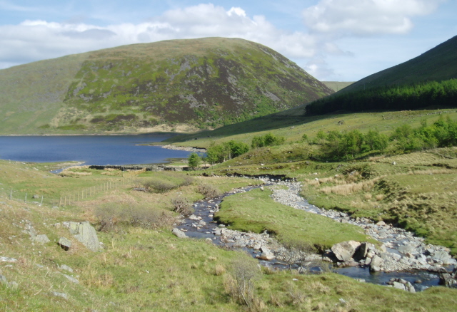
Megget Water
Megget Water is a river in the parish of Yarrow, Selkirkshire in the Scottish Borders area of Scotland. The Water rises at Broad Law (2,760 ft), passes...

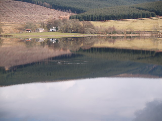
St Mary's Loch
St Mary's Loch is the largest natural loch in the Scottish Borders, and is situated on the south side of the A708 road between Selkirk and Moffat, about...
Ettrick, Scotland
Ettrick (Scottish Gaelic: Eadaraig, IPA: [ˈet̪əɾɪkʲ]) is a small village and civil parish in the Scottish Borders area of Scotland. It is located on the...

Cappercleuch
Cappercleuch is a settlement on the A708, at St. Mary's Loch in the Scottish Borders area of Scotland, in the historic county of Selkirkshire. Places nearby...

Tushielaw Tower
Tushielaw Tower is a 16th-century tower house, about 2.5 miles (4.0 km) north and east of Ettrick, Scottish Borders, Scotland, and west of Ettrick Water...

Dryhope
Dryhope is a village in the Scottish Borders area of Scotland, by St. Mary's Loch, on the A708. Known for its rolling green hills and ample walking paths...
Have you been to Earl's Hill?
Leave your review of Earl's Hill below (or comments, questions and feedback).