Beacon Hill

Hill, Mountain in Devon East Devon

England

Beacon Hill

Membury: approaching Case Bridge Case Bridge, out of shot, is a crossing of the river Yarty. Ahead the lane leads to Membury village. Looking north west
Membury: approaching Case Bridge Credit: Martin Bodman

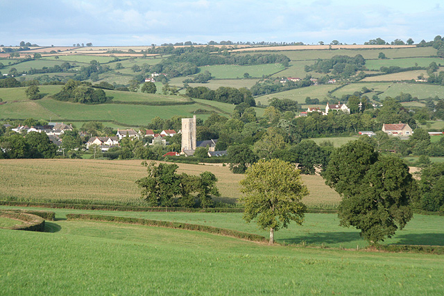
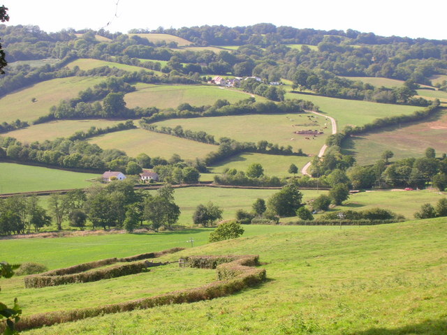
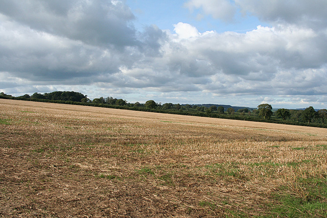
Beacon Hill is a prominent hill located in the county of Devon, England. It is situated near the town of Sidmouth, in the East Devon Area of Outstanding Natural Beauty. Rising to an elevation of approximately 259 meters (850 feet), Beacon Hill offers breathtaking panoramic views of the surrounding countryside and the Jurassic Coast, which is a UNESCO World Heritage Site.

The hill is a popular destination for locals and tourists alike, who are drawn to its natural beauty and tranquil atmosphere. It is a haven for nature enthusiasts, boasting diverse flora and fauna, including ancient woodlands, wildflower meadows, and a wide variety of bird species. Visitors can enjoy leisurely walks along well-maintained footpaths, taking in the stunning vistas and immersing themselves in the peaceful surroundings.

In addition to its natural allure, Beacon Hill also holds historical significance. As its name suggests, the hill was once home to a beacon, which was used as a signal fire to warn of approaching danger during times of war. The remnants of the beacon can still be seen today, serving as a reminder of the area's past.

Facilities for visitors to Beacon Hill are limited, as the focus is primarily on preserving its natural character. However, there are a few picnic spots and benches scattered around, allowing visitors to relax and take in the scenery. It is recommended to come prepared with appropriate footwear and attire, as the terrain can be uneven and muddy in certain areas.

Overall, Beacon Hill in Devon is a captivating destination that offers a perfect blend of natural beauty and historical significance. Whether one seeks a peaceful retreat or an opportunity to connect with nature, this hill provides an unforgettable experience.

If you have any feedback on the listing, please let us know in the comments section below.

Beacon Hill Images

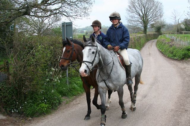
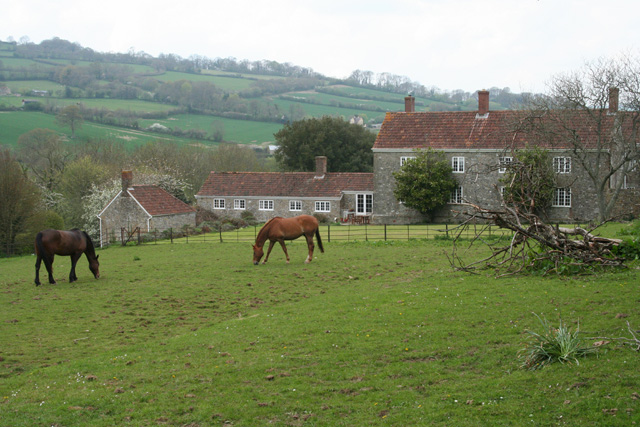
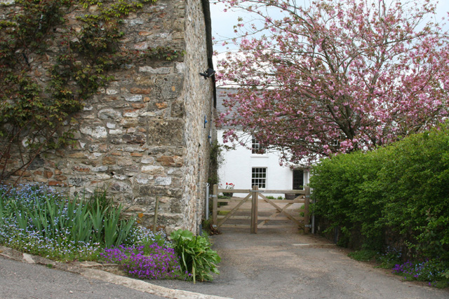
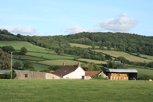
Images are sourced within 2km of 50.819523/-3.0663468 or Grid Reference ST2402. Thanks to Geograph Open Source API. All images are credited.

Membury: approaching Case Bridge Case Bridge, out of shot, is a crossing of the river Yarty. Ahead the lane leads to Membury village. Looking north west
Membury: approaching Case Bridge
Case Bridge, out of shot, is a crossing of the river Yarty. Ahead the lane leads to Membury village. Looking north west
Membury: nearing Waterhouse Farm On the public footpath from Case Bridge. Looking south-south-east. The farmhouse dates from the 16th century, according to W G Hoskins [W G Hoskins, Devon, Devon Books, 1992]
Membury: nearing Waterhouse Farm
On the public footpath from Case Bridge. Looking south-south-east. The farmhouse dates from the 16th century, according to W G Hoskins [W G Hoskins, Devon, Devon Books, 1992]
Membury: Yarty Farm In the Yarty valley, looking north west. Seen from the footpath from Beckford Bridge
Membury: Yarty Farm
In the Yarty valley, looking north west. Seen from the footpath from Beckford Bridge
Stockland: Cuckford Farm By the lane from Kilmington to Stockland. Looking north-north-east
Stockland: Cuckford Farm
By the lane from Kilmington to Stockland. Looking north-north-east
Stockland: towards Rull Farm Looking east-south-east with the Corry valley beyond the farm buildings
Stockland: towards Rull Farm
Looking east-south-east with the Corry valley beyond the farm buildings
Stockland: pig farm Near Broadhayes Farm, looking south-south-east
Stockland: pig farm
Near Broadhayes Farm, looking south-south-east
Stockland: by Ford Farm Looking north east by a crossing of the Corry Brook
Stockland: by Ford Farm
Looking north east by a crossing of the Corry Brook
Stockland: at Longlands Cross Looking north-north-east towards the village with the tower of St Michael’s church visible
Stockland: at Longlands Cross
Looking north-north-east towards the village with the tower of St Michael’s church visible
Stockland: by Marlpit Cross Looking north east towards the Yarty valley
Stockland: by Marlpit Cross
Looking north east towards the Yarty valley
Stockland: above Millhayes Looking south west over barns at Higher Seavington. Millhayes is situated in the Corry valley
Stockland: above Millhayes
Looking south west over barns at Higher Seavington. Millhayes is situated in the Corry valley
Stockland: towards the village Looking east-north-east from a bend in Groundhead Road
Stockland: towards the village
Looking east-north-east from a bend in Groundhead Road
Stockland: by The King’s Arms Looking west-north-west along the street leading towards Cotleigh and Honiton. The King's Arms is on the right past the for sale sign
Stockland: by The King’s Arms
Looking west-north-west along the street leading towards Cotleigh and Honiton. The King's Arms is on the right past the for sale sign
Stockland: The King’s Arms The inn had its own entry in the Good Pub Guide 2005 and dates from the 16th century. It has a restaurant. Looking east
Stockland: The King’s Arms
The inn had its own entry in the Good Pub Guide 2005 and dates from the 16th century. It has a restaurant. Looking east
Stockland: St Michael’s church The church dates from the 14th and 15th centuries. Stockland was a Dorset parish until transferred to Devon in 1844. In 1252 Henry III granted a fair for the village for ever ‘every year on the eve, day and morrow of the Assumption of Blessed Mary’. In 1447 the fair dates were changed to correspond to the feast of St Michael and again in 1512 to celebrate St Barnabas’s day. Inside the church, which stands at the southern end of the village, is a memorial to the men of the parish who lost their lives in combat in the two world wars: twenty in 1914-1918 and one man in 1939-1945. There are a number of yew trees in the churchyard. Looking north west
Stockland: St Michael’s church
The church dates from the 14th and 15th centuries. Stockland was a Dorset parish until transferred to Devon in 1844. In 1252 Henry III granted a fair for the village for ever ‘every year on the eve, day and morrow of the Assumption of Blessed Mary’. In 1447 the fair dates were changed to correspond to the feast of St Michael and again in 1512 to celebrate St Barnabas’s day. Inside the church, which stands at the southern end of the village, is a memorial to the men of the parish who lost their lives in combat in the two world wars: twenty in 1914-1918 and one man in 1939-1945. There are a number of yew trees in the churchyard. Looking north west
Higher Beckford Wooded Hedge systems around Yarty Valley fields looking across the valley
Higher Beckford
Wooded Hedge systems around Yarty Valley fields looking across the valley
Stockland: Corry Brook Just below a ford, usually dry, near Lower Corry. Looking south-south-east
Stockland: Corry Brook
Just below a ford, usually dry, near Lower Corry. Looking south-south-east
Membury: the Yarty valley Looking west across the valley, a little south of Stockland village
Membury: the Yarty valley
Looking west across the valley, a little south of Stockland village
Membury: the Yarty valley Looking south west in the direction of Beacon Hill
Membury: the Yarty valley
Looking south west in the direction of Beacon Hill
Show me another place!

Beacon Hill is located at Grid Ref: ST2402 (Lat: 50.819523, Lng: -3.0663468)

Administrative County: Devon

District: East Devon

Police Authority: Devon and Cornwall

What 3 Words

///hissing.servants.overtones. Near Axminster, Devon

Nearby Locations

Beacon Hill Heathstock

Related Wikis

Stockland, Devon

Stockland is a village and civil parish in Devon, close to the Somerset boundary. The parish is surrounded clockwise from the north by the parishes of...

Dalwood

Dalwood is a village and county parish in the East Devon district of the English county of Devon. It is approximately 3 miles (4.8 km) away from the nearest...

Stockland Castle

Stockland Castle is the name given to two Iron Age hill forts on Stockland Hill close to Stockland in Devon, England. Stockland Great Castle (50.8178°N...

Stockland Hill transmitting station

The Stockland Hill transmitting station is a transmitting facility of FM Radio and UHF television located near Honiton, Devon, England. This transmitter...

Nearby Amenities

Located within 500m of 50.819523,-3.0663468
Beacon Hill
Ele: 218
Natural: peak
Lat/Long: 50.8193639/-3.0660602
Heathstock
Place: hamlet
Lat/Long: 50.8210295/-3.0718855
Generator Method: photovoltaic
Generator Output Electricity: yes
Generator Source: solar
Generator Type: solar_photovoltaic_panel
Location: roof
Power: generator
Source: Bing
Lat/Long: 50.8205893/-3.069575
Generator Method: photovoltaic
Generator Output Electricity: yes
Generator Source: solar
Generator Type: solar_photovoltaic_panel
Location: ground
Power: generator
Source: Bing
Lat/Long: 50.8173679/-3.0648744
Generator Method: photovoltaic
Generator Output Electricity: yes
Generator Source: solar
Generator Type: solar_photovoltaic_panel
Location: ground
Power: generator
Source: Bing
Lat/Long: 50.8173967/-3.064853
Generator Method: photovoltaic
Generator Output Electricity: yes
Generator Source: solar
Generator Type: solar_photovoltaic_panel
Location: roof
Power: generator
Source: Bing
Lat/Long: 50.8195895/-3.0693148
Long Close Copse
Natural: wood
Lat/Long: 50.821801/-3.0659333
Cummins Copse
Natural: wood
Lat/Long: 50.8228735/-3.0636319
Rakehill Copse
Natural: wood
Lat/Long: 50.8239052/-3.0670005
Power: pole
Source: bing
Lat/Long: 50.8222553/-3.0691375
Power: pole
Source: bing
Lat/Long: 50.8218817/-3.0698444
Power: pole
Source: bing
Lat/Long: 50.8214925/-3.0706043
Natural: spring
Lat/Long: 50.822694/-3.0711138
Power: pole
Source: bing
Lat/Long: 50.8233292/-3.0671543
Power: pole
Source: bing
Lat/Long: 50.8238561/-3.066178
Power: pole
Source: bing
Lat/Long: 50.8227929/-3.068144
Power: pole
Source: bing
Lat/Long: 50.8207596/-3.0711991
Power: pole
Source: bing
Transformer: distribution
Lat/Long: 50.8204012/-3.0714539
Power: pole
Source: bing
Lat/Long: 50.8196539/-3.0710328
Power: pole
Source: bing
Lat/Long: 50.819054/-3.0707082
Power: pole
Source: bing
Lat/Long: 50.8182593/-3.0702308
Power: pole
Source: bing
Lat/Long: 50.8171747/-3.0696139
Power: pole
Source: bing
Lat/Long: 50.8167324/-3.0703729
Power: pole
Source: bing
Lat/Long: 50.8162444/-3.0712232
The data included in this document is from www.openstreetmap.org. The data is made available under ODbL.

Have you been to Beacon Hill?

Leave your review of Beacon Hill below (or comments, questions and feedback).