Bakingstone Hill

Hill, Mountain in Orkney

Scotland

Bakingstone Hill

Skird Hill Bagged after The Berry with Jim Bloomer and Tricky Speirs.
Name: Skird Hill
Hill number: 12199
Height: 171m / 561ft
Parent (Ma/M): 1551  Knap of Trowieglen
Area:23: Orkney Islands
Class: 1
Grid ref: ND255913 (est)
Drop: 54m
Col: 117m  ND247911
Skird Hill Credit: Rude Health

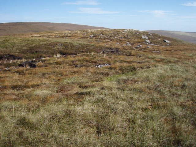
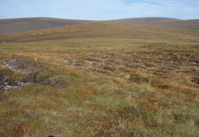
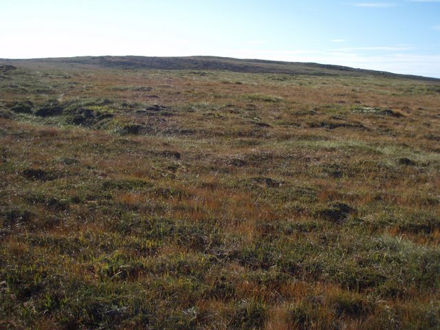
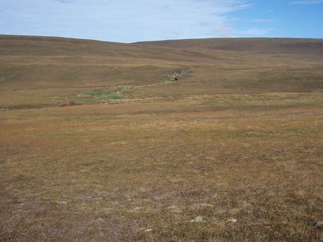
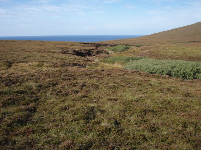
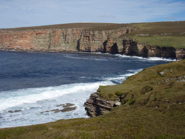
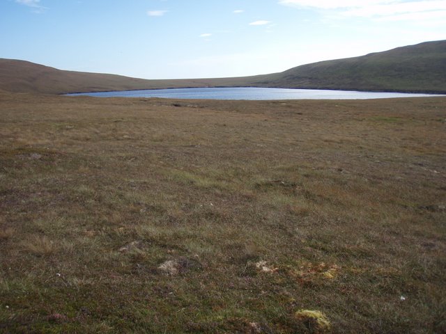
Bakingstone Hill is a prominent hill located on the island of Orkney, situated in the northernmost part of Scotland. This hill, also known as a mountain, is part of the Orkney Islands archipelago and stands at an elevation of around 75 meters (246 feet) above sea level.

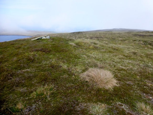
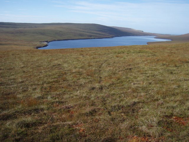
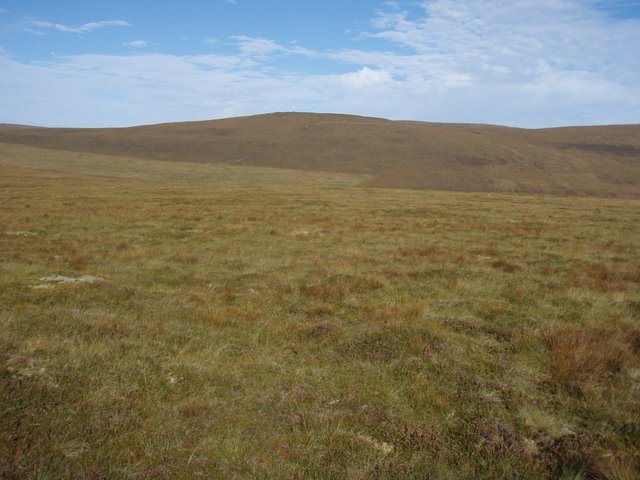
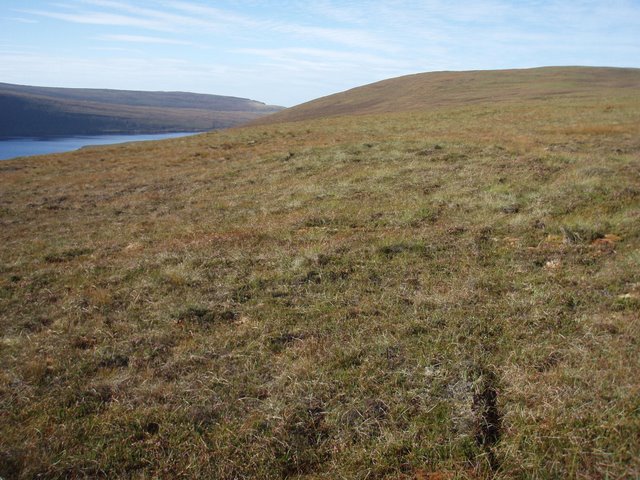
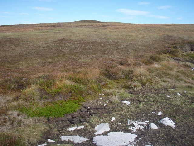
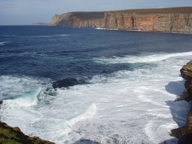
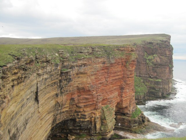
The hill is characterized by its distinctive summit, which is flat and covered in grass. It offers a picturesque view of the surrounding landscape, including the nearby coastline, rolling hills, and scattered farmland. Bakingstone Hill is a popular destination for outdoor enthusiasts and nature lovers, as it provides an excellent vantage point for photography, birdwatching, and enjoying the breathtaking sunsets.

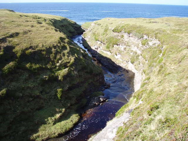
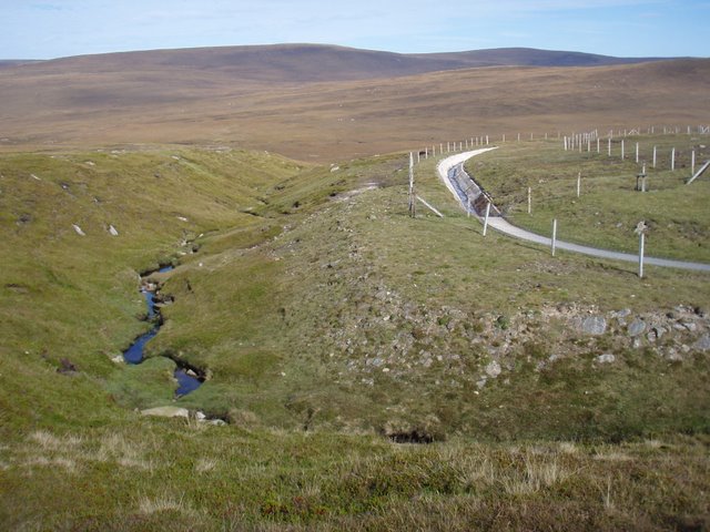
The name "Bakingstone Hill" is believed to originate from the Old Norse language, which was spoken by the Viking settlers who inhabited Orkney centuries ago. The hill's name may be derived from the Norse word "bekkr," meaning "stream," and "steinn," meaning "stone." This suggests that there may have been a stream or stone feature near the hill that influenced its name.

In addition to its natural beauty, Bakingstone Hill also holds historical significance. The surrounding area contains remnants of ancient settlements, burial mounds, and standing stones, indicating that the hill has been inhabited for thousands of years. These archaeological sites contribute to the rich cultural heritage of Orkney and attract visitors interested in exploring the region's history.

Overall, Bakingstone Hill stands as a prominent landmark in Orkney, offering both natural beauty and historical intrigue to those who venture to its summit.

If you have any feedback on the listing, please let us know in the comments section below.

Bakingstone Hill Images

Images are sourced within 2km of 58.815231/-3.3017954 or Grid Reference ND2492. Thanks to Geograph Open Source API. All images are credited.

Skird Hill Bagged after The Berry with Jim Bloomer and Tricky Speirs.
Name: Skird Hill
Hill number: 12199
Height: 171m / 561ft
Parent (Ma/M): 1551  Knap of Trowieglen
Area:23: Orkney Islands
Class: 1
Grid ref: ND255913 (est)
Drop: 54m
Col: 117m  ND247911
Skird Hill
Bagged after The Berry with Jim Bloomer and Tricky Speirs. Name: Skird Hill Hill number: 12199 Height: 171m / 561ft Parent (Ma/M): 1551 Knap of Trowieglen Area:23: Orkney Islands Class: 1 Grid ref: ND255913 (est) Drop: 54m Col: 117m ND247911
Heldale Water  The largest loch on Hoy, with building associated water supply at the end.
Heldale Water
The largest loch on Hoy, with building associated water supply at the end.
Looking across to Black Pows  The next ridge north is Sky Fea.
Looking across to Black Pows
The next ridge north is Sky Fea.
Bakingstone Hill The rounded hill north of Heldale water seen to the left.
Bakingstone Hill
The rounded hill north of Heldale water seen to the left.
Bakingstone Hill The northern end of the southern bump on this hill.
Bakingstone Hill
The northern end of the southern bump on this hill.
The northern top of Bakingstone Hill The slightly lower end of the hill.
The northern top of Bakingstone Hill
The slightly lower end of the hill.
Bakingstone Hill Grassy moorland leading up the hill.
Bakingstone Hill
Grassy moorland leading up the hill.
Burn draining Sands Water The willow bushes highlight the course of the burn.
Burn draining Sands Water
The willow bushes highlight the course of the burn.
Sands Water burn The burn drains Sands Water into Little Rack Wick.
Sands Water burn
The burn drains Sands Water into Little Rack Wick.
Little Rack Wick The west coast of Hoy has the most fantastic cliffscape, very intimidating to go to the edge.  Rack is norse for rock and wick bay so the name is appropriate.
Little Rack Wick
The west coast of Hoy has the most fantastic cliffscape, very intimidating to go to the edge. Rack is norse for rock and wick bay so the name is appropriate.
Burn of Greenheads The burn runs in a surprisingly deep mini gorge.
Burn of Greenheads
The burn runs in a surprisingly deep mini gorge.
Burn of Hoglinns and its man made counterpart The natural burn on the left joins the Burn of Greenheads just north of the square.  However, looking at the dam arrangement slightly upstream when the flow is high enough some of the flow is diverted into a man made channel which sends the water to Heldale Water.  Heldale water would seem to be the holding reservoir on Hoy.  Someone is bound to know better.
Burn of Hoglinns and its man made counterpart
The natural burn on the left joins the Burn of Greenheads just north of the square. However, looking at the dam arrangement slightly upstream when the flow is high enough some of the flow is diverted into a man made channel which sends the water to Heldale Water. Heldale water would seem to be the holding reservoir on Hoy. Someone is bound to know better.
Hoglinns Water Some of the outflow from the loch is diverted into Heldale water, so I assume that used for water supply.
Hoglinns Water
Some of the outflow from the loch is diverted into Heldale water, so I assume that used for water supply.
Skird Hill  This hill separates Hoy's two largest lochs namely Heldale Water and Hoglinns Water.
Skird Hill
This hill separates Hoy's two largest lochs namely Heldale Water and Hoglinns Water.
Across Little Rack Wick to Rack Wick The west coast of Hoy is pretty much continuous impressive cliffs.  Even on a calm day the water seems quite lively.
Across Little Rack Wick to Rack Wick
The west coast of Hoy is pretty much continuous impressive cliffs. Even on a calm day the water seems quite lively.
Cliffs of Hoy The Berry is a headland with high cliffs on the south side of Hoy
Cliffs of Hoy
The Berry is a headland with high cliffs on the south side of Hoy
Show me another place!

Bakingstone Hill is located at Grid Ref: ND2492 (Lat: 58.815231, Lng: -3.3017954)

Unitary Authority: Orkney Islands

Police Authority: Highlands and Islands

What 3 Words

///afflicted.nails.whizzing. Near Lyness, Orkney Islands

Nearby Locations

Bakingstone Hill

Related Wikis

Hoglinns Water

Hoglinns Water is a small freshwater loch in the south of the island of Hoy, Orkney. It drains in to Heldale Water via Hoglinns Burn. The loch was surveyed...
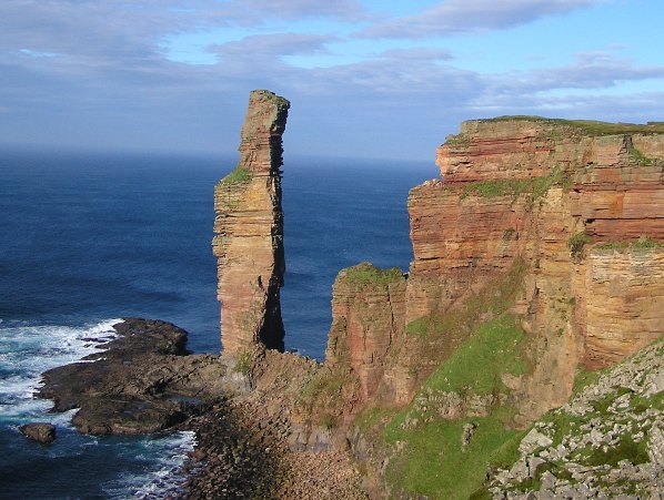
Needle (stack)

The Needle is a 70-metre-high (230 ft) sea stack on the island of Hoy, in Orkney, Scotland. It is located on the southwest coast of Hoy at ND243902. There...

Hoy

Hoy (Scots: Hoy; from Old Norse Háey, meaning "high island") is an island in Orkney, Scotland, measuring 143 square kilometres (55 sq mi) – the second...

Longhope, Orkney

Longhope is a coastal settlement on the island of South Walls, in Orkney, Scotland. South Walls is linked to Hoy by causeway; Longhope is the largest settlement...

Brims, Orkney

Brims is a village at the southern point of the island of Hoy, in Orkney, Scotland. The settlement is within the parish of Walls and Flotta. The RNLI lifeboat...

RNLB Thomas McCunn (ON 759)

RNLB Thomas McCunn (ON 759) is a 45ft 6in Watson-class lifeboat stationed at Longhope in Orkney, Scotland, from January 1933 until April 1962. During...

Lyness

Lyness is a village on the east coast of the island of Hoy, Orkney, Scotland. The village is within the parish of Walls and Flotta, and is situated at...

Scapa Flow Museum

Scapa Flow Museum is a war museum in Lyness on the Island of Hoy, Orkney, Scotland. Housed within a refurbished Romney hut and oil fuel pump house at the...

Have you been to Bakingstone Hill?

Leave your review of Bakingstone Hill below (or comments, questions and feedback).