Cefn y Cist

Hill, Mountain in Denbighshire

Wales

Cefn y Cist

Moorland at Gwter Siani South of the Minera to World's End road.
Moorland at Gwter Siani Credit: John H Darch

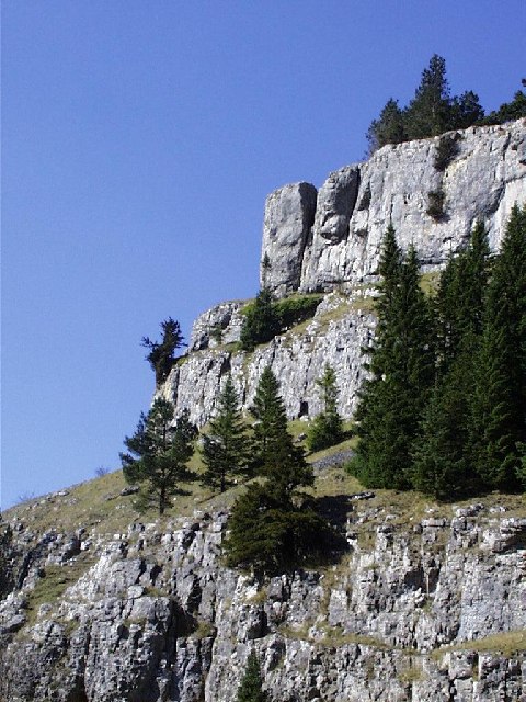
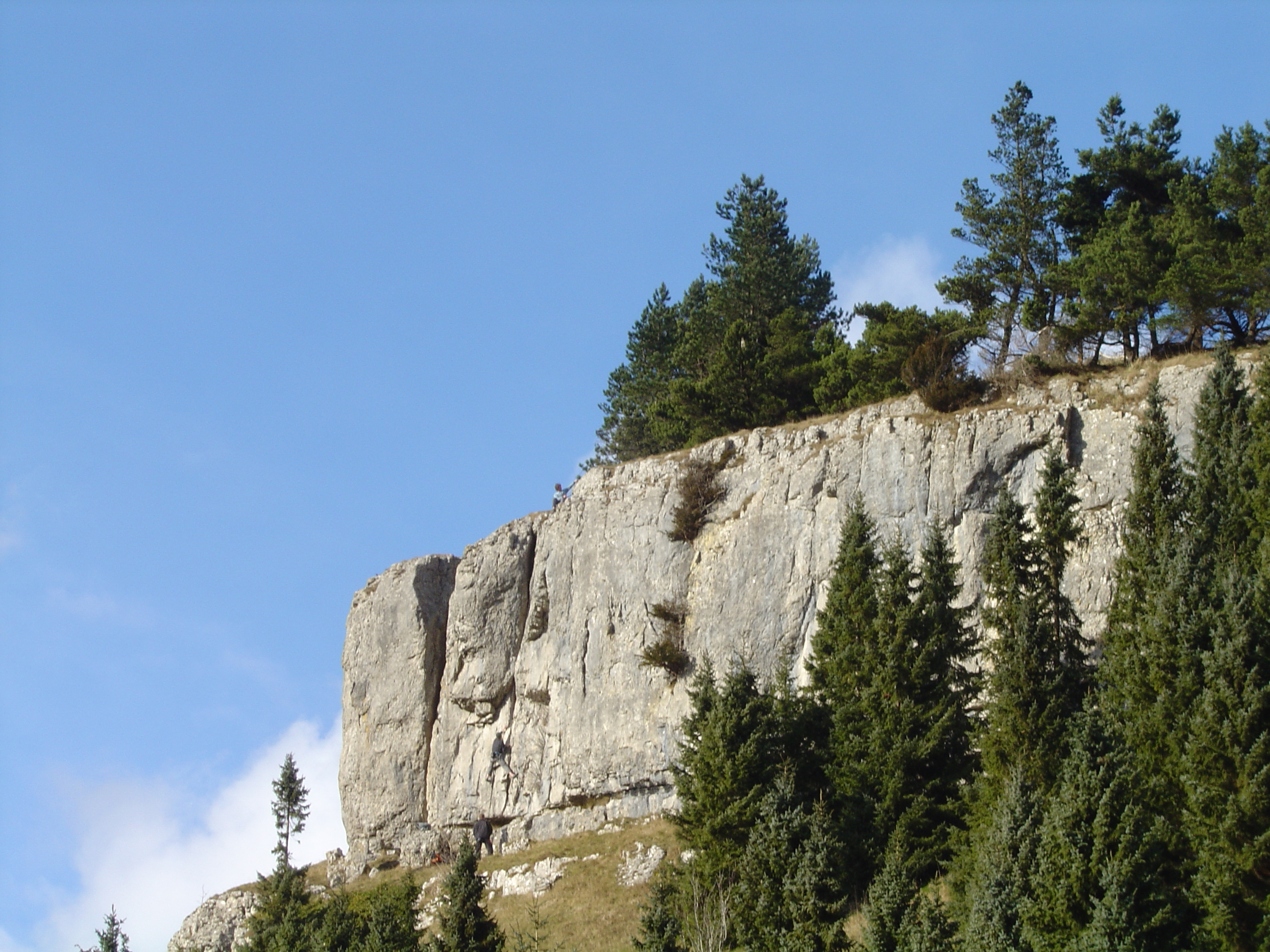
Cefn y Cist is a prominent hill located in the county of Denbighshire, Wales. It stands at an elevation of approximately 490 meters (1,608 feet) above sea level and is part of the Clwydian Range and Dee Valley Area of Outstanding Natural Beauty.

The hill is situated near the village of Llanbedr-Dyffryn-Clwyd and offers breathtaking panoramic views of the surrounding countryside. Its commanding position makes it a popular destination for hikers, nature enthusiasts, and photographers. On a clear day, visitors can admire the stunning vistas stretching across the Vale of Clwyd, the River Clwyd, and the nearby hills.

Cefn y Cist is characterized by rolling hillsides covered in grassland and heather, interspersed with patches of woodland. The area is rich in biodiversity, hosting a variety of flora and fauna. It is home to numerous species of birds, including kestrels, buzzards, and peregrine falcons, which can often be seen soaring overhead.

The hill offers several walking trails, ranging from gentle strolls to more challenging hikes. The Cefn y Cist Trail, a circular route of approximately 8 kilometers (5 miles), takes visitors through the hill's diverse landscapes, offering opportunities to spot wildlife and enjoy the tranquility of the countryside.

Cefn y Cist provides a peaceful retreat for those seeking to escape the hustle and bustle of everyday life. Its natural beauty, coupled with its accessibility, makes it a popular destination for both locals and tourists alike, offering a chance to immerse oneself in the stunning landscapes and experience the serenity of the Welsh countryside.

If you have any feedback on the listing, please let us know in the comments section below.

Cefn y Cist Images

Images are sourced within 2km of 53.025758/-3.1300862 or Grid Reference SJ2448. Thanks to Geograph Open Source API. All images are credited.

Moorland at Gwter Siani South of the Minera to World's End road.
Moorland at Gwter Siani
South of the Minera to World's End road.
Footpath over the moor On Ruabon Mountain.
Footpath over the moor
On Ruabon Mountain.
Grouse butts Adjacent to the tarn on Ruabon Mountain.
Grouse butts
Adjacent to the tarn on Ruabon Mountain.
Very boggy path and a lone tree The tree has presumably germinated from a seed that escaped from the plantations downhill and to the north-northwest around World's End; it's about the only thing that breaks the acres of heather moorland up here.
Very boggy path and a lone tree
The tree has presumably germinated from a seed that escaped from the plantations downhill and to the north-northwest around World's End; it's about the only thing that breaks the acres of heather moorland up here.
A boggy quad-bike track on the moor The moorland track appears to be partly, at least, associated with the occasional grouse shoot up here. I flushed several red grouse during the morning, and at least one that looked like a rather less common black grouse.
A boggy quad-bike track on the moor
The moorland track appears to be partly, at least, associated with the occasional grouse shoot up here. I flushed several red grouse during the morning, and at least one that looked like a rather less common black grouse.
Apparently unremarkable heather moorland Appearances are a little deceptive. The close foreground is the crash site of a brand new Bristol Beaufighter MkX, registered no NE302, which came down here in late 1943, whilst en route from the factory in Weston-Super-Mare to a unit in Cumbria - killing the pilot Flight Sergeant John Shepherd. Photographs from some years ago show scattered fragments of the aircraft, which made three distinct depressions at the time of the accident, coinciding with the fuselage and the two engines. As far as I could see, the remnants are now lost under the heather cover. A further description is at <span class="nowrap"><a title="https://coflein.gov.uk/en/site/544230," rel="nofollow ugc noopener" href="https://coflein.gov.uk/en/site/544230,">Link</a><img style="margin-left:2px;" alt="External link" title="External link - shift click to open in new window" src="https://s1.geograph.org.uk/img/external.png" width="10" height="10"/></span> and the 2nd link <span class="nowrap"><a title="http://www.peakdistrictaircrashes.co.uk/pages/wales/walesne302.htm" rel="nofollow ugc noopener" href="http://www.peakdistrictaircrashes.co.uk/pages/wales/walesne302.htm">Link</a><img style="margin-left:2px;" alt="External link" title="External link - shift click to open in new window" src="https://s1.geograph.org.uk/img/external.png" width="10" height="10"/></span> down that page will lead you to the photos mentioned above.
Apparently unremarkable heather moorland
Appearances are a little deceptive. The close foreground is the crash site of a brand new Bristol Beaufighter MkX, registered no NE302, which came down here in late 1943, whilst en route from the factory in Weston-Super-Mare to a unit in Cumbria - killing the pilot Flight Sergeant John Shepherd. Photographs from some years ago show scattered fragments of the aircraft, which made three distinct depressions at the time of the accident, coinciding with the fuselage and the two engines. As far as I could see, the remnants are now lost under the heather cover. A further description is at LinkExternal link and the 2nd link LinkExternal link down that page will lead you to the photos mentioned above.
Grouse butt on Eglwyseg Mountain One in a line of 8 or 10 that I could see on either side of me - the moor is actively managed for the grouse, and there were a few birds about on this fairly bright day.
Grouse butt on Eglwyseg Mountain
One in a line of 8 or 10 that I could see on either side of me - the moor is actively managed for the grouse, and there were a few birds about on this fairly bright day.
A little off-piste Poor navigation on my part - coming from the south, I thought I'd missed the footpath which cuts east-west across this moor, so decided to just head downhill and west towards the forests. Bad idea. The heather was about 3 feet deep in places, and still wet from the previous day's rain; by the time I had negotiated a couple of hundred yards of this, I was soaked from the waist down.
A little off-piste
Poor navigation on my part - coming from the south, I thought I'd missed the footpath which cuts east-west across this moor, so decided to just head downhill and west towards the forests. Bad idea. The heather was about 3 feet deep in places, and still wet from the previous day's rain; by the time I had negotiated a couple of hundred yards of this, I was soaked from the waist down.
Moorland above the World's End forestry The immediate foreground is moorland vegetation - long rough 'marsh grass' and the like, with heather and ling. Further down, and clearly visible as a grassy circular feature, is one of several disused mineshafts which were sunk, probably late 18th or early 19th centuries, to work a lead & silver seam which runs east-west through this part of the hill. They are described in a little more detail at <span class="nowrap"><a title="https://coflein.gov.uk/en/site/269187/" rel="nofollow ugc noopener" href="https://coflein.gov.uk/en/site/269187/">Link</a><img style="margin-left:2px;" alt="External link" title="External link - shift click to open in new window" src="https://s1.geograph.org.uk/img/external.png" width="10" height="10"/></span>
Moorland above the World's End forestry
The immediate foreground is moorland vegetation - long rough 'marsh grass' and the like, with heather and ling. Further down, and clearly visible as a grassy circular feature, is one of several disused mineshafts which were sunk, probably late 18th or early 19th centuries, to work a lead & silver seam which runs east-west through this part of the hill. They are described in a little more detail at LinkExternal link
Disused mineshaft and spoil The largest, and most prominent, of several collapsed mineshaft features on the hillside just above the World's End forestry. They mark late 18th or early 19th century efforts to exploit a source of lead and silver which runs through here, and which also resulted in a number of adit mines in what's now the forested area. Described by Coflein at <span class="nowrap"><a title="https://coflein.gov.uk/en/site/269187/" rel="nofollow ugc noopener" href="https://coflein.gov.uk/en/site/269187/">Link</a><img style="margin-left:2px;" alt="External link" title="External link - shift click to open in new window" src="https://s1.geograph.org.uk/img/external.png" width="10" height="10"/></span>
Disused mineshaft and spoil
The largest, and most prominent, of several collapsed mineshaft features on the hillside just above the World's End forestry. They mark late 18th or early 19th century efforts to exploit a source of lead and silver which runs through here, and which also resulted in a number of adit mines in what's now the forested area. Described by Coflein at LinkExternal link
A mining adit in the World's End forestry One of several in this valley, which also has a series of tips and trackways, all associated with the same lead & silver vein running east/west through the limestone. This adit is described in a little detail at <span class="nowrap"><a title="https://coflein.gov.uk/en/site/150326/" rel="nofollow ugc noopener" href="https://coflein.gov.uk/en/site/150326/">Link</a><img style="margin-left:2px;" alt="External link" title="External link - shift click to open in new window" src="https://s1.geograph.org.uk/img/external.png" width="10" height="10"/></span>
A mining adit in the World's End forestry
One of several in this valley, which also has a series of tips and trackways, all associated with the same lead & silver vein running east/west through the limestone. This adit is described in a little detail at LinkExternal link
World's End Level no 1 One of a small number of mining features and adits in the forest, dating from the early-to-mid 19th century, which were associated with efforts to exploit a source of lead and silver in the limestone. Some more details are described at <span class="nowrap"><a title="https://archwilio.org.uk/arch/query/page.php?watprn=CPAT88528&dbname=cpat&tbname=core" rel="nofollow ugc noopener" href="https://archwilio.org.uk/arch/query/page.php?watprn=CPAT88528&dbname=cpat&tbname=core">Link</a><img style="margin-left:2px;" alt="External link" title="External link - shift click to open in new window" src="https://s1.geograph.org.uk/img/external.png" width="10" height="10"/></span>
World's End Level no 1
One of a small number of mining features and adits in the forest, dating from the early-to-mid 19th century, which were associated with efforts to exploit a source of lead and silver in the limestone. Some more details are described at LinkExternal link
Craig y Forwyn, World's End Craig y Forwyn is part of the extensive Eglwyseg escarpment of limestone cliffs which run along the western edge of Ruabon and Eglwyseg Mountains, all of them packed chock-full of quality rock climbs of various grades. Up here, if so inclined, you'll find trad routes on natural limestone from Severe right up to E4 or E5 - enough to keep anyone happy for a day or two.
Craig y Forwyn, World's End
Craig y Forwyn is part of the extensive Eglwyseg escarpment of limestone cliffs which run along the western edge of Ruabon and Eglwyseg Mountains, all of them packed chock-full of quality rock climbs of various grades. Up here, if so inclined, you'll find trad routes on natural limestone from Severe right up to E4 or E5 - enough to keep anyone happy for a day or two.
Offa's Dyke Way footpath below Craig yr Adar The path here is just emerging from the forested area at this gate.
Offa's Dyke Way footpath below Craig yr Adar
The path here is just emerging from the forested area at this gate.
Welcome to SJ 2449 Road through moorland at Gwter Siani at the extreme edge of the gridsquare.
Welcome to SJ 2449
Road through moorland at Gwter Siani at the extreme edge of the gridsquare.
More interesting landscape Having crossed the bleak moorland towards World's End from the north, the view of the escarpment in the distance takes your breath away.
More interesting landscape
Having crossed the bleak moorland towards World's End from the north, the view of the escarpment in the distance takes your breath away.
Escarpment on Craig Arthur View of this wonderful feature from a safe distance.
Escarpment on Craig Arthur
View of this wonderful feature from a safe distance.
Little lambs Newborn and carefree, two lovely lambs do a bit of exploring around the tree trunk near the roadside.
Little lambs
Newborn and carefree, two lovely lambs do a bit of exploring around the tree trunk near the roadside.
Show me another place!

Cefn y Cist is located at Grid Ref: SJ2448 (Lat: 53.025758, Lng: -3.1300862)

Unitary Authority: Wrexham

Police Authority: North Wales

What 3 Words

///linen.goodnight.loves. Near Rhosllanerchrugog, Wrexham

Nearby Locations

Cefn y Cist

Related Wikis

Ruabon Moors

The Ruabon Moors are an area of upland moorland in Wales to the west of Ruabon and Wrexham. They lie partly within Wrexham County Borough and partly within...

Craig y Forwyn (Denbighshire)

Craig y Forwyn ("Maiden's Crag") is a crag that encloses the northern side of World's End, near the town of Llangollen in Denbighshire, Wales. It is part...

World's End, Denbighshire

World's End (Welsh: Pen Draw'r Byd) is a narrow vale located between Wrexham and Llangollen in Denbighshire, Wales. It lies at the head of the Eglwyseg...

Esclusham Mountain

Esclusham Mountain (Welsh: Mynydd Esclus or Mynydd Esclys) is an area in Wrexham County Borough, Wales, United Kingdom, and is part of the Ruabon Moors...

Nearby Amenities

Located within 500m of 53.025758,-3.1300862
Cefn Y Cist
Ele: 492
Natural: peak
Wikidata: Q13126971
Lat/Long: 53.0250281/-3.1304639
Historic: mine_shaft
Lat/Long: 53.029564/-3.1333038
The data included in this document is from www.openstreetmap.org. The data is made available under ODbL.

Have you been to Cefn y Cist?

Leave your review of Cefn y Cist below (or comments, questions and feedback).