Carn Tullich

Hill, Mountain in Banffshire

Scotland

Carn Tullich

View down Allt na Bae A tributary of the River Livet.
View down Allt na Bae Credit: Dorothy Carse

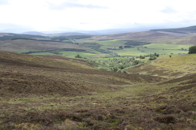
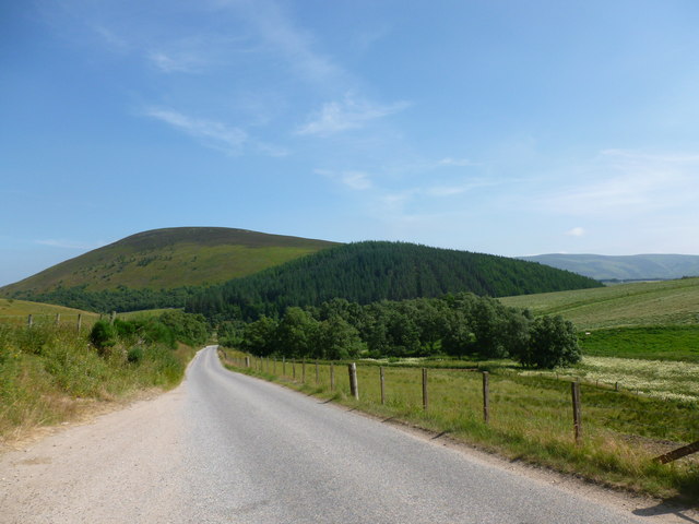
Carn Tullich is a prominent hill located in Banffshire, Scotland. It is part of the Grampian Mountains and stands at an elevation of approximately 529 meters (1,736 feet) above sea level. Offering commanding views of the surrounding landscape, the hill is a popular destination for hikers and nature enthusiasts.

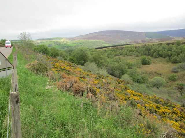
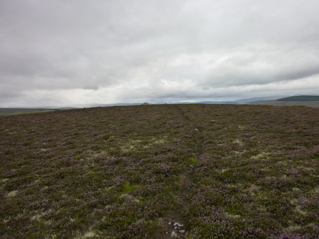
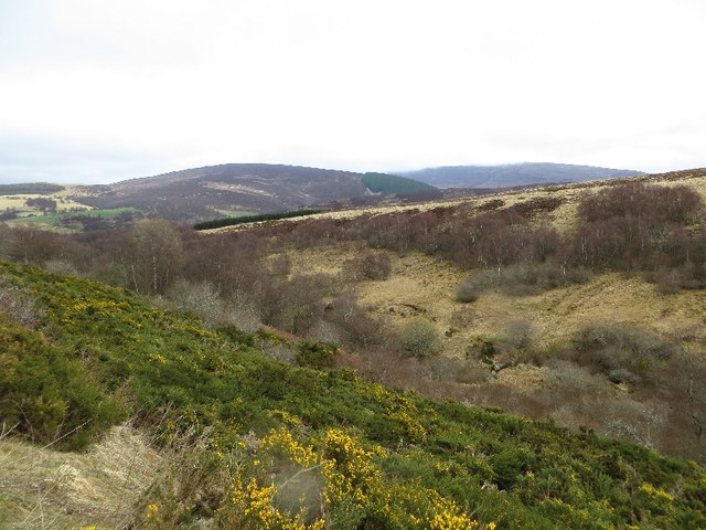
Situated in the northeast of Scotland, Carn Tullich is characterized by its rugged terrain, with steep slopes covered in heather, grasses, and scattered rocks. Its distinct shape and elevation make it easily identifiable from the surrounding area.

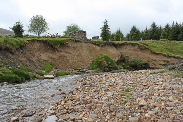
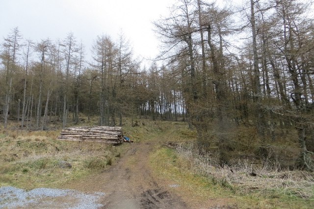
The hill is accessible via a well-marked footpath, which starts from a nearby car park. The trail takes visitors through a variety of landscapes, including woodlands and moorlands, before reaching the summit. Along the way, hikers may encounter a diverse range of flora and fauna, including heather, bilberries, and various bird species.

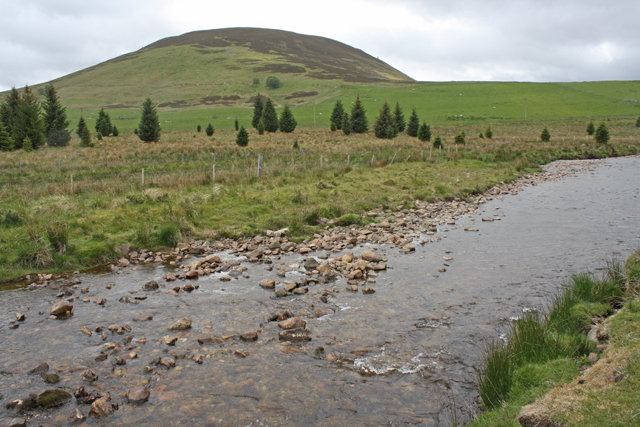
At the summit, visitors are rewarded with magnificent panoramic views of Banffshire and the surrounding countryside. On a clear day, it is possible to see as far as the Moray Firth and the Cairngorms National Park. The hill offers a peaceful and tranquil atmosphere, providing an ideal setting for relaxation and contemplation.

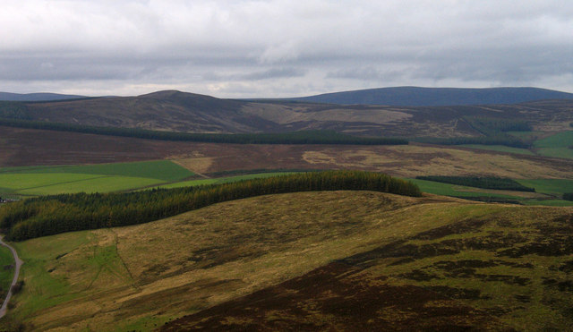
Carn Tullich is a popular destination for outdoor activities such as hillwalking, birdwatching, and photography. Its accessibility, scenic beauty, and diverse wildlife make it a must-visit location for both locals and tourists looking to immerse themselves in the natural beauty of Banffshire.

If you have any feedback on the listing, please let us know in the comments section below.

Carn Tullich Images

Images are sourced within 2km of 57.306206/-3.2780226 or Grid Reference NJ2324. Thanks to Geograph Open Source API. All images are credited.

View down Allt na Bae A tributary of the River Livet.
View down Allt na Bae
A tributary of the River Livet.
Erosion, River Livet The ruined buildings of Poolwick are about to fall in.
Erosion, River Livet
The ruined buildings of Poolwick are about to fall in.
River Livet near Glack Looking towards The Bochel.
River Livet near Glack
Looking towards The Bochel.
West ridge of The Bochel The heather and grass slopes of the west ridge of The Bochel descend towards coniferous plantings. The conical hill left of centre is Carn Daimh and the more distant flat-topped hill to the right is Carn a’ Ghille Chearr, one of the Hills of Cromdale.
West ridge of The Bochel
The heather and grass slopes of the west ridge of The Bochel descend towards coniferous plantings. The conical hill left of centre is Carn Daimh and the more distant flat-topped hill to the right is Carn a’ Ghille Chearr, one of the Hills of Cromdale.
Looking towards Croftbain From the B9008.
Looking towards Croftbain
From the B9008.
The Bochel and the Glenlivet road The Bochel is the rounded hill in this view.  Its name probably derives from the Gaelic word Buachaille, meaning shepherd or herdsman.
The Bochel and the Glenlivet road
The Bochel is the rounded hill in this view. Its name probably derives from the Gaelic word Buachaille, meaning shepherd or herdsman.
Bochel Summit Narrow path through the heather leading to the summit cairn.
Bochel Summit
Narrow path through the heather leading to the summit cairn.
Carn Tullich Slopes Heathery southern slopes of Carn Tullich from the Bochel path.
Carn Tullich Slopes
Heathery southern slopes of Carn Tullich from the Bochel path.
Woodland, Knockandhu A small conifer plantation.
Woodland, Knockandhu
A small conifer plantation.
Carttach Burn A scrubby defile below the B9008.
Carttach Burn
A scrubby defile below the B9008.
Ford and footbridge, Glen Livet Crossing the Livet on the western side of the Ladder Hills.
Ford and footbridge, Glen Livet
Crossing the Livet on the western side of the Ladder Hills.
Glen of Crombie Water Looking down the glen of Crombie Water, with The Bochel on the right, Carn na h-Iolaire on the left, Carn Tullich in the distance and Cairn Muldonich beyond.
Glen of Crombie Water
Looking down the glen of Crombie Water, with The Bochel on the right, Carn na h-Iolaire on the left, Carn Tullich in the distance and Cairn Muldonich beyond.
Track to Buiternach Cemetery
Foot of The Bochel From The Bochel Circuit path
Foot of The Bochel
From The Bochel Circuit path
The Bochel From The Bochel Circuit path
The Bochel
From The Bochel Circuit path
The Baden The area beyond the gate is marked 'The Baden' on the map
but I have no idea what feature of the scene this refers to.
The Baden
The area beyond the gate is marked 'The Baden' on the map but I have no idea what feature of the scene this refers to.
Marker post on The Bochel Circuit path The mistake I made here was to carry on down the track instead of turning right at the marker post . . .
Marker post on The Bochel Circuit path
The mistake I made here was to carry on down the track instead of turning right at the marker post . . .
View from Delhandy I think Delhandy is the name of the derelict building on the left.
View from Delhandy
I think Delhandy is the name of the derelict building on the left.
Show me another place!

Carn Tullich is located at Grid Ref: NJ2324 (Lat: 57.306206, Lng: -3.2780226)

Unitary Authority: Moray

Police Authority: North East

What 3 Words

///hotdog.cuddling.fashion. Near Dufftown, Moray

Nearby Locations

Carn Tullich

Related Wikis

County of Moray

Moray; (Scottish Gaelic: Moireibh [ˈmɤɾʲəv]) or Morayshire, called Elginshire until 1919, is a historic county, registration county and lieutenancy area...

Church of The Incarnation, Tombae

The Church of The Incarnation was built between 1827 and 1829 as a Roman Catholic church, under the patronage of the Gordon family, in Banffshire, Scotland...

Tamnavulin distillery

Tamnavulin distillery is a producer of single malt Scotch whisky that was founded in 1966. The distillery is operated by Whyte & Mackay, which Philippines...

Auchnarrow

Auchnarrow (Scottish Gaelic: Achadh an Arbha) is a village in Moray, Scotland.

Clashnoir

Clashnoir is a settlement in Glenlivet, Moray, Scotland, 92 miles north of Edinburgh and 25 miles south of Elgin.

Braeval distillery

Braeval distillery is a distiller of Scotch whisky in Chapeltown, Banffshire, Scotland. Founded in 1973 as Braes of Glenlivet, the distillery is owned...

Glenlivet Estate

The Glenlivet Estate is located in Glenlivet, Scotland in the Cairngorms National Park. It measures 58,000 acres (230 km2) and is part of The Crown Estate...

Auchbreck

Auchbreck (Scottish Gaelic: An t-Achadh Breac, meaning the speckled field) is a village in Moray, Scotland.

Nearby Amenities

Located within 500m of 57.306206,-3.2780226
Carn Tullich
Corbett: no
Ele: 373
Graham: no
Munro: no
Natural: peak
Lat/Long: 57.305756/-3.2773549
The data included in this document is from www.openstreetmap.org. The data is made available under ODbL.

Have you been to Carn Tullich?

Leave your review of Carn Tullich below (or comments, questions and feedback).