Craigie Law

Hill, Mountain in Angus

Scotland

Craigie Law

Forest track north of Tulloch Track heading northwards through the forest north of Tulloch, part of the circular route from Freuchies around Crock.
Forest track north of Tulloch Credit: Scott Cormie

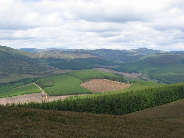
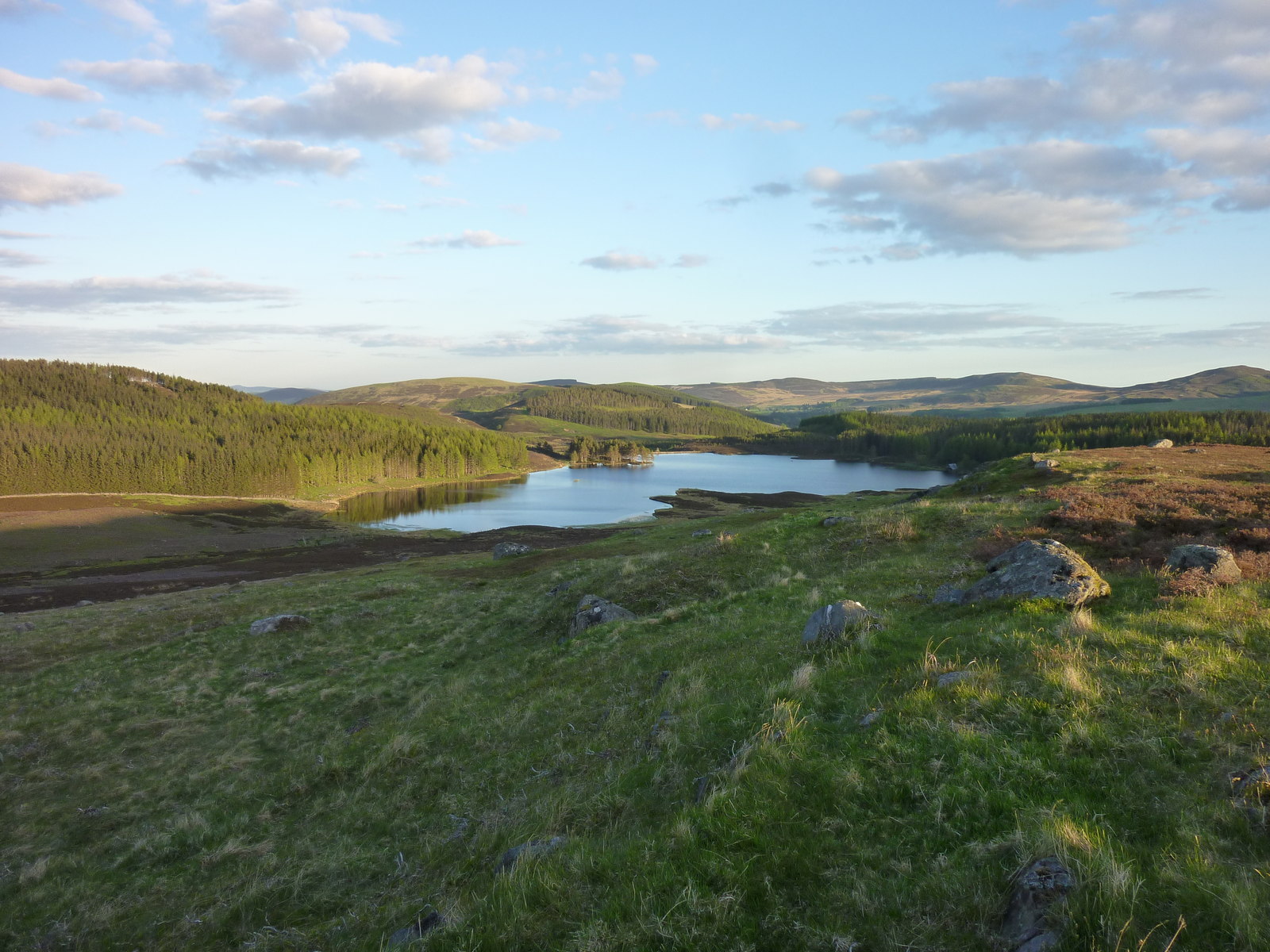
Craigie Law is a prominent hill located in the county of Angus, Scotland. With an elevation of approximately 213 meters (699 feet), it offers stunning panoramic views of the surrounding countryside and is a popular destination for outdoor enthusiasts and nature lovers.

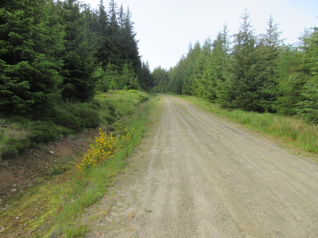
Situated near the coastal town of Arbroath, Craigie Law is an easily accessible landmark, attracting locals and tourists alike. The hill is characterized by its gentle slopes, which make it suitable for hikers of all skill levels. Its well-maintained trails and footpaths allow visitors to explore the area and enjoy the breathtaking scenery.

Craigie Law is rich in biodiversity, boasting a variety of flora and fauna. The hill is covered in a patchwork of heather, grasses, and wildflowers, creating a vibrant and picturesque landscape. The hillside is home to several species of birds, including buzzards, kestrels, and skylarks, making it a haven for birdwatchers.

In addition to its natural beauty, Craigie Law holds historical significance. It is believed to have been an important site during the Pictish era, with evidence of ancient settlements and burial grounds found in the vicinity. The hill also played a role in World War II, serving as a strategic lookout point for spotting enemy aircraft.

Overall, Craigie Law offers a captivating blend of natural splendor, historical significance, and recreational opportunities. Whether it be for a leisurely stroll, a challenging hike, or simply to soak in the breathtaking views, this Angus hill provides an unforgettable experience for visitors of all ages.

If you have any feedback on the listing, please let us know in the comments section below.

Craigie Law Images

Images are sourced within 2km of 56.769497/-3.2683291 or Grid Reference NO2264. Thanks to Geograph Open Source API. All images are credited.

Forest track north of Tulloch Track heading northwards through the forest north of Tulloch, part of the circular route from Freuchies around Crock.
Forest track north of Tulloch
Track heading northwards through the forest north of Tulloch, part of the circular route from Freuchies around Crock.
Younger plantation Young plantation of trees on the north-western slopes of Crock, with Badandun Hill in the distance.
Younger plantation
Young plantation of trees on the north-western slopes of Crock, with Badandun Hill in the distance.
Birches among the pines Scattered birches in the pine forest next to the track north of Crock.
Birches among the pines
Scattered birches in the pine forest next to the track north of Crock.
Heading back to Freuchies The track beginning its southward journey back to Freuchies on the loop around Crock.
Heading back to Freuchies
The track beginning its southward journey back to Freuchies on the loop around Crock.
Line of pines Remaining pine trees above a new plantation west of Glenmarkie.
Line of pines
Remaining pine trees above a new plantation west of Glenmarkie.
New plantation on the hillside New plantation on the eastern slope of Crock.
New plantation on the hillside
New plantation on the eastern slope of Crock.
Craighead Farmland gives way to the moors over the Muckle Burn.Taken before I disappeared into the forest for many squares.
Craighead
Farmland gives way to the moors over the Muckle Burn.Taken before I disappeared into the forest for many squares.
"Crablogger" This picture was taken at long range and cropped! The beast here devours forests. The arm can grab fell and desprag/debark the trunk in seconds.  I saw the machine later when out of use and it had written on the arm "Danger do not approach within 500ft" A quick conversion reassured me, I took this photo from 400m range, on the way up Crock. 

(Crablogger refers to a similar animal in Thunderbirds- it was of course a) nuclear powered and  b) went wrong)
"Crablogger"
This picture was taken at long range and cropped! The beast here devours forests. The arm can grab fell and desprag/debark the trunk in seconds. I saw the machine later when out of use and it had written on the arm "Danger do not approach within 500ft" A quick conversion reassured me, I took this photo from 400m range, on the way up Crock. (Crablogger refers to a similar animal in Thunderbirds- it was of course a) nuclear powered and b) went wrong)
Crock Near the summit of Crock, the name simply means "hill", usually spelt Cnoc. The summit is a small area of moorland set in a vast conifer plantation. The easiest way up is a track from the north, but felling replanting is likely to change things. View looking north, the striking peak is Mayar (927m)
Crock
Near the summit of Crock, the name simply means "hill", usually spelt Cnoc. The summit is a small area of moorland set in a vast conifer plantation. The easiest way up is a track from the north, but felling replanting is likely to change things. View looking north, the striking peak is Mayar (927m)
Logpiles north of Craigie Law Logs cut and ready to be trucked out of the forest on the road at the left.
Logpiles north of Craigie Law
Logs cut and ready to be trucked out of the forest on the road at the left.
Finlet Burn Several stages in forest management can be seen in this picture.  The banks of the burn are left unplanted, there is a recent clear fell and a couple of different aged plantings. Looking north towards the high Mounth plateau.
Finlet Burn
Several stages in forest management can be seen in this picture. The banks of the burn are left unplanted, there is a recent clear fell and a couple of different aged plantings. Looking north towards the high Mounth plateau.
Glenmarkie A farm in the midst of the forest. The land here is grazed by sheep and cattle (They are currently using a Limousin bull, so lots of beigy-orange calves). The farm is also an equestrian  centre/guest house, the tracks and moors here are all marked with horseshoes - its ideal country for riding.  The background is the forested slope of Hare Cairn,
Glenmarkie
A farm in the midst of the forest. The land here is grazed by sheep and cattle (They are currently using a Limousin bull, so lots of beigy-orange calves). The farm is also an equestrian centre/guest house, the tracks and moors here are all marked with horseshoes - its ideal country for riding. The background is the forested slope of Hare Cairn,
Glenmarkie Lodge Taken from just outside its square, but a fine example of a Highland Lodge.
Glenmarkie Lodge
Taken from just outside its square, but a fine example of a Highland Lodge.
Glenmarkie Farm Horses grazing beyond the all weather training area. Glenmarkie is a secluded guest house offering riding holidays. The forest relents here allowing easy access to vast areas of moorland.
Glenmarkie Farm
Horses grazing beyond the all weather training area. Glenmarkie is a secluded guest house offering riding holidays. The forest relents here allowing easy access to vast areas of moorland.
Newton Burn meander A winter view with Glenmarkie Lodge in the background.
Newton Burn meander
A winter view with Glenmarkie Lodge in the background.
Forest edge, Glenmarkie Edge of large forest block east of Glenmarkie Farm.
Forest edge, Glenmarkie
Edge of large forest block east of Glenmarkie Farm.
Glen Taitney This shallow glen is largely forested, a crop having recently been taken out from this part. The line just above the surviving trees in the middle distance is a leat that once ran to just above Glenmarkie Lodge.
Glen Taitney
This shallow glen is largely forested, a crop having recently been taken out from this part. The line just above the surviving trees in the middle distance is a leat that once ran to just above Glenmarkie Lodge.
Mid  Shank A long gentle ridge running south from Craigie Thieves.  Covered in heather and well populated by grouse. The prominent hill is Hare Cairn.  Blackwater Reservoir can just be seen.
Mid Shank
A long gentle ridge running south from Craigie Thieves. Covered in heather and well populated by grouse. The prominent hill is Hare Cairn. Blackwater Reservoir can just be seen.
Show me another place!

Craigie Law is located at Grid Ref: NO2264 (Lat: 56.769497, Lng: -3.2683291)

Unitary Authority: Angus

Police Authority: Tayside

What 3 Words

///forces.awestruck.imposes. Near Alyth, Perth & Kinross

Nearby Locations

Craigie Law

Related Wikis

Auchintaple Loch

Auchintaple Loch also known as Auchenchapel Loch, is a small shallow freshwater loch that is located in Glen Isla in Angus, Scotland. == See also == List...

Folda, Angus

Folda is a hamlet in Glen Isla, Angus, Scotland. It is situated on the River Isla, twelve miles north-west of Kirriemuir and eleven miles north of Blairgowrie...

Little Forter

Little Forter is a hamlet in Glen Isla, Angus, Scotland. It is on the River Isla, 13 miles (21 kilometres) north-west of Kirriemuir and 11 miles (18 kilometres...

Forter Castle

Forter Castle is located in Glenisla, Perthshire, Scotland. It was built in 1560 by James Ogilvy, the 5th Lord of Airlie. In 1640, it was burned by Archibald...

Nearby Amenities

Located within 500m of 56.769497,-3.2683291
Craigie Law
Ele: 459
Natural: peak
Lat/Long: 56.7696588/-3.2671286
The data included in this document is from www.openstreetmap.org. The data is made available under ODbL.

Have you been to Craigie Law?

Leave your review of Craigie Law below (or comments, questions and feedback).