Banks

Settlement in Kirkcudbrightshire

Scotland

Banks

Galtway Churchyard, nr Kirkcudbright Galtway Church dated from the 12th century, and was very small at about 30ft x 15ft. Very little remains of the church, but the churchyard is still in occasional use, with one gravestone recording a death in 2012. In the foreground of this photo is the tomb of the Lidderdale family, including John Lidderdale, died 1777. The church is also known as St Michael's Church. A quarter of a mile to the ENE of the graveyard was located Galtway Village. Known to have been inhabited in 1641, hardly anything remains of the settlement.
Galtway Churchyard, nr Kirkcudbright Credit: Forrest and Jen

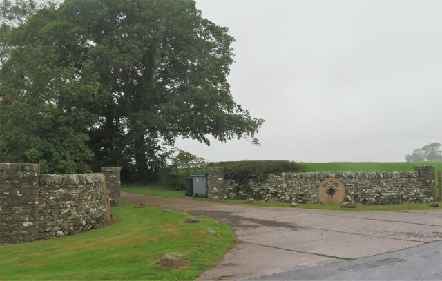
Banks is a small village located in the historical county of Kirkcudbrightshire, in the southwest of Scotland. Situated near the eastern coast, Banks is nestled in the picturesque landscape of the Scottish Lowlands. The village is approximately 8 miles northeast of Castle Douglas and 15 miles south of Dumfries.

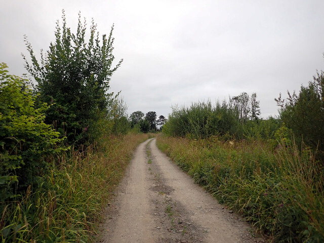
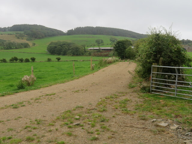
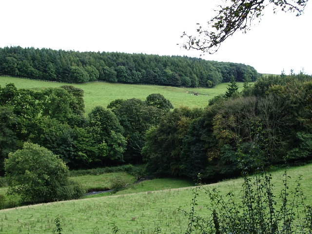
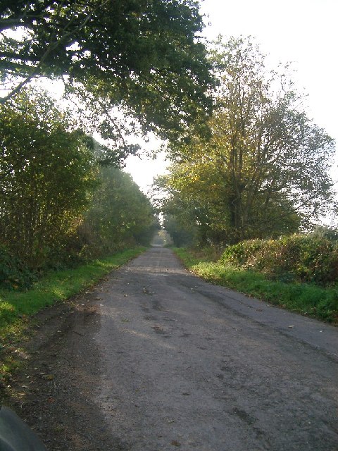
Banks is known for its tranquil and scenic surroundings. The area is characterized by rolling hills, green farmland, and charming country lanes, making it a popular destination for those seeking a peaceful getaway. The village itself is small, with a population of around 200 residents.

Despite its size, Banks offers basic amenities to its residents and visitors. The village features a local convenience store, providing essential groceries and supplies. Additionally, there is a small primary school serving the local children.

The village is well-connected to the surrounding areas by road, making it easily accessible for those traveling by car. The nearby A75 road connects Banks to larger towns and cities in the region, offering convenient access to services and attractions further afield.

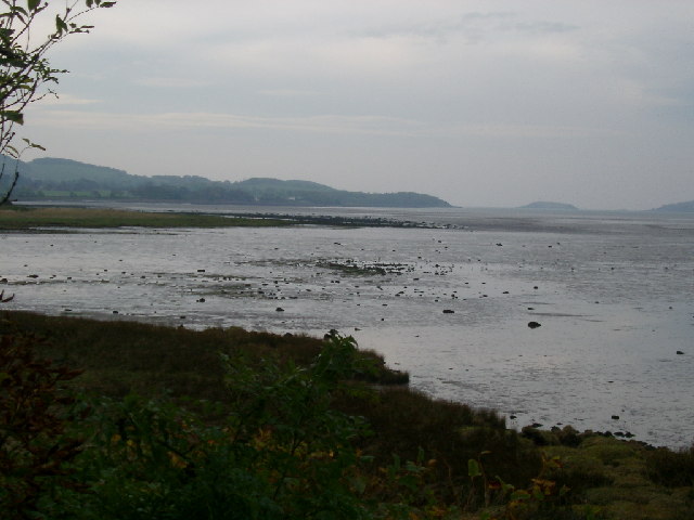
Banks is also known for its proximity to some of Scotland's stunning natural beauty spots. The Galloway Forest Park, renowned for its dark skies and excellent stargazing opportunities, is just a short drive away. The Solway Coast, with its sandy beaches and rugged coastline, is also easily accessible from the village.

Overall, Banks is a charming and peaceful village, offering a tranquil escape for those seeking a slower pace of life within Scotland's beautiful Lowlands.

If you have any feedback on the listing, please let us know in the comments section below.

Banks Images

Images are sourced within 2km of 54.809692/-4.0398545 or Grid Reference NX6948. Thanks to Geograph Open Source API. All images are credited.

Galtway Churchyard, nr Kirkcudbright Galtway Church dated from the 12th century, and was very small at about 30ft x 15ft. Very little remains of the church, but the churchyard is still in occasional use, with one gravestone recording a death in 2012. In the foreground of this photo is the tomb of the Lidderdale family, including John Lidderdale, died 1777. The church is also known as St Michael's Church. A quarter of a mile to the ENE of the graveyard was located Galtway Village. Known to have been inhabited in 1641, hardly anything remains of the settlement.
Galtway Churchyard, nr Kirkcudbright
Galtway Church dated from the 12th century, and was very small at about 30ft x 15ft. Very little remains of the church, but the churchyard is still in occasional use, with one gravestone recording a death in 2012. In the foreground of this photo is the tomb of the Lidderdale family, including John Lidderdale, died 1777. The church is also known as St Michael's Church. A quarter of a mile to the ENE of the graveyard was located Galtway Village. Known to have been inhabited in 1641, hardly anything remains of the settlement.
High Banks Steading, nr Kirkcudbright Now in ruins, High Banks Steading dates back to before 1850. The wooden stables in the foreground were built about 2018. To the NW is High Banks House.
High Banks Steading, nr Kirkcudbright
Now in ruins, High Banks Steading dates back to before 1850. The wooden stables in the foreground were built about 2018. To the NW is High Banks House.
Farm entrance off A711 The entrance to the lane leading to Milton farm which stands at the edge of the military training area.
Farm entrance off A711
The entrance to the lane leading to Milton farm which stands at the edge of the military training area.
Track, St. Mary's Isle, Kirkcudbright St Mary's Isle in a peninsula in the estuary of the River Dee to the south of Kirkcudbright. It lies between Manxman's Lake and Goat Well Bay. At low tide it is about 1.75km long and 550m wide at its widest. The tidal island of Inch lies to its south off Point of the Isle. There was an Augustinian Priory on the Isle between the 12th and 16th centuries; all traces of it were removed when the Earls of Selkirk landscaped the Isle in the 17th and 18th centuries.
Track, St. Mary's Isle, Kirkcudbright
St Mary's Isle in a peninsula in the estuary of the River Dee to the south of Kirkcudbright. It lies between Manxman's Lake and Goat Well Bay. At low tide it is about 1.75km long and 550m wide at its widest. The tidal island of Inch lies to its south off Point of the Isle. There was an Augustinian Priory on the Isle between the 12th and 16th centuries; all traces of it were removed when the Earls of Selkirk landscaped the Isle in the 17th and 18th centuries.
Manxman's Lake seen from St. Mary's Isle, Kirkcudbright St Mary's Isle in a peninsula in the estuary of the River Dee to the south of Kirkcudbright. It lies between Manxman's Lake and Goat Well Bay. At low tide it is about 1.75km long and 550m wide at its widest. The tidal island of Inch lies to its south off Point of the Isle. There was an Augustinian Priory on the Isle between the 12th and 16th centuries; all traces of it were removed when the Earls of Selkirk landscaped the Isle in the 17th and 18th centuries.
Manxman's Lake seen from St. Mary's Isle, Kirkcudbright
St Mary's Isle in a peninsula in the estuary of the River Dee to the south of Kirkcudbright. It lies between Manxman's Lake and Goat Well Bay. At low tide it is about 1.75km long and 550m wide at its widest. The tidal island of Inch lies to its south off Point of the Isle. There was an Augustinian Priory on the Isle between the 12th and 16th centuries; all traces of it were removed when the Earls of Selkirk landscaped the Isle in the 17th and 18th centuries.
Woodland path, St. Mary's Isle, Kirkcudbright St Mary's Isle in a peninsula in the estuary of the River Dee to the south of Kirkcudbright. It lies between Manxman's Lake and Goat Well Bay. At low tide it is about 1.75km long and 550m wide at its widest. The tidal island of Inch lies to its south off Point of the Isle. There was an Augustinian Priory on the Isle between the 12th and 16th centuries; all traces of it were removed when the Earls of Selkirk landscaped the Isle in the 17th and 18th centuries.
Woodland path, St. Mary's Isle, Kirkcudbright
St Mary's Isle in a peninsula in the estuary of the River Dee to the south of Kirkcudbright. It lies between Manxman's Lake and Goat Well Bay. At low tide it is about 1.75km long and 550m wide at its widest. The tidal island of Inch lies to its south off Point of the Isle. There was an Augustinian Priory on the Isle between the 12th and 16th centuries; all traces of it were removed when the Earls of Selkirk landscaped the Isle in the 17th and 18th centuries.
Path, St. Mary's Isle, Kirkcudbright St Mary's Isle in a peninsula in the estuary of the River Dee to the south of Kirkcudbright. It lies between Manxman's Lake and Goat Well Bay. At low tide it is about 1.75km long and 550m wide at its widest. The tidal island of Inch lies to its south off Point of the Isle. There was an Augustinian Priory on the Isle between the 12th and 16th centuries; all traces of it were removed when the Earls of Selkirk landscaped the Isle in the 17th and 18th centuries.
Path, St. Mary's Isle, Kirkcudbright
St Mary's Isle in a peninsula in the estuary of the River Dee to the south of Kirkcudbright. It lies between Manxman's Lake and Goat Well Bay. At low tide it is about 1.75km long and 550m wide at its widest. The tidal island of Inch lies to its south off Point of the Isle. There was an Augustinian Priory on the Isle between the 12th and 16th centuries; all traces of it were removed when the Earls of Selkirk landscaped the Isle in the 17th and 18th centuries.
Lane towards Mutehill This country lane flirts with this grid square, being inside it for some 200m here and for a similar length at the NW corner of the grid square.
Lane towards Mutehill
This country lane flirts with this grid square, being inside it for some 200m here and for a similar length at the NW corner of the grid square.
Farmland near Torrs Green pastures between the coast and Castle Hill.
Farmland near Torrs
Green pastures between the coast and Castle Hill.
Driveway entrance to Milton Just off the A711 Kirkcudbright to Dundrennan road.
Driveway entrance to Milton
Just off the A711 Kirkcudbright to Dundrennan road.
Entry to North Milton
North Milton The entrance to North Milton farm.
North Milton
The entrance to North Milton farm.
The Buckland Burn at Cannee This is a view of the burn just after the Buckland Bridge, taken from the road, just before it enters the former Orchard Banks Plantation
The Buckland Burn at Cannee
This is a view of the burn just after the Buckland Bridge, taken from the road, just before it enters the former Orchard Banks Plantation
Trees lining the road near Grange Farm, Muthill One of the few bits of this area of the countryside that wasn't flying a red flag that day - most of this peninsula (if you can call it that) is MOD training area and I didn't want to get shot as a spy/terrorist, so this is as exciting as the photos got!
Trees lining the road near Grange Farm, Muthill
One of the few bits of this area of the countryside that wasn't flying a red flag that day - most of this peninsula (if you can call it that) is MOD training area and I didn't want to get shot as a spy/terrorist, so this is as exciting as the photos got!
Mudflats towards Paul Jones Point, St Mary's Isle, Kirkcudbright taken from the shore in the Black Moray Plantation across Manxman's Lake to Paul Jones Point, St Mary's Isle, Kirkcudbright
Mudflats towards Paul Jones Point, St Mary's Isle, Kirkcudbright
taken from the shore in the Black Moray Plantation across Manxman's Lake to Paul Jones Point, St Mary's Isle, Kirkcudbright
Manxman's Lake near Kirkcudbright on the East side of Kirkcudbright Bay looking Southish
Manxman's Lake
near Kirkcudbright on the East side of Kirkcudbright Bay looking Southish
Show me another place!

Banks is located at Grid Ref: NX6948 (Lat: 54.809692, Lng: -4.0398545)

Unitary Authority: Dumfries and Galloway

Police Authority: Dumfries and Galloway

What 3 Words

///nuzzling.provide.sings. Near Kirkcudbright, Dumfries & Galloway

Nearby Locations

Banks

Related Wikis

River Dee, Galloway

The River Dee (Scottish Gaelic: Dè / Uisge Dhè), in south-west Scotland, flows from its source in Loch Dee amongst the Galloway Hills, firstly to Clatteringshaws...

High Banks cup and ring markings

The High Banks cup and ring markings are a series of Neolithic or Bronze Age carvings on an outcrop of rock near High Banks farm, 3 km SE of Kirkcudbright...

Kirkcudbright

Kirkcudbright ( kur-KOO-bree; Scots: Kirkcoubrie; Scottish Gaelic: Cille Chùithbeirt) is a town, parish and a Royal Burgh from 1455 in Kirkcudbrightshire...

Dundrennan Range

Dundrennan Range is a weapons testing range on the Solway Firth, near Kirkcudbright in Dumfries and Galloway, in south west Scotland, it is part of the...

Kirkcudbright Hospital

Kirkcudbright Hospital is a health facility in Barrhill Road, Kirkcudbright, Dumfries and Galloway, Scotland. It is managed by NHS Dumfries and Galloway...

St Cuthbert Wanderers F.C.

Saint Cuthbert Wanderers Football Club are a football club from the town of Kirkcudbright in the Stewartry in Galloway, Scotland. They play in the South...

Stewartry Museum

The Stewartry Museum is a local museum in Kirkcudbright, Scotland, which covers the history of this part of Galloway. == History == The museum was originally...

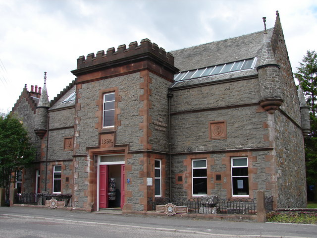
County Buildings, Kirkcudbright

County Buildings is a municipal building in Kirkcudbright, in the Dumfries and Galloway council area in Scotland. It was originally two houses on High...

Nearby Amenities

Located within 500m of 54.809692,-4.0398545
Source: PGS
Lat/Long: 54.8113991/-4.0469511
Source: PGS
Lat/Long: 54.8111357/-4.046979
Source: PGS
Lat/Long: 54.8108167/-4.0469908
Source: PGS
Lat/Long: 54.8104618/-4.0469704
Source: PGS
Lat/Long: 54.8100648/-4.0471152
Source: PGS
Lat/Long: 54.8097904/-4.0473957
Power: pole
Lat/Long: 54.8137612/-4.0430573
Power: pole
Lat/Long: 54.8131307/-4.0429022
Power: pole
Lat/Long: 54.8125125/-4.0427599
Power: pole
Lat/Long: 54.8117094/-4.0425772
Power: pole
Lat/Long: 54.8109369/-4.0423923
Power: pole
Lat/Long: 54.81019/-4.0422245
Power: pole
Lat/Long: 54.8094787/-4.0420588
Power: pole
Lat/Long: 54.8087098/-4.0418761
Power: pole
Lat/Long: 54.8079385/-4.041687
Power: pole
Lat/Long: 54.8069823/-4.0410731
Power: pole
Lat/Long: 54.8064558/-4.0414852
Power: pole
Lat/Long: 54.8055142/-4.042182
The data included in this document is from www.openstreetmap.org. The data is made available under ODbL.

Have you been to Banks?

Leave your review of Banks below (or comments, questions and feedback).