Bodnasparet

Hill, Mountain in Angus

Scotland

Bodnasparet

Hill road, Badandun Hill The quite appalling erosion which is caused by driving vehicles over the fragile moorland vegetation is apparent.   The scarring of the landscape is visible from miles away.
Hill road, Badandun Hill Credit: Iain A Robertson

Bodnasparet is a prominent hill located in the Angus region of Scotland. It is part of the Grampian Mountains range and stands at an elevation of approximately 621 meters (2,037 feet) above sea level. The hill is situated near the town of Glenisla, about 23 kilometers northwest of the town of Kirriemuir.

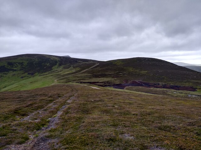
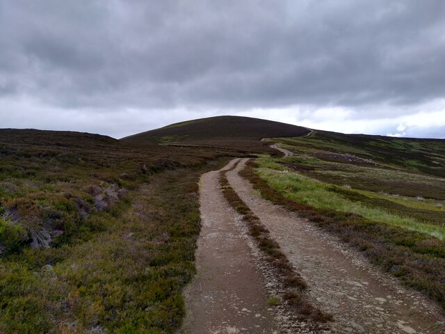
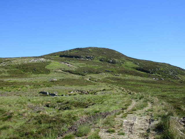
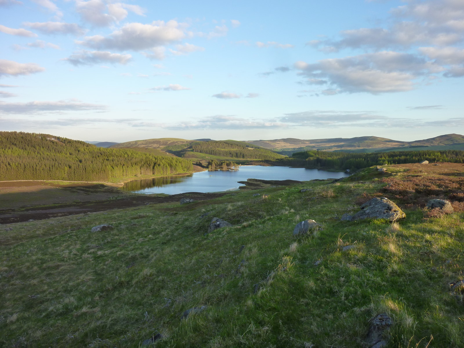
Bodnasparet is known for its distinctive shape and rugged terrain, which makes it a popular destination for hikers and mountaineers. The hill is characterized by steep slopes and rocky outcrops, providing a challenging yet rewarding experience for outdoor enthusiasts. Its summit offers breathtaking panoramic views of the surrounding countryside, including the Glenisla Valley and nearby mountain ranges.

The hill is covered in heather and grass, creating a vibrant and picturesque landscape, especially during the summer months when wildflowers bloom. It is also home to a variety of wildlife, including red deer, mountain hares, and various bird species.

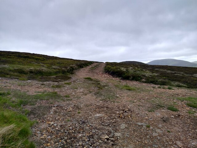
Access to Bodnasparet is available through a network of trails and paths that wind through the surrounding hills. These routes cater to different levels of difficulty, allowing both experienced hikers and beginners to explore and enjoy the area.

Overall, Bodnasparet is a notable landmark in the Angus region, offering outdoor enthusiasts a chance to immerse themselves in the natural beauty of the Scottish Highlands and experience the thrill of conquering its challenging slopes.

If you have any feedback on the listing, please let us know in the comments section below.

Bodnasparet Images

Images are sourced within 2km of 56.810327/-3.2740979 or Grid Reference NO2269. Thanks to Geograph Open Source API. All images are credited.

Hill road, Badandun Hill The quite appalling erosion which is caused by driving vehicles over the fragile moorland vegetation is apparent.   The scarring of the landscape is visible from miles away.
Hill road, Badandun Hill
The quite appalling erosion which is caused by driving vehicles over the fragile moorland vegetation is apparent. The scarring of the landscape is visible from miles away.
Muir burn on Bodnasparet Muir burn need not disfigure a hillside, but straight lines and right angles are unnecessary blemishes.
Muir burn on Bodnasparet
Muir burn need not disfigure a hillside, but straight lines and right angles are unnecessary blemishes.
SE from the slopes of Craig Law Looking south-east across the glen the rounded shape of Badandun Hill dominates the view.
SE from the slopes of Craig Law
Looking south-east across the glen the rounded shape of Badandun Hill dominates the view.
The road to Craig Law This is part of the network of roads which give access to the grouse moors.
The road to Craig Law
This is part of the network of roads which give access to the grouse moors.
The plateau at the end of Glen Isla Coming down Mid Hill this is the view towards the next hills, Tarmach Cairn and Bawhelps, which are just little bumps in the large plateau that extends from here to Loch Muick in the north, Glen Shee in the west and who knows what in the east. The nose that shows up in the background is, if I'm not mistaken, part of Mayar.
The plateau at the end of Glen Isla
Coming down Mid Hill this is the view towards the next hills, Tarmach Cairn and Bawhelps, which are just little bumps in the large plateau that extends from here to Loch Muick in the north, Glen Shee in the west and who knows what in the east. The nose that shows up in the background is, if I'm not mistaken, part of Mayar.
Summit of Mid Hill This, I think, is the summit cairn of Mid Hill, a pretty non-descript hill at the end of Glen Isla, which leads onto a large plateau. This cairn is fairly small, not really a cairn. A bit further west is a larger stony structure, but this seems slightly higher.
Summit of Mid Hill
This, I think, is the summit cairn of Mid Hill, a pretty non-descript hill at the end of Glen Isla, which leads onto a large plateau. This cairn is fairly small, not really a cairn. A bit further west is a larger stony structure, but this seems slightly higher.
Track up Mid Hill The last kilometre of the track up Mid Hill. This is a very boring track, bulldozed onto the hill, but it gives easy access to the hills beyond.
Track up Mid Hill
The last kilometre of the track up Mid Hill. This is a very boring track, bulldozed onto the hill, but it gives easy access to the hills beyond.
Four way crossroads The rare four way crossroads of bulldozed hill tracks. The track to the left leads onto the summit of Mid Hill. The one straight circumvents the summit and leads further onto the plateau. The one on the right leads to Craig Lair, and can then be used to get back to Glen Isla.
Four way crossroads
The rare four way crossroads of bulldozed hill tracks. The track to the left leads onto the summit of Mid Hill. The one straight circumvents the summit and leads further onto the plateau. The one on the right leads to Craig Lair, and can then be used to get back to Glen Isla.
Bealach between Craig Lair and Badandun Hill Four or five black and white creatures (which I took to be feral goats - any other theories welcomed!) disappeared down the opposite slope towards the Sluggan just before I took this photo.
Bealach between Craig Lair and Badandun Hill
Four or five black and white creatures (which I took to be feral goats - any other theories welcomed!) disappeared down the opposite slope towards the Sluggan just before I took this photo.
Hill track on Badandun Hill The route here is very much a broad track (as shown on the 1:25000 map) rather than the path shown on the 1:50000 scale map.  Further up, it is quite badly eroded.
Hill track on Badandun Hill
The route here is very much a broad track (as shown on the 1:25000 map) rather than the path shown on the 1:50000 scale map. Further up, it is quite badly eroded.
Felled forest Northern tip of the felled forest east of Badandun Hill.
Felled forest
Northern tip of the felled forest east of Badandun Hill.
Craig Lair Craig Lair viewed from the path on the col with Badandun Hill.
Craig Lair
Craig Lair viewed from the path on the col with Badandun Hill.
Fore Brae Fore Brae viewed from the south-east, with Creag Leacach and Monamenach visible beyond.
Fore Brae
Fore Brae viewed from the south-east, with Creag Leacach and Monamenach visible beyond.
Hill road with members of walking party The road has climbed out of Glen Isla via Fergus and is part of a series of such roads on these mountains.
Glen Isla lies below on the near side of the thinly sunlit hills.
Hill road with members of walking party
The road has climbed out of Glen Isla via Fergus and is part of a series of such roads on these mountains. Glen Isla lies below on the near side of the thinly sunlit hills.
Hill road climbing towards Craig Lair Craig Lair is a minor rise on a winding hill ridge which passes over a number of similar, but increasingly higher tops finally reaching the Munro, Mayar. According to current OS mapping, the road continues over or bypasses a number of those tops but ends short of Barwhelps.
Hill road climbing towards Craig Lair
Craig Lair is a minor rise on a winding hill ridge which passes over a number of similar, but increasingly higher tops finally reaching the Munro, Mayar. According to current OS mapping, the road continues over or bypasses a number of those tops but ends short of Barwhelps.
Summit area of Craig Lair A well constructed cairn stands at or close to the highest point of Craig Lair which is a minor top on a long ridge which continues to Mayar, a distant blip seen on the skyline left of the cairn. Mayar is a Munro as is Dreish, the dome to the right of the cairn.
Summit area of Craig Lair
A well constructed cairn stands at or close to the highest point of Craig Lair which is a minor top on a long ridge which continues to Mayar, a distant blip seen on the skyline left of the cairn. Mayar is a Munro as is Dreish, the dome to the right of the cairn.
Desecration of mountain scenery above Glen Isla A disgraceful scene close to the summit of Badandun Hill. Iain Robertson had already commented on the "appalling erosion" on the mountain in 2011... <a title="https://www.geograph.org.uk/photo/2380076" href="https://www.geograph.org.uk/photo/2380076">Link</a>. Now the situation is far worse! Here, to the left of the image a new stretch of road has been bulldozed creating a virtual dual carriageway on the mountainside. The older road to the right had presumably become too eroded for comfortable motoring!
There are similar scenes all over Badandun Hill and on slopes nearby where roads have been cut or simply motored into the land by multiple passes of vehicles. This isn't merely a matter of visual impact savage though that is; there has to be concern that the earth-surfaced road will become eroded by rainwater and meltwater which will worsen the scar and make the new road unusable. No doubt then, the estate will just dig another!
Desecration of mountain scenery above Glen Isla
A disgraceful scene close to the summit of Badandun Hill. Iain Robertson had already commented on the "appalling erosion" on the mountain in 2011... Link. Now the situation is far worse! Here, to the left of the image a new stretch of road has been bulldozed creating a virtual dual carriageway on the mountainside. The older road to the right had presumably become too eroded for comfortable motoring! There are similar scenes all over Badandun Hill and on slopes nearby where roads have been cut or simply motored into the land by multiple passes of vehicles. This isn't merely a matter of visual impact savage though that is; there has to be concern that the earth-surfaced road will become eroded by rainwater and meltwater which will worsen the scar and make the new road unusable. No doubt then, the estate will just dig another!
Desecration of mountain scenery above Glen Isla (2) A disgraceful scene on the slope of Badandun Hill. Iain Robertson had already commented on the "appalling erosion" on the mountain in 2011... <a title="https://www.geograph.org.uk/photo/2380076" href="https://www.geograph.org.uk/photo/2380076">Link</a>. Now the situation is far worse! Here, a new stretch of road has been created simply by tearing off the vegetation and the top layer of soil / peat. The road appears to be surfaced with earth.
There are similar scenes all over Badandun Hill and on slopes nearby where roads have been cut or simply motored into the land by multiple passes of vehicles. This isn't merely a matter of visual impact savage though that is; there has to be concern that the earth-surfaced road will become eroded by rainwater and meltwater which will worsen the scar and make the new road unusable. No doubt then, the estate will just dig another!
Desecration of mountain scenery above Glen Isla (2)
A disgraceful scene on the slope of Badandun Hill. Iain Robertson had already commented on the "appalling erosion" on the mountain in 2011... Link. Now the situation is far worse! Here, a new stretch of road has been created simply by tearing off the vegetation and the top layer of soil / peat. The road appears to be surfaced with earth. There are similar scenes all over Badandun Hill and on slopes nearby where roads have been cut or simply motored into the land by multiple passes of vehicles. This isn't merely a matter of visual impact savage though that is; there has to be concern that the earth-surfaced road will become eroded by rainwater and meltwater which will worsen the scar and make the new road unusable. No doubt then, the estate will just dig another!
Show me another place!

Bodnasparet is located at Grid Ref: NO2269 (Lat: 56.810327, Lng: -3.2740979)

Unitary Authority: Angus

Police Authority: Tayside

What 3 Words

///fondest.champions.seatbelt. Near Alyth, Perth & Kinross

Nearby Locations

Bodnasparet

Related Wikis

Mayar (mountain)

Mayar is a mountain in the Grampians, in Angus, Scotland. It is usually climbed together with its near neighbour, Driesh. At an elevation of 928 m, it...

Auchintaple Loch

Auchintaple Loch also known as Auchenchapel Loch, is a small shallow freshwater loch that is located in Glen Isla in Angus, Scotland. == See also == List...

Little Forter

Little Forter is a hamlet in Glen Isla, Angus, Scotland. It is on the River Isla, 13 miles (21 kilometres) north-west of Kirriemuir and 11 miles (18 kilometres...

Folda, Angus

Folda is a hamlet in Glen Isla, Angus, Scotland. It is situated on the River Isla, twelve miles north-west of Kirriemuir and eleven miles north of Blairgowrie...

Have you been to Bodnasparet?

Leave your review of Bodnasparet below (or comments, questions and feedback).