Deer Law

Hill, Mountain in Peeblesshire

Scotland

Deer Law

View towards Layer Knowe from Black Law With the Yarrow Valley near St Mary's Loch just visible to the left.
View towards Layer Knowe from Black Law Credit: wrobison

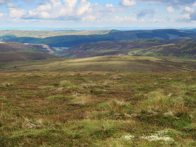
Deer Law is a prominent hill located in Peeblesshire, a historic county in the Scottish Borders region of Scotland. Situated in the southern uplands, this stunning mountain rises to an elevation of approximately 601 meters (1,972 feet) above sea level. It is nestled within the scenic landscape of the Tweed Valley, offering breathtaking panoramic views of the surrounding countryside.

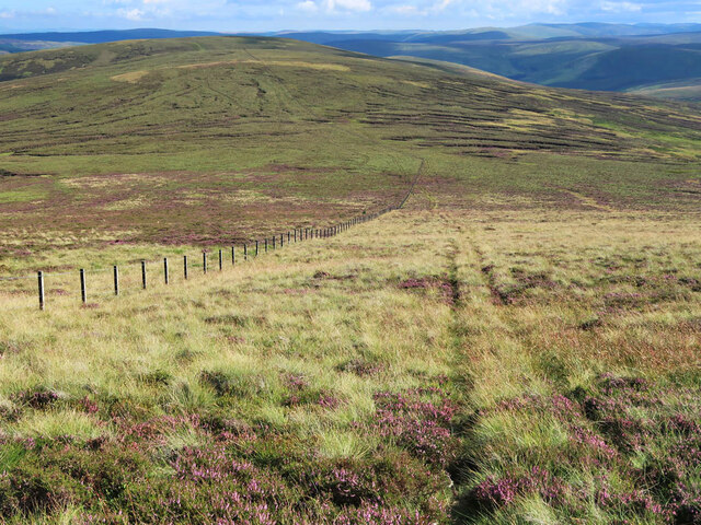
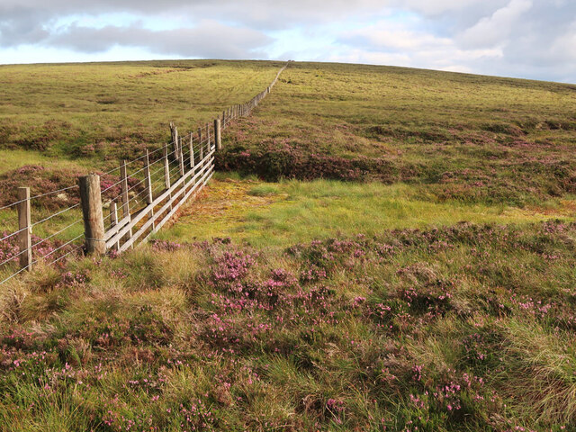
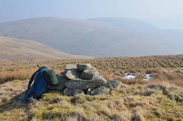
Deer Law is a popular destination for outdoor enthusiasts, hikers, and nature lovers. Its extensive network of well-maintained paths and trails makes it easily accessible to visitors of all abilities, offering a range of options for exploration and enjoyment. The hill's diverse terrain, consisting of heather moorland, rocky outcrops, and gentle slopes, adds to the allure and variety of the experience.

Abundant wildlife can be found in the area, including various species of birds, such as red grouse and peregrine falcons, as well as mammals like red deer and mountain hares. The hill is particularly known for its deer population, which provides a unique opportunity for wildlife enthusiasts to observe these majestic creatures in their natural habitat.

Deer Law also holds historical significance, with evidence of ancient settlements and prehistoric remains found in the vicinity. These archaeological remnants offer glimpses into the rich cultural heritage of the region.

Whether it be for a leisurely stroll amidst stunning natural beauty, an avid pursuit of wildlife observation, or a desire to connect with the area's historical past, Deer Law in Peeblesshire provides a captivating experience that leaves a lasting impression on all who visit.

If you have any feedback on the listing, please let us know in the comments section below.

Deer Law Images

Images are sourced within 2km of 55.51753/-3.2322455 or Grid Reference NT2225. Thanks to Geograph Open Source API. All images are credited.

View towards Layer Knowe from Black Law With the Yarrow Valley near St Mary's Loch just visible to the left.
View towards Layer Knowe from Black Law
With the Yarrow Valley near St Mary's Loch just visible to the left.
Fence and track on Black Law Looking south to Conscleuch Head and Deer Law.
Fence and track on Black Law
Looking south to Conscleuch Head and Deer Law.
Track to the col between Deer Law and Conscleuch Head Looking towards Conscleuch Head and Black Law.
Track to the col between Deer Law and Conscleuch Head
Looking towards Conscleuch Head and Black Law.
Moorland on Deer Law Megget Reservoir in the distance.
Moorland on Deer Law
Megget Reservoir in the distance.
Moorland on Conscleuch Head Looking towards Layer Knowe.
Moorland on Conscleuch Head
Looking towards Layer Knowe.
Fence and bog between Black Law and Conscleuch Head A good fence and an area of bog to be avoided.
Fence and bog between Black Law and Conscleuch Head
A good fence and an area of bog to be avoided.
How Cleuch This telephoto shot towards How Cleuch on Broomy Law was taken from Syart Rig.
How Cleuch
This telephoto shot towards How Cleuch on Broomy Law was taken from Syart Rig.
Black Law west top The march fence on Blackhouse Heights.
Black Law west top
The march fence on Blackhouse Heights.
West branch of Shiel Grain Shiel Grain drains the S-facing slopes between Redsike Head and Conscleuch Head in the catchment of the Glengaber Burn. The prominent track outlined by snowdrift is the route between Manor and Megget, here crossing Black Rig.
West branch of Shiel Grain
Shiel Grain drains the S-facing slopes between Redsike Head and Conscleuch Head in the catchment of the Glengaber Burn. The prominent track outlined by snowdrift is the route between Manor and Megget, here crossing Black Rig.
Fence junction, Black Law A boundary fence with a view across to the burn in White Cleuch on Notman Law with Dollar Law off to the right.
Fence junction, Black Law
A boundary fence with a view across to the burn in White Cleuch on Notman Law with Dollar Law off to the right.
Lichen on Black Law Patterns of lichen on a stone at about 680m not far from the summit of Black Law above the Manor Valley.
Lichen on Black Law
Patterns of lichen on a stone at about 680m not far from the summit of Black Law above the Manor Valley.
Approaching the summit of Black Law Parallel furrows run in the heather for some distance within the fence. If this had been ploughing for forestry it would have been significantly higher and more exposed than plantations nearby.
Approaching the summit of Black Law
Parallel furrows run in the heather for some distance within the fence. If this had been ploughing for forestry it would have been significantly higher and more exposed than plantations nearby.
Boar Cleuch 'Cleuch' is generally a steep-sided side valley, and a common word in the hill names around here.
Boar Cleuch
'Cleuch' is generally a steep-sided side valley, and a common word in the hill names around here.
Glen Gaber A view up to the SW side of Deer Law with the slope of Broomy Law on the right.
Glen Gaber
A view up to the SW side of Deer Law with the slope of Broomy Law on the right.
Glengaber Burn and sheepfolds Sheepfolds at the junction of Boar Cleuch and the Glengaber Burn.
Glengaber Burn and sheepfolds
Sheepfolds at the junction of Boar Cleuch and the Glengaber Burn.
Upper Glen Gaber Sheep pens to the right below Deer Law with Black Rig descending from the left further up the glen, seen from part way up Broomy Law.
Upper Glen Gaber
Sheep pens to the right below Deer Law with Black Rig descending from the left further up the glen, seen from part way up Broomy Law.
Summit cairn, Broomy Law One of Scotland's less frequented summits, but a pleasant spot on a mild and hazy March day.
Summit cairn, Broomy Law
One of Scotland's less frequented summits, but a pleasant spot on a mild and hazy March day.
Col north of Broomy Law A few snow remnants in the shade on the saddle between Broomy Law and Deer Law.
Col north of Broomy Law
A few snow remnants in the shade on the saddle between Broomy Law and Deer Law.
Show me another place!

Deer Law is located at Grid Ref: NT2225 (Lat: 55.51753, Lng: -3.2322455)

Unitary Authority: The Scottish Borders

Police Authority: The Lothians and Scottish Borders

What 3 Words

///defeated.outlawing.spurted. Near Ettrick, Scottish Borders

Nearby Locations

Deer Law

Related Wikis

Black Law (hill)

Black Law is a hill in the Manor Hills range, part of the Southern Uplands of Scotland. One of the more remote Donalds, it does not easily combine into...

Craigierig

Craigierig is a village on the Megget Reservoir, in the Scottish Borders area of Scotland, in the former Selkirkshire. Places nearby include the Glengaber...

Cappercleuch

Cappercleuch is a settlement on the A708, at St. Mary's Loch in the Scottish Borders area of Scotland, in the historic county of Selkirkshire. Places nearby...

Megget

Megget is a former chapelry or parish containing the valley of Megget Water, now forming the westernmost part of the parish of Yarrow, Selkirkshire in...

Nearby Amenities

Located within 500m of 55.51753,-3.2322455
Deer Law
Ele: 629
Natural: peak
Lat/Long: 55.5175069/-3.2319471
The data included in this document is from www.openstreetmap.org. The data is made available under ODbL.

Have you been to Deer Law?

Leave your review of Deer Law below (or comments, questions and feedback).