Drowning Dubs

Hill, Mountain in Peeblesshire

Scotland

Drowning Dubs

Northeast side of Craigdilly Overlooking Shiel Hope and Megget Reservoir.  A sheep walk.
Northeast side of Craigdilly Credit: Richard Webb

Drowning Dubs is a prominent hill located in Peeblesshire, a historic county in the Scottish Borders region of Scotland. With an elevation of approximately 533 meters (1,749 feet), it is classified as a Marilyn, which means it is a hill with a prominence of at least 150 meters (492 feet).

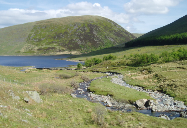
Situated within the Moorfoot Hills, Drowning Dubs offers breathtaking panoramic views of the surrounding countryside. Its location on the edge of the Southern Uplands provides visitors with stunning vistas of rolling hills, deep valleys, and forests. On clear days, the hill offers glimpses of nearby landmarks such as the Pentland Hills to the northwest and the Cheviot Hills to the southeast.

The ascent to Drowning Dubs can be challenging yet rewarding, with various routes available for hikers and mountaineers. The most popular approach is from the south, starting from Glengavel Reservoir, where a path leads uphill through heather-clad slopes. The climb is steep at times, but the well-trodden trail offers a relatively straightforward ascent.

Upon reaching the summit, adventurers are met with a trig point marking the highest point on the hill, offering a sense of accomplishment and a spot to rest and enjoy the panoramic views. Drowning Dubs is a haven for outdoor enthusiasts, attracting hikers, nature lovers, and photographers seeking to immerse themselves in the beauty and tranquility of the Scottish countryside.

If you have any feedback on the listing, please let us know in the comments section below.

Drowning Dubs Images

Images are sourced within 2km of 55.473661/-3.2533729 or Grid Reference NT2020. Thanks to Geograph Open Source API. All images are credited.

Northeast side of Craigdilly Overlooking Shiel Hope and Megget Reservoir.  A sheep walk.
Northeast side of Craigdilly
Overlooking Shiel Hope and Megget Reservoir. A sheep walk.
Moorland, Shiel Hope Eastern side of Craigdilly.
Moorland, Shiel Hope
Eastern side of Craigdilly.
Shielhope Descending clag above a somewhat cut off glen (thanks to Megget Reservoir).
Shielhope
Descending clag above a somewhat cut off glen (thanks to Megget Reservoir).
Shiel Hope The south side of the Megget Reservoir.
Shiel Hope
The south side of the Megget Reservoir.
A lone tree at Syart Rig The hills in this location comprise of tussock grass, bog and heather patches, so it was unusual to come across this small fir tree.
A lone tree at Syart Rig
The hills in this location comprise of tussock grass, bog and heather patches, so it was unusual to come across this small fir tree.
Syart Law from the road to Meggat Sorry, but I liked the fluffy grass.  Anyway Syart Law on the right with Syart Rig in the background and White Knowe on the left.
Syart Law from the road to Meggat
Sorry, but I liked the fluffy grass. Anyway Syart Law on the right with Syart Rig in the background and White Knowe on the left.
North Grain, Chapelhope Burn Looking upstream to Muckle Knees in the distance.
North Grain, Chapelhope Burn
Looking upstream to Muckle Knees in the distance.
Waterfall, North Grain.
Small stream, North Grain. Looking up a small tributary to North Grain, between Ratlin Side on the right and Shielhope Hill on the left.
Small stream, North Grain.
Looking up a small tributary to North Grain, between Ratlin Side on the right and Shielhope Hill on the left.
Confluence, Shielhope burn The two main upper branches of the burn, one from Muckle Knees, the other from Shielhope hill, join here.
Confluence, Shielhope burn
The two main upper branches of the burn, one from Muckle Knees, the other from Shielhope hill, join here.
Shielhope burn Looking downstream towards the Megget Reservoir
Shielhope burn
Looking downstream towards the Megget Reservoir
Sheepfold, Shielhope burn This one is the usual round shape, but has two protruding arms like a clock at 12:15.  It also has a fence round it - to keep out the sheep?
Sheepfold, Shielhope burn
This one is the usual round shape, but has two protruding arms like a clock at 12:15. It also has a fence round it - to keep out the sheep?
Bay, Megget Reservoir The end of the valley of Shielhope burn has become a small bay after the flooding of the reservoir.
Bay, Megget Reservoir
The end of the valley of Shielhope burn has become a small bay after the flooding of the reservoir.
Footbridge, Shielhope burn A useful link for those walkers attempting to traverse the S side of the Megget Reservoir.
Footbridge, Shielhope burn
A useful link for those walkers attempting to traverse the S side of the Megget Reservoir.
Confluence, Shielhope burn The side burn of Shielhope Sike comes down from the R to finish in a small waterfall.
Confluence, Shielhope burn
The side burn of Shielhope Sike comes down from the R to finish in a small waterfall.
Grouse Butt no. 8, Shielhope Hill There's not many grouse these days on Shielhope Hill, we saw just a few white mountain hares, looking rather distinctive against the heather.
Grouse Butt no. 8, Shielhope Hill
There's not many grouse these days on Shielhope Hill, we saw just a few white mountain hares, looking rather distinctive against the heather.
Drowning Dubs A rather wetter patch than most in this area, which is saying a lot.
Drowning Dubs
A rather wetter patch than most in this area, which is saying a lot.
Bird table? Shielhope Hill This rather bizarre structure about 1m high looks like an old bird table, though rather tilted due to the movement of the peat.
Bird table? Shielhope Hill
This rather bizarre structure about 1m high looks like an old bird table, though rather tilted due to the movement of the peat.
Show me another place!

Drowning Dubs is located at Grid Ref: NT2020 (Lat: 55.473661, Lng: -3.2533729)

Unitary Authority: The Scottish Borders

Police Authority: The Lothians and Scottish Borders

What 3 Words

///implanted.spectacle.promoting. Near Ettrick, Scottish Borders

Related Wikis

Megget

Megget is a former chapelry or parish containing the valley of Megget Water, now forming the westernmost part of the parish of Yarrow, Selkirkshire in...
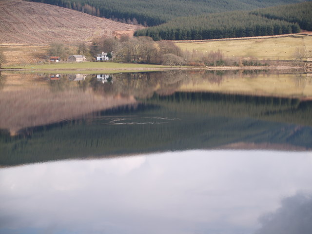
Megget Reservoir

Megget Reservoir is an impounding reservoir in the Megget valley in Ettrick Forest, in the Scottish Borders. The 259 hectares (640 acres) reservoir is...

Craigierig

Craigierig is a village on the Megget Reservoir, in the Scottish Borders area of Scotland, in the former Selkirkshire. Places nearby include the Glengaber...
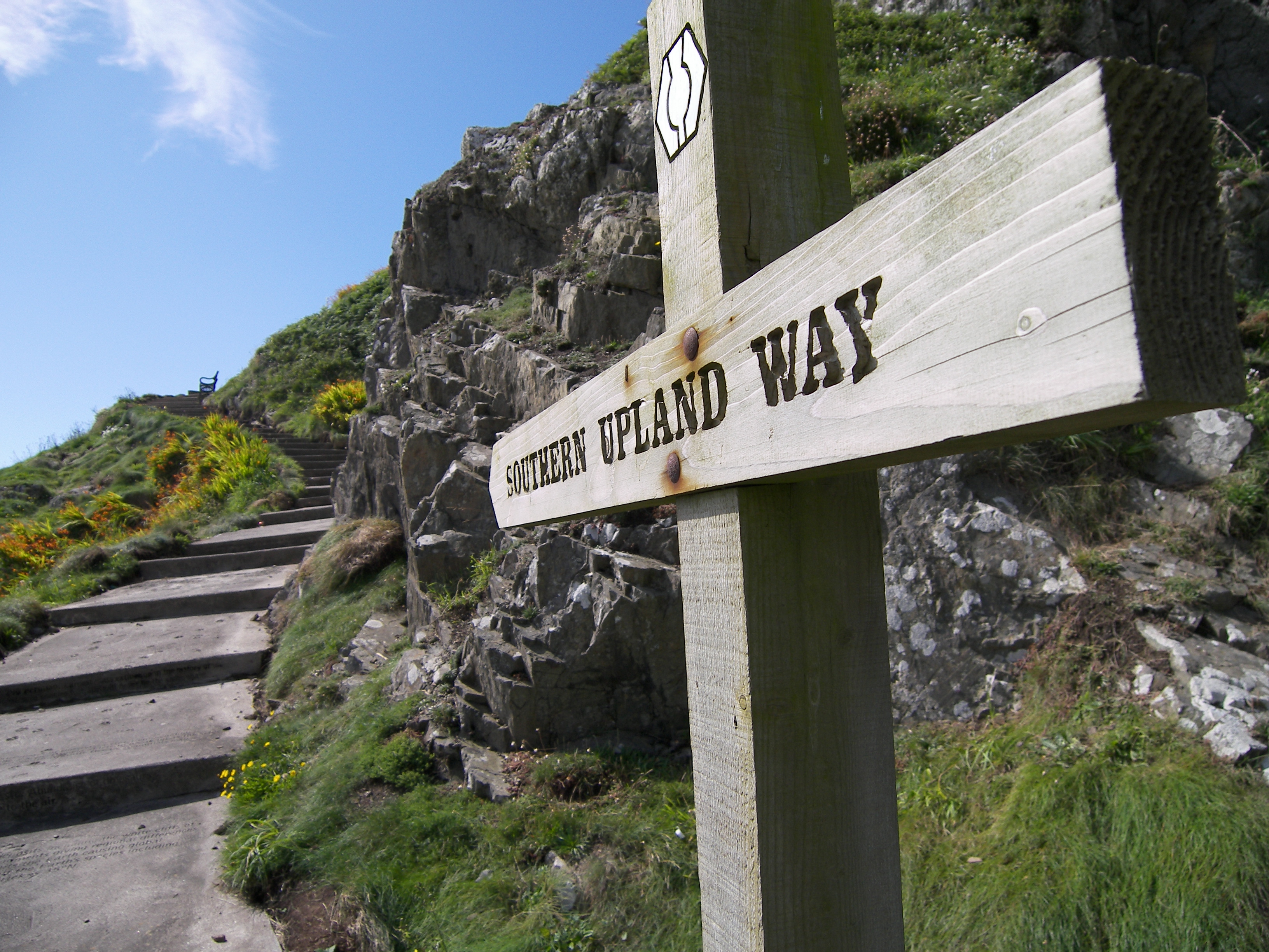
Southern Upland Way

The Southern Upland Way is a 344-kilometre (214 mi) coast-to-coast long-distance footpath in southern Scotland. The route links Portpatrick in the west...

Megget Water

Megget Water is a river in the parish of Yarrow, Selkirkshire in the Scottish Borders area of Scotland. The Water rises at Broad Law (2,760 ft), passes...

Cappercleuch

Cappercleuch is a settlement on the A708, at St. Mary's Loch in the Scottish Borders area of Scotland, in the historic county of Selkirkshire. Places nearby...

Bowerhope

Bowerhope is a village off the A708, in the Scottish Borders area of Scotland, on the banks of St Mary's Loch in Ettrick Forest. == See also == List of...

St Mary's Loch

St Mary's Loch is the largest natural loch in the Scottish Borders, and is situated on the south side of the A708 road between Selkirk and Moffat, about...

Have you been to Drowning Dubs?

Leave your review of Drowning Dubs below (or comments, questions and feedback).