Trowgrain Middle

Hill, Mountain in Dumfriesshire

Scotland

Trowgrain Middle

Dodging a sheep on the A708 Motorists have to be aware of sheep wandering on to the road between Riskinhope and the Grey Mare’s Tail car park.
Dodging a sheep on the A708 Credit: Walter Baxter

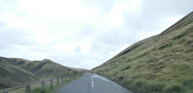
Trowgrain Middle is a prominent hill located in Dumfriesshire, Scotland. Standing at an elevation of approximately 457 meters (1,499 feet), it is considered one of the notable peaks in the region. The hill is situated in a rural area, surrounded by picturesque landscapes and rolling countryside.

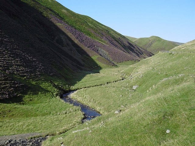
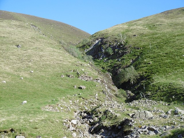
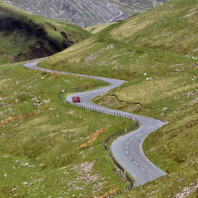
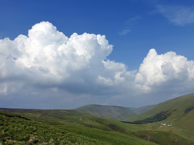
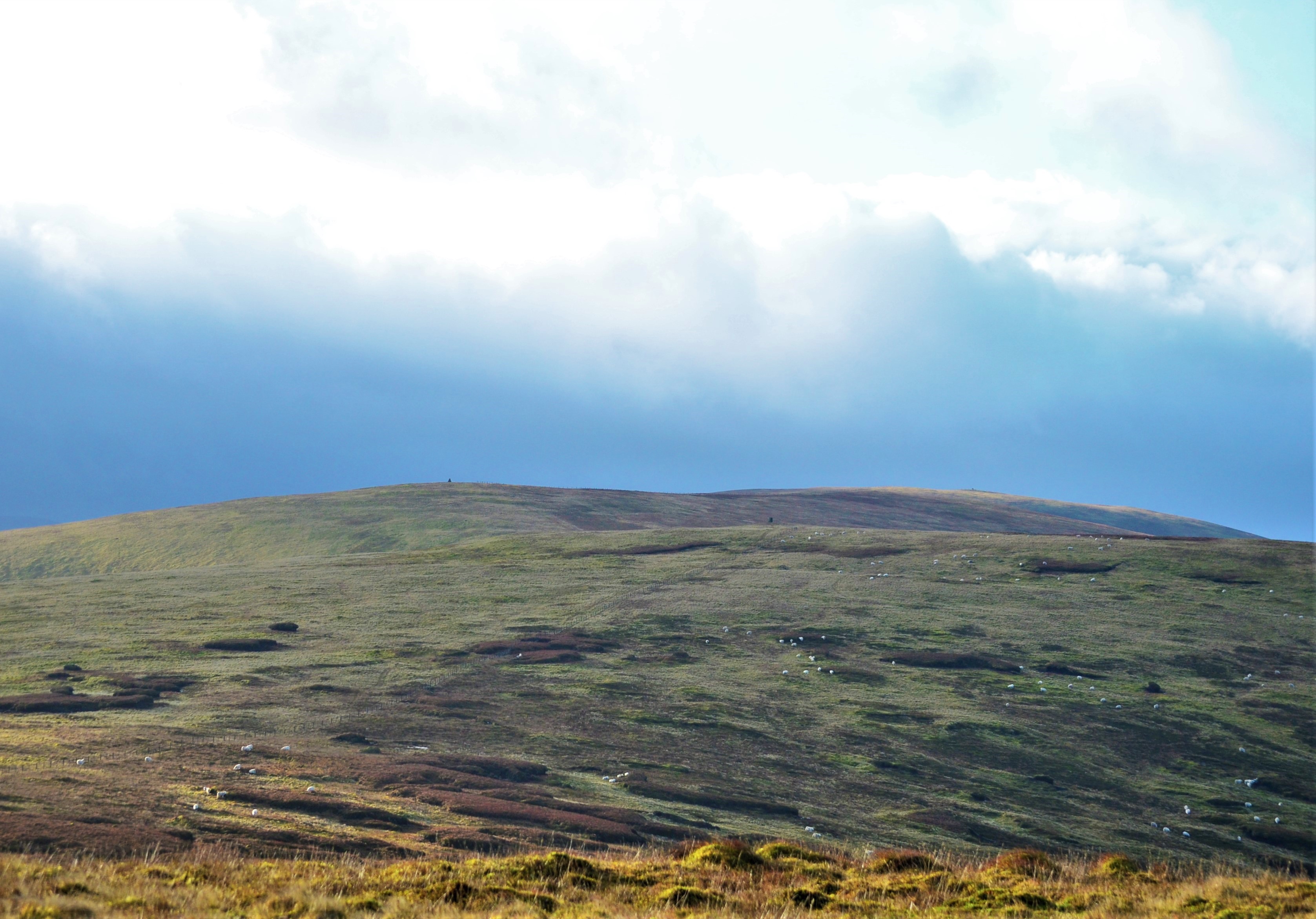
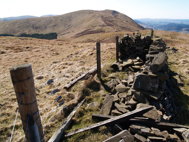
Trowgrain Middle is part of the Southern Uplands range, which stretches across the southern region of Scotland. The hill itself boasts a distinctive shape, with a gently sloping terrain leading up to a rounded summit. From the top, visitors are treated to breathtaking panoramic views of the surrounding countryside, including nearby hills and valleys.

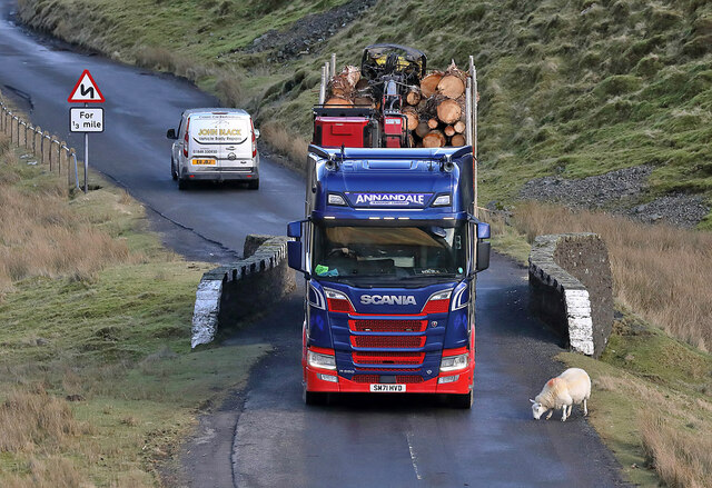
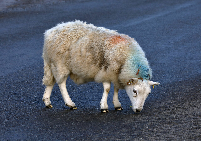
The area surrounding Trowgrain Middle is characterized by its rich biodiversity. The hill is adorned with a variety of plant species, including heather, gorse, and wildflowers, which provide a vibrant display of colors during the warmer months. The hillside is also home to an array of wildlife, including birds, small mammals, and occasionally, grazing sheep.

Trowgrain Middle is a popular destination for outdoor enthusiasts and nature lovers alike. The hill offers opportunities for hiking, walking, and birdwatching, with several trails and footpaths crisscrossing its slopes. The terrain is generally moderate, making it accessible to a wide range of abilities.

Overall, Trowgrain Middle is a scenic and tranquil location, offering visitors a chance to connect with nature and enjoy the beauty of the Scottish countryside. Whether it's exploring the hill's diverse flora and fauna or simply admiring the sweeping vistas, Trowgrain Middle is sure to leave a lasting impression on all who venture to its summit.

If you have any feedback on the listing, please let us know in the comments section below.

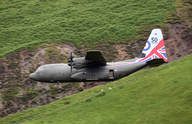
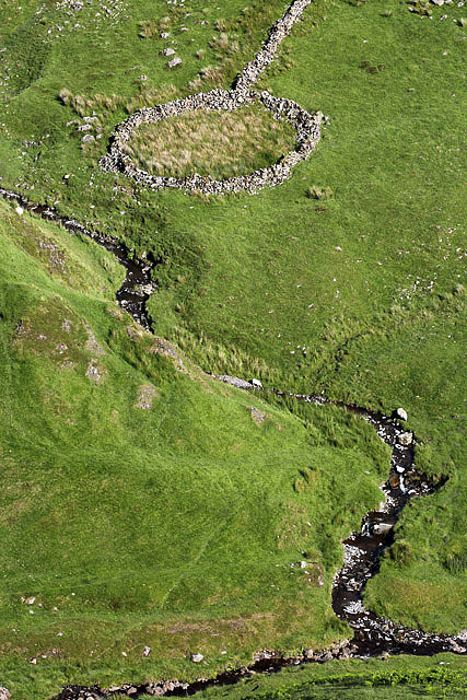
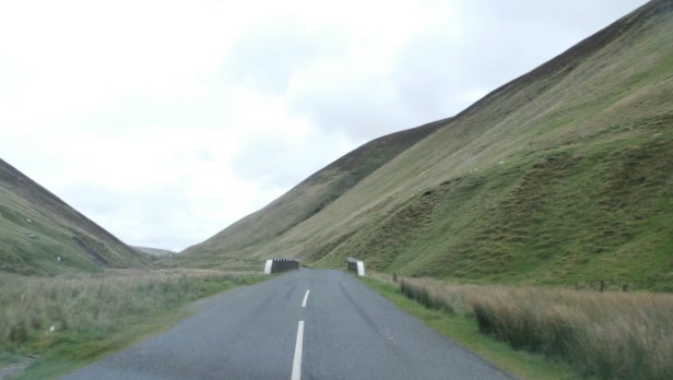
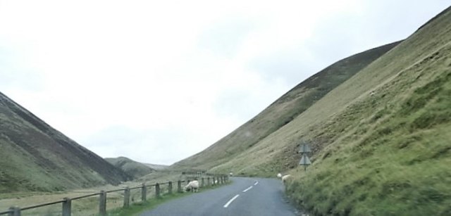
Trowgrain Middle Images

Images are sourced within 2km of 55.422774/-3.2548729 or Grid Reference NT2015. Thanks to Geograph Open Source API. All images are credited.

Dodging a sheep on the A708 Motorists have to be aware of sheep wandering on to the road between Riskinhope and the Grey Mare’s Tail car park.
Dodging a sheep on the A708
Motorists have to be aware of sheep wandering on to the road between Riskinhope and the Grey Mare’s Tail car park.
A sheep on the A708 Sheep wandering on to the road between Riskinhope and the Grey Mare’s Tail car park is a common sight. This sheep was licking the tarmac.
A sheep on the A708
Sheep wandering on to the road between Riskinhope and the Grey Mare’s Tail car park is a common sight. This sheep was licking the tarmac.
Moffat Water The upper reaches of Moffat Dale in the heather season.
Moffat Water
The upper reaches of Moffat Dale in the heather season.
Strang Cleuch One of several steep burns and ravines flowing into the depths of Moffat Dale.
Strang Cleuch
One of several steep burns and ravines flowing into the depths of Moffat Dale.
A winding road in Moffat Dale This is the narrowest part in the Selkirk to Moffat Valley where the A708 winds its way up from the Grey Mare’s Tail car park to Birkhill. Motorists need to be on the alert for sheep wandering on the road.
A winding road in Moffat Dale
This is the narrowest part in the Selkirk to Moffat Valley where the A708 winds its way up from the Grey Mare’s Tail car park to Birkhill. Motorists need to be on the alert for sheep wandering on the road.
Rough grazing on the west side of Dob’s Linn These hills in the Selkirk to Moffat Valley are grazed by sheep. Paper Hill is in the central distance with the whitewashed buildings at Birkhill on the far right. It was a pleasant afternoon to be out while waiting to see if any RAF low flying aircraft would pass by. My only success was three single Tucano training aircraft from this position. This was the first aircraft <a href="https://www.geograph.org.uk/photo/5019110">NT1915 : An RAF Tucano in the Moffat Valley</a>.
Rough grazing on the west side of Dob’s Linn
These hills in the Selkirk to Moffat Valley are grazed by sheep. Paper Hill is in the central distance with the whitewashed buildings at Birkhill on the far right. It was a pleasant afternoon to be out while waiting to see if any RAF low flying aircraft would pass by. My only success was three single Tucano training aircraft from this position. This was the first aircraft NT1915 : An RAF Tucano in the Moffat Valley.
An RAF Tucano in the Moffat Valley The Turboprop Tucano is a 2-seat aircraft used by the RAF for training student fast-jet pilots. This was my position on the hill on the west side of Dob’s Lin near Birkhill <a href="https://www.geograph.org.uk/photo/5019104">NT1915 : Rough grazing on the west side of Dob’s Linn</a>.
An RAF Tucano in the Moffat Valley
The Turboprop Tucano is a 2-seat aircraft used by the RAF for training student fast-jet pilots. This was my position on the hill on the west side of Dob’s Lin near Birkhill NT1915 : Rough grazing on the west side of Dob’s Linn.
A special tail Hercules in the Moffat Valley 47 Squadron of the RAF has celebrated its centenary with a special tail C-130 Hercules painted in 100th anniversary colours. This was viewed from Trowgrain Middle.
A special tail Hercules in the Moffat Valley
47 Squadron of the RAF has celebrated its centenary with a special tail C-130 Hercules painted in 100th anniversary colours. This was viewed from Trowgrain Middle.
A special tail Hercules in the Moffat Valley A Hercules C-130 from RAF Brize Norton has been painted to commemorate 50 years in service of the Hercules aircraft. This was viewed from Trowgrain Middle.
A special tail Hercules in the Moffat Valley
A Hercules C-130 from RAF Brize Norton has been painted to commemorate 50 years in service of the Hercules aircraft. This was viewed from Trowgrain Middle.
A sheepfold in the Moffat Valley The sheepfold is on the northwest side of the A708 near Dob’s Linn.
A sheepfold in the Moffat Valley
The sheepfold is on the northwest side of the A708 near Dob’s Linn.
Bridge over Moffat Water
Sheep on the A708
Sheep on the A708
A708 in the Moffat Valley
Dob's Linn Classic geological type locality, which marks the internationally agreed boundary between the Ordovician and Silurian periods. This was first recognized by Charles Lapworth who studied the fossil graptolites found in the Birkhill Shales here in the 1870s.
Dob's Linn
Classic geological type locality, which marks the internationally agreed boundary between the Ordovician and Silurian periods. This was first recognized by Charles Lapworth who studied the fossil graptolites found in the Birkhill Shales here in the 1870s.
Strang Cleuch Strang Cleuch contains an unnamed burn which is a tributary of the Moffat Water. The burn flows down the steep hillside from the col between Mid Rig and Andrewhinney Hill.
Strang Cleuch
Strang Cleuch contains an unnamed burn which is a tributary of the Moffat Water. The burn flows down the steep hillside from the col between Mid Rig and Andrewhinney Hill.
Dob's Linn A tributary of the Moffat Water flowing through a steep valley.
Dob's Linn
A tributary of the Moffat Water flowing through a steep valley.
Summit of Andrewhinney Hill Loch Skeen can be seen in the distance.
Summit of Andrewhinney Hill
Loch Skeen can be seen in the distance.
Looking towards Dob's Linn There is a sheepfold at the mouth of the valley.
Looking towards Dob's Linn
There is a sheepfold at the mouth of the valley.
Show me another place!

Trowgrain Middle is located at Grid Ref: NT2015 (Lat: 55.422774, Lng: -3.2548729)

Unitary Authority: Dumfries and Galloway

Police Authority: Dumfries and Galloway

What 3 Words

///blazing.tasks.published. Near Ettrick, Scottish Borders

Related Wikis

Dob's Linn

Dob's Linn is a small steep valley in Dumfries and Galloway, just north of the A708 road between Moffat and Selkirk, in Scotland. It is part of the Grey...

Andrewhinney Hill

Andrewhinney Hill is a hill in the Ettrick Hills range, part of the Southern Uplands of Scotland. It is the highest summit of a ridge that runs parallel...

Southern Uplands

The Southern Uplands (Scottish Gaelic: Na Monaidhean a Deas) are the southernmost and least populous of mainland Scotland's three major geographic areas...

Grey Mare's Tail, Moffat Hills

Grey Mare's Tail is a 60-metre (200 ft) hanging valley waterfall near to Moffat in southern Scotland. The fall is produced by the Tail Burn flowing from...

Loch Skeen

Loch Skeen or Loch Skene is a loch in Dumfries and Galloway in the south of Scotland. It is located about 10 miles to the north-east of Moffat and feeds...

White Coomb

White Coomb is a hill in the Moffat Hills range, part of the Southern Uplands of Scotland. Its broad summit is the highest point in the range and the registration...

Ettrick, Scotland

Ettrick (Scottish Gaelic: Eadaraig, IPA: [ˈet̪əɾɪkʲ]) is a small village and civil parish in the Scottish Borders area of Scotland. It is located on the...

Bodesbeck Law

Bodesbeck Law is a hill in the Ettrick Hills range, part of the Southern Uplands of Scotland. It is the primary west-south-western terminus of the ridge...

Have you been to Trowgrain Middle?

Leave your review of Trowgrain Middle below (or comments, questions and feedback).