Beal Hill
Hill, Mountain in Perthshire
Scotland
Beal Hill

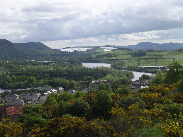
Beal Hill is a prominent hill located in Perthshire, Scotland. It is part of the Ochil Hills range and reaches an elevation of approximately 548 meters (1,798 feet). The hill is situated in a rural area, offering breathtaking panoramic views of the surrounding countryside.
Beal Hill is characterized by its rugged terrain and rocky slopes. The hill is covered in heather, bracken, and grass, providing a habitat for various wildlife species such as deer, grouse, and birds of prey. The hillside is also dotted with small streams and waterfalls, adding to its natural beauty.
The summit of Beal Hill can be reached by several walking trails, making it a popular destination for hikers and nature enthusiasts. The ascent can be challenging at times, requiring a moderate level of fitness and proper hiking gear. However, the rewarding views from the top make it all worth it.
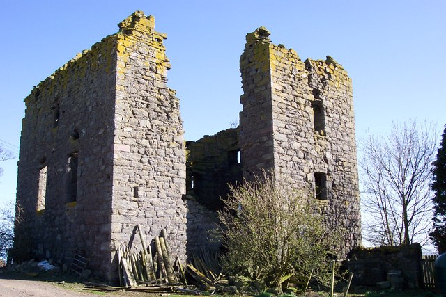
Aside from its natural beauty, Beal Hill also holds historical significance. It is believed to have been used as a lookout point during ancient times, providing a strategic vantage point for observing the surrounding area. Today, remnants of an Iron Age fort can still be seen on the hill, adding an element of intrigue to its allure.
Overall, Beal Hill offers a captivating blend of natural beauty, wildlife, and historical significance. Whether one is seeking adventure, tranquility, or a deeper connection with nature, this hill in Perthshire is sure to leave a lasting impression.
If you have any feedback on the listing, please let us know in the comments section below.
Beal Hill Images
Images are sourced within 2km of 56.431475/-3.2928554 or Grid Reference NO2027. Thanks to Geograph Open Source API. All images are credited.


![Blackbank Prehistoric Hut Circles Two small enclosures remain in unimproved moorland 590m NNW of Blackbank steading. The sub-square NW enclosure measures 10m from NW to SE by 10.5m transversely within a heather-covered bank up to 1.8m thick and 0.3m high. A narrow gap on the SE may be an entrance. To the SE, a roughly circular enclosure measuring about 10m in diameter remains on a low knoll. Three subrectangular structures up to 4m in length are near the first enclosure. A low turf bank runs past the enclosures a few metres to the S and may be contemporary.
For more info. see: ‘Blackbank | Canmore’. 2023. Canmore.org.uk &lt;<span class="nowrap"><a title="https://canmore.org.uk/site/30430/blackbank" rel="nofollow ugc noopener" href="https://canmore.org.uk/site/30430/blackbank">Link</a><img style="margin-left:2px;" alt="External link" title="External link - shift click to open in new window" src="https://s1.geograph.org.uk/img/external.png" width="10" height="10"/></span> &gt; [accessed 12 March 2023]
](https://s2.geograph.org.uk/geophotos/07/43/03/7430382_ebbd0508.jpg)


Beal Hill is located at Grid Ref: NO2027 (Lat: 56.431475, Lng: -3.2928554)
Unitary Authority: Perth and Kinross
Police Authority: Tayside
What 3 Words
///dates.conspired.relating. Near Errol, Perth & Kinross
Nearby Locations
Related Wikis
Rait
Rait () is a small village in Perth and Kinross, Scotland. It lies 2+1⁄2 miles (4 kilometres) northwest of Errol, in the Gowrie area west of Dundee, on...
Kilspindie
Kilspindie is a village in Perth and Kinross, Scotland. It is situated on the Kilspindie burn, approximately 2+3⁄4 miles (4.5 kilometres) northwest of...

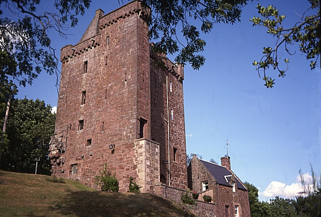
Fingask Castle
Fingask Castle is a country house in Perth and Kinross, Scotland. It is perched 200 feet (61 m) above Rait, three miles (5 km) north-east of Errol, in...
Gowrie
Gowrie (Scottish Gaelic: Gobharaidh) is a region in central Scotland and one of the original provinces of the Kingdom of Alba. It covered the eastern part...
Kinnaird, Gowrie
Kinnaird (Scottish Gaelic: An Ceann Àrd, "high headland") is a village in Gowrie, Perthshire, Scotland. It is notable for its 15th-century castle. The...

Balbeggie
Balbeggie () is a village in Perth and Kinross, Scotland about 7 miles (11 kilometres) northeast of Perth on the A94 road. == References ==

Battle of Dunsinane
The Battle of Dunsinane, also known as the Battle of the Seven Sleepers, was fought between the forces of Macbeth, King of Scotland and forces led by Siward...
Dunsinane Hill
Dunsinane Hill ( dun-SIN-ən) is a hill of the Sidlaws near the village of Collace in Perthshire, Scotland. It is mentioned in Shakespeare's play Macbeth...
Nearby Amenities
Located within 500m of 56.431475,-3.2928554Have you been to Beal Hill?
Leave your review of Beal Hill below (or comments, questions and feedback).