Moel Tan y Coed
Hill, Mountain in Denbighshire
Wales
Moel Tan y Coed

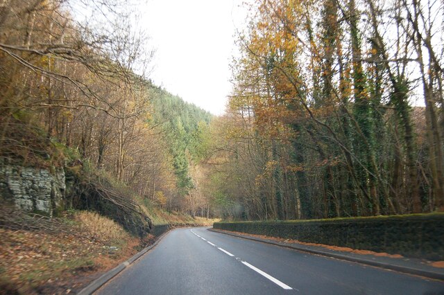
Moel Tan y Coed is a noteworthy hill/mountain located in the county of Denbighshire, Wales. Standing at an elevation of 456 meters (1,496 feet), it forms a prominent feature in the picturesque Clwydian Range Area of Outstanding Natural Beauty.
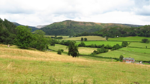
The summit of Moel Tan y Coed offers breathtaking panoramic views of the surrounding countryside, including the lush green valleys, rolling hills, and charming villages that dot the landscape. On a clear day, it is even possible to catch glimpses of the Irish Sea shimmering in the distance.
The hill is composed primarily of ancient rocks, such as mudstone and sandstone, dating back millions of years. This geological diversity has led to the development of a rich and varied ecosystem, supporting a wide range of plant and animal species. Visitors to Moel Tan y Coed can expect to encounter heather-covered slopes, scattered woodlands, and open grasslands teeming with wildlife.
For outdoor enthusiasts, Moel Tan y Coed offers numerous opportunities for hiking, walking, and wildlife observation. There are several well-marked trails that lead to the summit, varying in difficulty to cater to different levels of fitness and experience. The more challenging routes reward hikers with uninterrupted views of the surrounding countryside, while the gentler paths provide a leisurely stroll through the tranquil Welsh countryside.
Overall, Moel Tan y Coed is a natural gem in Denbighshire, offering visitors a chance to immerse themselves in the beauty of the Clwydian Range and experience the remarkable landscapes that Wales has to offer.
If you have any feedback on the listing, please let us know in the comments section below.
Moel Tan y Coed Images
Images are sourced within 2km of 52.98684/-3.1928278 or Grid Reference SJ2043. Thanks to Geograph Open Source API. All images are credited.


Moel Tan y Coed is located at Grid Ref: SJ2043 (Lat: 52.98684, Lng: -3.1928278)
Unitary Authority: Denbighshire
Police Authority: North Wales
What 3 Words
///handover.nitrogen.synthetic. Near Llangollen, Denbighshire
Nearby Locations
Related Wikis

Valle Crucis Abbey
Valle Crucis Abbey (Valley of the Cross) is a Cistercian abbey located in Llantysilio in Denbighshire, Wales. More formally the Abbey Church of the Blessed...

Bryntysilio Hall
Bryntysilio Hall is a country house in Llantysilio, Denbighshire, north Wales, two miles west of Llangollen. It was the summer residence of Sir Theodore...
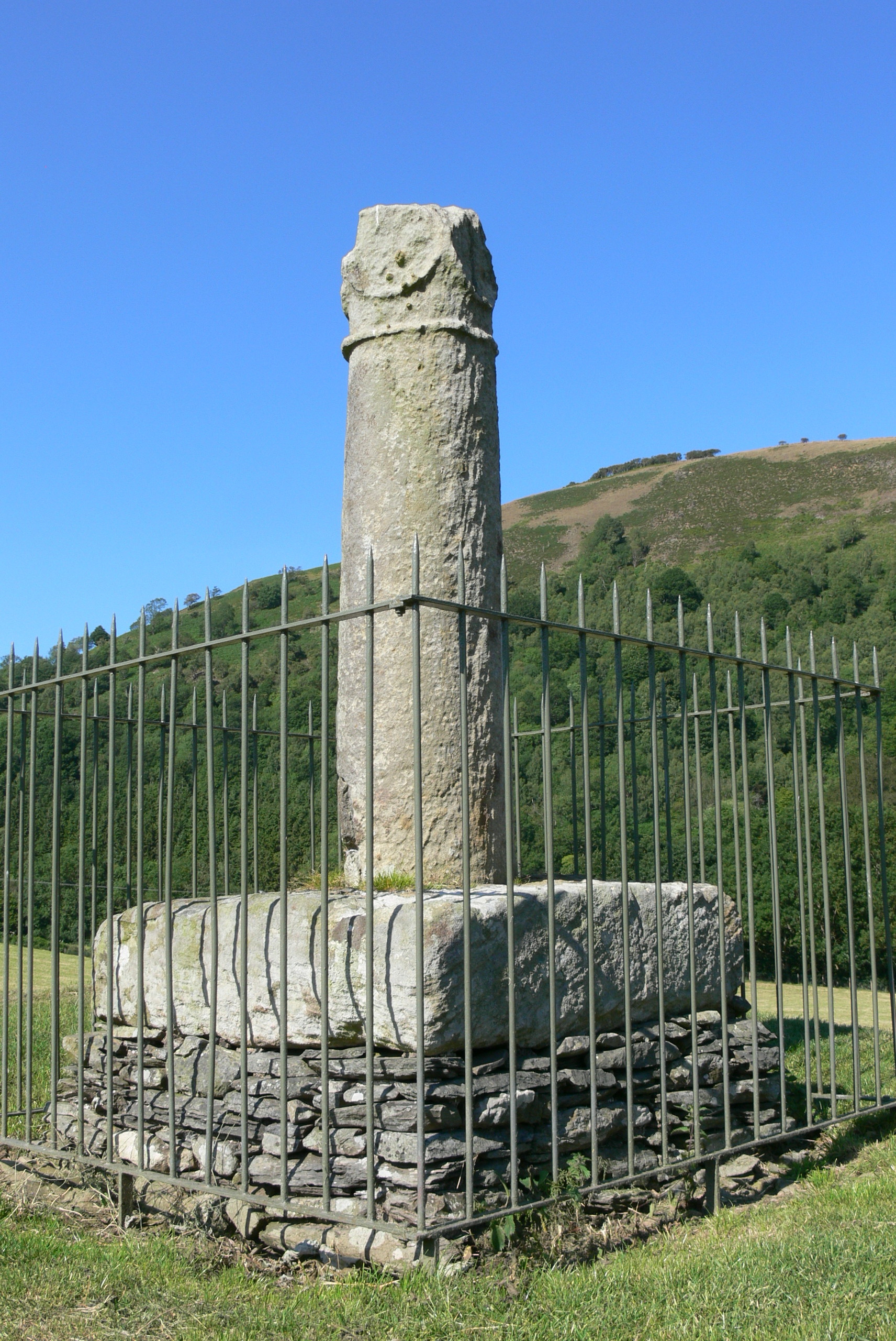
Pillar of Eliseg
The Pillar of Eliseg – also known as Elise's Pillar or Croes Elisedd in Welsh – stands near Valle Crucis Abbey, Denbighshire, Wales [Grid reference SJ...
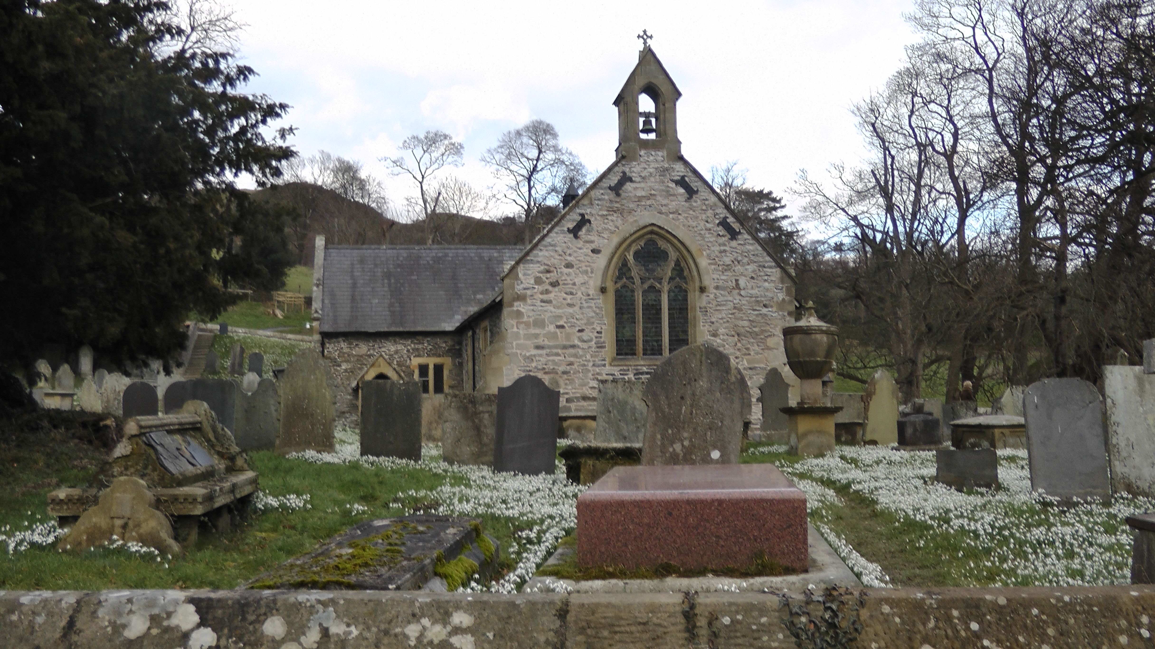
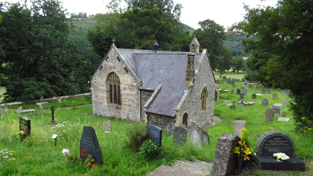
St Tysilio's Church, Llantysilio
Llantysilio Church is a parish church in Llantysilio, near Llangollen, Denbighshire, North Wales.It sits on uprising land from the banks of the river Dee...
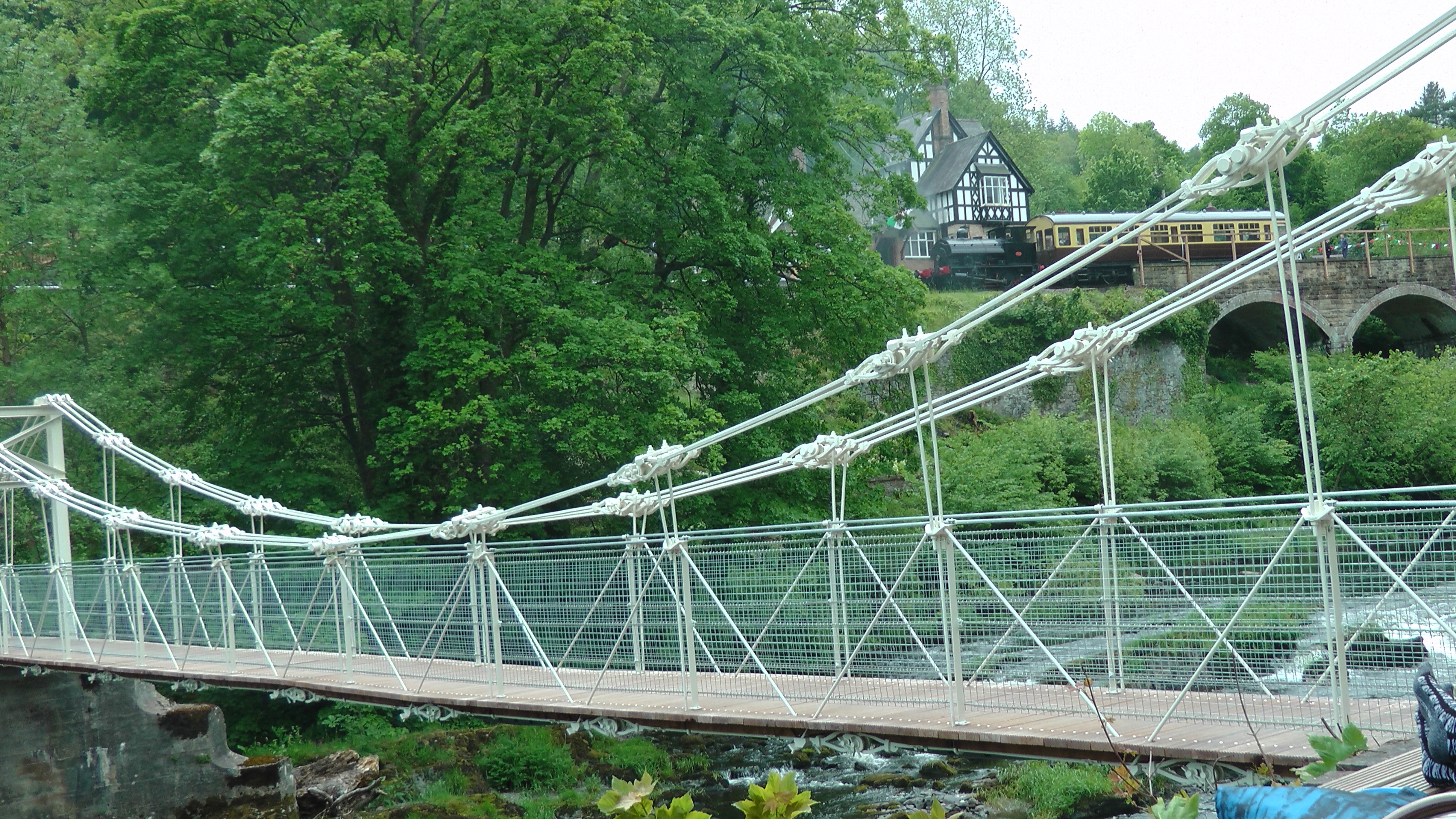
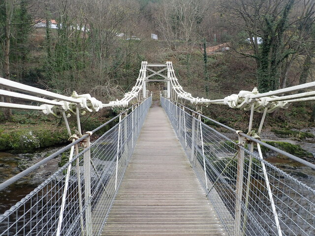
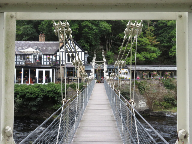
Chain Bridge (Berwyn)
The Chain Bridge is a footbridge over the River Dee at Berwyn, Llangollen, Denbighshire, north Wales. Is owned by Llangollen Town Council and a pathway...
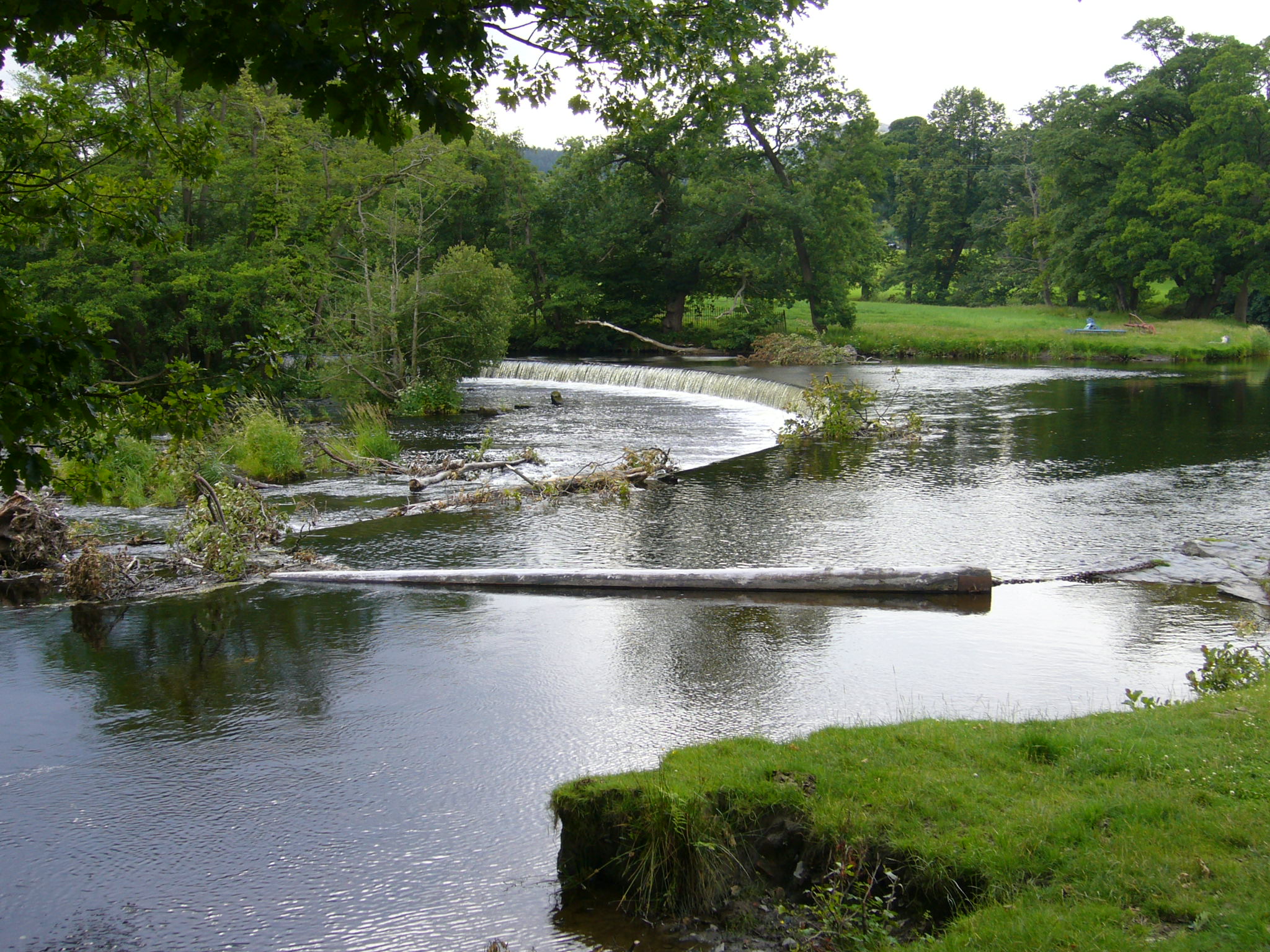
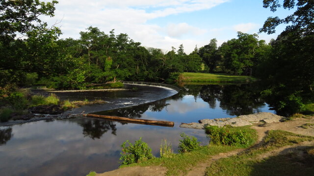
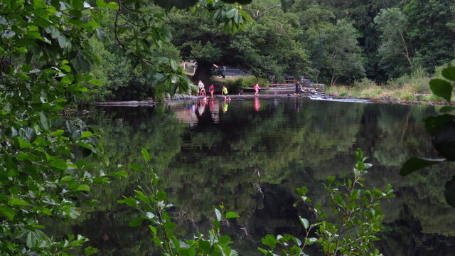
Horseshoe Falls (Wales)
Horseshoe Falls (Welsh: Rhaeadr y Bedol) (grid reference SJ196433) is a weir on the River Dee near Llantysilio Hall in Denbighshire, Wales, about 5 kilometres...

Llantysilio
Llantysilio (Welsh: Llandysilio-yn-Iâl) is a community in Denbighshire, Wales, near Llangollen. It has a population of 472, falling to 421 at the 2011...
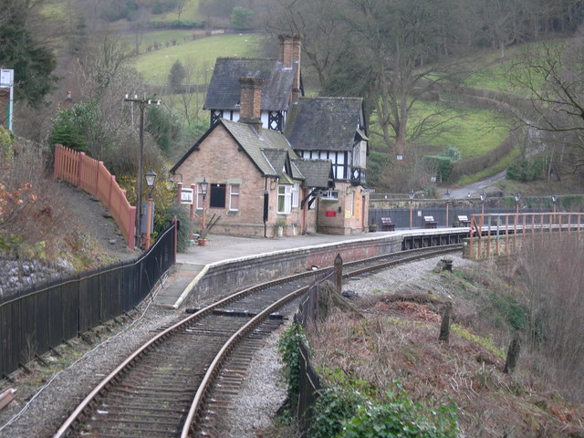
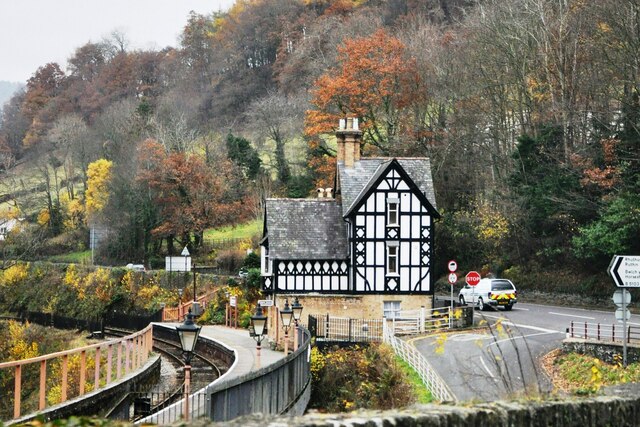
Berwyn railway station
Berwyn railway station in Denbighshire, Wales, is a railway station on the former cross-country line between Ruabon and Barmouth. The station, which opened...
Nearby Amenities
Located within 500m of 52.98684,-3.1928278Have you been to Moel Tan y Coed?
Leave your review of Moel Tan y Coed below (or comments, questions and feedback).