Grain Hill

Hill, Mountain in Midlothian

Scotland

Grain Hill

Hummocky ground near Penicuik Glacial deposition beside the Pentland Hills.
Hummocky ground near Penicuik Credit: Richard Webb

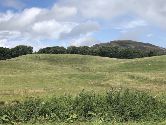
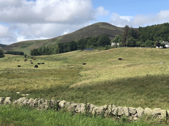
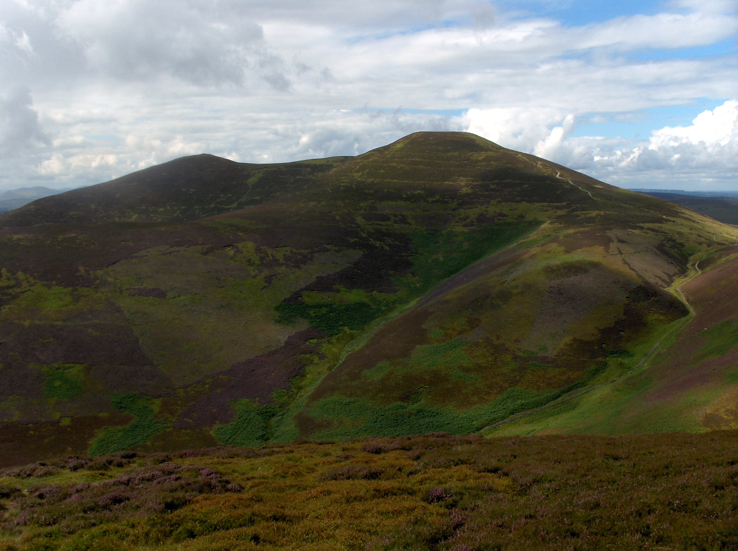
Grain Hill is a prominent hill located in Midlothian, Scotland. With an elevation of approximately 250 meters (820 feet), it is classified as a hill or mountain in the region. Situated in the southern part of Midlothian, Grain Hill offers breathtaking views of the surrounding countryside and is a popular destination for outdoor enthusiasts and nature lovers.

The hill is known for its diverse and rich flora and fauna, with a variety of plant species and wildlife inhabiting its slopes. It is a haven for hikers, cyclists, and walkers, who enjoy exploring the numerous trails and paths that crisscross the hill. The terrain is mostly gentle, making it accessible to people of all fitness levels.

At the summit of Grain Hill, there is a trig point that serves as a landmark and provides panoramic views of the Midlothian countryside, including the nearby towns of Loanhead and Roslin. On clear days, it is even possible to see as far as the Pentland Hills and the Firth of Forth.

Grain Hill holds historical significance as well. It is believed to have been used as a fort or hillfort in ancient times, providing a strategic vantage point for the local communities. Archaeological remains such as ditches and ramparts can still be seen on the hill, offering glimpses into its past.

Overall, Grain Hill in Midlothian is a beautiful natural landmark that offers both recreational opportunities and a connection to the region's history. It is a cherished destination for locals and visitors alike, providing a serene escape from the hustle and bustle of everyday life.

If you have any feedback on the listing, please let us know in the comments section below.

Grain Hill Images

Images are sourced within 2km of 55.834559/-3.2835286 or Grid Reference NT1960. Thanks to Geograph Open Source API. All images are credited.

Hummocky ground near Penicuik Glacial deposition beside the Pentland Hills.
Hummocky ground near Penicuik
Glacial deposition beside the Pentland Hills.
Pasture near Carsewell Beneath the Pentland Hills.
Pasture near Carsewell
Beneath the Pentland Hills.
Rough ground by the Carlops Road The field above the Braidwood Burn appears to have been left ungrazed or unmown.
Rough ground by the Carlops Road
The field above the Braidwood Burn appears to have been left ungrazed or unmown.
East and West Kip Two sharp little summits on the ridge of the Pentland Hills, seen from the far shore of the Threipmuir Reservoir.
East and West Kip
Two sharp little summits on the ridge of the Pentland Hills, seen from the far shore of the Threipmuir Reservoir.
Scald Law and the Grain Burn A feeder for the Grain Burn runs down from a quiet, shallow valley below Scald Law.
Scald Law and the Grain Burn
A feeder for the Grain Burn runs down from a quiet, shallow valley below Scald Law.
Grain Hill A heather covered spur running south east from Scald Law.
Grain Hill
A heather covered spur running south east from Scald Law.
View of Loganlea Reservoir from Turnhouse Hill summit
Loganlea Reservoir from the footpath on Turnhouse Hill Nine boats with fishermen can be seen on the loch, their cars parked on the private road at the far side. Fishing is permitted by licence only. The 19th century reservoir provides drinking water for Edinburgh.
Loganlea Reservoir from the footpath on Turnhouse Hill
Nine boats with fishermen can be seen on the loch, their cars parked on the private road at the far side. Fishing is permitted by licence only. The 19th century reservoir provides drinking water for Edinburgh.
The Logan Burn flows into the Loganlea Reservoir
Stile on the descent from Scald Law
The descent from East Kip Loganlea Reservoir in the distance.
The descent from East Kip
Loganlea Reservoir in the distance.
The east ridge of West Kip
The summit of West Kip East Kip and Scald Law following on to the east.
The summit of West Kip
East Kip and Scald Law following on to the east.
Young trees by the Carlops Road A small mixed planting of conifers and hardwoods, with farmland and plantations beyond, and Carnethy Hill 3km away.
Young trees by the Carlops Road
A small mixed planting of conifers and hardwoods, with farmland and plantations beyond, and Carnethy Hill 3km away.
Burn above The Howe, Pentland Hills Black Hill and part of Gask Hill (R) are catching the sunlight on a windy but sunny day.
Burn above The Howe, Pentland Hills
Black Hill and part of Gask Hill (R) are catching the sunlight on a windy but sunny day.
Descending to The Howe, Pentland Hills The track from Carnethy and Scald Law gives a fine view of the Logan Burn with the narrow defile of Green Cleuch bending round to the right.
Descending to The Howe, Pentland Hills
The track from Carnethy and Scald Law gives a fine view of the Logan Burn with the narrow defile of Green Cleuch bending round to the right.
The Logan Burn at The Howe The burn enters Loganlea Reservoir here and exits at the NE end to flow down to Glencorse Reservoir.
The Logan Burn at The Howe
The burn enters Loganlea Reservoir here and exits at the NE end to flow down to Glencorse Reservoir.
On the road by Loganlea Reservoir Returning to Flotterstone after an invigorating windswept walk on the ridge over Turnhouse Hill and Carnethy. A few years ago the road was a gravel surfaced track.
On the road by Loganlea Reservoir
Returning to Flotterstone after an invigorating windswept walk on the ridge over Turnhouse Hill and Carnethy. A few years ago the road was a gravel surfaced track.
Show me another place!

Grain Hill is located at Grid Ref: NT1960 (Lat: 55.834559, Lng: -3.2835286)

Unitary Authority: Midlothian

Police Authority: The Lothians and Scottish Borders

What 3 Words

///already.straddled.hypocrite. Near Penicuik, Midlothian

Related Wikis

Scald Law

Scald Law is a hill in Midlothian, Scotland. At 579 metres (1,900 ft) it is the highest of the Pentland Hills. The hill is composed of Devonian volcanic...

South Black Hill

South Black Hill is a hill in the Pentland Hills range of Scotland. It is located in the west of Midlothian on the east flank of the approximately 25 km...

Silverburn, Midlothian

Silverburn is a small hamlet near Penicuik, in Midlothian, south-east Scotland. It has a small community centre, with a garden surrounding the hall, which...

Carnethy Hill

Carnethy Hill, the second highest of the Pentland Hills, is a hill 3 miles (5 km) north-west of Penicuik, Scotland. It lends its name to the Carnethy 5...

Nearby Amenities

Located within 500m of 55.834559,-3.2835286
Grain Hill
Natural: peak
Lat/Long: 55.8339261/-3.283457
Historic: ruins
Lat/Long: 55.8309514/-3.279815
The data included in this document is from www.openstreetmap.org. The data is made available under ODbL.

Have you been to Grain Hill?

Leave your review of Grain Hill below (or comments, questions and feedback).