South Black Hill

Hill, Mountain in Midlothian

Scotland

South Black Hill

Path in the valley  of the Quarrel Burn Heading up Braid Law.
Path in the valley of the Quarrel Burn Credit: Oliver Dixon

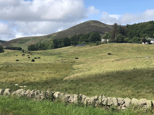
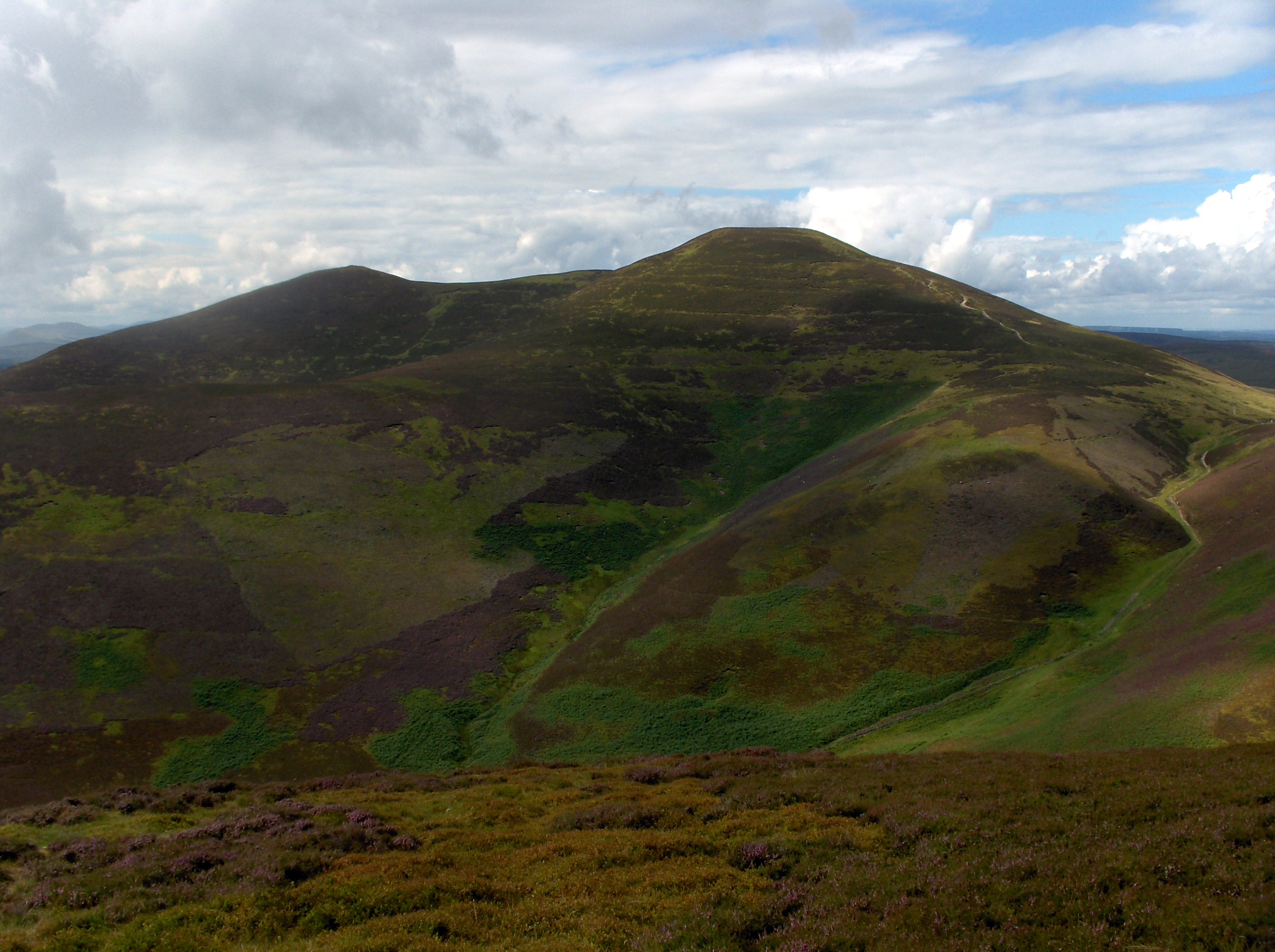
South Black Hill is a prominent hill located in Midlothian, Scotland. Standing at an elevation of 437 meters (1,434 feet), it is part of the Pentland Hills range, which is renowned for its scenic beauty and outdoor recreational opportunities. South Black Hill is situated towards the southern end of this range and offers breathtaking panoramic views of the surrounding countryside.

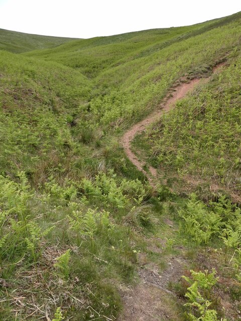
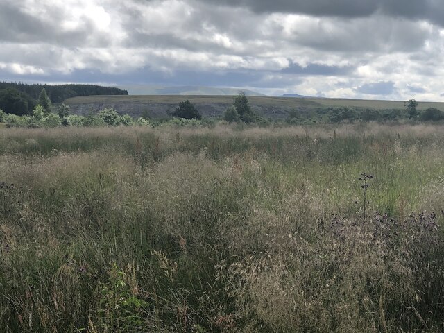
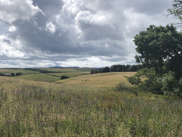
The hill is characterized by its steep slopes and rugged terrain, making it a popular destination for hikers and walkers seeking a challenging but rewarding trek. The ascent to the summit can be demanding, but the stunning vistas at the top make it well worth the effort. On a clear day, visitors can admire the rolling hills, deep valleys, and shimmering reservoirs that dot the landscape.

South Black Hill is also home to a diverse range of flora and fauna, contributing to its natural appeal. The heather-covered slopes provide habitat for various bird species, including skylarks and meadow pipits, making it a haven for birdwatchers. Hares and rabbits can often be spotted darting across the open moorland, adding to the area's wildlife diversity.

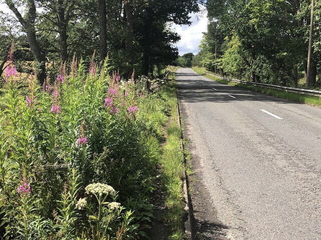
Due to its proximity to nearby towns and cities, South Black Hill attracts a steady stream of outdoor enthusiasts throughout the year. It is easily accessible via a network of well-maintained trails and can be reached from various starting points, such as the nearby village of Auchendinny.

Overall, South Black Hill is a striking natural feature that offers a challenging yet rewarding experience for those seeking to immerse themselves in the rugged beauty of the Pentland Hills.

If you have any feedback on the listing, please let us know in the comments section below.

South Black Hill Images

Images are sourced within 2km of 55.830994/-3.2936129 or Grid Reference NT1960. Thanks to Geograph Open Source API. All images are credited.

Path in the valley  of the Quarrel Burn Heading up Braid Law.
Path in the valley of the Quarrel Burn
Heading up Braid Law.
Path across the Quarrel Burn Quarrel Burn Reservoir in the background.
Path across the Quarrel Burn
Quarrel Burn Reservoir in the background.
Pasture near Carsewell Beneath the Pentland Hills.
Pasture near Carsewell
Beneath the Pentland Hills.
Rough ground by the Carlops Road Appears not to have been grazed for some time.
Rough ground by the Carlops Road
Appears not to have been grazed for some time.
Rough ground by the Carlops Road The field above the Braidwood Burn appears to have been left ungrazed or unmown.
Rough ground by the Carlops Road
The field above the Braidwood Burn appears to have been left ungrazed or unmown.
Near Brunstane View from the very scenic Penicuik  to Carlops road.
Near Brunstane
View from the very scenic Penicuik to Carlops road.
A766, Braidwood
A766, Braidwood
Pentlands panorama View over to West Kip, East Kip, Scald Law and South Black Hill from above the larch tree plantation on Cap Law (Gap Law).
Pentlands panorama
View over to West Kip, East Kip, Scald Law and South Black Hill from above the larch tree plantation on Cap Law (Gap Law).
Fallen larches, Cap Law (Gap Law) The top of West Kip peeks out through the gnarled larches.
Fallen larches, Cap Law (Gap Law)
The top of West Kip peeks out through the gnarled larches.
Pentland Hills above a layer of low cloud A zoom lens shot taken from about 25 miles away on the northern slopes of Tinto.

The distinctive small sharp peak of West Kip can clearly be seen, with Scald Law and Carnethy Hill to the right of the shot.
Pentland Hills above a layer of low cloud
A zoom lens shot taken from about 25 miles away on the northern slopes of Tinto. The distinctive small sharp peak of West Kip can clearly be seen, with Scald Law and Carnethy Hill to the right of the shot.
A702 near Silverburn One of the main routes south from Edinburgh, running along the southeastern edge of the Pentland Hills.
A702 near Silverburn
One of the main routes south from Edinburgh, running along the southeastern edge of the Pentland Hills.
Braid Law A rhyolite hill in the Pentlands. View from near Eight Mile Burn.
Braid Law
A rhyolite hill in the Pentlands. View from near Eight Mile Burn.
Eight Mile Burn View of Eight Mile Burn from a track which once serviced the Quarrel Burn Reservoir.
Eight Mile Burn
View of Eight Mile Burn from a track which once serviced the Quarrel Burn Reservoir.
Wetland, Braidwood Wetland beside the A702 on coal measure sandstones which usually produce poor farmland.
Wetland, Braidwood
Wetland beside the A702 on coal measure sandstones which usually produce poor farmland.
Wetland and stripwood Coal measures agriculture. Poorly drained soils with the lower land waterlogged. This is between the A766 out of Penicuik and the A702.
Wetland and stripwood
Coal measures agriculture. Poorly drained soils with the lower land waterlogged. This is between the A766 out of Penicuik and the A702.
Quarry, Eight Mile Burn This appears to be a mound of glacial deposits.
Quarry, Eight Mile Burn
This appears to be a mound of glacial deposits.
A field beneath Braid Law The eastern side of the Pentland Hills near Eight Mile Burn.
A field beneath Braid Law
The eastern side of the Pentland Hills near Eight Mile Burn.
Windswept trees, Braid Law Trees with a permanent lean from southerly winds.
Windswept trees, Braid Law
Trees with a permanent lean from southerly winds.
Show me another place!

South Black Hill is located at Grid Ref: NT1960 (Lat: 55.830994, Lng: -3.2936129)

Unitary Authority: Midlothian

Police Authority: The Lothians and Scottish Borders

What 3 Words

///raven.rejoined.unionists. Near Penicuik, Midlothian

Related Wikis

South Black Hill

South Black Hill is a hill in the Pentland Hills range of Scotland. It is located in the west of Midlothian on the east flank of the approximately 25 km...

Scald Law

Scald Law is a hill in Midlothian, Scotland. At 579 metres (1,900 ft) it is the highest of the Pentland Hills. The hill is composed of Devonian volcanic...

Eight Mile Burn

Eight Mile Burn is a small settlement in Midlothian, South East Scotland, at the base of Pentland Hills Regional Park. It is approximately 11 miles from...

Silverburn, Midlothian

Silverburn is a small hamlet near Penicuik, in Midlothian, south-east Scotland. It has a small community centre, with a garden surrounding the hall, which...

Nearby Amenities

Located within 500m of 55.830994,-3.2936129
South Black Hill
Ele: 563
Natural: peak
Wikidata: Q19309268
Lat/Long: 55.831001/-3.293522
The data included in this document is from www.openstreetmap.org. The data is made available under ODbL.

Have you been to South Black Hill?

Leave your review of South Black Hill below (or comments, questions and feedback).