Hill of Three Cairns

Hill, Mountain in Perthshire

Scotland

Hill of Three Cairns

Entrance to turbine 5, Drumderg wind farm The Drumderg wind farm, south of (but no doubt visible from) the Cairngorms National Park, has been built on the site of an old military range. There are sixteen turbines, numbered, if you look at the site from the southwest, in lines, nearest first, then right to left in each line. This is turbine 5, at just over 380m above sea level, on the track heading to the east after the first junction of tracks. The first line of turbines, numbers 01 to 04 are in the first line and are behind the photographer. Number 05 is the most southeasterly of the second line, and the view looks away from turbines 06 to 08 in this line.
Entrance to turbine 5, Drumderg wind farm Credit: Andy Waddington

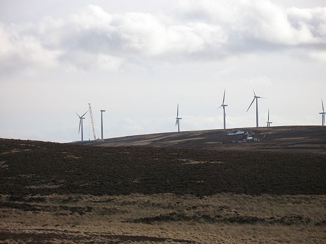
Hill of Three Cairns, located in Perthshire, Scotland, is a prominent hill that stands at an elevation of 319 meters (1,047 feet). The hill is named after the three cairns, or man-made piles of stones, that sit atop its summit. These cairns are thought to have been constructed in ancient times as markers or memorials.

The Hill of Three Cairns offers stunning panoramic views of the surrounding countryside, including the nearby River Tay and the picturesque town of Aberfeldy. The hill is a popular destination for hikers and outdoor enthusiasts, with several well-marked trails leading to the summit.

The area surrounding the hill is rich in history and natural beauty, with ancient ruins and burial mounds dotting the landscape. Wildlife enthusiasts will also enjoy the diverse flora and fauna that call the hill home, including red deer, buzzards, and rare alpine plants.

Overall, Hill of Three Cairns is a must-visit destination for those looking to experience the natural beauty and history of Perthshire.

If you have any feedback on the listing, please let us know in the comments section below.

Hill of Three Cairns Images

Images are sourced within 2km of 56.681121/-3.3163994 or Grid Reference NO1955. Thanks to Geograph Open Source API. All images are credited.

Entrance to turbine 5, Drumderg wind farm The Drumderg wind farm, south of (but no doubt visible from) the Cairngorms National Park, has been built on the site of an old military range. There are sixteen turbines, numbered, if you look at the site from the southwest, in lines, nearest first, then right to left in each line. This is turbine 5, at just over 380m above sea level, on the track heading to the east after the first junction of tracks. The first line of turbines, numbers 01 to 04 are in the first line and are behind the photographer. Number 05 is the most southeasterly of the second line, and the view looks away from turbines 06 to 08 in this line.
Entrance to turbine 5, Drumderg wind farm
The Drumderg wind farm, south of (but no doubt visible from) the Cairngorms National Park, has been built on the site of an old military range. There are sixteen turbines, numbered, if you look at the site from the southwest, in lines, nearest first, then right to left in each line. This is turbine 5, at just over 380m above sea level, on the track heading to the east after the first junction of tracks. The first line of turbines, numbers 01 to 04 are in the first line and are behind the photographer. Number 05 is the most southeasterly of the second line, and the view looks away from turbines 06 to 08 in this line.
Graffiti on turbine 6, Drumderg wind farm It's a huge canvas to paint on, but clearly the artist hadn't thought to bring a big ladder or other climbing aids to reach most of it. Still, it seems unusually enterprising of any spray-can vandal to reach somewhere quite this bleak and remote from a population centre though it would seem to offer a generally safe environment in terms of getting caught and reprimanded, so maybe that was its main appeal. A wide audience seems unlikely. Turbine 06 is the second in the second line of four turbines, and in this view turbines 03 and a blade of 04 are on the left, with turbines 07 and 08 to the right. This one is just shy of 400m above sea level and there are sixteen altogether, between 370 and 420m asl on this disused military range.
Graffiti on turbine 6, Drumderg wind farm
It's a huge canvas to paint on, but clearly the artist hadn't thought to bring a big ladder or other climbing aids to reach most of it. Still, it seems unusually enterprising of any spray-can vandal to reach somewhere quite this bleak and remote from a population centre though it would seem to offer a generally safe environment in terms of getting caught and reprimanded, so maybe that was its main appeal. A wide audience seems unlikely. Turbine 06 is the second in the second line of four turbines, and in this view turbines 03 and a blade of 04 are on the left, with turbines 07 and 08 to the right. This one is just shy of 400m above sea level and there are sixteen altogether, between 370 and 420m asl on this disused military range.
Track to the exit, Drumderg wind farm There are 8.3 kilometre of access tracks on the Drumderg wind farm, giving access to its sixteen turbines and a tall anemometer mast. Most are of this standard, although one stretch is not signposted for use by vehicles and is perhaps a little steeper and less frequented. The site is a former military firing range, and the turbines lie between 370 and 420m above sea level. The photo was taken from c 400m asl, on the middle track across the southwestern slopes of Drumderg and heads for the exit to the public road 1.7 km away. Visible in this view are turbines 07, 06, 05 and 01.
Track to the exit, Drumderg wind farm
There are 8.3 kilometre of access tracks on the Drumderg wind farm, giving access to its sixteen turbines and a tall anemometer mast. Most are of this standard, although one stretch is not signposted for use by vehicles and is perhaps a little steeper and less frequented. The site is a former military firing range, and the turbines lie between 370 and 420m above sea level. The photo was taken from c 400m asl, on the middle track across the southwestern slopes of Drumderg and heads for the exit to the public road 1.7 km away. Visible in this view are turbines 07, 06, 05 and 01.
Find your turbine, Drumderg wind farm Turbines 01-04 were left at the first junction within the wind farm, whilst anyone arriving at this junction will have just passed turbine 05. You could reach turbines 12 to 14 by either way at this junction, but the signs can be smaller and cheaper if you are directed to go left. Turbine 09 is at the start of the longest line of turbines, 09-14, but there is no track between 09 and the rest of that line (turbine 10 is reached by going up to turbine 11 and coming back on a short spur track). Turbines 15 and 16 are the shortest "line" of turbines, on the NE side of the hill and perhaps slightly sheltered on the lee slope in the prevailing wind. Turbines 09 (nearer, on the right) and 10 are featured in this view, generating on a SW wind bringing sleet earlier in the day and unpleasant conditions for kayaking (which is why I was wandering around a wind farm, as hardier souls took on the Black Water).
Find your turbine, Drumderg wind farm
Turbines 01-04 were left at the first junction within the wind farm, whilst anyone arriving at this junction will have just passed turbine 05. You could reach turbines 12 to 14 by either way at this junction, but the signs can be smaller and cheaper if you are directed to go left. Turbine 09 is at the start of the longest line of turbines, 09-14, but there is no track between 09 and the rest of that line (turbine 10 is reached by going up to turbine 11 and coming back on a short spur track). Turbines 15 and 16 are the shortest "line" of turbines, on the NE side of the hill and perhaps slightly sheltered on the lee slope in the prevailing wind. Turbines 09 (nearer, on the right) and 10 are featured in this view, generating on a SW wind bringing sleet earlier in the day and unpleasant conditions for kayaking (which is why I was wandering around a wind farm, as hardier souls took on the Black Water).
Minor road between Smyrna and High Rannagulzion Looking north-westward towards Drumderg Wind Farm.
Minor road between Smyrna and High Rannagulzion
Looking north-westward towards Drumderg Wind Farm.
Drumderg Wind Farm Seven up, six to go. Almost every passing place on the road was occupied by cars, the occupants of which were taking photos of the turbines. And they say it would drive people away from the area!
Drumderg Wind Farm
Seven up, six to go. Almost every passing place on the road was occupied by cars, the occupants of which were taking photos of the turbines. And they say it would drive people away from the area!
Drumderg Power Station Wind turbines being installed in the Forest of Alyth.
Drumderg Power Station
Wind turbines being installed in the Forest of Alyth.
Drumderg Power Station Under construction. Several towers are lying in sections before assembly. There were a few flashing amber lights moving about the hill, so somebody was busy.
<span class="nowrap"><a title="http://drumdergwindfarm.com/" rel="nofollow ugc noopener" href="http://drumdergwindfarm.com/">Link</a><img style="margin-left:2px;" alt="External link" title="External link - shift click to open in new window" src="https://s1.geograph.org.uk/img/external.png" width="10" height="10"/></span>
Drumderg Power Station
Under construction. Several towers are lying in sections before assembly. There were a few flashing amber lights moving about the hill, so somebody was busy. LinkExternal link
Drumderg wind generators Several were not working despite a stiff breeze when we passed.
Drumderg wind generators
Several were not working despite a stiff breeze when we passed.
Drumderg Windfarm Newly operational in 2008.
Drumderg Windfarm
Newly operational in 2008.
Craighead Farm Drumderg wind farm in background.
Craighead Farm
Drumderg wind farm in background.
Alyth burn Balduff Hill visible in the background.
Alyth burn
Balduff Hill visible in the background.
Drumderg windfarm
Drumderg windfarm
Drumderg from Wood of Easter Bleaton Looking across the drainage of the Burn of Drumturn, with the Drumderg wind farm in the distance.
Drumderg from Wood of Easter Bleaton
Looking across the drainage of the Burn of Drumturn, with the Drumderg wind farm in the distance.
Edge of plantation, Forest of Alyth
View to Drumderg from near Smyrna
Drumderg Wind Farm from the south
Drumderg Wind Farm
Drumderg Wind Farm
Show me another place!

Hill of Three Cairns is located at Grid Ref: NO1955 (Lat: 56.681121, Lng: -3.3163994)

Unitary Authority: Perth and Kinross

Police Authority: Tayside

What 3 Words

///snowmen.flying.glorified. Near Alyth, Perth & Kinross

Nearby Locations

Hill of Three Cairns

Related Wikis

Kilry Glen

Kilry Glen, in Angus, Scotland, is the glen of the Burn of Kilry, a tributary of the River Isla. It is situated west of the B954 road, approximately four...

Bamff

Bamff House is the home of the Ramsays of Bamff, and is located within a 1,300-acre (5.3 km2) estate in Perthshire, Scotland. Bamff House began as a fortified...

Auchinleish

Auchinleish is a village in Angus, Scotland. == References ==

Kirkton of Glenisla

Kirkton of Glenisla consists of a church and graveyard, a hotel, hall and several homes forming the largest concentration of habitation in Glenisla, Angus...

Nearby Amenities

Located within 500m of 56.681121,-3.3163994
Hill of Three Cairns
Ele: 378
Natural: peak
Lat/Long: 56.6815084/-3.3166751
The data included in this document is from www.openstreetmap.org. The data is made available under ODbL.

Have you been to Hill of Three Cairns?

Leave your review of Hill of Three Cairns below (or comments, questions and feedback).