Fenton Heights

Hill, Mountain in Dumfriesshire

Scotland

Fenton Heights

The Black Esk The Black Esk near Eskdalemuir.
The Black Esk Credit: Colin Kinnear

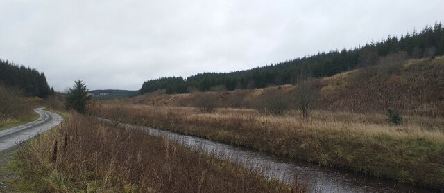
Fenton Heights is a prominent hill located in Dumfriesshire, Scotland. Rising to an elevation of approximately 1,200 feet, it offers stunning panoramic views of the surrounding countryside and is a popular destination for hikers and nature enthusiasts.

The hill is characterized by its rugged terrain, with rocky outcrops and steep slopes making for a challenging but rewarding climb. The summit of Fenton Heights provides a breathtaking vantage point from which to admire the rolling hills, valleys, and forests that stretch out in all directions.

The area surrounding Fenton Heights is rich in biodiversity, with a variety of plant and animal species calling the hill home. Visitors may encounter wildlife such as red deer, foxes, and birds of prey as they explore the hillside.

Fenton Heights is easily accessible by foot or by car, with several well-marked trails leading to the summit. Whether seeking a peaceful retreat in nature or a physical challenge, Fenton Heights offers something for everyone to enjoy in the scenic landscapes of Dumfriesshire.

If you have any feedback on the listing, please let us know in the comments section below.

Fenton Heights Images

Images are sourced within 2km of 55.221488/-3.2678488 or Grid Reference NY1992. Thanks to Geograph Open Source API. All images are credited.

The Black Esk The Black Esk near Eskdalemuir.
The Black Esk
The Black Esk near Eskdalemuir.
A sheepfold at Black Cleuch This is located in a hill grazing area to the east-northeast of Great Hill.
A sheepfold at Black Cleuch
This is located in a hill grazing area to the east-northeast of Great Hill.
An old van at Black Cleuch This was a strange sight in a large grazing area in the middle of nowhere but I suspect it will be used by a farmer for feed storage.
An old van at Black Cleuch
This was a strange sight in a large grazing area in the middle of nowhere but I suspect it will be used by a farmer for feed storage.
Crossing the Black Esk at Sandyford On the B723.
Crossing the Black Esk at Sandyford
On the B723.
B723 near Sandyford
B723 near Sandyford
B723 towards Boreland
Black Esk at Sandyford Looking down-river from the Sandyford Bridge at Sandyford.
Black Esk at Sandyford
Looking down-river from the Sandyford Bridge at Sandyford.
Waterworks near Sandyford Serving the Black Esk Reservoir <a href="https://www.geograph.org.uk/gridref/NY2096">NY2096</a>.
Waterworks near Sandyford
Serving the Black Esk Reservoir NY2096.
Logging road near Sandyford Inside the Forestry Commission's bit of Eskdalemuir Forest, once called Twiglees Forest.
Logging road near Sandyford
Inside the Forestry Commission's bit of Eskdalemuir Forest, once called Twiglees Forest.
B723, Sandyford Near the Black Esk reservoir.
B723, Sandyford
Near the Black Esk reservoir.
Rough grazing at Great Hill To the north of the summit trig point.
Rough grazing at Great Hill
To the north of the summit trig point.
A drystane dyke on Pikestone Hill This dyke runs parallel with a timber post and wire fence.
A drystane dyke on Pikestone Hill
This dyke runs parallel with a timber post and wire fence.
Farmland at Great Hill This area consists of improved and rough grazing for sheep and cattle.
Farmland at Great Hill
This area consists of improved and rough grazing for sheep and cattle.
View northwest to Closs Farm, Valley of Dryfe Water near Boreland
Clearfell and new planting A small area of pine trees has been cleared from here, and new trees have been planted, currently being protected within the green plastic tubes.
Clearfell and new planting
A small area of pine trees has been cleared from here, and new trees have been planted, currently being protected within the green plastic tubes.
B723 towards Eskdalemuir I can't imagine that this road is ever busy.
B723 towards Eskdalemuir
I can't imagine that this road is ever busy.
Gated entrance The photographer is standing on the B723 road, which is fenced, as the hillside beyond is used for grazing sheep - though there weren't many around on this occasion.
Gated entrance
The photographer is standing on the B723 road, which is fenced, as the hillside beyond is used for grazing sheep - though there weren't many around on this occasion.
B723, Lockerbie to Eskdalemuir Road Looking north in the direction of Eskdalemuir.
B723, Lockerbie to Eskdalemuir Road
Looking north in the direction of Eskdalemuir.
Show me another place!

Fenton Heights is located at Grid Ref: NY1992 (Lat: 55.221488, Lng: -3.2678488)

Unitary Authority: Dumfries and Galloway

Police Authority: Dumfries and Galloway

What 3 Words

///confronts.joints.defrost. Near Johnstonebridge, Dumfries & Galloway

Nearby Locations

Kirk Hill Fenton Heights

Related Wikis

Boreland

Boreland is a village in Dumfries and Galloway, Scotland, which is located in Dryfesdale about 7 miles (11 kilometres) north of Lockerbie on the B723 road...

Castle O'er Forest

Castle O'er Forest is a forest south of Eskdalemuir, Dumfries and Galloway, in southern Scotland.It is bisected by the River Esk. Eskdalemuir Forest adjoins...

Whitcastles stone circle

Whitcastles or Little Hartfell (grid reference NY 2240 8806) is a stone circle 6½ miles NE of Lockerbie, Dumfries and Galloway. Nine fallen stones lie...

Girdle Stanes

The Girdle Stanes (grid reference NY 25351 96153) is a stone circle near Eskdalemuir, Dumfries and Galloway. The western portion of the circle has been...

Nearby Amenities

Located within 500m of 55.221488,-3.2678488
Fenton Heights
Corbett: no
Ele: 279
Graham: no
Munro: no
Natural: peak
Source: OS7
Lat/Long: 55.2215737/-3.267892
The data included in this document is from www.openstreetmap.org. The data is made available under ODbL.

Have you been to Fenton Heights?

Leave your review of Fenton Heights below (or comments, questions and feedback).