Broad Hill

Hill, Mountain in Fife

Scotland

Broad Hill

Balmule Ruined steading at Balmule. A silage crop has been taken off the foreground field.
Balmule Credit: Richard Webb

Broad Hill is a prominent hill located in Fife, Scotland. With an elevation of approximately 425 meters (1,394 feet), it is classified as a hill rather than a mountain. Situated near the town of Dunfermline, Broad Hill is part of the Ochil Hills range, which stretches across central Scotland.

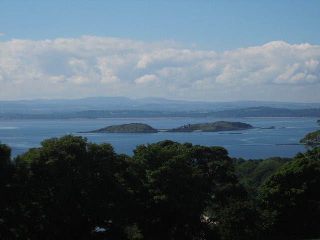
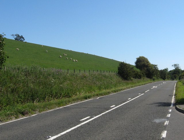
The hill is easily accessible, with a well-maintained footpath leading to its summit, making it a popular destination for hikers and nature enthusiasts. The trail offers stunning panoramic views of the surrounding countryside, including the Firth of Forth and the Forth Rail Bridge, adding to the appeal of this natural attraction.

Broad Hill is characterized by its gentle slopes covered in heather and grass, providing a picturesque landscape throughout the year. The hill is also home to a diverse range of flora and fauna, including various bird species such as kestrels and buzzards, as well as rabbits and deer.

Historically, Broad Hill has served as a site for archaeological exploration. Evidence of prehistoric settlement has been uncovered, including the remnants of ancient forts and burial mounds, adding an element of historical intrigue to the area.

Overall, Broad Hill is a popular destination for outdoor enthusiasts seeking a moderately challenging hike with rewarding views. Its accessibility, natural beauty, and historical significance make it a notable landmark in Fife, attracting visitors from near and far.

If you have any feedback on the listing, please let us know in the comments section below.

Broad Hill Images

Images are sourced within 2km of 56.070903/-3.302764 or Grid Reference NT1887. Thanks to Geograph Open Source API. All images are credited.

Balmule Ruined steading at Balmule. A silage crop has been taken off the foreground field.
Balmule
Ruined steading at Balmule. A silage crop has been taken off the foreground field.
Grassland, Balmule A silage crop has been recently taken from this field.
Grassland, Balmule
A silage crop has been recently taken from this field.
A view over the Firth of Forth near Aberdour With the island if Inch Colm in the middle of the photograph.
A view over the Firth of Forth near Aberdour
With the island if Inch Colm in the middle of the photograph.
The A921 road heading to Burntisland From above Aberdour.
The A921 road heading to Burntisland
From above Aberdour.
Montquey Hill and Quarry The modestly-sized ridge of Montquey Hill and the remains of an old whinstone quarry at its eastern end.
Montquey Hill and Quarry
The modestly-sized ridge of Montquey Hill and the remains of an old whinstone quarry at its eastern end.
Burntisland Road The A909 heading to Burntisland with Dunearn hill in the distance.
Burntisland Road
The A909 heading to Burntisland with Dunearn hill in the distance.
The A909 at Hawkhill A reciprocal view of Simon Johnston's photo from 9 years ago <a href="https://www.geograph.org.uk/photo/1098283">NT2087 : Road to Burntisland</a>.
The A909 at Hawkhill
A reciprocal view of Simon Johnston's photo from 9 years ago NT2087 : Road to Burntisland.
Trackside wall and hawthorn The track leads from the A909 to the fishery on Stenhouse Reservoir.
Trackside wall and hawthorn
The track leads from the A909 to the fishery on Stenhouse Reservoir.
Stenhouse Reservoir Seen through rain. The island is marked on the map as the 'Devil's Spadeful'
Stenhouse Reservoir
Seen through rain. The island is marked on the map as the 'Devil's Spadeful'
Fife and the Tay from the air Mossmorran chemical plant dominates the scene, with Loch Leven also visible.
Fife and the Tay from the air
Mossmorran chemical plant dominates the scene, with Loch Leven also visible.
Logs for Sale Road to Dunearn off the A909.
Logs for Sale
Road to Dunearn off the A909.
Torry Hill
Torry Hill
Field below the viewpoint Looking towards Edinburgh in the distance.
Field below the viewpoint
Looking towards Edinburgh in the distance.
Farm track Leading from the A921 to Dalachy Farm.
Farm track
Leading from the A921 to Dalachy Farm.
Fife Farm Tracks Part of the network of minor roads and tracks between Aberdour and Burntisland.
Fife Farm Tracks
Part of the network of minor roads and tracks between Aberdour and Burntisland.
Torry Hill and Dunearn Hill Torry Hill on the left, Dunearn further off on the right, site of an ancient fort, dating from the early Iron Age.
Torry Hill and Dunearn Hill
Torry Hill on the left, Dunearn further off on the right, site of an ancient fort, dating from the early Iron Age.
Track to Aberdour Farm tracks and footpaths lead from Dunearn to Aberdour.
Track to Aberdour
Farm tracks and footpaths lead from Dunearn to Aberdour.
Track to Montquey Quarry The whinstone (dolerite) quarry is shown on the 1854 6" map.
Track to Montquey Quarry
The whinstone (dolerite) quarry is shown on the 1854 6" map.
Show me another place!

Broad Hill is located at Grid Ref: NT1887 (Lat: 56.070903, Lng: -3.302764)

Unitary Authority: Fife

Police Authority: Fife

What 3 Words

///talents.eruptions.reports. Near Aberdour, Fife

Nearby Locations

Broad Hill Cullaloe Woods

Related Wikis

Aberdour railway station

Aberdour railway station is a railway station in the village of Aberdour, Fife, Scotland. The station is managed by ScotRail and is on the Fife Circle...
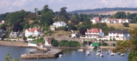
Aberdour

Aberdour ( ; Scots: , Scottish Gaelic: Obar Dobhair) is a scenic and historic village on the south coast of Fife, Scotland. It is on the north shore of...

Mossmorran

The Mossmorran Natural Gas Liquids (NGL) plant is part of the northern North Sea Brent oil and gas field system and is located on the outskirts of Cowdenbeath...
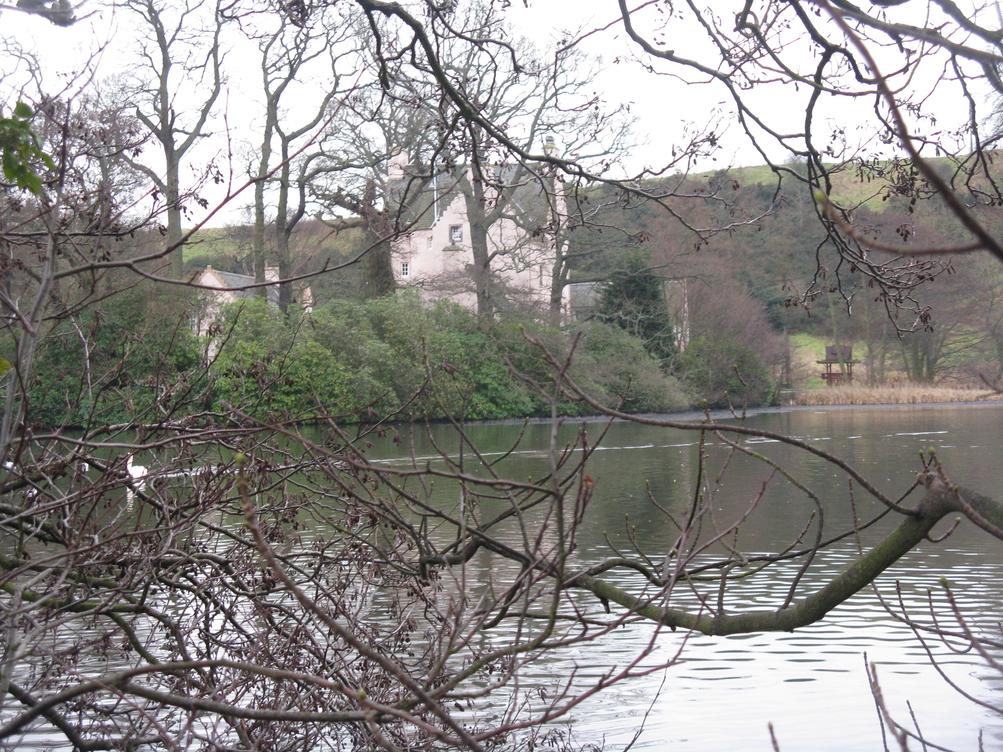
Couston Castle

Couston Castle is an L-plan tower house dating from the late sixteenth or early seventeenth centuries, just north east of Dalgety Bay, at the edge of Otterston...

Nearby Amenities

Located within 500m of 56.070903,-3.302764
Ele: 125
Ele Ft: 411
Lat/Long: 56.0729382/-3.3019585
Turning Circle
Lat/Long: 56.0702862/-3.3074768
Direction: 13
Tourism: viewpoint
Lat/Long: 56.074093/-3.3070757
Parking
Capacity Disabled: 2
Lat/Long: 56.0712422/-3.3087511
Board Type: wildlife
Information: board
Tourism: information
Lat/Long: 56.0718241/-3.3090363
Board Type: wildlife
Information: board
Tourism: information
Lat/Long: 56.0740322/-3.3071274
Information: board
Tourism: information
Lat/Long: 56.0703821/-3.3079179
Bench
Material: wood
Lat/Long: 56.0742682/-3.304431
Power: pole
Lat/Long: 56.0686112/-3.3077387
Power: pole
Lat/Long: 56.0688014/-3.3067203
Power: pole
Lat/Long: 56.0684457/-3.3086132
Power: pole
Lat/Long: 56.0675443/-3.3055824
Power: pole
Lat/Long: 56.066942/-3.3050496
Power: pole
Lat/Long: 56.0681465/-3.3061196
Power: pole
Lat/Long: 56.0685731/-3.306432
Broad Hill
Place: locality
Lat/Long: 56.071085/-3.3032947
The data included in this document is from www.openstreetmap.org. The data is made available under ODbL.

Have you been to Broad Hill?

Leave your review of Broad Hill below (or comments, questions and feedback).