Charles Hill

Hill, Mountain in Fife

Scotland

Charles Hill

Beacons at Hawkcraig Point Apparently used by tankers coming into the Braehead Oil Terminal. The new steps are part of the Fife Coastal Path heading east from Aberdour to Burntisland.
Beacons at Hawkcraig Point Credit: M J Richardson

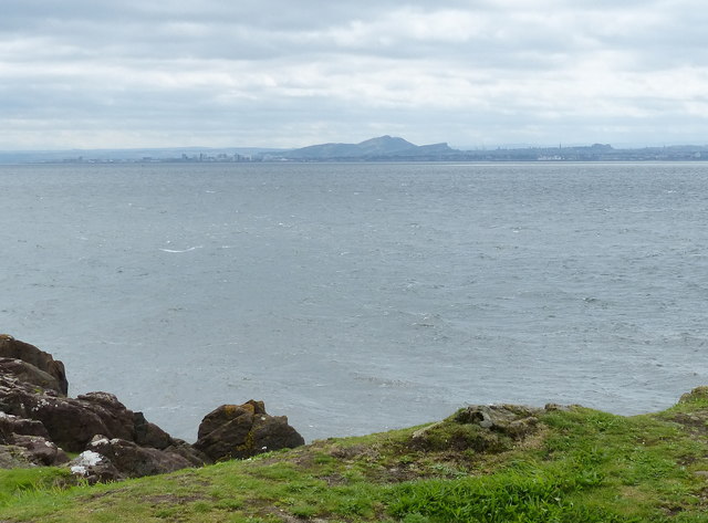
Charles Hill is a prominent peak located in the region of Fife, Scotland. Standing at an impressive height of 522 meters (1,713 feet), it is often referred to as a hill rather than a mountain due to its size. Situated near the town of Dunfermline, Charles Hill offers breathtaking panoramic views of the surrounding area.

The hill is part of the Lomond Hills Regional Park, a protected area known for its natural beauty and diverse wildlife. Charles Hill is characterized by its rolling green slopes and rocky outcrops, creating a picturesque landscape that attracts both locals and visitors alike.

Hiking enthusiasts are drawn to Charles Hill for its well-maintained trails, making it a popular destination for outdoor activities such as hillwalking and rambling. The ascent to the summit is moderate, offering a rewarding challenge for all skill levels. On a clear day, climbers are rewarded with magnificent views stretching across Fife, with distant glimpses of Edinburgh and the Firth of Forth.

The hill is also home to a wide variety of flora and fauna, including heather, wildflowers, and several species of birds. Nature lovers can indulge in the tranquility of the surroundings and may spot wildlife such as deer, rabbits, and foxes.

Overall, Charles Hill is a remarkable natural landmark in Fife, offering a perfect blend of outdoor adventure, stunning vistas, and a peaceful escape from the bustling city life.

If you have any feedback on the listing, please let us know in the comments section below.
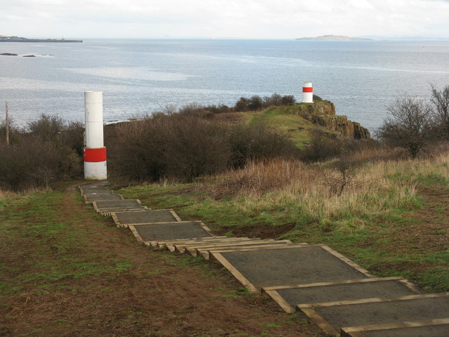
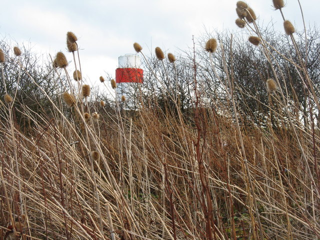
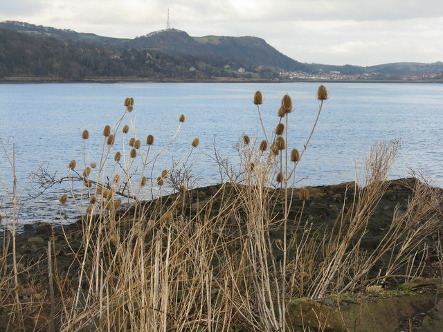
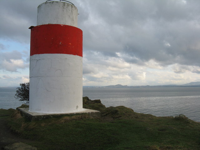
Charles Hill Images

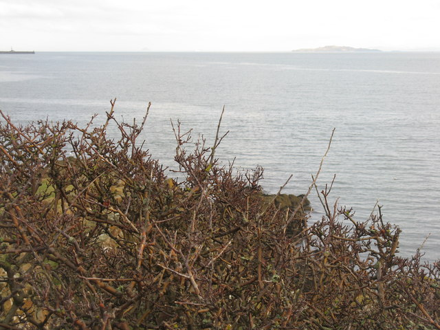
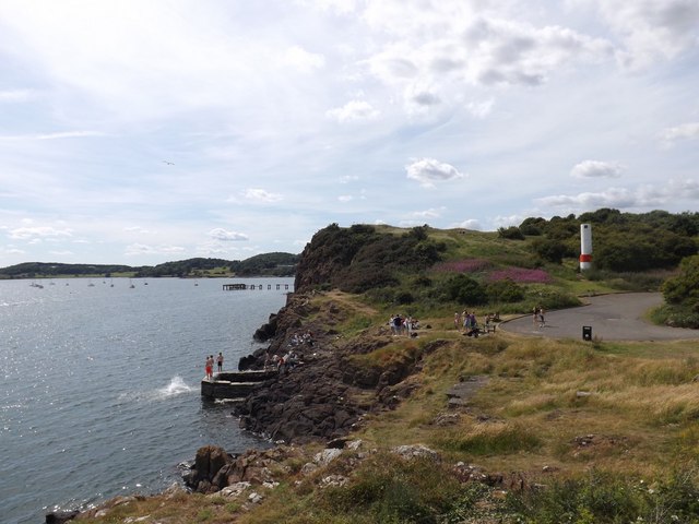
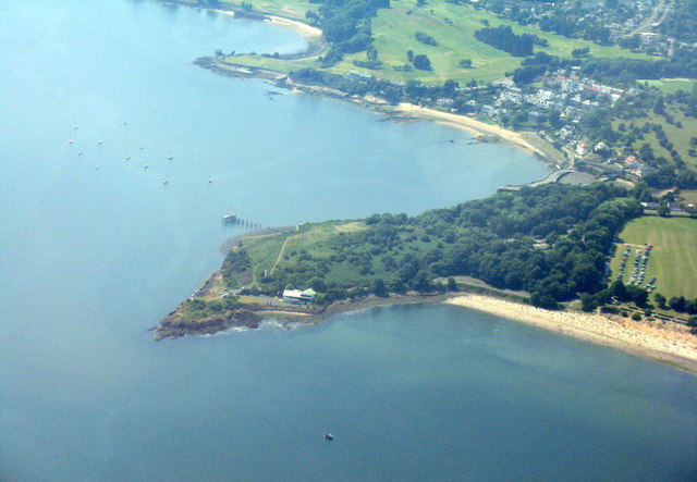
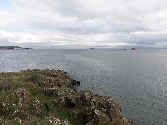
Images are sourced within 2km of 56.039951/-3.3083981 or Grid Reference NT1883. Thanks to Geograph Open Source API. All images are credited.

Beacons at Hawkcraig Point Apparently used by tankers coming into the Braehead Oil Terminal. The new steps are part of the Fife Coastal Path heading east from Aberdour to Burntisland.
Beacons at Hawkcraig Point
Apparently used by tankers coming into the Braehead Oil Terminal. The new steps are part of the Fife Coastal Path heading east from Aberdour to Burntisland.
Teasels at Hawkcraig Point With one of the two navigation beacons for Braefoot behind.
Teasels at Hawkcraig Point
With one of the two navigation beacons for Braefoot behind.
Hawkcraig and teasels Looking across Silversands Bay to the transmitter on The Binn, beyond Burntisland.
Hawkcraig and teasels
Looking across Silversands Bay to the transmitter on The Binn, beyond Burntisland.
Beacon at Hawkcraig Point One of two to assist tankers heading for Braefoot Oil Terminal. With Edinburgh and Arthurs seat 14 km across the Firth of Forth.
Beacon at Hawkcraig Point
One of two to assist tankers heading for Braefoot Oil Terminal. With Edinburgh and Arthurs seat 14 km across the Firth of Forth.
Wind-batterd hawthorn at Hawkcraig Point With Inchkeith in the distance.
Wind-batterd hawthorn at Hawkcraig Point
With Inchkeith in the distance.
Hawk Craig from Hawkcraig Point The southernmost point at Silversands.
Hawk Craig from Hawkcraig Point
The southernmost point at Silversands.
Hawk Craig from above Burntisland With Aberdour beach and harbour beyond.
Hawk Craig from above Burntisland
With Aberdour beach and harbour beyond.
The Happy Harrier The LPG tanker Happy Harrier, recently departed from Braefoot gas terminal (see Geograph image <a href="https://www.geograph.org.uk/photo/3679531">NT1883 : Gas terminal, Braefoot Bay</a>) en route for Port Jerome in France. The 3595 gross tonnes Happy Harrier was constructed in Tokyo, Japan in 1988 and is owned by Bsm-UK of Newcastle upon Tyne.
The Happy Harrier
The LPG tanker Happy Harrier, recently departed from Braefoot gas terminal (see Geograph image NT1883 : Gas terminal, Braefoot Bay) en route for Port Jerome in France. The 3595 gross tonnes Happy Harrier was constructed in Tokyo, Japan in 1988 and is owned by Bsm-UK of Newcastle upon Tyne.
View over Hawkcraig Point A view from Hawkcraig Point, with docks at Burntisland visible in the distance. The lpg tanker Happy Harrier can be seen in the Forth estuary having recently departed from Braefoot gas terminal en route for Port Jerome in France. For detail view see: <a href="https://www.geograph.org.uk/photo/3684534">NT2083 : The Happy Harrier</a>
View over Hawkcraig Point
A view from Hawkcraig Point, with docks at Burntisland visible in the distance. The lpg tanker Happy Harrier can be seen in the Forth estuary having recently departed from Braefoot gas terminal en route for Port Jerome in France. For detail view see: NT2083 : The Happy Harrier
View over Black Sands at Aberdour from Hawkcraig Point
Lighthouse beacon at Hawkscraig Point
Silversands Bay from the air Hawkcraig Point is in the foreground. Many sunbathers can be seen on the beach and in the sea.
Silversands Bay from the air
Hawkcraig Point is in the foreground. Many sunbathers can be seen on the beach and in the sea.
Hawk Craig from Hawkcraig Point
Information board at Hawkcraig Point
Seat overlooking the Firth of Forth
Firth of Forth at Hawkcraig Point Arthur's Seat in the city of Edinburgh is nearly nine miles away across the Firth of Forth.
Firth of Forth at Hawkcraig Point
Arthur's Seat in the city of Edinburgh is nearly nine miles away across the Firth of Forth.
Navigation beacon at Hawkcraig Point Hawkcraig Point lies between Aberdour and Silversands Bay. There are two navigation beacons aiding tankers berthing at Braefoot Bay.
Navigation beacon at Hawkcraig Point
Hawkcraig Point lies between Aberdour and Silversands Bay. There are two navigation beacons aiding tankers berthing at Braefoot Bay.
Silver Sands - three folk an' a dug Aberdour.  2 beautiful beaches, a harbour, a castle.  Some lovely wee shops.  There used to be a hundred pubs but now there's only a few.

Over a hundred years ago: <span class="nowrap"><a title="http://ibase.abdn.ac.uk/aberdeenic/index.php?a=wordsearch&s=item&key=Wczo4OiJhYmVyZG91ciI7&pg=26" rel="nofollow ugc noopener" href="http://ibase.abdn.ac.uk/aberdeenic/index.php?a=wordsearch&s=item&key=Wczo4OiJhYmVyZG91ciI7&pg=26">Link</a><img style="margin-left:2px;" alt="External link" title="External link - shift click to open in new window" src="https://s1.geograph.org.uk/img/external.png" width="10" height="10"/></span>
<span class="nowrap"><a title="http://ibase.abdn.ac.uk/aberdeenic/index.php?a=wordsearch&s=item&key=Wczo4OiJhYmVyZG91ciI7&pg=36" rel="nofollow ugc noopener" href="http://ibase.abdn.ac.uk/aberdeenic/index.php?a=wordsearch&s=item&key=Wczo4OiJhYmVyZG91ciI7&pg=36">Link</a><img style="margin-left:2px;" alt="External link" title="External link - shift click to open in new window" src="https://s1.geograph.org.uk/img/external.png" width="10" height="10"/></span>
Silver Sands - three folk an' a dug
Aberdour. 2 beautiful beaches, a harbour, a castle. Some lovely wee shops. There used to be a hundred pubs but now there's only a few. Over a hundred years ago: LinkExternal link LinkExternal link
Show me another place!

Charles Hill is located at Grid Ref: NT1883 (Lat: 56.039951, Lng: -3.3083981)

Unitary Authority: Fife

Police Authority: Fife

What 3 Words

///ignore.iceberg.nuance. Near Aberdour, Fife

Related Wikis

Inchcolm Abbey

Inchcolm Abbey is a medieval abbey located on the island of Inchcolm in the Firth of Forth in Scotland. The Abbey, which is located at the centre of the...

Inchcolm

Inchcolm (from the Scottish Gaelic "Innis Choluim", meaning Columba's Island) is an island in the Firth of Forth in Scotland. The island has a long history...

Aberdour

Aberdour ( ; Scots: , Scottish Gaelic: Obar Dobhair) is a scenic and historic village on the south coast of Fife, Scotland. It is on the north shore of...

St Bridget's Kirk

St. Bridget's Kirk is a ruined church on the outskirts of Dalgety Bay, Fife, Scotland. It is a shell of a medieval church, dating back at least as far...

Nearby Amenities

Located within 500m of 56.039951,-3.3083981
Barnhill Bay
Natural: bay
Source: OS_OpenData_StreetView
Lat/Long: 56.0431187/-3.3079786
Monks' Cave
Archaeological Site: settlement
Historic: archaeological_site
Source: survey
Lat/Long: 56.0392476/-3.3082768
Turning Circle
Lat/Long: 56.0401481/-3.3078088
Source: survey;bing
Lat/Long: 56.0399061/-3.3074288
Source: survey;bing
Lat/Long: 56.039911/-3.3073586
Source: survey;bing
Lat/Long: 56.0399226/-3.3073449
Source: survey;bing
Lat/Long: 56.0399352/-3.307348
Source: survey;bing
Lat/Long: 56.0399383/-3.3074361
Source: survey;bing
Lat/Long: 56.0399432/-3.3073658
Seamark Light Character: Fl
Seamark Light Period: 3
Seamark Light Range: 15
Seamark Type: light_major
Lat/Long: 56.03586/-3.3117047
Seamark Light Category: vertical
Seamark Light Character: F
Seamark Light Multiple: 2
Seamark Type: light_minor
Lat/Long: 56.0365867/-3.3106707
Seamark Light Category: vertical
Seamark Light Character: F
Seamark Light Multiple: 2
Seamark Type: light_minor
Lat/Long: 56.0370328/-3.3092628
Seamark Light Category: vertical
Seamark Light Character: F
Seamark Light Multiple: 2
Seamark Type: light_minor
Lat/Long: 56.037432/-3.3086114
Charles Hill
Natural: peak
Lat/Long: 56.04012/-3.3084635
Ferny Hill
Place: locality
Lat/Long: 56.0387573/-3.3134673
The data included in this document is from www.openstreetmap.org. The data is made available under ODbL.

Have you been to Charles Hill?

Leave your review of Charles Hill below (or comments, questions and feedback).