Ruigh Speanan

Hill, Mountain in Aberdeenshire

Scotland

Ruigh Speanan

Heather and birch above River Avon at Inchrory
Heather and birch above River Avon at Inchrory Credit: Alan Reid

Located in Aberdeenshire, Scotland, Ruigh Speanan is a rugged and majestic hill known for its breathtaking beauty and panoramic views. Standing at an elevation of approximately 605 meters (1,985 feet), it is a popular destination for hikers and nature enthusiasts.

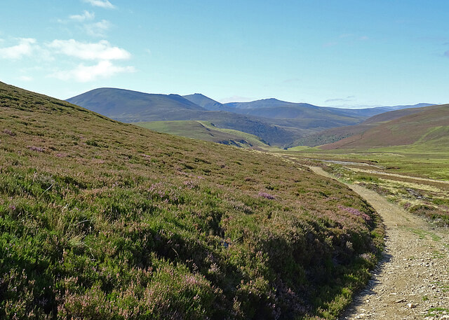
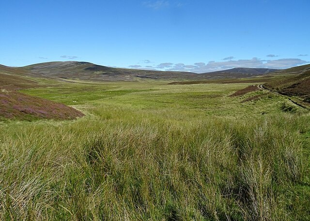
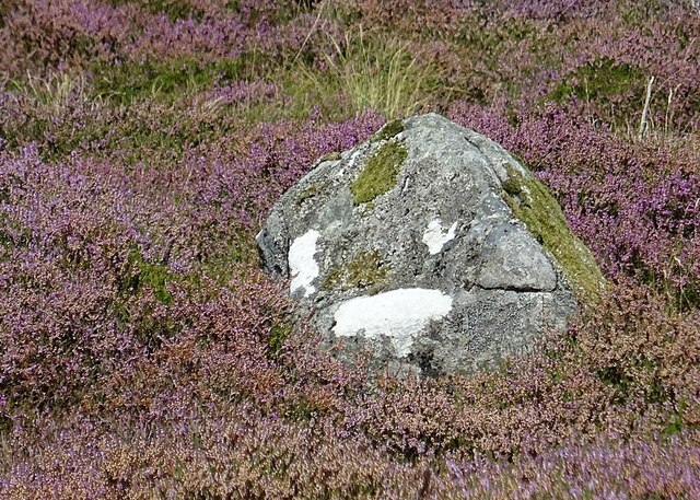
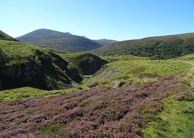
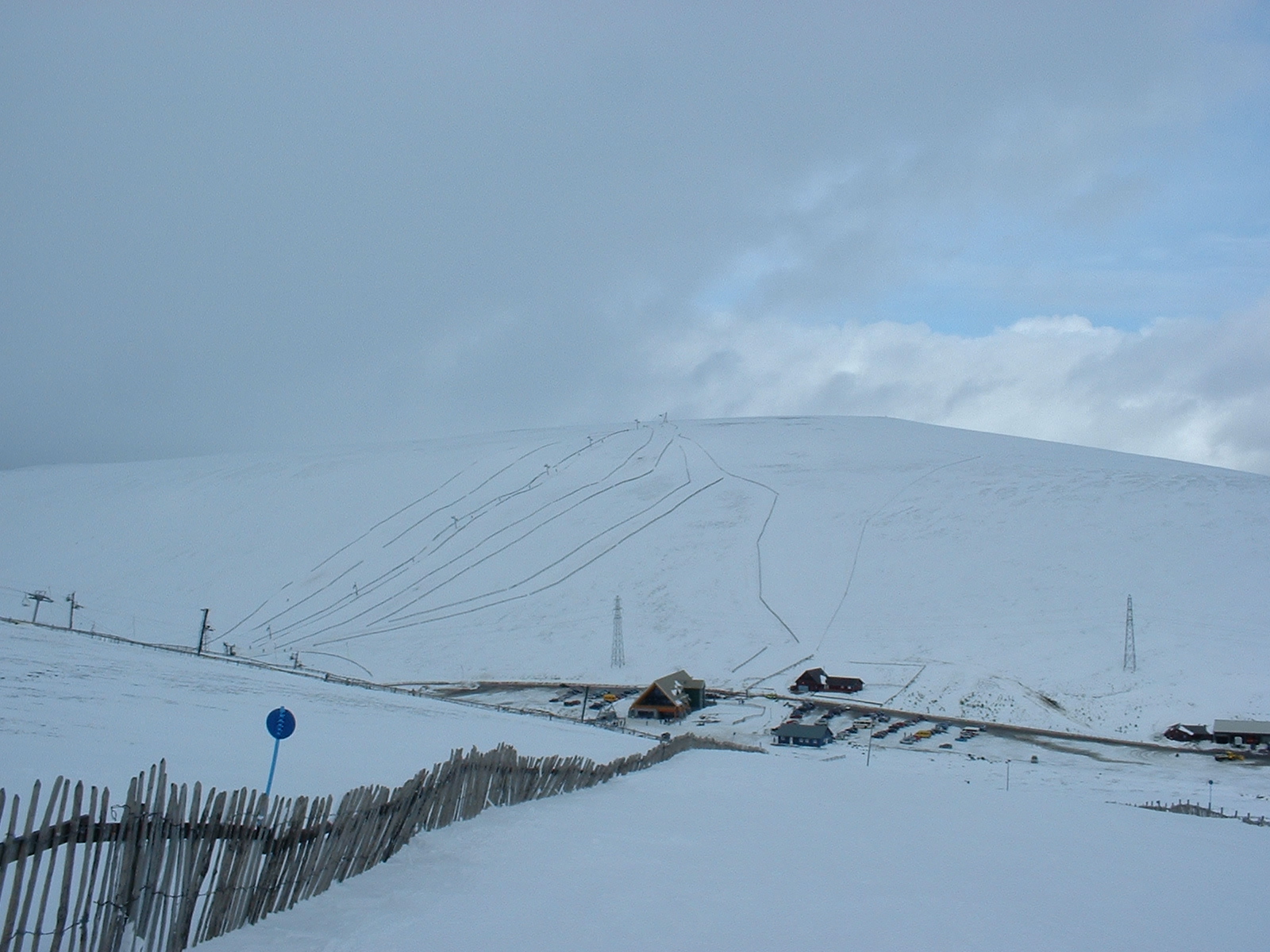
Ruigh Speanan boasts a varied landscape, with its slopes covered in lush greenery during the warmer months and a dusting of snow during the winter. The hill is characterized by its rocky terrain, which adds to its wild and untamed charm.

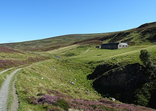
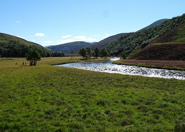
The ascent to the summit of Ruigh Speanan offers a challenging yet rewarding experience. Hikers can choose from a range of paths and trails that wind their way up the hill, passing through heather-covered moorlands and ancient woodlands. As they ascend, they are treated to stunning vistas of the surrounding countryside, including the nearby Cairngorms National Park.

The hill is also home to a diverse array of wildlife. Visitors may catch glimpses of red deer, mountain hares, and various species of birds, including the elusive golden eagle. The hill's flora is equally impressive, with an abundance of wildflowers and rare plants that thrive in its unique habitat.

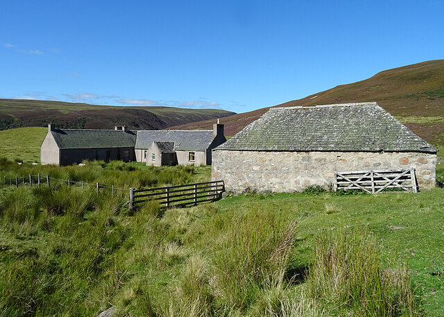
Ruigh Speanan is not only a natural haven but also holds historical significance. It is said to have been a site of ancient settlements, with remnants of old stone structures still visible today. These archaeological remains provide a glimpse into the area's rich past.

Whether exploring its rugged trails, admiring its scenic vistas, or uncovering its ancient history, Ruigh Speanan offers a captivating experience for all who venture to this remarkable hill in Aberdeenshire.

If you have any feedback on the listing, please let us know in the comments section below.

Ruigh Speanan Images

Images are sourced within 2km of 57.14988/-3.3490575 or Grid Reference NJ1807. Thanks to Geograph Open Source API. All images are credited.

Heather and birch above River Avon at Inchrory
Linn of Avon
Linn of Avon
Inchrory in Glen Avon
Glen Builg The choice of one locality as the subject her is rather artitrary. Loch Builg is on the left, and the Builg Burn flows down from it to join the River Avon at Inchrory, at the bottom of this view. Above and to the right of Inchrory is the long ridge of Ben A'an, with its several summits.
Glen Builg
The choice of one locality as the subject her is rather artitrary. Loch Builg is on the left, and the Builg Burn flows down from it to join the River Avon at Inchrory, at the bottom of this view. Above and to the right of Inchrory is the long ridge of Ben A'an, with its several summits.
Glen Builg and Strath Avon The snow in the foreground is on the eastern end of Ben Avon. To the right is Glen Builg, which joins the River Avon almost in the centre of the view, and then steep-sided Strath Avon continues towards the left. The Ladder Hills are at upper right and Ben Rinnes is just visible left of centre on the horizon.
Glen Builg and Strath Avon
The snow in the foreground is on the eastern end of Ben Avon. To the right is Glen Builg, which joins the River Avon almost in the centre of the view, and then steep-sided Strath Avon continues towards the left. The Ladder Hills are at upper right and Ben Rinnes is just visible left of centre on the horizon.
Glen Avon and Fèith Bhàit The River Avon marks Glen Avon at lower left. It is joined by the River Builg, from lower right, at Inchrory, and continues down Strath Avon to the left. Above Inchrory is a flat boggy area drained by Fèith Bhàit, a headwater of the River Don. The distant snow-capped hills are the Ladder Hills.
Glen Avon and Fèith Bhàit
The River Avon marks Glen Avon at lower left. It is joined by the River Builg, from lower right, at Inchrory, and continues down Strath Avon to the left. Above Inchrory is a flat boggy area drained by Fèith Bhàit, a headwater of the River Don. The distant snow-capped hills are the Ladder Hills.
Inchrory Inchrory has escaped the fate of many a Highand shooting lodge, being still in good condition and in use. From up here the tennis court and walled garden can be seen.
Inchrory
Inchrory has escaped the fate of many a Highand shooting lodge, being still in good condition and in use. From up here the tennis court and walled garden can be seen.
Inchrory and Fèith Bhàit Inchrory is at the bottom of this view, and above it the road that links it to Corgarff via Delnadamph can be seen winding round the flank of Cairn Culchavie. Below the road is the pale boggy expanse from which the Fèith Bhàit, a headwater of the River Don, emerges. The snow-capped mountain at upper right is Morven.
Inchrory and Fèith Bhàit
Inchrory is at the bottom of this view, and above it the road that links it to Corgarff via Delnadamph can be seen winding round the flank of Cairn Culchavie. Below the road is the pale boggy expanse from which the Fèith Bhàit, a headwater of the River Don, emerges. The snow-capped mountain at upper right is Morven.
Old Drove Road As the drove road reaches its highest point on Stròn na Crois Araich, it swings left and the view towards Ben Avon is revealed. The tops are, left to right, Meall Gaineimh, Stob Bac an Fhurain and Stob an t-Sluichd.
Old Drove Road
As the drove road reaches its highest point on Stròn na Crois Araich, it swings left and the view towards Ben Avon is revealed. The tops are, left to right, Meall Gaineimh, Stob Bac an Fhurain and Stob an t-Sluichd.
Fèith Bhàit Fèith means a bog or morass, and this certainly looks like very wet ground. The drove road hugs the slope of the hill for good reason. The bog is the source of the River Don.
Fèith Bhàit
Fèith means a bog or morass, and this certainly looks like very wet ground. The drove road hugs the slope of the hill for good reason. The bog is the source of the River Don.
Lagganauld The deserted house and outbuildings stands on a magnificent but remote site above Inchrory.
Lagganauld
The deserted house and outbuildings stands on a magnificent but remote site above Inchrory.
Lagganauld This is the track down from the abandoned buildings at Lagganauld to Inchrory.
Lagganauld
This is the track down from the abandoned buildings at Lagganauld to Inchrory.
Gonk Stone? We thought that the patches of white lichen made this stone look like the gonk toys that were all the rage in the 1970s.
Gonk Stone?
We thought that the patches of white lichen made this stone look like the gonk toys that were all the rage in the 1970s.
Gully at Lagganauld The burn has carved a deep gully through the Inchrory Limestone below Lagganauld. The view is dominated by Ben Avon.
Gully at Lagganauld
The burn has carved a deep gully through the Inchrory Limestone below Lagganauld. The view is dominated by Ben Avon.
Inchrory Limestone The old maps show at least one lime kiln beside the track between Inchrory and Lagganauld, suggesting that this is part of former limestone quarrying.
Inchrory Limestone
The old maps show at least one lime kiln beside the track between Inchrory and Lagganauld, suggesting that this is part of former limestone quarrying.
Dandelion Pappus (Taraxacum) This is the seed head of one of the 250 or so species of Dandelion found in Britain and Ireland.
Dandelion Pappus (Taraxacum)
This is the seed head of one of the 250 or so species of Dandelion found in Britain and Ireland.
Cait nan Gabhar The steep slope on the left is named on the old maps as Cait nan Gabhar, and the burn in the foreground is Allt Roderick.
Cait nan Gabhar
The steep slope on the left is named on the old maps as Cait nan Gabhar, and the burn in the foreground is Allt Roderick.
Strath Avon The wide flat floor of Strath Avon suggests that at some point there must have been a loch here.
Strath Avon
The wide flat floor of Strath Avon suggests that at some point there must have been a loch here.
Show me another place!

Ruigh Speanan is located at Grid Ref: NJ1807 (Lat: 57.14988, Lng: -3.3490575)

Unitary Authority: Aberdeenshire

Police Authority: North East

What 3 Words

///handbook.rocker.wrenching. Near Inverey, Aberdeenshire

Nearby Locations

Ruigh Speanan

Related Wikis

Delnadamph Lodge

Delnadamph Lodge was located on the Balmoral Estate about 8 miles (13 km) north of the castle. The lodge and its estate lands were bought by Queen Elizabeth...

Corgarff Castle

Corgarff Castle is located slightly west of the village of Corgarff, in Aberdeenshire, north-east Scotland. It stands by the Lecht road, which crosses...

Lecht Ski Centre

The Lecht Ski Centre is an alpine ski area in the Cairngorms in the Scottish Highlands. The ski slopes are set around the mountains Beinn a' Chruinnich...

Cock Bridge (Aberdeenshire)

Cock Bridge is a settlement in Aberdeenshire, Scotland, located in the Cairngorms National Park, on the A939 road near Corgarff and Corgarff Castle, between...

Have you been to Ruigh Speanan?

Leave your review of Ruigh Speanan below (or comments, questions and feedback).