Carn Liath

Hill, Mountain in Banffshire

Scotland

Carn Liath

Mountain bikers below summit of Carn Diamh The bikers are on the final stage of their climb though not all will necessarily visit the summit, even the rough track they're using passes close to the highest point and a branch of it does indeed go there.
Mountain bikers below summit of Carn Diamh Credit: Trevor Littlewood

Carn Liath is a prominent hill located in the county of Banffshire, Scotland. It is situated in the Cairngorms National Park, which is known for its stunning natural beauty and diverse wildlife. Standing at an elevation of 862 meters (2,828 feet), Carn Liath is classified as a Corbett, a term used to describe Scottish hills between 2,500 and 3,000 feet in height.

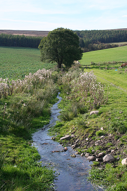
The hill is composed mainly of granite, which gives it a distinctive appearance and makes it an attractive destination for hikers and mountaineers. Its slopes are covered in heather and grass, creating a picturesque landscape that changes colors with the seasons. On clear days, reaching the summit of Carn Liath offers breathtaking panoramic views of the surrounding mountains, valleys, and lochs.

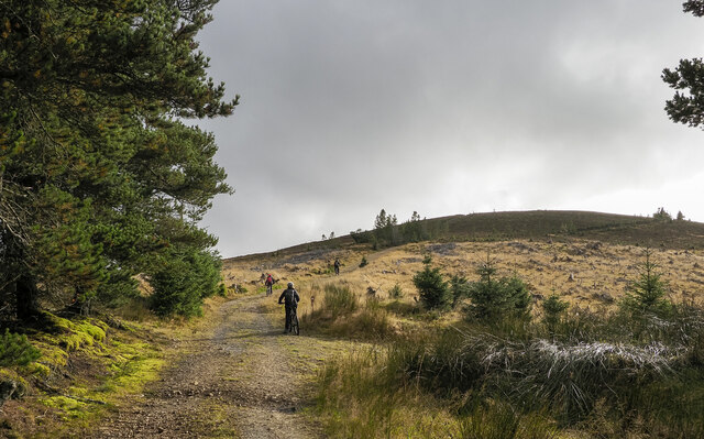
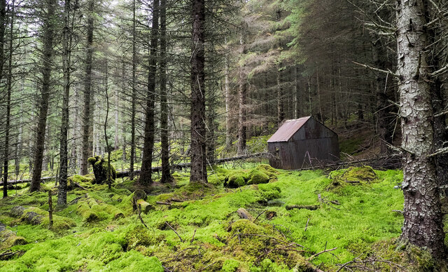
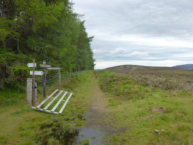
Carn Liath is a popular destination for outdoor enthusiasts, offering a range of activities such as hillwalking, hiking, and wildlife spotting. The area surrounding the hill is home to a variety of wildlife, including red deer, golden eagles, and ptarmigan. Visitors may also come across remnants of historical sites, such as old cairns or stone circles, adding an element of intrigue to the experience.

Access to Carn Liath is relatively straightforward, with several well-marked trails leading to the summit. The hill is easily reachable from nearby towns and villages, such as Tomintoul and Grantown-on-Spey, making it a convenient destination for both locals and tourists. Whether seeking a challenging hike or a peaceful escape into nature, Carn Liath offers a rewarding experience for all who venture to its summit.

If you have any feedback on the listing, please let us know in the comments section below.

Carn Liath Images

Images are sourced within 2km of 57.325925/-3.3561018 or Grid Reference NJ1826. Thanks to Geograph Open Source API. All images are credited.

Mountain bikers below summit of Carn Diamh The bikers are on the final stage of their climb though not all will necessarily visit the summit, even the rough track they're using passes close to the highest point and a branch of it does indeed go there.
Mountain bikers below summit of Carn Diamh
The bikers are on the final stage of their climb though not all will necessarily visit the summit, even the rough track they're using passes close to the highest point and a branch of it does indeed go there.
Coniferous plantation with cabin in Coire na Fuaraig The cabin is leaning and is presumably out of current use; it's on the north side of a forest ride with a thin but clear path.
Coniferous plantation with cabin in Coire na Fuaraig
The cabin is leaning and is presumably out of current use; it's on the north side of a forest ride with a thin but clear path.
Farmland near Blairfindy
Cottage at Gallowhill
Lynebeg Burn Considering how dry the weather has been recently, the burn seems very high.
Lynebeg Burn
Considering how dry the weather has been recently, the burn seems very high.
Carn Daimh Track junction Several waymarked tracks meet just to the north of Carn Daimh summit.
Carn Daimh Track junction
Several waymarked tracks meet just to the north of Carn Daimh summit.
Looking to Carn Liath Carn Liath from the Speyside way.
Looking to Carn Liath
Carn Liath from the Speyside way.
Josie's well The source of the water for the Glenlivet distillery.
Josie's well
The source of the water for the Glenlivet distillery.
Site of the old Glenlivet distillery This cairn marks the site of the original Glenlivet Distillery. It was founded by George Smith and first licensed in 1824, though had probably been operating as an illicit still before this.
The distillery moved to its current site, further down the hill, in 1859.
Site of the old Glenlivet distillery
This cairn marks the site of the original Glenlivet Distillery. It was founded by George Smith and first licensed in 1824, though had probably been operating as an illicit still before this. The distillery moved to its current site, further down the hill, in 1859.
Gallow Hill Carn Liath in the distance.
Gallow Hill
Carn Liath in the distance.
Glenlivet House
Glenlivet House
Westertown Viewed across the ford where the track crosses Allt a' Choire.
Westertown
Viewed across the ford where the track crosses Allt a' Choire.
Caterpillar This rusty-coloured caterpillar was making its way along the road near Westertown. Assuming that it was going head first, the head is to the left. Could it be an Ermine Moth? My book has proved useless, so any help with identification will be appreciated.
Caterpillar
This rusty-coloured caterpillar was making its way along the road near Westertown. Assuming that it was going head first, the head is to the left. Could it be an Ermine Moth? My book has proved useless, so any help with identification will be appreciated.
Glen Livet View north from the summit of Carn Diamh. At 570m quite a small bump. Down below is Glen Livet. Most of the land in the photo is part of the Glenlivet Estate which is part of the Crown Estate. Now the Crown Estate which has a portfolio of £8.1b, does not belong to the Queen as its name implies but it’s administered on behalf of the Government and any revenue from it eases our tax bill.

From my blog: <span class="nowrap"><a title="https://fhithich.wordpress.com/2015/08/12/glen-livet/" rel="nofollow ugc noopener" href="https://fhithich.wordpress.com/2015/08/12/glen-livet/">Link</a><img style="margin-left:2px;" alt="External link" title="External link - shift click to open in new window" src="https://s1.geograph.org.uk/img/external.png" width="10" height="10"/></span>
Glen Livet
View north from the summit of Carn Diamh. At 570m quite a small bump. Down below is Glen Livet. Most of the land in the photo is part of the Glenlivet Estate which is part of the Crown Estate. Now the Crown Estate which has a portfolio of £8.1b, does not belong to the Queen as its name implies but it’s administered on behalf of the Government and any revenue from it eases our tax bill. From my blog: LinkExternal link
Easter Corrie or Eastertown The maps say Eastertown, but the post code directory and the owners call it Easter Corrie. The buildings have been converted to four holiday cottages, and the owners operate wildlife safaris. See <span class="nowrap"><a title="www.glenlivet-wildlife.co.uk" rel="nofollow ugc noopener" href="http://www.glenlivet-wildlife.co.uk">Link</a><img style="margin-left:2px;" alt="External link" title="External link - shift click to open in new window" src="https://s1.geograph.org.uk/img/external.png" width="10" height="10"/></span> for details. The lean-to on the left is the old hen-house, and still contains the hens' nesting boxes. The rather incongruous wooden extension is on the old stables, but the owners have plans to restore the buildings, including replacing this extension.
Easter Corrie or Eastertown
The maps say Eastertown, but the post code directory and the owners call it Easter Corrie. The buildings have been converted to four holiday cottages, and the owners operate wildlife safaris. See LinkExternal link for details. The lean-to on the left is the old hen-house, and still contains the hens' nesting boxes. The rather incongruous wooden extension is on the old stables, but the owners have plans to restore the buildings, including replacing this extension.
Easter Corrie or Eastertown The maps say Eastertown, but the post code directory and the owners call it Easter Corrie. The buildings have been converted to four holiday cottages, and the owners operate wildlife safaris. See <span class="nowrap"><a title="www.glenlivet-wildlife.co.uk" rel="nofollow ugc noopener" href="http://www.glenlivet-wildlife.co.uk">Link</a><img style="margin-left:2px;" alt="External link" title="External link - shift click to open in new window" src="https://s1.geograph.org.uk/img/external.png" width="10" height="10"/></span> for details. This is the extension to the right of <a href="https://www.geograph.org.uk/photo/1301111">NJ2026 : Easter Corrie or Eastertown</a>. This wooden extension is also to be replaced by a more appropriate structure.
Easter Corrie or Eastertown
The maps say Eastertown, but the post code directory and the owners call it Easter Corrie. The buildings have been converted to four holiday cottages, and the owners operate wildlife safaris. See LinkExternal link for details. This is the extension to the right of NJ2026 : Easter Corrie or Eastertown. This wooden extension is also to be replaced by a more appropriate structure.
Easter Corrie or Eastertown The maps say Eastertown, but the post code directory and the owners call it Easter Corrie. The buildings have been converted to four holiday cottages, and the owners operate wildlife safaris. See <span class="nowrap"><a title="www.glenlivet-wildlife.co.uk" rel="nofollow ugc noopener" href="http://www.glenlivet-wildlife.co.uk">Link</a><img style="margin-left:2px;" alt="External link" title="External link - shift click to open in new window" src="https://s1.geograph.org.uk/img/external.png" width="10" height="10"/></span> for details. This is probably the oldest building, and was originally the mill. There was a mill wheel at the far end of the building.
Easter Corrie or Eastertown
The maps say Eastertown, but the post code directory and the owners call it Easter Corrie. The buildings have been converted to four holiday cottages, and the owners operate wildlife safaris. See LinkExternal link for details. This is probably the oldest building, and was originally the mill. There was a mill wheel at the far end of the building.
Easter Corrie or Eastertown The maps say Eastertown, but the post code directory and the owners call it Easter Corrie. The buildings have been converted to four holiday cottages, and the owners operate wildlife safaris. See <span class="nowrap"><a title="www.glenlivet-wildlife.co.uk" rel="nofollow ugc noopener" href="http://www.glenlivet-wildlife.co.uk">Link</a><img style="margin-left:2px;" alt="External link" title="External link - shift click to open in new window" src="https://s1.geograph.org.uk/img/external.png" width="10" height="10"/></span> for details. The wooden sun room, cold in winter and hot in summer, is to be replaced and the building restored.
Easter Corrie or Eastertown
The maps say Eastertown, but the post code directory and the owners call it Easter Corrie. The buildings have been converted to four holiday cottages, and the owners operate wildlife safaris. See LinkExternal link for details. The wooden sun room, cold in winter and hot in summer, is to be replaced and the building restored.
Show me another place!

Carn Liath is located at Grid Ref: NJ1826 (Lat: 57.325925, Lng: -3.3561018)

Unitary Authority: Moray

Police Authority: North East

What 3 Words

///arming.blackbird.coats. Near Grantown-on-Spey, Highland

Nearby Locations

Carn Liath

Related Wikis

The Glenlivet distillery

The Glenlivet distillery is a distillery near Ballindalloch in Moray, Scotland that produces single malt Scotch whisky. It is the oldest legal distillery...

Blairfindy Castle

Blairfindy Castle is an L-plan tower house, dating from the 16th century, around 6.5 miles (10.5 km) north of Tomintoul, and west of the River Livet....

Glenlivet

Glenlivet (Scottish Gaelic: Gleann Lìobhait) is the glen in the Scottish Highlands through which the River Livet flows. The river rises high in the Ladder...

Auchbreck

Auchbreck (Scottish Gaelic: An t-Achadh Breac, meaning the speckled field) is a village in Moray, Scotland.

Tamnavulin distillery

Tamnavulin distillery is a producer of single malt Scotch whisky that was founded in 1966. The distillery is operated by Whyte & Mackay, which Philippines...

Drumin Castle

Drumin Castle is a ruined tower house near Glenlivet, Moray, Scotland. The castle is situated on a ridge above the junction of the Livet and Avon Rivers...

Church of The Incarnation, Tombae

The Church of The Incarnation was built between 1827 and 1829 as a Roman Catholic church, under the patronage of the Gordon family, in Banffshire, Scotland...

Deskie Castle

Deskie Castle was a medieval tower house that is thought to have been near Bridgend of Livet, Moray, Scotland. == History == Little is known of the castle...

Nearby Amenities

Located within 500m of 57.325925,-3.3561018
Càrn Liath
Ele: 547
Natural: peak
Lat/Long: 57.3261949/-3.3562344
The data included in this document is from www.openstreetmap.org. The data is made available under ODbL.

Have you been to Carn Liath?

Leave your review of Carn Liath below (or comments, questions and feedback).