East Kip

Hill, Mountain in Midlothian

Scotland

East Kip

Path in the valley  of the Quarrel Burn Heading up Braid Law.
Path in the valley of the Quarrel Burn Credit: Oliver Dixon

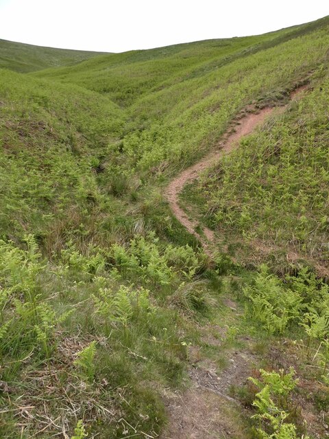
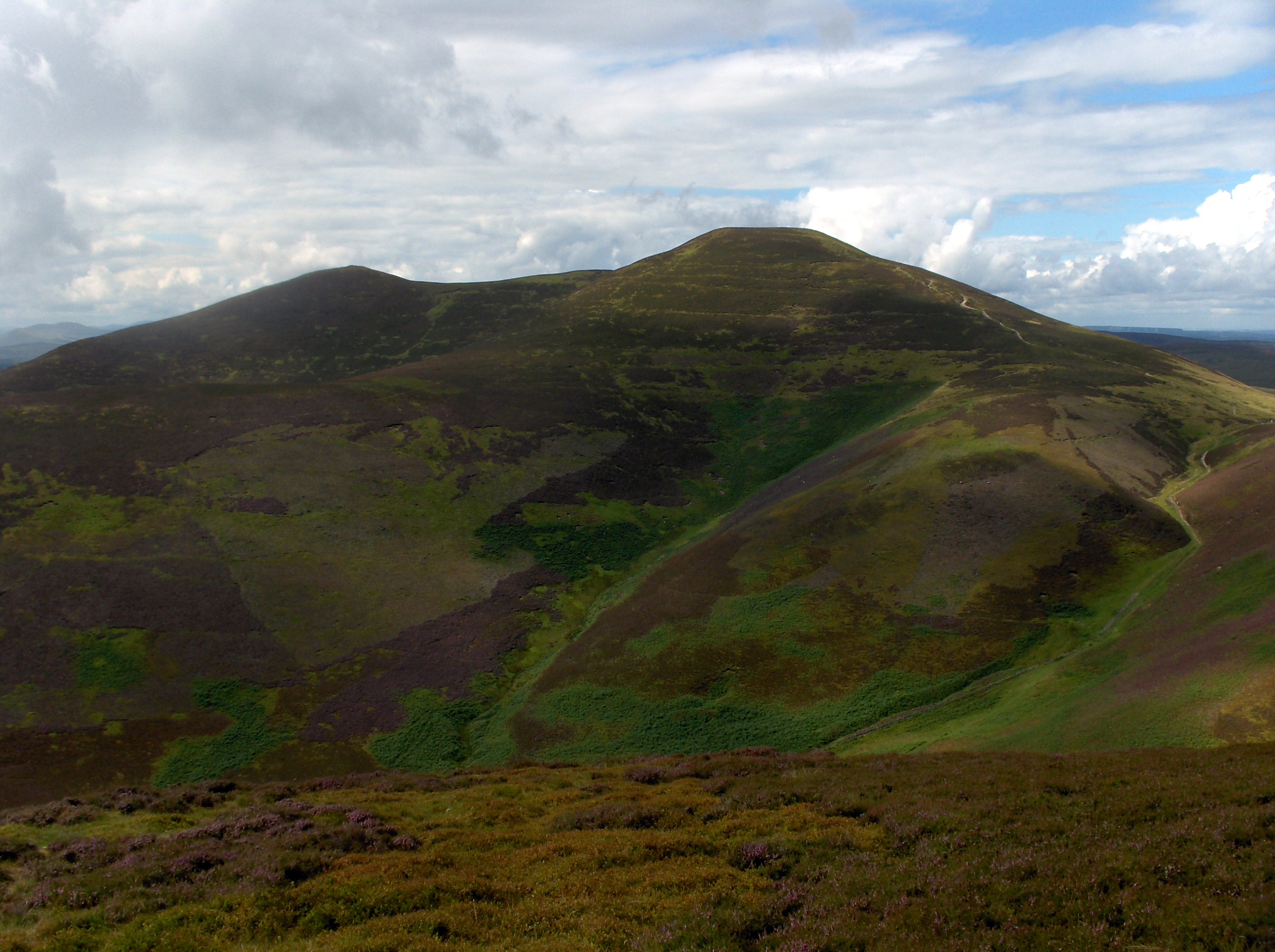
East Kip is a hill located in the Midlothian region of Scotland. It is part of the Pentland Hills range, which is a popular destination for hikers and outdoor enthusiasts. East Kip stands at an elevation of 534 meters (1752 feet) above sea level, making it one of the higher peaks in the area.

The hill is characterized by its rugged terrain, with steep slopes and rocky outcrops, providing a challenging but rewarding climb for those who attempt to summit it. The summit offers stunning panoramic views of the surrounding countryside, including the nearby towns of Edinburgh and Penicuik.

East Kip is home to a variety of wildlife, including birds of prey such as buzzards and kestrels, as well as a range of plant species that thrive in the hill's unique microclimate. The area is also rich in history, with ancient ruins and archaeological sites scattered throughout the landscape, providing a glimpse into the area's past.

Overall, East Kip is a picturesque and diverse hill that offers both natural beauty and recreational opportunities for visitors to enjoy.

If you have any feedback on the listing, please let us know in the comments section below.

East Kip Images

Images are sourced within 2km of 55.834099/-3.3058507 or Grid Reference NT1860. Thanks to Geograph Open Source API. All images are credited.

Path in the valley  of the Quarrel Burn Heading up Braid Law.
Path in the valley of the Quarrel Burn
Heading up Braid Law.
Path across the Quarrel Burn Quarrel Burn Reservoir in the background.
Path across the Quarrel Burn
Quarrel Burn Reservoir in the background.
One man and his mutt View looking down the side Cap Law to a reservoir.  The shadows are me and my dog!
One man and his mutt
View looking down the side Cap Law to a reservoir. The shadows are me and my dog!
Monks Burn, Pentland Hills An old sheepfold near the head of this burn below Monks Rig.
Monks Burn, Pentland Hills
An old sheepfold near the head of this burn below Monks Rig.
Pentlands panorama View over to West Kip, East Kip, Scald Law and South Black Hill from above the larch tree plantation on Cap Law (Gap Law).
Pentlands panorama
View over to West Kip, East Kip, Scald Law and South Black Hill from above the larch tree plantation on Cap Law (Gap Law).
Fallen larches, Cap Law (Gap Law) The top of West Kip peeks out through the gnarled larches.
Fallen larches, Cap Law (Gap Law)
The top of West Kip peeks out through the gnarled larches.
Pentland Hills above a layer of low cloud A zoom lens shot taken from about 25 miles away on the northern slopes of Tinto.

The distinctive small sharp peak of West Kip can clearly be seen, with Scald Law and Carnethy Hill to the right of the shot.
Pentland Hills above a layer of low cloud
A zoom lens shot taken from about 25 miles away on the northern slopes of Tinto. The distinctive small sharp peak of West Kip can clearly be seen, with Scald Law and Carnethy Hill to the right of the shot.
No coins at the Font Stone Hard times as there are no coins left in the hollow in the Font Stone today - compare with the riches in <a href="https://www.geograph.org.uk/photo/1187823">NT1759 : Font Stone on Monks Rigg</a>.
No coins at the Font Stone
Hard times as there are no coins left in the hollow in the Font Stone today - compare with the riches in NT1759 : Font Stone on Monks Rigg.
A702 near Silverburn One of the main routes south from Edinburgh, running along the southeastern edge of the Pentland Hills.
A702 near Silverburn
One of the main routes south from Edinburgh, running along the southeastern edge of the Pentland Hills.
Braid Law A rhyolite hill in the Pentlands. View from near Eight Mile Burn.
Braid Law
A rhyolite hill in the Pentlands. View from near Eight Mile Burn.
Eight Mile Burn View of Eight Mile Burn from a track which once serviced the Quarrel Burn Reservoir.
Eight Mile Burn
View of Eight Mile Burn from a track which once serviced the Quarrel Burn Reservoir.
Quarry, Eight Mile Burn This appears to be a mound of glacial deposits.
Quarry, Eight Mile Burn
This appears to be a mound of glacial deposits.
A field beneath Braid Law The eastern side of the Pentland Hills near Eight Mile Burn.
A field beneath Braid Law
The eastern side of the Pentland Hills near Eight Mile Burn.
Windswept trees, Braid Law Trees with a permanent lean from southerly winds.
Windswept trees, Braid Law
Trees with a permanent lean from southerly winds.
Loganlea Reservoir Where the Logan Burn enters the reservoir from the south-west. Carnethy Hill in the background.
Loganlea Reservoir
Where the Logan Burn enters the reservoir from the south-west. Carnethy Hill in the background.
Signpost at the Howe With the Logan Burn. The footpath heading northwest takes you through Greencleugh to Balerno. See <a title="https://www.geograph.org.uk/photo/1658054" href="https://www.geograph.org.uk/photo/1658054">Link</a> for Richard Webb's photo of the same signpost in snow.
Signpost at the Howe
With the Logan Burn. The footpath heading northwest takes you through Greencleugh to Balerno. See Link for Richard Webb's photo of the same signpost in snow.
Scald Law trig point Looking west south-west towards East Kip.
Scald Law trig point
Looking west south-west towards East Kip.
The Howe Large farmhouse at the top end of Loganlea Reservoir.
The Howe
Large farmhouse at the top end of Loganlea Reservoir.
Show me another place!

East Kip is located at Grid Ref: NT1860 (Lat: 55.834099, Lng: -3.3058507)

Unitary Authority: Midlothian

Police Authority: The Lothians and Scottish Borders

What 3 Words

///prune.buffoon.pleasing. Near Penicuik, Midlothian

Nearby Locations

Kips Wood East Kip

Related Wikis

South Black Hill

South Black Hill is a hill in the Pentland Hills range of Scotland. It is located in the west of Midlothian on the east flank of the approximately 25 km...

Scald Law

Scald Law is a hill in Midlothian, Scotland. At 579 metres (1,900 ft) it is the highest of the Pentland Hills. The hill is composed of Devonian volcanic...

Eight Mile Burn

Eight Mile Burn is a small settlement in Midlothian, South East Scotland, at the base of Pentland Hills Regional Park. It is approximately 11 miles from...

Loganlea Reservoir

Loganlea Reservoir is a small reservoir in the Pentland Hills, Midlothian, Scotland, UK. The Logan Burn connects the reservoir with Glencorse Reservoir...

Nearby Amenities

Located within 500m of 55.834099,-3.3058507
East Kip
Ele: 534
Natural: peak
Wikidata: Q19278728
Lat/Long: 55.8339778/-3.306169
Ford: yes
Lat/Long: 55.8319543/-3.3070779
The data included in this document is from www.openstreetmap.org. The data is made available under ODbL.

Have you been to East Kip?

Leave your review of East Kip below (or comments, questions and feedback).