Brimley Hill

Hill, Mountain in Devon Somerset West and Taunton

England

Brimley Hill

Clayhidon: Hidon Mill The mill, now a private residence, retained a waterwheel when offered for sale in 2002. It was powered by leats from the Culm and a stream running down from Gollick Park
Clayhidon: Hidon Mill Credit: Martin Bodman

Brimley Hill, located in Devon, England, is a prominent hill that stands at an elevation of approximately 266 meters (873 feet) above sea level. It is part of the expansive Dartmoor National Park, which is renowned for its rugged landscapes and natural beauty. Brimley Hill is situated in the eastern region of the park, offering breathtaking panoramic views of the surrounding countryside and nearby moorland.

The hill itself is characterized by its gently sloping sides and a relatively flat summit, making it accessible for hikers and nature enthusiasts of varying abilities. Its location within Dartmoor National Park provides opportunities for visitors to explore the diverse flora and fauna that thrive in the area. The hill is covered in heather, gorse, and grasses, creating a vibrant and colorful landscape throughout the year.

Brimley Hill is also home to an array of wildlife, including various species of birds, small mammals, and insects. The area is known for its tranquil atmosphere, making it an ideal spot for birdwatching and wildlife photography.

For outdoor enthusiasts, Brimley Hill offers a range of recreational activities. Hiking and walking trails can be found at the base of the hill, leading visitors through the surrounding countryside and providing access to other notable landmarks within Dartmoor National Park. Additionally, the hill is a popular destination for paragliding and hang gliding, thanks to its favorable wind conditions and open spaces.

Overall, Brimley Hill in Devon is a picturesque and accessible natural landmark, offering stunning views, diverse wildlife, and a range of outdoor activities for visitors to enjoy.

If you have any feedback on the listing, please let us know in the comments section below.
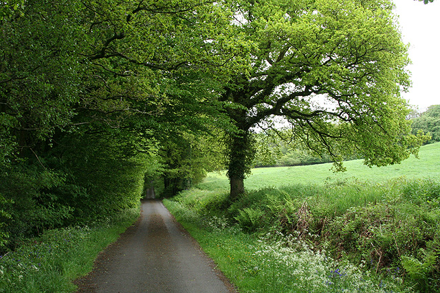
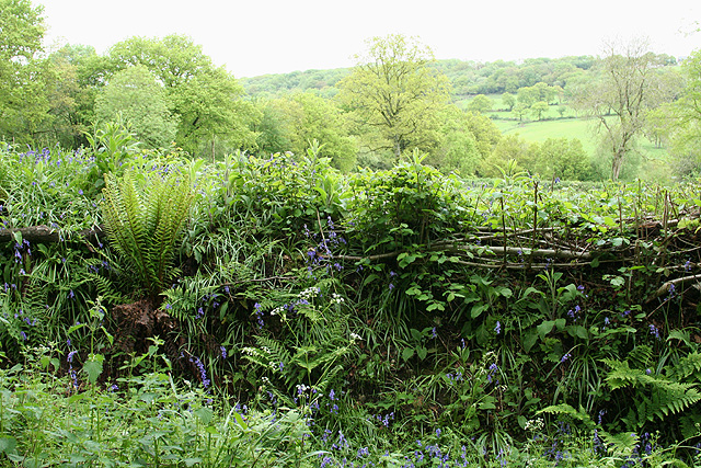
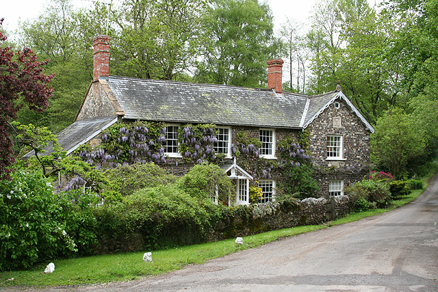
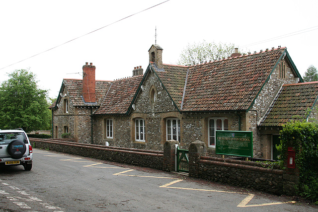
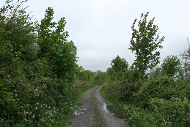
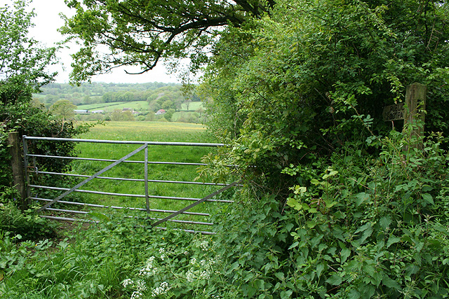
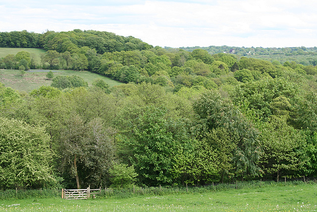
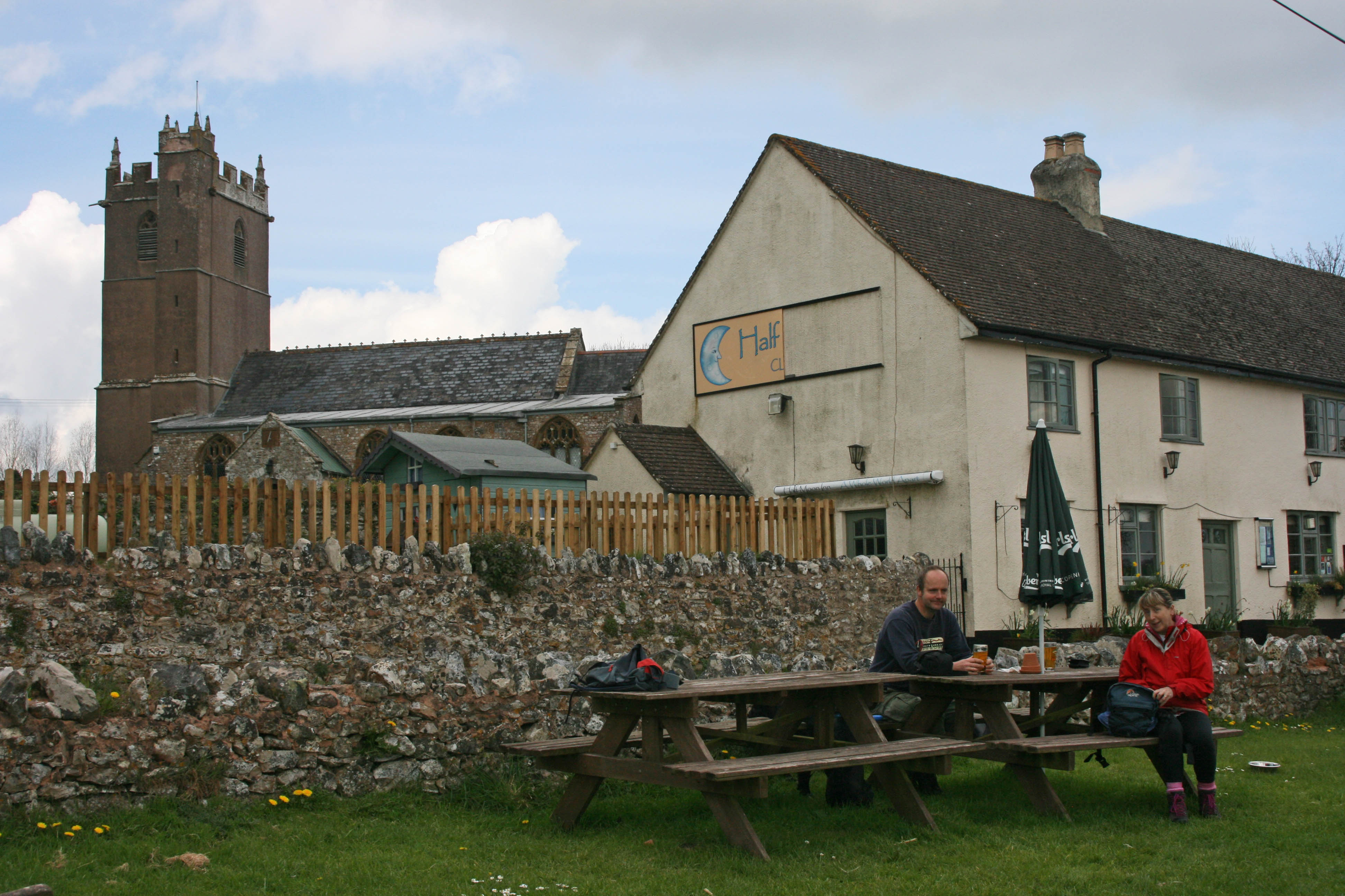
Brimley Hill Images

Images are sourced within 2km of 50.919373/-3.1656256 or Grid Reference ST1813. Thanks to Geograph Open Source API. All images are credited.

Clayhidon: Hidon Mill The mill, now a private residence, retained a waterwheel when offered for sale in 2002. It was powered by leats from the Culm and a stream running down from Gollick Park
Clayhidon: Hidon Mill
The mill, now a private residence, retained a waterwheel when offered for sale in 2002. It was powered by leats from the Culm and a stream running down from Gollick Park
Clayhidon: parish hall The hall stands by a T-junction
Clayhidon: parish hall
The hall stands by a T-junction
Clayhidon: nearing Lillycombe Farm Looking south west. The signpost at Lillycombe Cross can just be seen. After rain
Clayhidon: nearing Lillycombe Farm
Looking south west. The signpost at Lillycombe Cross can just be seen. After rain
Clayhidon: Lillycombe Farm Looking north west on the road to Hemyock. At Lillycombe Cross the signpost carries the alternative spelling ‘Lilycombe’
Clayhidon: Lillycombe Farm
Looking north west on the road to Hemyock. At Lillycombe Cross the signpost carries the alternative spelling ‘Lilycombe’
Clayhidon: lane from Lilycombe Cross Looking south on the way to Biscombe Cross.
Clayhidon: lane from Lilycombe Cross
Looking south on the way to Biscombe Cross.
Clayhidon: towards Grants Farm Looking east-south-east from the lane between Lilycombe Cross and Biscombe Cross
Clayhidon: towards Grants Farm
Looking east-south-east from the lane between Lilycombe Cross and Biscombe Cross
Churchstanton: lane to Biscombe Looking east-south-east
Churchstanton: lane to Biscombe
Looking east-south-east
Churchstanton: hedgebank near Biscombe Looking north-north-east
Churchstanton: hedgebank near Biscombe
Looking north-north-east
Churchstanton: Stapley Mill A 19th century watermill and millers house now combined in one residence. The course of the leat is still evident in the garden. Looking north east
Churchstanton: Stapley Mill
A 19th century watermill and millers house now combined in one residence. The course of the leat is still evident in the garden. Looking north east
Churchstanton: Churchstanton School At Willand. Established on this site since 20 October 1879. Looking south west
Churchstanton: Churchstanton School
At Willand. Established on this site since 20 October 1879. Looking south west
Churchstanton: Rainbow Lane Near its junction with Broad Street on the Blackdowns. The lane or track runs to Biscombe. Looking north-north-west
Churchstanton: Rainbow Lane
Near its junction with Broad Street on the Blackdowns. The lane or track runs to Biscombe. Looking north-north-west
Churchstanton:  church of St Peter and St Paul Tower of the parish church seen from the north west
Churchstanton: church of St Peter and St Paul
Tower of the parish church seen from the north west
Churchstanton: lane to Court Farm Looking west-north-west
Churchstanton: lane to Court Farm
Looking west-north-west
Churchstanton: near Courtsmoor Farm Start of a public footpath providing a shortcut across fields. Lear’s Farm in the distance. The public footpath sign is almost lost amongst the foliage
Churchstanton: near Courtsmoor Farm
Start of a public footpath providing a shortcut across fields. Lear’s Farm in the distance. The public footpath sign is almost lost amongst the foliage
Churchstanton: Ringdown Nature Reserve A 59-acre site acquired by the Somerset Wildlife Trust in 1998. It runs down to a tributary of the river Culm. The estate includes wet woodland, marshy grassland, spring line mire and improved grassland. Orchids and butterwort feature together with devils bit scabious and bog asphodel. Woodcock and snipe can be seen here in the winter
Churchstanton: Ringdown Nature Reserve
A 59-acre site acquired by the Somerset Wildlife Trust in 1998. It runs down to a tributary of the river Culm. The estate includes wet woodland, marshy grassland, spring line mire and improved grassland. Orchids and butterwort feature together with devils bit scabious and bog asphodel. Woodcock and snipe can be seen here in the winter
Churchstanton: Downlands Lane Looking north
Churchstanton: Downlands Lane
Looking north
Clayhidon: Devon boundary At the turning to Biscombe and Stapley. Looking west-north-west. To the right, out of shot, is the Somerset parish of Churchstanton
Clayhidon: Devon boundary
At the turning to Biscombe and Stapley. Looking west-north-west. To the right, out of shot, is the Somerset parish of Churchstanton
Clayhidon: footpath to Ringdown Common Seen from Applehayes Lane and looking east over the Wiltown Valley. Brimley Hill is in the distance, right
Clayhidon: footpath to Ringdown Common
Seen from Applehayes Lane and looking east over the Wiltown Valley. Brimley Hill is in the distance, right
Show me another place!

Brimley Hill is located at Grid Ref: ST1813 (Lat: 50.919373, Lng: -3.1656256)

Administrative County: Somerset

District: Somerset West and Taunton

Police Authority: Avon and Somerset

What 3 Words

///crashing.talents.conforms. Near Hemyock, Devon

Related Wikis

Churchstanton

Churchstanton is a village and civil parish in Somerset, England, situated within the Blackdown Hills Area of Outstanding Natural Beauty, on the River...

Ringdown SSSI, Somerset

Ringdown (grid reference ST178155) is a 4.0 hectare (9.9 acre) biological Site of Special Scientific Interest west of Burnworthy in the Blackdown Hills...

Clayhidon

Clayhidon () is a village and civil parish in Mid Devon, England. The parish church is St. Andrews. The parish is in the Blackdown Hills and its northern...

RAF Culmhead

Royal Air Force Culmhead or more simply RAF Culmhead is a former Royal Air Force station, situated at Churchstanton on the Blackdown Hills in Somerset...

Nearby Amenities

Located within 500m of 50.919373,-3.1656256
Brimley Hill
Place: locality
Lat/Long: 50.9226277/-3.1683497
The data included in this document is from www.openstreetmap.org. The data is made available under ODbL.

Have you been to Brimley Hill?

Leave your review of Brimley Hill below (or comments, questions and feedback).