Carn Daimh

Hill, Mountain in Banffshire

Scotland

Carn Daimh

Summit area of Cairn Ellick Cairn Ellick is a modest hill, an outlying top of another, Carn Daimh; much of it is covered with planted conifers. The summit area is heather covered and there's a small cairn where the two hill walkers are standing. The highest point however is reckoned to be at the camera position.
Summit area of Cairn Ellick Credit: Trevor Littlewood

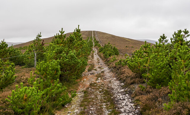
Carn Daimh, located in Banffshire, Scotland, is a prominent hill/mountain in the eastern part of the country. Standing at an elevation of approximately 704 meters (2,310 feet), it offers stunning panoramic views of the surrounding landscape.

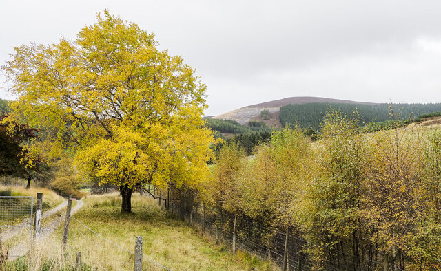
The hill/mountain is part of the Cairngorms National Park, a vast and diverse area known for its rugged beauty and rich wildlife. Carn Daimh is situated in close proximity to other notable peaks, such as Ben Rinnes to the west and Tap o' Noth to the east, making it a popular destination for hikers and nature enthusiasts.

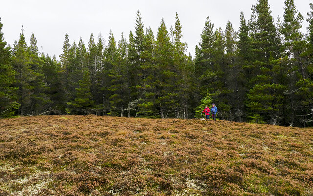
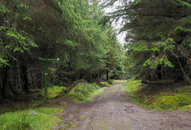
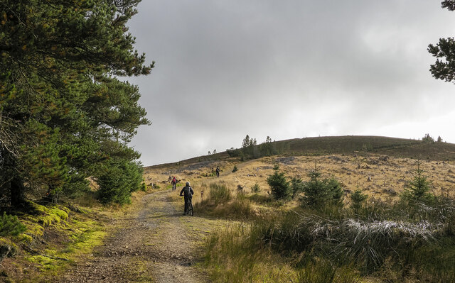
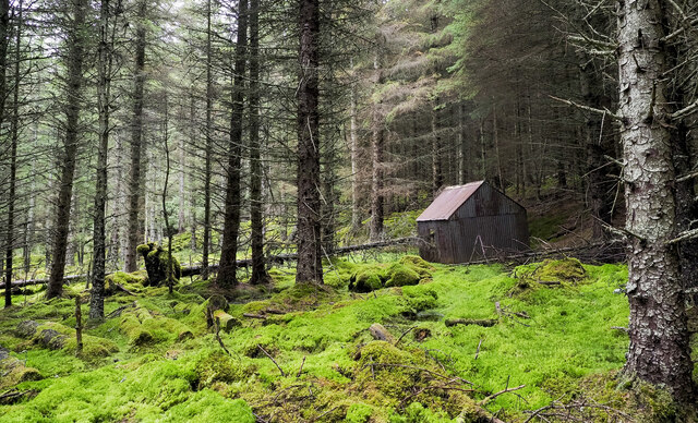
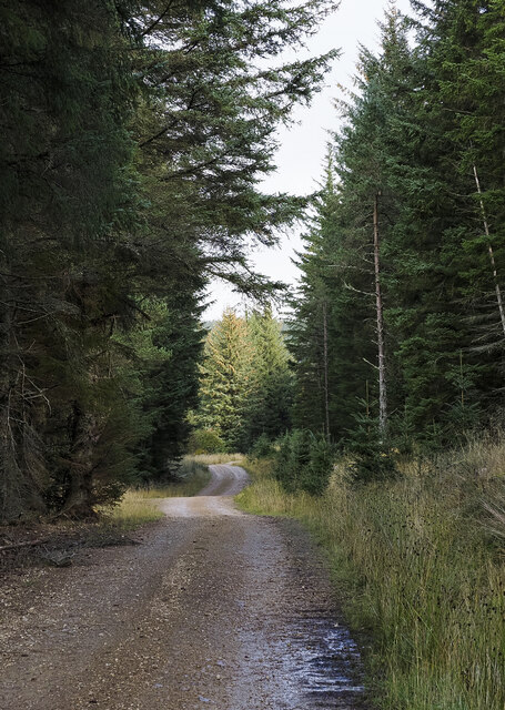
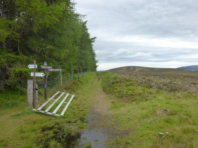
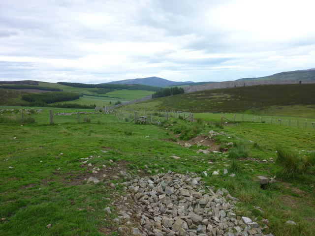
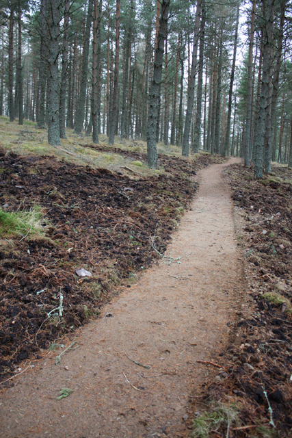
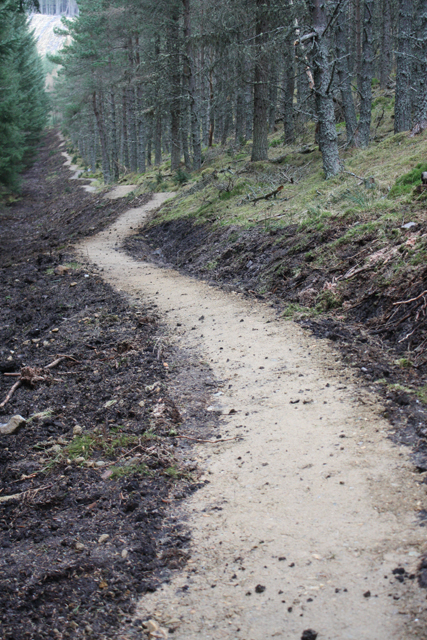
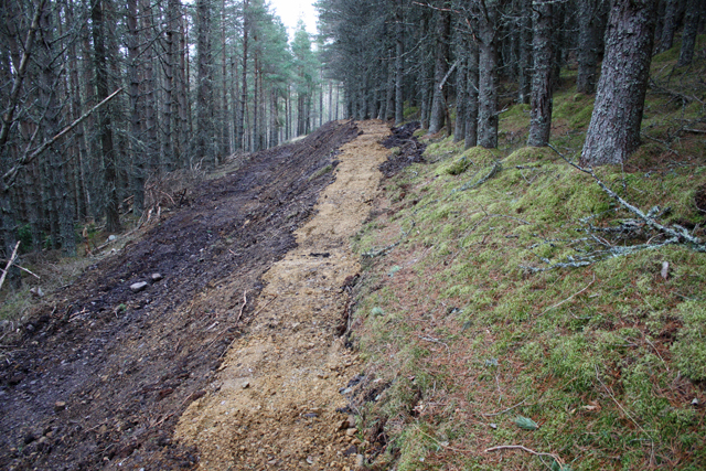
The terrain of Carn Daimh is characterized by rolling hills, heather moorlands, and scattered boulders. The ascent to the summit can be challenging, but the reward is well worth the effort. On clear days, the views from the top extend for miles, encompassing the nearby mountain ranges, glens, and the sparkling waters of the North Sea.

The hill/mountain provides a habitat for various species of flora and fauna, including heather, mosses, and lichens, as well as birds of prey such as golden eagles and peregrine falcons. It is also home to a diverse range of wildlife, including red deer, mountain hares, and ptarmigans.

Carn Daimh attracts visitors throughout the year, with summer months offering the best weather conditions for outdoor activities. Hiking, hillwalking, and photography are popular pursuits, allowing visitors to immerse themselves in the natural beauty of this picturesque corner of Banffshire.

If you have any feedback on the listing, please let us know in the comments section below.
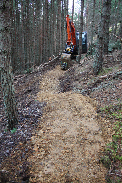
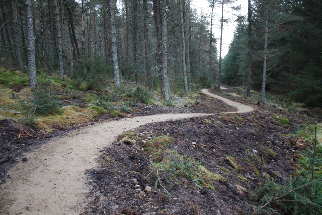
Carn Daimh Images

Images are sourced within 2km of 57.307968/-3.3601052 or Grid Reference NJ1824. Thanks to Geograph Open Source API. All images are credited.

Summit area of Cairn Ellick Cairn Ellick is a modest hill, an outlying top of another, Carn Daimh; much of it is covered with planted conifers. The summit area is heather covered and there's a small cairn where the two hill walkers are standing. The highest point however is reckoned to be at the camera position.
Summit area of Cairn Ellick
Cairn Ellick is a modest hill, an outlying top of another, Carn Daimh; much of it is covered with planted conifers. The summit area is heather covered and there's a small cairn where the two hill walkers are standing. The highest point however is reckoned to be at the camera position.
Speyside Way approaching from south-south-west The long distance path high on the slopes of Cairn Ellick having climbed from the direction of Tomintoul. The path turns sharply right, (NNW.) at the signpost and climbs further, almost to the hill's summit.
Speyside Way approaching from south-south-west
The long distance path high on the slopes of Cairn Ellick having climbed from the direction of Tomintoul. The path turns sharply right, (NNW.) at the signpost and climbs further, almost to the hill's summit.
Path rising to summit of Carn Diamh The path is climbing from the south-east through something of an avenue of pine trees. Curiously, the route of the Speyside Way avoids the summit by contouring around the west side, yet it passes within thirty vertical metres of the top.
Path rising to summit of Carn Diamh
The path is climbing from the south-east through something of an avenue of pine trees. Curiously, the route of the Speyside Way avoids the summit by contouring around the west side, yet it passes within thirty vertical metres of the top.
Mountain bikers below summit of Carn Diamh The bikers are on the final stage of their climb though not all will necessarily visit the summit, even the rough track they're using passes close to the highest point and a branch of it does indeed go there.
Mountain bikers below summit of Carn Diamh
The bikers are on the final stage of their climb though not all will necessarily visit the summit, even the rough track they're using passes close to the highest point and a branch of it does indeed go there.
Coniferous plantation with cabin in Coire na Fuaraig The cabin is leaning and is presumably out of current use; it's on the north side of a forest ride with a thin but clear path.
Coniferous plantation with cabin in Coire na Fuaraig
The cabin is leaning and is presumably out of current use; it's on the north side of a forest ride with a thin but clear path.
Forest road climbing towards Coire na Fuaraig The road is on the north side of a minor hill, Tom a' Chor and is climbing to the east. It's clearly a forestry road and will probably have served as access for a gravel pit but its current major use must be by mountain bikers.
Forest road climbing towards Coire na Fuaraig
The road is on the north side of a minor hill, Tom a' Chor and is climbing to the east. It's clearly a forestry road and will probably have served as access for a gravel pit but its current major use must be by mountain bikers.
Prominent tree beside access road for Inverchor Inverchor is a remote house on the east side of the valley of the Chabet Water; in the image it's hidden by the lower trees.
The distant hill is Carn Diamh.
Prominent tree beside access road for Inverchor
Inverchor is a remote house on the east side of the valley of the Chabet Water; in the image it's hidden by the lower trees. The distant hill is Carn Diamh.
Carn Daimh track Approach to Carn Daimh along the track from Cairn Ellick.
Carn Daimh track
Approach to Carn Daimh along the track from Cairn Ellick.
Carn Daimh Track junction Several waymarked tracks meet just to the north of Carn Daimh summit.
Carn Daimh Track junction
Several waymarked tracks meet just to the north of Carn Daimh summit.
Looking to Carn Liath Carn Liath from the Speyside way.
Looking to Carn Liath
Carn Liath from the Speyside way.
Carn Daimh Climb Gate on the track up Carn Daimh from Tomnavoulin.
Carn Daimh Climb
Gate on the track up Carn Daimh from Tomnavoulin.
Carn Daimh Climb Looking across the fields toward Ben Rinnes from the well marked Carn Daimh circuit.
Carn Daimh Climb
Looking across the fields toward Ben Rinnes from the well marked Carn Daimh circuit.
New mountain bike trail, Glenlivet Estate The estate are building trails around Carn Meilich, Tom a' Chor and Carn Daimh.  Due to open August 2013, this is part of the blue (easy) route.
New mountain bike trail, Glenlivet Estate
The estate are building trails around Carn Meilich, Tom a' Chor and Carn Daimh. Due to open August 2013, this is part of the blue (easy) route.
Mountain bike trail, Tom a' Chor Glenlivet Estate are building new mountain bike trails, due to open August 2013.  This is part of the red route.
Mountain bike trail, Tom a' Chor
Glenlivet Estate are building new mountain bike trails, due to open August 2013. This is part of the red route.
Mountain bike trail under construction New trails on Glenlivet Estate, due to open August 2013. This is part of the red route.
Mountain bike trail under construction
New trails on Glenlivet Estate, due to open August 2013. This is part of the red route.
Mountain bike trail construction A new trail centre being built on Glenlivet Estate.  Due to open August 2013, this is part of the red route.
Mountain bike trail construction
A new trail centre being built on Glenlivet Estate. Due to open August 2013, this is part of the red route.
Forest track, Tom a' Chor
Mountain bike trail, Tom a' Chor New trails under construction on Glenlivet Estate.  Due to open August 2013, this is part of the red route.
Mountain bike trail, Tom a' Chor
New trails under construction on Glenlivet Estate. Due to open August 2013, this is part of the red route.
Show me another place!

Carn Daimh is located at Grid Ref: NJ1824 (Lat: 57.307968, Lng: -3.3601052)

Unitary Authority: Moray

Police Authority: North East

What 3 Words

///breakaway.bronzed.headliner. Near Grantown-on-Spey, Highland

Nearby Locations

Carn Daimh

Related Wikis

Tomintoul distillery

Tomintoul distillery is a distillery in Kirkmichael, between Ballindalloch and Tomintoul in the Speyside region of Scotland, producing malt whisky for...

Glenlivet Estate

The Glenlivet Estate is located in Glenlivet, Scotland in the Cairngorms National Park. It measures 58,000 acres (230 km2) and is part of The Crown Estate...

Tamnavulin distillery

Tamnavulin distillery is a producer of single malt Scotch whisky that was founded in 1966. The distillery is operated by Whyte & Mackay, which Philippines...

Kirkmichael, Moray

Kirkmichael is a parish and hamlet in Moray, Scotland. Kirkmichael was historically part of Banffshire.The hamlet lies approximately 8 miles south of Ballindalloch...

Auchnarrow

Auchnarrow (Scottish Gaelic: Achadh an Arbha) is a village in Moray, Scotland.

Church of The Incarnation, Tombae

The Church of The Incarnation was built between 1827 and 1829 as a Roman Catholic church, under the patronage of the Gordon family, in Banffshire, Scotland...

County of Moray

Moray; (Scottish Gaelic: Moireibh [ˈmɤɾʲəv]) or Morayshire, called Elginshire until 1919, is a historic county, registration county and lieutenancy area...

Blairfindy Castle

Blairfindy Castle is an L-plan tower house, dating from the 16th century, around 6.5 miles (10.5 km) north of Tomintoul, and west of the River Livet....

Nearby Amenities

Located within 500m of 57.307968,-3.3601052
Càrn Daimh
Corbett: no
Ele: 568
Graham: no
Marilyn: yes
Munro: no
Natural: peak
Prominence: 194
Lat/Long: 57.3079956/-3.3601962
The data included in this document is from www.openstreetmap.org. The data is made available under ODbL.

Have you been to Carn Daimh?

Leave your review of Carn Daimh below (or comments, questions and feedback).