Bankhead

Settlement in Angus

Scotland

Bankhead

Chapel Road at Lady Park, Carrot Hill Looking north-eastward.
Chapel Road at Lady Park, Carrot Hill Credit: Peter Wood

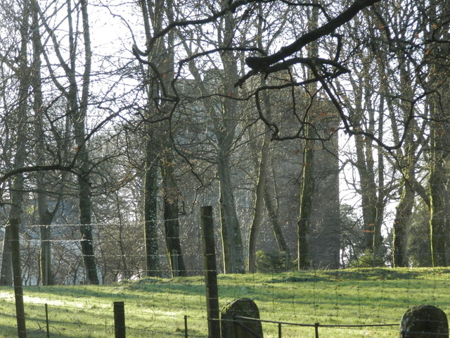
Bankhead is a small rural community located in the county of Angus, Scotland. Situated approximately 12 miles north of the town of Forfar, Bankhead is nestled amidst picturesque countryside and rolling hills, offering residents a tranquil and scenic environment.

The village is primarily an agricultural area, with farming being the main occupation for many of its inhabitants. The fertile soil of the region supports a variety of crops, including barley, wheat, and potatoes. Livestock farming is also a significant industry in Bankhead, with sheep and cattle rearing being prevalent.

Bankhead boasts a tight-knit community, with a small population of around 300 residents. The village is known for its friendly and welcoming atmosphere, where neighbors often come together for community events and social gatherings. The local primary school plays a central role in the village, providing education to the children of Bankhead and surrounding areas.

While Bankhead itself may be small, it benefits from its close proximity to larger towns such as Forfar and Dundee. These towns offer a range of amenities, including shopping centers, healthcare facilities, and recreational activities, ensuring that residents have access to all necessary services.

The surrounding natural beauty of Bankhead provides ample opportunities for outdoor activities, such as hiking, cycling, and fishing. The nearby Angus Glens offer stunning landscapes and wildlife, attracting visitors from far and wide.

Overall, Bankhead presents a peaceful and idyllic place to live, with a strong sense of community and a beautiful natural setting.

If you have any feedback on the listing, please let us know in the comments section below.

Bankhead Images

Images are sourced within 2km of 56.539886/-2.8797043 or Grid Reference NO4639. Thanks to Geograph Open Source API. All images are credited.

Chapel Road at Lady Park, Carrot Hill Looking north-eastward.
Chapel Road at Lady Park, Carrot Hill
Looking north-eastward.
Footpath through the heather at Lady Park, Carrot Hill Looking south-westward
Footpath through the heather at Lady Park, Carrot Hill
Looking south-westward
Ordnance Survey Cut Mark This mark can be found on a stone that forms the track side wall near to Carrot Hill.
The recorded details give a height of 221.3751 metres above sea level.
For more detail see : <span class="nowrap"><a title="https://www.bench-marks.org.uk/bm162181" rel="nofollow ugc noopener" href="https://www.bench-marks.org.uk/bm162181">Link</a><img style="margin-left:2px;" alt="External link" title="External link - shift click to open in new window" src="https://s1.geograph.org.uk/img/external.png" width="10" height="10"/></span>
Ordnance Survey Cut Mark
This mark can be found on a stone that forms the track side wall near to Carrot Hill. The recorded details give a height of 221.3751 metres above sea level. For more detail see : LinkExternal link
Road leading to Greenburn near Carrot Hill
A start to the harvest A swathe of barley has been safely gathered in despite the recent bad weather
A start to the harvest
A swathe of barley has been safely gathered in despite the recent bad weather
Makeshift Windbreak on Carrot Hill
Trig Point on Carrot Hill
Woodland at Carrot Hill
Barley, Carrot Hill The barley is still green, while stubble is being ploughed not far away. Carrot Hill has a conifer plantation, but is otherwise divided between an arable south and moorland north side.
Barley, Carrot Hill
The barley is still green, while stubble is being ploughed not far away. Carrot Hill has a conifer plantation, but is otherwise divided between an arable south and moorland north side.
North side of Carrot Hill The higher ground on the north side of Carrot Hill is moorland. The southern side is arable to the top.
North side of Carrot Hill
The higher ground on the north side of Carrot Hill is moorland. The southern side is arable to the top.
Heather in bloom on Carrothill Dodd Hill is in the distance
Heather in bloom on Carrothill
Dodd Hill is in the distance
Cows in field at Carrothill
Forest track on Carrothill
Moorland on Carrot Hill
Track near Carrothill
Woodland, Carrot Hill East of the road in a small plantation.
Woodland, Carrot Hill
East of the road in a small plantation.
Woodland, Carrot Hill A felled and recently replanted block east of the road on Carrot Hill.
Woodland, Carrot Hill
A felled and recently replanted block east of the road on Carrot Hill.
Barley on Carrot Hill A view from the Ordnance Survey marked viewpoint on Carrot Hill towards Craigowl Hill.
Barley on Carrot Hill
A view from the Ordnance Survey marked viewpoint on Carrot Hill towards Craigowl Hill.
Show me another place!

Bankhead is located at Grid Ref: NO4639 (Lat: 56.539886, Lng: -2.8797043)

Unitary Authority: Angus

Police Authority: Tayside

What 3 Words

///worth.folds.called. Near Monifieth, Angus

Nearby Locations

Bankhead

Related Wikis

Wellbank

Wellbank is a village in Angus, Scotland. It lies approximately three miles north of Dundee, on the B978 road. == Local Bus Services in the Area == Based...

Gagie railway station

Gagie Halt railway station was a railway halt in Scotland, on the Dundee and Forfar direct line, built by the London, Midland and Scottish Railway. It...

Bucklerheads

Bucklershead is a village in Angus, Scotland. It lies approximately three miles north of Monifieth, on the B978 road. == References ==

Affleck Castle

Affleck Castle, also known as Auchenleck Castle, is a tall L-plan tower house dating from the 15th century, 4 miles (6.4 km) north of Monifieth and 1 mile...

Nearby Amenities

Located within 500m of 56.539886,-2.8797043
Design: barrel
Power: tower
Lat/Long: 56.5359312/-2.8785908
Design: barrel
Power: tower
Lat/Long: 56.5369773/-2.8744615
Power: pole
Lat/Long: 56.5367743/-2.8838935
Power: pole
Lat/Long: 56.5374795/-2.8836807
Power: pole
Lat/Long: 56.5381982/-2.8834657
Power: pole
Lat/Long: 56.5399263/-2.8876351
Power: pole
Lat/Long: 56.5394717/-2.8865534
Power: pole
Lat/Long: 56.5390525/-2.8855182
Power: pole
Lat/Long: 56.5386357/-2.8845053
Power: pole
Lat/Long: 56.5377105/-2.8822931
Power: pole
Lat/Long: 56.537603/-2.8816813
Power: pole
Lat/Long: 56.5374893/-2.8810163
The data included in this document is from www.openstreetmap.org. The data is made available under ODbL.

Have you been to Bankhead?

Leave your review of Bankhead below (or comments, questions and feedback).