Carn Dearg

Hill, Mountain in Banffshire

Scotland

Carn Dearg

Loch Builg Easy to spot from the air, but a long way on foot, Loch Builg is on the pass between Strath Avon and Glen Gairn. To the right is Fèith Laoigh, separating Càrn Dearg from snow-covered Ben Avon at extreme right. To the left of Càrn Dearg is the River Gairn. Notice that Loch Builg is still partly covered in ice.
Loch Builg Credit: Anne Burgess

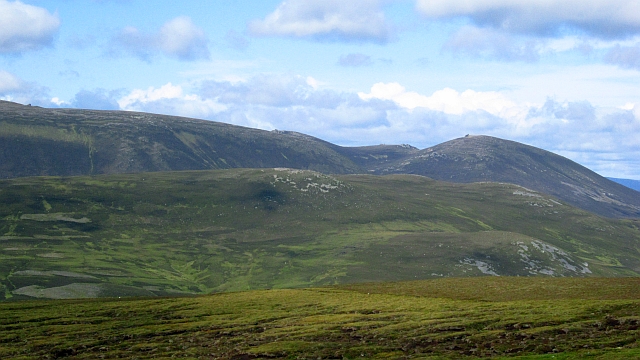
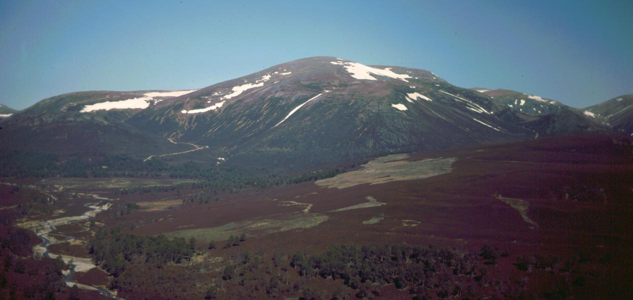
Carn Dearg, located in Banffshire, Scotland, is a prominent hill/mountain with a height of 945 meters (3,100 feet). It is part of the Grampian Mountains range, renowned for its stunning natural beauty and challenging terrains. The hill/mountain is situated within the Cairngorms National Park, one of the largest national parks in the United Kingdom.

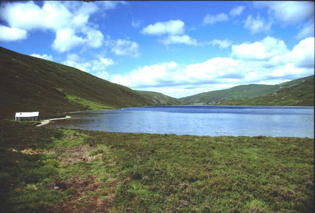
Carn Dearg offers breathtaking panoramic views of the surrounding landscape, including the picturesque Strathdon valley and the Cairngorms. Its distinctive shape and steep slopes make it a popular destination for hikers, mountaineers, and nature enthusiasts seeking outdoor adventures.

The ascent to the summit of Carn Dearg can be demanding, especially during winter months when the hill/mountain is often covered in snow. However, experienced climbers and walkers are rewarded with stunning vistas and a sense of accomplishment upon reaching the top.

The hill/mountain is rich in flora and fauna, hosting a diverse range of plant species and providing a habitat for various wildlife. Visitors may encounter red deer, mountain hares, and a variety of bird species, adding to the allure of the area.

Access to Carn Dearg is typically gained from the nearest town of Strathdon, with several routes available for those wishing to conquer its peak. It is advisable to check weather conditions and be well-prepared before embarking on any hillwalking or climbing activities in this area.

Overall, Carn Dearg in Banffshire is a magnificent hill/mountain, offering both a physical challenge and a visual feast for outdoor enthusiasts seeking to explore the natural wonders of Scotland.

If you have any feedback on the listing, please let us know in the comments section below.

Carn Dearg Images

Images are sourced within 2km of 57.107694/-3.3612771 or Grid Reference NJ1702. Thanks to Geograph Open Source API. All images are credited.

Loch Builg Easy to spot from the air, but a long way on foot, Loch Builg is on the pass between Strath Avon and Glen Gairn. To the right is Fèith Laoigh, separating Càrn Dearg from snow-covered Ben Avon at extreme right. To the left of Càrn Dearg is the River Gairn. Notice that Loch Builg is still partly covered in ice.
Loch Builg
Easy to spot from the air, but a long way on foot, Loch Builg is on the pass between Strath Avon and Glen Gairn. To the right is Fèith Laoigh, separating Càrn Dearg from snow-covered Ben Avon at extreme right. To the left of Càrn Dearg is the River Gairn. Notice that Loch Builg is still partly covered in ice.
Loch Builg Looking north along Loch Builg to Glen Builg and eventually the steep-sided trough of Strath Avon in the distance. The snow-covered mountain on the left is Ben Avon. You just about make out where the ruins of Loch Builg Lodge are, to the left of the largest of the small lochans at the head of the loch.
Loch Builg
Looking north along Loch Builg to Glen Builg and eventually the steep-sided trough of Strath Avon in the distance. The snow-covered mountain on the left is Ben Avon. You just about make out where the ruins of Loch Builg Lodge are, to the left of the largest of the small lochans at the head of the loch.
Loch Builg The white line on the surface of the loch is the edge of the ice just catching the light. Beyond the loch is Meikle Geal Charn, continuing right to Cairn Sawvie. At the top are the snow-capped tops of the Ladder Hills.
Loch Builg
The white line on the surface of the loch is the edge of the ice just catching the light. Beyond the loch is Meikle Geal Charn, continuing right to Cairn Sawvie. At the top are the snow-capped tops of the Ladder Hills.
Carn Dearg and Meall Gaineimh Outlying tops of  Ben Avon - Carn Dearg is the nearer hill not seen against the sky, Meall Gaineimh is the rounded top on the right.
Carn Dearg and Meall Gaineimh
Outlying tops of Ben Avon - Carn Dearg is the nearer hill not seen against the sky, Meall Gaineimh is the rounded top on the right.
Loch Builg A view from the slopes of Culardoch.

Loch Builg occupies a pass between Glen Avon and Glen Gairn and provides a through route from Tomintoul to Deeside via Glen Gairn or the Bealach Dearg.
Loch Builg
A view from the slopes of Culardoch. Loch Builg occupies a pass between Glen Avon and Glen Gairn and provides a through route from Tomintoul to Deeside via Glen Gairn or the Bealach Dearg.
Footbridge across the River Gairn Bulldozed track up to Bealach Dubh and drovers' road over to Inver in background. Bridge no longer exists.
Footbridge across the River Gairn
Bulldozed track up to Bealach Dubh and drovers' road over to Inver in background. Bridge no longer exists.
Big Brae near East Muir Gorm Craig
Lochbuilg Lodge and Loch Builg
Lochan Oir
Lochan Oir
Loch Builg
Loch Builg
Heading into Glen Gairn Trekking into the back of beyond on a long walk from Tomintoul to Deeside.
Heading into Glen Gairn
Trekking into the back of beyond on a long walk from Tomintoul to Deeside.
Lochbuilg Lodge (ruin) The remains of Lochbuilg Lodge can be seen in the grassy green patch left centre of the picture, with Carn Dearg rising behind.
Lochbuilg Lodge (ruin)
The remains of Lochbuilg Lodge can be seen in the grassy green patch left centre of the picture, with Carn Dearg rising behind.
Bridge over the river Gairn
River Gairn A remarkable dry stalkers' path runs high upon the northern banks of River Gairn.
River Gairn
A remarkable dry stalkers' path runs high upon the northern banks of River Gairn.
Small lochan above River Gairn Beside a track not shown on the map.
Small lochan above River Gairn
Beside a track not shown on the map.
Glen Gairn Looking SW up the glen.
Glen Gairn
Looking SW up the glen.
An old gateway near Loch Builg The gate is lying in the heather behind the post on the right.  The footpath follows the eastern shore of the loch.
An old gateway near Loch Builg
The gate is lying in the heather behind the post on the right. The footpath follows the eastern shore of the loch.
Footpath beside Loch Builg The path goes along the east side of the loch.
Footpath beside Loch Builg
The path goes along the east side of the loch.
Show me another place!

Carn Dearg is located at Grid Ref: NJ1702 (Lat: 57.107694, Lng: -3.3612771)

Unitary Authority: Moray

Police Authority: North East

What 3 Words

///youth.hoped.something. Near Inverey, Aberdeenshire

Nearby Locations

Carn Dearg Carn Tiekeiver

Related Wikis

Culardoch

Culardoch (900 m) is a mountain in the Cairngorms of Scotland, located northeast of Braemar in Aberdeenshire. A smooth and heathery peak southeast of the...

Ben Avon

Ben Avon (Scottish Gaelic: Beinn Athfhinn, 'mountain of the Avon') is a mountain in the Cairngorms of Scotland. It is a sprawling mountain with a broad...

Delnadamph Lodge

Delnadamph Lodge was located on the Balmoral Estate about 8 miles (13 km) north of the castle. The lodge and its estate lands were bought by Queen Elizabeth...

Beinn a' Bhùird

Beinn a' Bhùird is a Munro in the Cairngorm mountain range of Scotland. In Watson (1975) the author suggests the mountain should be named Beinn Bòrd -...

Nearby Amenities

Located within 500m of 57.107694,-3.3612771
Càrn Dearg
Ele: 772
Natural: peak
Lat/Long: 57.1040462/-3.3619727
The data included in this document is from www.openstreetmap.org. The data is made available under ODbL.

Have you been to Carn Dearg?

Leave your review of Carn Dearg below (or comments, questions and feedback).