Birken Hillock

Hill, Mountain in Perthshire

Scotland

Birken Hillock

A big boy, Rochallie I believe he is an Aberdeen Angus.
A big boy, Rochallie Credit: Maigheach-gheal

Birken Hillock is a prominent hill located in the picturesque county of Perthshire, Scotland. With an elevation of approximately 450 meters, it offers breathtaking panoramic views of the surrounding countryside and is a popular destination for outdoor enthusiasts.

Situated in the southern part of Perthshire, Birken Hillock is characterized by its rugged terrain, covered in heather and scattered with birch trees. The hill is known for its distinctive shape, resembling a hump or hillock, hence its name. Its slopes are relatively steep, but manageable for hikers and climbers of various skill levels.

The ascent to the summit of Birken Hillock is rewarded with mesmerizing vistas of rolling hills, lush forests, and sparkling lochs that dot the landscape. On clearer days, it is even possible to catch glimpses of the towering peaks of the nearby Grampian Mountains.

The hill offers a range of outdoor activities, including hiking, hillwalking, and birdwatching. The diverse flora and fauna found in the area make it an ideal spot for nature lovers and photographers seeking to capture the beauty of the Scottish Highlands.

Access to Birken Hillock is relatively easy, with a well-marked trail leading from the nearby village of Auchterarder. The hill is a popular destination throughout the year, attracting visitors who appreciate its natural splendor and the tranquility it offers. Whether it's a challenging hike or a leisurely stroll, Birken Hillock provides an opportunity to immerse oneself in the stunning landscapes of Perthshire.

If you have any feedback on the listing, please let us know in the comments section below.

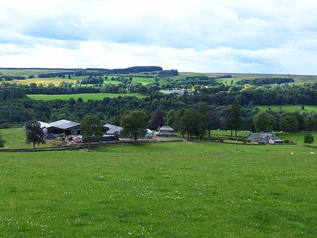
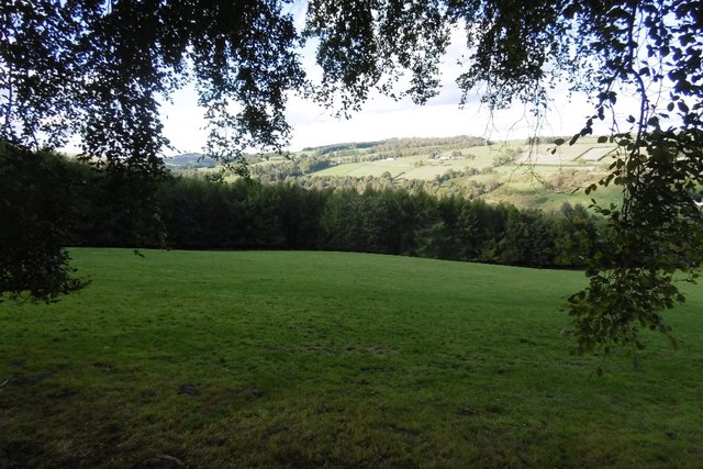
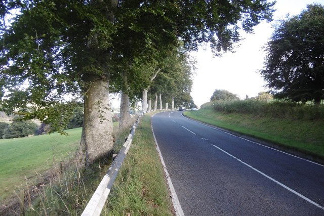
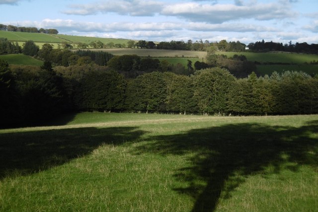
Birken Hillock Images

Images are sourced within 2km of 56.640219/-3.3552818 or Grid Reference NO1650. Thanks to Geograph Open Source API. All images are credited.

A big boy, Rochallie I believe he is an Aberdeen Angus.
A big boy, Rochallie
I believe he is an Aberdeen Angus.
Road block, Milton of Drimmie The flock of sheep are being driven along the minor road by a shepherd on a quad bike.
Road block, Milton of Drimmie
The flock of sheep are being driven along the minor road by a shepherd on a quad bike.
Blocked gateway near Rannagulzion House The wooden gate has been blocked by overgrown rubble and rocks.
Blocked gateway near Rannagulzion House
The wooden gate has been blocked by overgrown rubble and rocks.
The Cateran Trail near Burnside of Drimmie The trail passes through what appears to be a farmyard.
The Cateran Trail near Burnside of Drimmie
The trail passes through what appears to be a farmyard.
The Cateran Trail near Burnside of Drimmie The trail is named after the Caterans - a group of marauding cattle thieves who plundered the Strathardle Glen from medieval times until the 17th century.
The Cateran Trail near Burnside of Drimmie
The trail is named after the Caterans - a group of marauding cattle thieves who plundered the Strathardle Glen from medieval times until the 17th century.
Middle Drimmie Farm Home to the Glenericht herd of Charolais cattle.  Glen Ericht lies beyond.
Middle Drimmie Farm
Home to the Glenericht herd of Charolais cattle. Glen Ericht lies beyond.
Middle Drimmie Wood Whatever it was in the past, now a few scattered Scots Pines.
Middle Drimmie Wood
Whatever it was in the past, now a few scattered Scots Pines.
Middle Drimmie Farm Home to the Glenericht herd of Charolais cattle.  Glen Ericht lies beyond.
Middle Drimmie Farm
Home to the Glenericht herd of Charolais cattle. Glen Ericht lies beyond.
Burnside of Drimmie Farm
Bridge over the Burn of Drimmie The 16 turbines of the Drumderg windfarm <a href="https://www.geograph.org.uk/gridref/NO1755">NO1755</a> on the skyline.
Bridge over the Burn of Drimmie
The 16 turbines of the Drumderg windfarm NO1755 on the skyline.
Cattle at Burnside of Drimmie Heatheryhaugh is hidden in the trees.
Cattle at Burnside of Drimmie
Heatheryhaugh is hidden in the trees.
Cattle by the Burn of Drimmie
Western slopes of the Hill of Drimmie
Field, Rochallie Looking over the River Ericht from the A93.
Field, Rochallie
Looking over the River Ericht from the A93.
A93, Rochallie Looking towards Rattray.
A93, Rochallie
Looking towards Rattray.
Field, Rochallie Grassland sloping down towards the River Ericht.
Field, Rochallie
Grassland sloping down towards the River Ericht.
A93, Rochallie A lot of the A93 between Bridge of Cally and Rattray is tree lined.
A93, Rochallie
A lot of the A93 between Bridge of Cally and Rattray is tree lined.
Field near Mains of Mause It may have been a warm day, but the shadows are long and it's still afternoon,  Well into Autumn now.
Field near Mains of Mause
It may have been a warm day, but the shadows are long and it's still afternoon, Well into Autumn now.
Show me another place!

Birken Hillock is located at Grid Ref: NO1650 (Lat: 56.640219, Lng: -3.3552818)

Unitary Authority: Perth and Kinross

Police Authority: Tayside

What 3 Words

///bunch.medium.acrobats. Near Blairgowrie, Perth & Kinross

Nearby Locations

Birken Hillock Milton Wood

Related Wikis

River Ardle

The River Ardle (Scottish Gaelic: Abhainn Àrdail) is a tributary of the River Ericht. It runs for 10 miles (16 km) through Strathardle in Perthshire, Scotland...

Bridge of Cally

Bridge of Cally is a small village in Kirkmichael parish, Perth and Kinross, Scotland. It sits at the junction of three glens, Glenshee, Strathardle and...

Bamff

Bamff House is the home of the Ramsays of Bamff, and is located within a 1,300-acre (5.3 km2) estate in Perthshire, Scotland. Bamff House began as a fortified...

Newton Castle

Newton Castle stands in its grounds near the town of Blairgowrie in Perth and Kinross, Scotland. It is a Category A listed building dating to the mid-16th...

Nearby Amenities

Located within 500m of 56.640219,-3.3552818
Power: pole
Lat/Long: 56.6367273/-3.3600849
Power: pole
Lat/Long: 56.6388247/-3.3476749
Power: pole
Lat/Long: 56.6388256/-3.348795
Power: pole
Lat/Long: 56.6388195/-3.3498945
Power: pole
Lat/Long: 56.6388116/-3.351132
Power: pole
Lat/Long: 56.638816/-3.3524869
The data included in this document is from www.openstreetmap.org. The data is made available under ODbL.

Have you been to Birken Hillock?

Leave your review of Birken Hillock below (or comments, questions and feedback).