Cramalt Craig

Hill, Mountain in Peeblesshire

Scotland

Cramalt Craig

Moorland on Cramalt Craig Looking down to Pykestone Knowe and the Megget Reservoir.
Moorland on Cramalt Craig Credit: wrobison

Cramalt Craig is a prominent hill located in Peeblesshire, a historic county in the southern part of Scotland. It stands at an elevation of approximately 541 meters (1,775 feet) and is part of the larger Moorfoot Hills range. The hill is situated around 8 kilometers (5 miles) southwest of the town of Peebles and is easily accessible for hikers and nature enthusiasts.

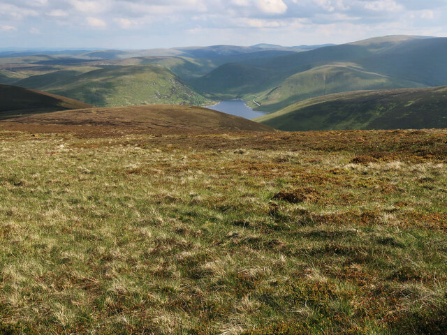
Cramalt Craig boasts a distinctive rocky outcrop at its summit, which offers breathtaking panoramic views of the surrounding countryside. On a clear day, visitors can admire the scenic landscapes of the Scottish Borders, with rolling hills, lush green valleys, and distant peaks. The hill is particularly popular among walkers and climbers due to its challenging yet rewarding trails.

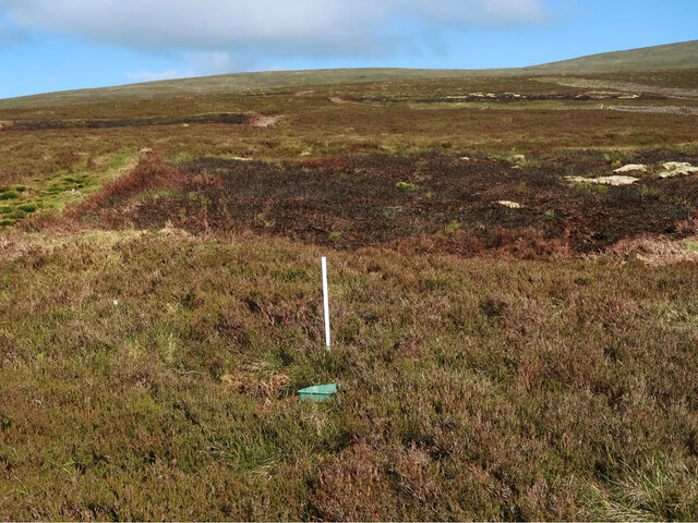
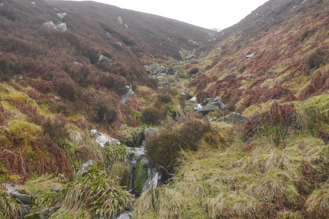
The path leading up to Cramalt Craig is well-maintained and offers a variety of terrains, from gentle slopes to steeper sections that require some scrambling. The ascent can take approximately 2-3 hours, depending on the chosen route and individual fitness levels. Along the way, hikers may encounter diverse flora and fauna, including heather, wildflowers, and various bird species.

Cramalt Craig is not only a natural attraction but also holds historical significance. In the vicinity of the hill, there are remnants of ancient settlements and burial sites, providing a glimpse into the area's rich heritage.

Overall, Cramalt Craig is a stunning hill in Peeblesshire, offering outdoor enthusiasts an opportunity to immerse themselves in the beauty of the Scottish countryside while enjoying a challenging hike.

If you have any feedback on the listing, please let us know in the comments section below.

Cramalt Craig Images

Images are sourced within 2km of 55.509477/-3.3178823 or Grid Reference NT1624. Thanks to Geograph Open Source API. All images are credited.

Moorland on Cramalt Craig Looking down to Pykestone Knowe and the Megget Reservoir.
Moorland on Cramalt Craig
Looking down to Pykestone Knowe and the Megget Reservoir.
Track near Cramalt Craig summit Heading to the summit cairn.
Track near Cramalt Craig summit
Heading to the summit cairn.
Start of the Glentinning Burn On the north side of Cramalt Craig.
Start of the Glentinning Burn
On the north side of Cramalt Craig.
Grouse moorland on Sherraside Rig Between Cramalt Craig and Hunt Law.
Grouse moorland on Sherraside Rig
Between Cramalt Craig and Hunt Law.
Col between Cramalt Craig and Dun Law Looking towards Dun Law.
Col between Cramalt Craig and Dun Law
Looking towards Dun Law.
Cotton grass and heather moorland On the east side of Cramalt Craig near the Cramalt Burn.
Cotton grass and heather moorland
On the east side of Cramalt Craig near the Cramalt Burn.
Track beside the Cramalt Burn On the east side of Cramalt Craig.
Track beside the Cramalt Burn
On the east side of Cramalt Craig.
Cramalt Craig This telephoto shot of the east side of the hill was taken from the A708 in late January.
Cramalt Craig
This telephoto shot of the east side of the hill was taken from the A708 in late January.
Hill track, Cramalt Crook A track up from Cramalt farm by Megget Reservoir, nearing the ridge at Dun Law.
Hill track, Cramalt Crook
A track up from Cramalt farm by Megget Reservoir, nearing the ridge at Dun Law.
Cramalt Craig This telephoto shot of a snow-capped Cramalt Craig was taken from the northwest slopes of Bowerhope Law.
Cramalt Craig
This telephoto shot of a snow-capped Cramalt Craig was taken from the northwest slopes of Bowerhope Law.
Cleuch, Ling Hope Beneath Pykestone Knowe.
Cleuch, Ling Hope
Beneath Pykestone Knowe.
Pykestone Knowe Steep moorland slopes above Ling Hope.  The glen is aptly named, expect to keep tying your laces, the heather is very persistent.

A pretty grim day with rain and high winds.
Pykestone Knowe
Steep moorland slopes above Ling Hope. The glen is aptly named, expect to keep tying your laces, the heather is very persistent. A pretty grim day with rain and high winds.
Linghope Burn The burn is fenced off and young trees planted. This is common in the Tweed catchment and wooded headwaters benefit the wildlife in the river with emphasis on the economically important salmon.
Linghope Burn
The burn is fenced off and young trees planted. This is common in the Tweed catchment and wooded headwaters benefit the wildlife in the river with emphasis on the economically important salmon.
Waterfall, Linghope Burn A step in Ling Hope.  There has been some tree planting on the east side of the burn.
Waterfall, Linghope Burn
A step in Ling Hope. There has been some tree planting on the east side of the burn.
Slopes of Lamb Knowe Sheep on Lamb Knowe, their tracks give excellent going with the west side of Ling Hope being easier to walk along than the east side.
Slopes of Lamb Knowe
Sheep on Lamb Knowe, their tracks give excellent going with the west side of Ling Hope being easier to walk along than the east side.
Tods Cleuch Typical watercourse for these parts, steep and stepped. Some are intermittent with water flowing over the surface only in wet spells, drainage being through the scree beneath the soil.
Tods Cleuch
Typical watercourse for these parts, steep and stepped. Some are intermittent with water flowing over the surface only in wet spells, drainage being through the scree beneath the soil.
The very boggy col between Cramalt Craig and Hunt Law Fortunately not yet cut up by vehicles. If appears  that the kinder quadbike is the vehicle of choice over Cramalt Craig which unlike Hunt Law is reasonably unscathed.   View towards Cramalt Craig, it is worth noting that the fence shown on many maps has now been taken down.
The very boggy col between Cramalt Craig and Hunt Law
Fortunately not yet cut up by vehicles. If appears that the kinder quadbike is the vehicle of choice over Cramalt Craig which unlike Hunt Law is reasonably unscathed. View towards Cramalt Craig, it is worth noting that the fence shown on many maps has now been taken down.
Foot of Sherraside Rig Looking over peat covered moorland towards Hunt Law. The fence shown here <a href="https://www.geograph.org.uk/photo/16243">NT1525 : Sherraside Rig</a> in 2004 has been demolished. Some of the stobs are lying in the bogs.
Foot of Sherraside Rig
Looking over peat covered moorland towards Hunt Law. The fence shown here NT1525 : Sherraside Rig in 2004 has been demolished. Some of the stobs are lying in the bogs.
Show me another place!

Cramalt Craig is located at Grid Ref: NT1624 (Lat: 55.509477, Lng: -3.3178823)

Unitary Authority: The Scottish Borders

Police Authority: The Lothians and Scottish Borders

What 3 Words

///funded.parks.stopwatch. Near Ettrick, Scottish Borders

Nearby Locations

Cramalt Craig

Related Wikis

Broad Law

Broad Law is a hill in the Manor Hills range, part of the Southern Uplands of Scotland. The second-highest point in the Southern Uplands and the highest...

Megget Reservoir

Megget Reservoir is an impounding reservoir in the Megget valley in Ettrick Forest, in the Scottish Borders. The 259 hectares (640 acres) reservoir is...

Megget

Megget is a former chapelry or parish containing the valley of Megget Water, now forming the westernmost part of the parish of Yarrow, Selkirkshire in...

Craigierig

Craigierig is a village on the Megget Reservoir, in the Scottish Borders area of Scotland, in the former Selkirkshire. Places nearby include the Glengaber...

Nearby Amenities

Located within 500m of 55.509477,-3.3178823
Cramalt Craig
Ele: 831
Ele Ft: 2723
Munro: no
Natural: peak
Wikidata: Q96375641
Wikipedia: en:Cramalt Craig
Lat/Long: 55.5096349/-3.3178789
The data included in this document is from www.openstreetmap.org. The data is made available under ODbL.

Have you been to Cramalt Craig?

Leave your review of Cramalt Craig below (or comments, questions and feedback).