Househillwood

Settlement in Renfrewshire

Scotland

Househillwood

South Nitshill More houses.
South Nitshill Credit: wfmillar

Househillwood is a residential area located in Renfrewshire, Scotland. Situated approximately 10 miles west of Glasgow, it is part of the larger town of Paisley. The neighborhood is known for its peaceful atmosphere and charming surroundings.

Househillwood is predominantly made up of detached and semi-detached houses, offering a variety of property types to suit different needs. The architecture in the area is predominantly traditional, with some modern developments blending seamlessly into the landscape. Many of the properties enjoy stunning views of the surrounding countryside.

The area boasts excellent transport links, with easy access to the M8 motorway, connecting Househillwood to Glasgow and other major cities in the region. The nearby town of Paisley provides a range of amenities, including shopping centers, supermarkets, restaurants, and leisure facilities.

For outdoor enthusiasts, Househillwood offers plenty of opportunities to explore nature. The nearby Gleniffer Braes Country Park provides picturesque walking trails, cycling routes, and breathtaking views from the hilltops. The park is also home to a variety of wildlife, making it a popular spot for birdwatching and nature photography.

Families with children will find several schools in the area, ensuring quality education is easily accessible. Additionally, Househillwood benefits from being close to the University of the West of Scotland, offering higher education opportunities for residents.

Overall, Househillwood in Renfrewshire is a desirable residential area, combining the tranquility of the countryside with convenient access to urban amenities.

If you have any feedback on the listing, please let us know in the comments section below.

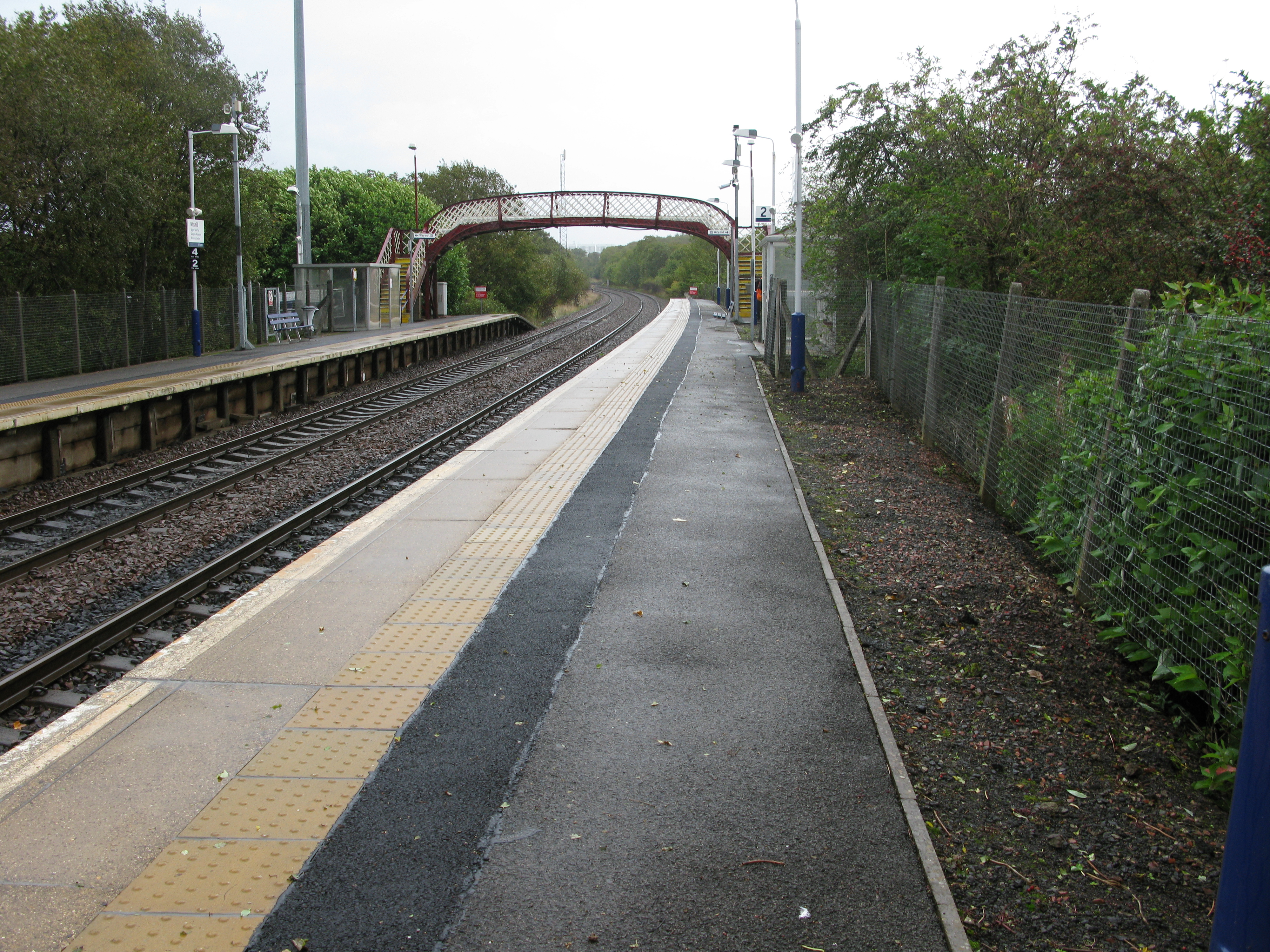
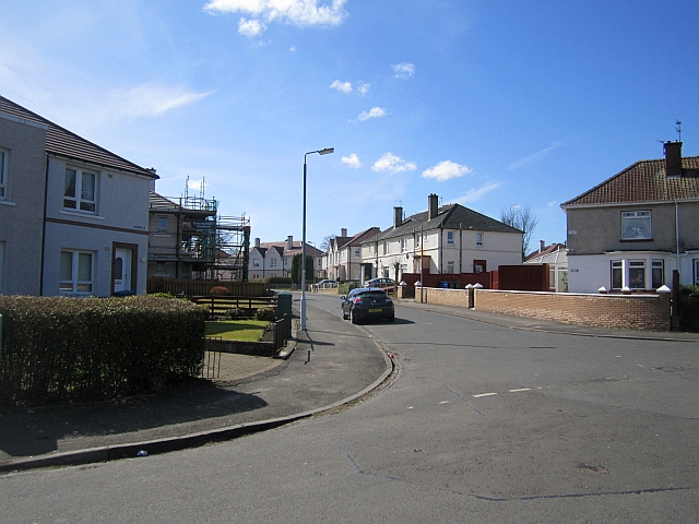
Househillwood Images

Images are sourced within 2km of 55.8195/-4.3637693 or Grid Reference NS5261. Thanks to Geograph Open Source API. All images are credited.

South Nitshill More houses.
South Nitshill
More houses.
South Nitshill Looking towards a roundabout on the B773 Parkhouse Road. This area is covered in new housing.
South Nitshill
Looking towards a roundabout on the B773 Parkhouse Road. This area is covered in new housing.
Postbox and Pylon, South Nitshill, Barrhead
A726 at Darnley Industrial Estate
Nia Roo Former pub on Nitshill Road by Woodneuk Road.  Spelled backward, this reads 'Oor Ain' and was apparently frequented by Rangers supporters.
Nia Roo
Former pub on Nitshill Road by Woodneuk Road. Spelled backward, this reads 'Oor Ain' and was apparently frequented by Rangers supporters.
Darnley Mill Country Park Darnley Mill Country Park is a site of importance for nature conservation in the southwest of the Glasgow. Its mosaic of habitats supports a diverse range of animals and plants. The habitats include grassland, wetland, open water (pond), scrub and a wooded river valley. The diverse species in the park include dippers, sedge warblers, reed buntings, buzzards and orange-tip butterflies.
Darnley Mill Country Park
Darnley Mill Country Park is a site of importance for nature conservation in the southwest of the Glasgow. Its mosaic of habitats supports a diverse range of animals and plants. The habitats include grassland, wetland, open water (pond), scrub and a wooded river valley. The diverse species in the park include dippers, sedge warblers, reed buntings, buzzards and orange-tip butterflies.
Weir on the Brock Burn In Darnley Mill Country Park.
Weir on the Brock Burn
In Darnley Mill Country Park.
Barrhead War Memorial Impressive grey stone memorial in Cowan Park, Barrhead.
Barrhead War Memorial
Impressive grey stone memorial in Cowan Park, Barrhead.
Sculpture & flats at Rankin Way, off Darnley Road, Barrhead
Cowan Park & War Memorial, Barrhead
Lodge House, Cowan Park, Barrhead
Day-Today express, Glasgow Road, Barrhead
Darnley Road heading east
The Darnley Sycamore This is reputed to be the Sycamore tree under which Mary Queen of Scots and her cousin and second husband, Henry Stewart, Lord Darnley sat while she nursed him back to health from an illness in 1565.

Beyond the tree is Nitshill Road (A726), and the red-coloured building beyond is the former Darnley Mill - now the World Buffet.
The Darnley Sycamore
This is reputed to be the Sycamore tree under which Mary Queen of Scots and her cousin and second husband, Henry Stewart, Lord Darnley sat while she nursed him back to health from an illness in 1565. Beyond the tree is Nitshill Road (A726), and the red-coloured building beyond is the former Darnley Mill - now the World Buffet.
Kennishead Road Queuing traffic waiting at the traffic lights at the junction with Nitshill Road (behind the photographer). 

On the left is the Shields Land Rover dealership.
Kennishead Road
Queuing traffic waiting at the traffic lights at the junction with Nitshill Road (behind the photographer). On the left is the Shields Land Rover dealership.
Old tram bridge over the Brock Burn This bridge was apparently built to carry a tram line for the Paisley District Tramways Company over the Brock Burn in 1910.  It now carries a footpath across the burn.

The plant in the middle is Giant Hogweed (Heracleum mantegazzianum).
Old tram bridge over the Brock Burn
This bridge was apparently built to carry a tram line for the Paisley District Tramways Company over the Brock Burn in 1910. It now carries a footpath across the burn. The plant in the middle is Giant Hogweed (Heracleum mantegazzianum).
Darnley Bridge The A726 Nitshill Road crosses the Brock Burn at this point. The photograph was taken from the adjacent old tram bridge. 

The plant in the middle is Giant Hogweed (Heracleum mantegazzianum).
Darnley Bridge
The A726 Nitshill Road crosses the Brock Burn at this point. The photograph was taken from the adjacent old tram bridge. The plant in the middle is Giant Hogweed (Heracleum mantegazzianum).
Willowford Road Houses on Willowford Road, viewed from the corner of Whitriggs Road.
Willowford Road
Houses on Willowford Road, viewed from the corner of Whitriggs Road.
Show me another place!

Househillwood is located at Grid Ref: NS5261 (Lat: 55.8195, Lng: -4.3637693)

Unitary Authority: City of Glasgow

Police Authority: Greater Glasgow

What 3 Words

///export.skins.waving. Near Barrhead, East Renfrewshire

Related Wikis

Nearby Amenities

Located within 500m of 55.8195,-4.3637693
Traffic Signals
Lat/Long: 55.8218951/-4.363301
Traffic Signals
Lat/Long: 55.8219934/-4.3633055
Traffic Signals
Lat/Long: 55.8186192/-4.3698667
Traffic Signals
Lat/Long: 55.818553/-4.3701135
Traffic Signals
Lat/Long: 55.8187939/-4.3716503
Nitshill
Is In: Glasgow, Strathclyde, Scotland, UK
Loc Name: Nitsie
Place: suburb
Wikidata: Q7041531
Wikipedia: en:Nitshill
Lat/Long: 55.8163761/-4.3617826
Created By: Potlatch 0.10b
Power: tower
Lat/Long: 55.8195889/-4.3683817
Power: tower
Lat/Long: 55.8170023/-4.369253
Power: tower
Lat/Long: 55.8209553/-4.3649999
Bus Stop
Barrhead Road / Sandend Road
Bus: yes
Naptan AtcoCode: 60902882
Naptan Bearing: SW
Naptan CommonName: Sandend Road
Naptan Indicator: Opp
Naptan Landmark: Sandend Road
Naptan NaptanCode: 45242392
Naptan Street: Barrhead Road
Public Transport: platform
Ref: 60902882
Source: survey;bing
Lat/Long: 55.8221962/-4.3616745
Bus Stop
Barrhead Road / Crookston Road
Bus: yes
Naptan AtcoCode: 60902881
Naptan Bearing: NE
Naptan CommonName: Sandend Road
Naptan Indicator: at
Naptan Landmark: Crookston Road
Naptan NaptanCode: 45237876
Naptan Street: Barrhead Road
Public Transport: platform
Ref: 60902881
Source: survey;bing
Lat/Long: 55.8222743/-4.3621537
Bus Stop
Crookston Road / Crovie Road
Naptan AtcoCode: 60903242
Naptan Bearing: S
Naptan CommonName: Crovie Road
Naptan Indicator: after
Naptan Landmark: Crovie Road
Naptan NaptanCode: 45238539
Naptan Street: Crookston Road
Ref: 60903242
Source: survey;bing
Lat/Long: 55.8232327/-4.3631607
Bus Stop
Crookston Road / Crovie Road
Naptan AtcoCode: 60903241
Naptan Bearing: N
Naptan CommonName: Crovie Road
Naptan Indicator: Opp
Naptan Landmark: Crovie Road
Naptan NaptanCode: 45243934
Naptan Street: Crookston Road
Ref: 60903241
Source: survey;bing
Lat/Long: 55.8237262/-4.3633866
Bus Stop
Nitshill, Maybole Street/ house number 35
Naptan AtcoCode: 60903856
Naptan Bearing: SE
Naptan CommonName: Pinmore Street
Naptan Indicator: after
Naptan Landmark: house number 35
Naptan NaptanCode: 45243979
Naptan Street: Maybole Street
Ref: 60903856
Lat/Long: 55.8160755/-4.3640546
Bus Stop
Nitshill Road / Barrhead Road
Bus: yes
Naptan AtcoCode: 612044
Naptan Bearing: NW
Naptan CommonName: Hurlet
Naptan Indicator: before
Naptan Landmark: Barrhead Road
Naptan NaptanCode: 37323235
Naptan Street: Nitshill Road
Public Transport: platform
Ref: 612044
Lat/Long: 55.81803/-4.36867
Bus Stop
Nitshill Road / Barrhead Road
Bus: yes
Naptan AtcoCode: 60902813
Naptan Bearing: SE
Naptan CommonName: Hurlet Cottages
Naptan Indicator: Opp
Naptan Landmark: Barrhead Road
Naptan NaptanCode: 45242632
Naptan Street: Nitshill Road
Public Transport: platform
Ref: 60902813
Lat/Long: 55.81819/-4.36848
Bus Stop
Nitshill Road / Craigbank Drive
Bus: yes
Naptan AtcoCode: 60902810
Naptan Bearing: NW
Naptan CommonName: Craigbank Drive
Naptan Indicator: Opp
Naptan Landmark: Craigbank Drive
Naptan NaptanCode: 45239359
Naptan Street: Nitshill Road
Public Transport: platform
Ref: 60902810
Lat/Long: 55.8163/-4.36327
Bus Stop
Nitshill Road / Levern Bridge
Bus: yes
Naptan AtcoCode: 60902812
Naptan Bearing: NW
Naptan CommonName: Levern Bridge
Naptan Indicator: Before
Naptan Landmark: Levern Bridge
Naptan NaptanCode: 45235298
Naptan Street: Nitshill Road
Public Transport: platform
Ref: 60902812
Lat/Long: 55.8175762/-4.3667501
Bus Stop
Nitshill Road / Levern Bridge
Bus: yes
Naptan AtcoCode: 60902811
Naptan Bearing: SE
Naptan CommonName: Levern Bridge
Naptan Indicator: After
Naptan Landmark: Levern Bridge
Naptan NaptanCode: 45239893
Naptan Street: Nitshill Road
Public Transport: platform
Ref: 60902811
Lat/Long: 55.81775/-4.36666
Bus Stop
Nitshill Road / Seamill Street
Bus: yes
Naptan AtcoCode: 60902809
Naptan Bearing: SE
Naptan CommonName: Seamill Street
Naptan Indicator: Opp
Naptan Landmark: Seamill Street
Naptan NaptanCode: 45238487
Naptan Street: Nitshill Road
Public Transport: platform
Ref: 60902809
Lat/Long: 55.81572/-4.36212
Bus Stop
Barrhead Road / Crookston Road
Bus: yes
Naptan AtcoCode: 60902879
Naptan Bearing: SW
Naptan CommonName: Crookston Road
Naptan Indicator: Opp
Naptan Landmark: Crookston Road
Naptan NaptanCode: 45235393
Naptan Street: Barrhead Road
Public Transport: platform
Ref: 60902879
Lat/Long: 55.82139/-4.36521
Bus Stop
Barrhead Road / Crookston Road
Bus: yes
Naptan AtcoCode: 60902880
Naptan Bearing: NE
Naptan CommonName: Crookston Road
Naptan Indicator: before
Naptan Landmark: Crookston Road
Naptan NaptanCode: 45239424
Naptan Street: Barrhead Road
Public Transport: platform
Ref: 60902880
Lat/Long: 55.8216717/-4.3649465
Bus Stop
Barrhead Road / Hurlethill Court
Bus: yes
Naptan AtcoCode: 60902875
Naptan Bearing: SW
Naptan CommonName: Hurlethill Court
Naptan Indicator: opp
Naptan Landmark: Hurlethill Court
Naptan NaptanCode: 45232958
Naptan Street: Barrhead Road
Public Transport: platform
Ref: 60902875
Lat/Long: 55.819483/-4.3687745
Bus Stop
Barrhead Road / Hurlethill Court
Bus: yes
Naptan AtcoCode: 60902876
Naptan Bearing: NE
Naptan CommonName: Hurlethill Court
Naptan Indicator: after
Naptan Landmark: Hurlethill Court
Naptan NaptanCode: 45242538
Naptan Street: Barrhead Road
Public Transport: platform
Ref: 60902876
Lat/Long: 55.819773/-4.3689967
Bus Stop
Barrhead Road / Nitshill Road
Bus: yes
Naptan AtcoCode: 60902877
Naptan Bearing: SW
Naptan CommonName: Roughmussel
Naptan Indicator: opp
Naptan Landmark: Nitshill Road
Naptan NaptanCode: 45232579
Naptan Street: Barrhead Road
Public Transport: platform
Ref: 60902877
Lat/Long: 55.8208/-4.36678
Bus Stop
Barrhead Road / Nitshill Road
Bus: yes
Naptan AtcoCode: 60902878
Naptan Bearing: NE
Naptan CommonName: Roughmussel
Naptan Indicator: at
Naptan Landmark: Nitshill Road
Naptan NaptanCode: 45235653
Naptan Street: Barrhead Road
Public Transport: platform
Ref: 60902878
Lat/Long: 55.820974/-4.3669541
Sunwaves Salon and Sunbed shop
Beauty: tanning
Shop: beauty
Lat/Long: 55.8163287/-4.3618853
Roughmussel
Place: quarter
Wikidata: Q7370908
Wikipedia: en:Roughmussel
Lat/Long: 55.8233739/-4.3645582
Post Box
Collection Times: Mo-Fr 09:00; Sa 07:00
Operator: Royal Mail
Post Box Type: pillar
Ref: G53 1036D
Royal Cypher: GR
Royal Cypher Wikidata: Q33102273
Source: survey
Lat/Long: 55.8165061/-4.3617712
Nisa Local
Brand: Nisa Local
Brand Wikidata: Q16999069
Brand Wikipedia: en:Nisa (retailer)
Shop: convenience
Lat/Long: 55.8161791/-4.3622728
Post Office
Nitshill Post Office
Addr Country: GB
Addr Postcode: G53 6RA
Brand: Post Office
Brand Wikidata: Q1783168
Contact Website: https://www.postoffice.co.uk/branch-finder/2278324/nitshill
Operator: Nisa Local
Ref Pol Id: 8683
Lat/Long: 55.8161889/-4.362254
Martins Quality Butcher
Addr City: Glasgow
Addr Housenumber: 16
Addr Postcode: G53 6RA
Addr Street: Craigbank Drive
Fhrs Id: 89768
Shop: butcher
Lat/Long: 55.8162507/-4.3621172
Cafe
Amarillo Cafe
Addr City: Glasgow
Addr Housenumber: 18
Addr Postcode: G53 6RA
Addr Street: Craigbank Drive
Fhrs Id: 594161
Lat/Long: 55.81628/-4.3620596
Newman
Contact Facebook: https://www.facebook.com/people/Newman-Eye-Care/100033974810842/
Email: info@newmaneyecare.com
Opening Hours: Mo-Fr 09:00-17:30; Sa 09:30-14:00; Su off
Phone: +44 141 881 1866
Shop: optician
Website: https://newmaneyecare.com/
Lat/Long: 55.8163094/-4.3619925
Traffic Calming: bump
Lat/Long: 55.8200927/-4.3601206
Direction: both
Surface: asphalt
Traffic Calming: hump
Lat/Long: 55.8170599/-4.3608885
Direction: both
Surface: asphalt
Traffic Calming: hump
Lat/Long: 55.8169129/-4.3606952
Traffic Calming: bump
Lat/Long: 55.8192917/-4.3586934
Traffic Calming: bump
Lat/Long: 55.8197916/-4.3586209
Addr Housenumber: 170
Addr Street: Nitshill Road
Lat/Long: 55.8167522/-4.3641771
Bench
Lat/Long: 55.822605/-4.3589224
Bench
Lat/Long: 55.8225758/-4.3593507
Bench
Lat/Long: 55.8224309/-4.3598277
Waste Basket
Lat/Long: 55.8221903/-4.361708
Bench
Lat/Long: 55.8223981/-4.3601093
Bench
Lat/Long: 55.8222549/-4.3607823
Bench
Lat/Long: 55.8202969/-4.3665781
Waste Basket
Lat/Long: 55.8225488/-4.3592774
Waste Basket
Lat/Long: 55.8224438/-4.3599111
Bench
Lat/Long: 55.8203662/-4.3660062
Waste Basket
Lat/Long: 55.8203656/-4.3660553
Parking Space
Capacity: 2
Lat/Long: 55.8163676/-4.3606675
Parking Space
Capacity: 4
Lat/Long: 55.8167266/-4.3603419
Parking Space
Capacity: 2
Lat/Long: 55.8166101/-4.3593683
Give Way
Direction: backward
Lat/Long: 55.8161529/-4.3626981
Crossing
Crossing: traffic_signals
Traffic Signals: pedestrian_crossing
Traffic Signals Direction: forward
Lat/Long: 55.8158473/-4.3625231
Crossing
Crossing: traffic_signals
Traffic Signals: pedestrian_crossing
Traffic Signals Direction: forward
Lat/Long: 55.8158974/-4.3624123
School
Howford Primary School
Lat/Long: 55.8168379/-4.362809
Generator Method: photovoltaic
Generator Output Electricity: yes
Generator Source: solar
Generator Type: solar_photovoltaic_panel
Power: generator
Lat/Long: 55.8224147/-4.3644622
Generator Method: photovoltaic
Generator Output Electricity: yes
Generator Source: solar
Generator Type: solar_photovoltaic_panel
Power: generator
Lat/Long: 55.8230983/-4.3624934
Speed Camera
Direction: 340
Maxspeed: 30 mph
Lat/Long: 55.8156634/-4.3623658
Traffic Signals
Lat/Long: 55.8186788/-4.3715923
Traffic Signals
Lat/Long: 55.8187862/-4.3715214
The data included in this document is from www.openstreetmap.org. The data is made available under ODbL.

Have you been to Househillwood?

Leave your review of Househillwood below (or comments, questions and feedback).