Benarty Hill

Hill, Mountain in Fife

Scotland

Benarty Hill

Loch Leven Heritage Trail Milestone (Findatie) Milestone (in km), on the Loch Leven Trail west of Findatie towards the south-eastern corner of the loch.
Loch Leven Heritage Trail Milestone (Findatie) Credit: Scott Cormie

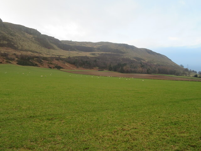
Benarty Hill is a prominent landmark located in Fife, Scotland. Also known as the "Bennachie of Fife," it is a prominent hill rising to a height of approximately 356 meters (1,168 feet) above sea level. Situated near the town of Lochgelly, it forms a distinctive part of the local landscape and is visible from miles around.

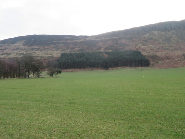
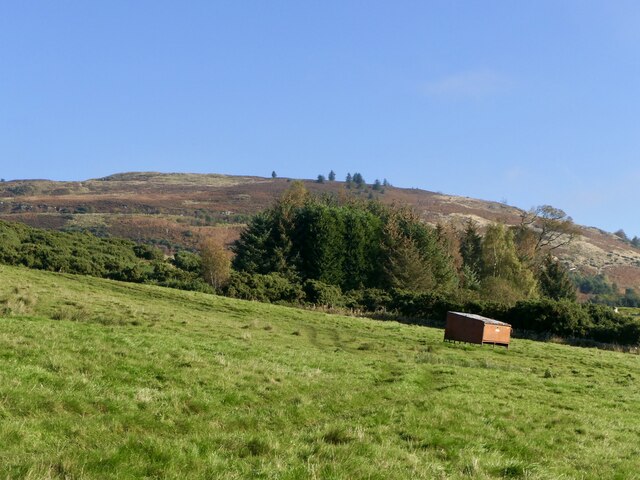
The hill is formed from a volcanic plug, a remnant of an ancient volcano that was active millions of years ago. Its unique shape and composition make it a popular destination for hikers, walkers, and nature enthusiasts. The hill is covered in grassy slopes and rugged terrain, with a well-defined path leading to the summit.

At the top of Benarty Hill, visitors are rewarded with breathtaking panoramic views of the surrounding area, including the Firth of Forth, Loch Leven, and the Lomond Hills. On clear days, it is even possible to see as far as Edinburgh and the Pentland Hills.

The hill is also rich in flora and fauna, supporting a diverse range of plant and animal species. Rare wildflowers can be found dotting the hillside, while birdwatchers may spot buzzards, kestrels, and other raptors soaring above.

Benarty Hill holds historical significance as well. It is believed to have been a site of human activity since ancient times, with evidence of a fort and a hillfort dating back to the Iron Age. The remains of these structures can still be seen on the hill today.

Overall, Benarty Hill is a popular and picturesque destination, offering both natural beauty and historical interest to visitors and locals alike.

If you have any feedback on the listing, please let us know in the comments section below.

Benarty Hill Images

Images are sourced within 2km of 56.16605/-3.3642492 or Grid Reference NT1597. Thanks to Geograph Open Source API. All images are credited.

Loch Leven Heritage Trail Milestone (Findatie) Milestone (in km), on the Loch Leven Trail west of Findatie towards the south-eastern corner of the loch.
Loch Leven Heritage Trail Milestone (Findatie)
Milestone (in km), on the Loch Leven Trail west of Findatie towards the south-eastern corner of the loch.
Loch Leven Heritage Trail Milestone (Vane Farm) Milestone (in km), on the Loch Leven Trail near Vane Farm on the south side of the loch.
Loch Leven Heritage Trail Milestone (Vane Farm)
Milestone (in km), on the Loch Leven Trail near Vane Farm on the south side of the loch.
Farmland at Gairneybank Looking north from the B9097. Newly ploughed stubble and an adjacent grass field.
Farmland at Gairneybank
Looking north from the B9097. Newly ploughed stubble and an adjacent grass field.
Benarty Hill Looking south from near West Brackley.
Benarty Hill
Looking south from near West Brackley.
Conservation grazing at Vane Farm Between Loch Leven and Benarty Hill, part of the RSPB Vane Farm Nature Reserve.
Conservation grazing at Vane Farm
Between Loch Leven and Benarty Hill, part of the RSPB Vane Farm Nature Reserve.
Plantations on Benarty Hill At the boundary between hill and farmland.
Plantations on Benarty Hill
At the boundary between hill and farmland.
Sheep pasture at East Brackley And the lower slopes of Benarty Hill.
Sheep pasture at East Brackley
And the lower slopes of Benarty Hill.
Loch Leven, with sunlight on St Serf's Island The rest of the landscape was in cloud, and suddenly the island lit up!
Loch Leven, with sunlight on St Serf's Island
The rest of the landscape was in cloud, and suddenly the island lit up!
Tiny waterfall in Benarty Woods This stream runs off the plateau with Benarty Hill and drops down through the trees. Here it crosses underneath the path traversing the hillside.
Tiny waterfall in Benarty Woods
This stream runs off the plateau with Benarty Hill and drops down through the trees. Here it crosses underneath the path traversing the hillside.
Stile at Benarty Hill Just beyond the summit of Benarty Hill, this small stile leads across the fence, a bit further onto the steep northern slopes. Views of Loch Leven beyond. Snow showers approaching from the west.
Stile at Benarty Hill
Just beyond the summit of Benarty Hill, this small stile leads across the fence, a bit further onto the steep northern slopes. Views of Loch Leven beyond. Snow showers approaching from the west.
Tree on the edge Impressive tree on the edge of the Benarty Hill plateau. A smattering of snow on the hills beyond Loch leven.
Tree on the edge
Impressive tree on the edge of the Benarty Hill plateau. A smattering of snow on the hills beyond Loch leven.
Sheep west of Ballingry This field is on the track that links Benarty Hill with Lochore Meadows.
Sheep west of Ballingry
This field is on the track that links Benarty Hill with Lochore Meadows.
Track through Benarty Woods This travel track links the plateau of Benarty Hill with the road.
Track through Benarty Woods
This travel track links the plateau of Benarty Hill with the road.
Hay Bales near Loch Leven The picture was taken from the path - officially called the 'Loch Leven Heritage Trail' - that encircles Loch Leven. It's about 13 miles round in total, and more time is probably spent out of view of the water than with it in sight (this grid-square, for instance, doesn't even touch the loch), which was surprising to me, having not studied its route beforehand.
I reckon there were probably more cyclists on the track than walkers, though this is of course impossible to gauge for sure due to cyclists travelling more quickly -  it might have just seemed that way. There were certainly a few other walkers doing a circuit, some of whom obviously had different starting points. Although it made sense after a bit of thinking about it, I was initially baffled when I found myself saying  hello to the same man approaching me from the opposite direction for a second time. The person I was walking with, however, didn't share my confusion at all!
I can never resist the photo opportunity that hay bales stretching out in a field of yellow provide, and this was the only point along the 13 mile circuit that there so many close by, though we did pass the odd small field containing a few old-style rectangular ones.
Hay Bales near Loch Leven
The picture was taken from the path - officially called the 'Loch Leven Heritage Trail' - that encircles Loch Leven. It's about 13 miles round in total, and more time is probably spent out of view of the water than with it in sight (this grid-square, for instance, doesn't even touch the loch), which was surprising to me, having not studied its route beforehand. I reckon there were probably more cyclists on the track than walkers, though this is of course impossible to gauge for sure due to cyclists travelling more quickly - it might have just seemed that way. There were certainly a few other walkers doing a circuit, some of whom obviously had different starting points. Although it made sense after a bit of thinking about it, I was initially baffled when I found myself saying hello to the same man approaching me from the opposite direction for a second time. The person I was walking with, however, didn't share my confusion at all! I can never resist the photo opportunity that hay bales stretching out in a field of yellow provide, and this was the only point along the 13 mile circuit that there so many close by, though we did pass the odd small field containing a few old-style rectangular ones.
B9097 towards Glenrothes
Pit road on the north side of Loch Ore Within the Lochore Meadows Country Park. The signs indicate a route of the Kingdom of Fife Millennium Cycleways.
Pit road on the north side of Loch Ore
Within the Lochore Meadows Country Park. The signs indicate a route of the Kingdom of Fife Millennium Cycleways.
Field, south side of Benarty Hill Benarty is made up of a dolerite sill which is tilted giving steep craggy sides and a gentle aspect to the south.
Field, south side of Benarty Hill
Benarty is made up of a dolerite sill which is tilted giving steep craggy sides and a gentle aspect to the south.
Exposed rock, Benarty Hill On the gentler southern slopes of the hill.
Exposed rock, Benarty Hill
On the gentler southern slopes of the hill.
Show me another place!

Benarty Hill is located at Grid Ref: NT1597 (Lat: 56.16605, Lng: -3.3642492)

Unitary Authority: Fife

Police Authority: Fife

What 3 Words

///sponsors.rang.workroom. Near Ballingry, Fife

Nearby Locations

Seamark Benarty Hill

Related Wikis

Benarty Hill

Benarty Hill, locally simply Benarty, rises above and to the west of Ballingry, in the west of Fife, Scotland. The summit ridge forms the boundary with...

Blairadam railway station

Blairadam railway station is a disused station in Fife, Scotland which was open from 1860 to 1964 on the Kinross-shire Railway. == History == The station...

St Serf's Inch Priory

The St Serf's Inch Priory (or Portmoak Priory) was a community of Augustinian canons based, initially at least, on St Serf's Inch in Loch Leven, Perth...

Loch Ore

Loch Ore is a loch situated in Fife, Scotland. It forms the core of Lochore Meadows Country Park. It is used mainly for leisure purposes, especially yachting...

Nearby Amenities

Located within 500m of 56.16605,-3.3642492
Benarty Hill
Corbett: no
Ele: 356
Graham: no
Marilyn: yes
Munro: no
Natural: peak
Prominence: 228
Source: npe
Wikidata: Q4886867
Wikipedia: en:Benarty Hill
Lat/Long: 56.166041/-3.3642423
Power: tower
Lat/Long: 56.1672864/-3.3693092
Power: tower
Lat/Long: 56.1684443/-3.3648805
Power: tower
Lat/Long: 56.1697457/-3.359903
Natural: spring
Lat/Long: 56.166177/-3.3564965
Power: pole
Lat/Long: 56.1701488/-3.362205
Power: pole
Lat/Long: 56.169893/-3.3632237
Power: pole
Lat/Long: 56.1696384/-3.3642037
Power: pole
Lat/Long: 56.169377/-3.3652142
Power: pole
Lat/Long: 56.1691315/-3.3661982
Power: pole
Lat/Long: 56.1688746/-3.3674783
Power: pole
Lat/Long: 56.1686473/-3.3687113
Power: pole
Lat/Long: 56.1684064/-3.369924
Power: pole
Lat/Long: 56.1681495/-3.3709692
The data included in this document is from www.openstreetmap.org. The data is made available under ODbL.

Have you been to Benarty Hill?

Leave your review of Benarty Hill below (or comments, questions and feedback).