Firthhope Rig

Hill, Mountain in Peeblesshire

Scotland

Firthhope Rig

White Coomb Summit Cairn On the summit of the Corbett and Donald of White Coomb - the 4th highest summit in the southern uplands. The 2nd and 3rd highest - of Broad Law and Cramalt Craig - can be seen above and to the right of the cairn. A glorious autumn day in the Borders Hills.
White Coomb Summit Cairn Credit: Adam Ward

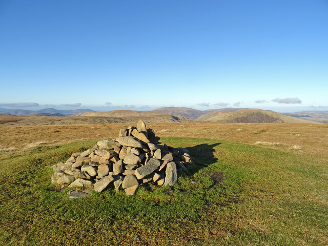
Firthhope Rig is a prominent hill located in Peeblesshire, Scotland. With an elevation of approximately 433 meters (1,421 feet), it stands as a notable feature in the local landscape. Situated near the town of Peebles, Firthhope Rig is easily accessible to both locals and visitors alike.

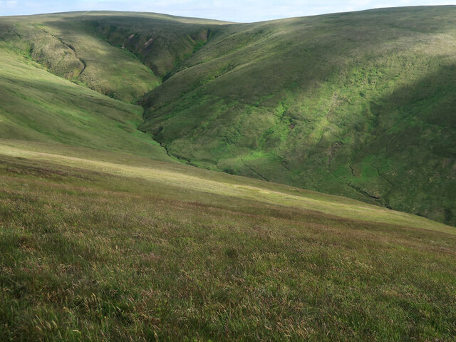
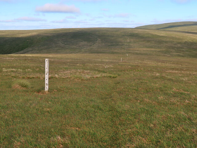
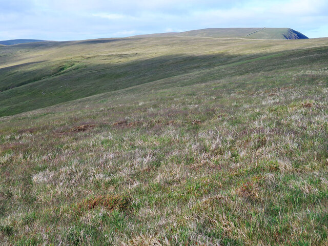
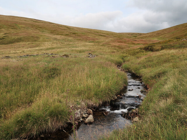
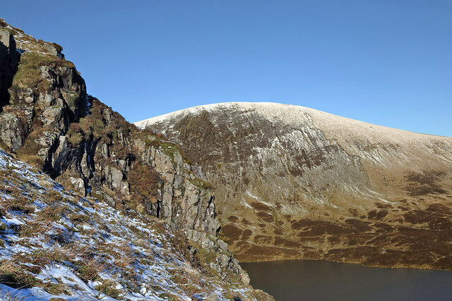
The hill is characterized by its gently sloping terrain, covered in heather and grasses, providing a picturesque view. Firthhope Rig offers a moderate hike for outdoor enthusiasts, with a well-marked path leading to the summit. As hikers ascend, they are rewarded with stunning vistas of the surrounding countryside, including the rolling hills and scenic valleys of Peeblesshire.

The summit of Firthhope Rig provides a breathtaking panoramic view, allowing visitors to admire the natural beauty of the area. On a clear day, one can see the distant peaks of the Scottish Borders, including the iconic Eildon Hills. The hill also offers a vantage point to observe local wildlife, such as birds of prey and deer, making it a popular spot for nature lovers and birdwatchers.

Firthhope Rig is a perfect destination for those seeking a peaceful and invigorating outdoor experience. Its accessibility, coupled with its natural beauty, makes it a favored location for walking, hiking, and even picnicking. Whether it be for recreational purposes or simply to enjoy the tranquility of the Scottish countryside, Firthhope Rig offers an idyllic escape for all who visit.

If you have any feedback on the listing, please let us know in the comments section below.

Firthhope Rig Images

Images are sourced within 2km of 55.425072/-3.3390552 or Grid Reference NT1515. Thanks to Geograph Open Source API. All images are credited.

White Coomb Summit Cairn On the summit of the Corbett and Donald of White Coomb - the 4th highest summit in the southern uplands. The 2nd and 3rd highest - of Broad Law and Cramalt Craig - can be seen above and to the right of the cairn. A glorious autumn day in the Borders Hills.
White Coomb Summit Cairn
On the summit of the Corbett and Donald of White Coomb - the 4th highest summit in the southern uplands. The 2nd and 3rd highest - of Broad Law and Cramalt Craig - can be seen above and to the right of the cairn. A glorious autumn day in the Borders Hills.
Donald's Cleuch Looking down from the slopes of Molls Cleuch Dod.
Donald's Cleuch
Looking down from the slopes of Molls Cleuch Dod.
Drystane dyke and fence on Firthhope Rig The fence is a recent addition on the boundary of the Talla and Gameshope area managed by the Border Forest Trust, see <a href="https://www.geograph.org.uk/photo/7209729">NT1420 : Border Forest Trust information board at Talla Water</a>.
Drystane dyke and fence on Firthhope Rig
The fence is a recent addition on the boundary of the Talla and Gameshope area managed by the Border Forest Trust, see NT1420 : Border Forest Trust information board at Talla Water.
Old fence posts on Great Hill
The top of Donald's Cleuch Looking towards Firthybrig Head, Lochcraig Head and Loch Craig.
The top of Donald's Cleuch
Looking towards Firthybrig Head, Lochcraig Head and Loch Craig.
The unnamed small burn in Ether Cleuch And an old, overgrown sheepfold on the right.
The unnamed small burn in Ether Cleuch
And an old, overgrown sheepfold on the right.
Walking on Mid Craig in early January The small gorge in shadow just left of centre is Midlaw Linn. For a view down Midlaw Linn, see <a href="https://www.geograph.org.uk/photo/686161">NT1616 : Midlaw Linn</a>.
Walking on Mid Craig in early January
The small gorge in shadow just left of centre is Midlaw Linn. For a view down Midlaw Linn, see NT1616 : Midlaw Linn.
A rock outcrop on Mid Craig Lochcraig Head is in the background with Loch Skene below.
A rock outcrop on Mid Craig
Lochcraig Head is in the background with Loch Skene below.
Rotten Bottom (bog) Following the dyke/fence to Rotten Bottom and Firthhope Rig.
Rotten Bottom (bog)
Following the dyke/fence to Rotten Bottom and Firthhope Rig.
Heading to White Coomb Leaving the summit of Firthhope Rig and heading to White Coomb.
Heading to White Coomb
Leaving the summit of Firthhope Rig and heading to White Coomb.
Great Hill (summit) The summit of Great Hill.
Great Hill (summit)
The summit of Great Hill.
Loch Skeen, Loch Craig, Mid Craig and White Coomb View of Loch Skeen and the hills surrounding the loch including Loch Craig and White Coomb
Loch Skeen, Loch Craig, Mid Craig and White Coomb
View of Loch Skeen and the hills surrounding the loch including Loch Craig and White Coomb
Path on Rough Craigs The top of a steep section of path on the east ridge of White Coomb. Loch Skene is in the background.
Path on Rough Craigs
The top of a steep section of path on the east ridge of White Coomb. Loch Skene is in the background.
East ridge of White Coomb A path, steep in places, follows the old wall up from the col by Upper Tarnberry, below which is the forestry plantation around the Polmoody Burn.
East ridge of White Coomb
A path, steep in places, follows the old wall up from the col by Upper Tarnberry, below which is the forestry plantation around the Polmoody Burn.
Summit cairn, White Coomb White Coomb (821m) is one of the three Corbetts in the Southern Uplands east of the M74 - the other two are Hart Fell and Broad Law. The summit's grassy plateau belies the craggy slopes on the east side overlooking Loch Skene and the Polmoody Burn.
Summit cairn, White Coomb
White Coomb (821m) is one of the three Corbetts in the Southern Uplands east of the M74 - the other two are Hart Fell and Broad Law. The summit's grassy plateau belies the craggy slopes on the east side overlooking Loch Skene and the Polmoody Burn.
Fence junction, White Coomb Fences from the Carrifran glen (L) and from the Tail Burn (R) meet just north of the summit, looking towards here to Firthhope Rig.
Fence junction, White Coomb
Fences from the Carrifran glen (L) and from the Tail Burn (R) meet just north of the summit, looking towards here to Firthhope Rig.
Saddle Yoke from Firthhope Rig The ridge of Saddle Yoke seen from the col NW of White Coomb.
Saddle Yoke from Firthhope Rig
The ridge of Saddle Yoke seen from the col NW of White Coomb.
Track from White Coomb Looking from Firthhope Rig alongside the old wall and fence.
Track from White Coomb
Looking from Firthhope Rig alongside the old wall and fence.
Show me another place!

Firthhope Rig is located at Grid Ref: NT1515 (Lat: 55.425072, Lng: -3.3390552)

Unitary Authority: The Scottish Borders

Police Authority: The Lothians and Scottish Borders

What 3 Words

///depth.flotation.clincher. Near Ettrick, Scottish Borders

Related Wikis

White Coomb

White Coomb is a hill in the Moffat Hills range, part of the Southern Uplands of Scotland. Its broad summit is the highest point in the range and the registration...

Loch Skeen

Loch Skeen or Loch Skene is a loch in Dumfries and Galloway in the south of Scotland. It is located about 10 miles to the north-east of Moffat and feeds...

Moffat Hills

The Moffat Hills are a range of hills in the Southern Uplands of Scotland. They form a roughly triangular shape with a west facing side, a north facing...

Grey Mare's Tail, Moffat Hills

Grey Mare's Tail is a 60-metre (200 ft) hanging valley waterfall near to Moffat in southern Scotland. The fall is produced by the Tail Burn flowing from...

Nearby Amenities

Located within 500m of 55.425072,-3.3390552
Firthhope Rig
Corbett: no
Donald: no
Graham: no
Man Made: cairn
Munro: no
Natural: peak
Note: cairn yes
Source: local_knowledge
Lat/Long: 55.4251533/-3.3391298
Barrier: stile
Stile: stepover
Lat/Long: 55.4257062/-3.3388247
Barrier: stile
Stile: stepover
Lat/Long: 55.4255608/-3.3388263
The data included in this document is from www.openstreetmap.org. The data is made available under ODbL.

Have you been to Firthhope Rig?

Leave your review of Firthhope Rig below (or comments, questions and feedback).