Fairliehope Hill

Hill, Mountain in Peeblesshire

Scotland

Fairliehope Hill

The Pentland Hills From Portmore Estate
The Pentland Hills Credit: Anthony O'Neil

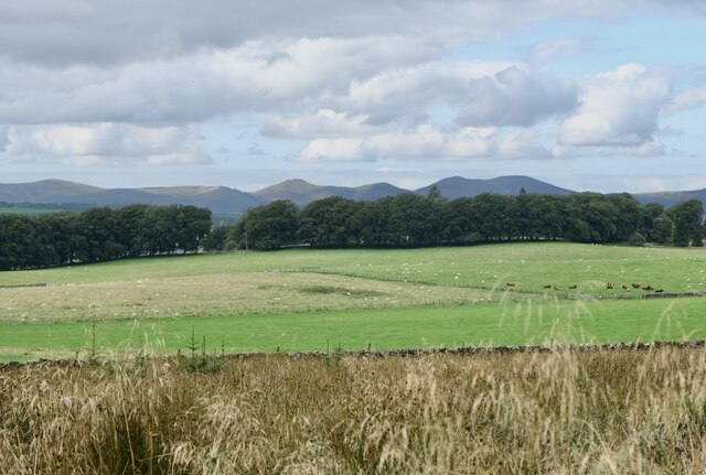
Fairliehope Hill is a prominent geographical feature located in Peeblesshire, Scotland. Rising to an elevation of approximately 465 meters (1,526 feet), it is classified as a hill in terms of its height. Nestled within the southern part of the Scottish Borders, this picturesque hill offers breathtaking views of the surrounding countryside.

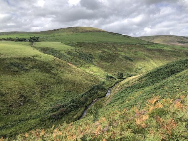
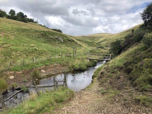
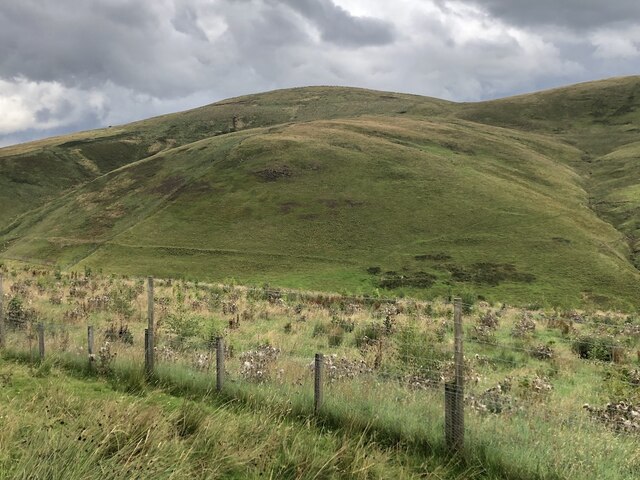
The ascent to Fairliehope Hill is moderately challenging, with a well-defined path leading to its summit. The hill is covered in heather, grasses, and patches of woodland, providing a diverse habitat for various flora and fauna. It is not uncommon to spot wildflowers, such as bluebells and primroses, dotting the landscape during the spring and summer months.

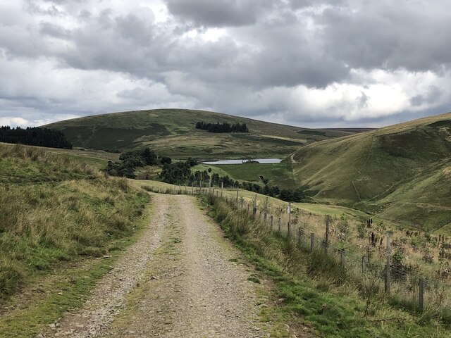
Reaching the top of Fairliehope Hill rewards visitors with panoramic vistas that extend for miles in all directions. On a clear day, one can see the rolling hills and valleys of Peeblesshire, as well as distant peaks of the Scottish Borders. The hill also offers stunning views of the nearby Tweed Valley and the meandering River Tweed.

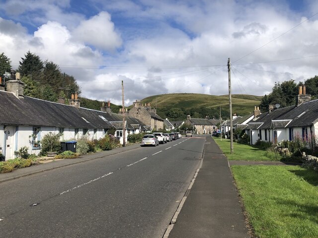
Fairliehope Hill is a popular destination for outdoor enthusiasts, including hikers and nature lovers. Its accessible location, just a short drive from the town of Peebles, makes it an ideal spot for a day trip. The hill is also frequented by birdwatchers, as it provides a habitat for various species, including red grouse, skylarks, and kestrels.

Overall, Fairliehope Hill offers a tranquil escape in the heart of the Scottish countryside, with its natural beauty and captivating views making it a must-visit destination for those exploring Peeblesshire.

If you have any feedback on the listing, please let us know in the comments section below.

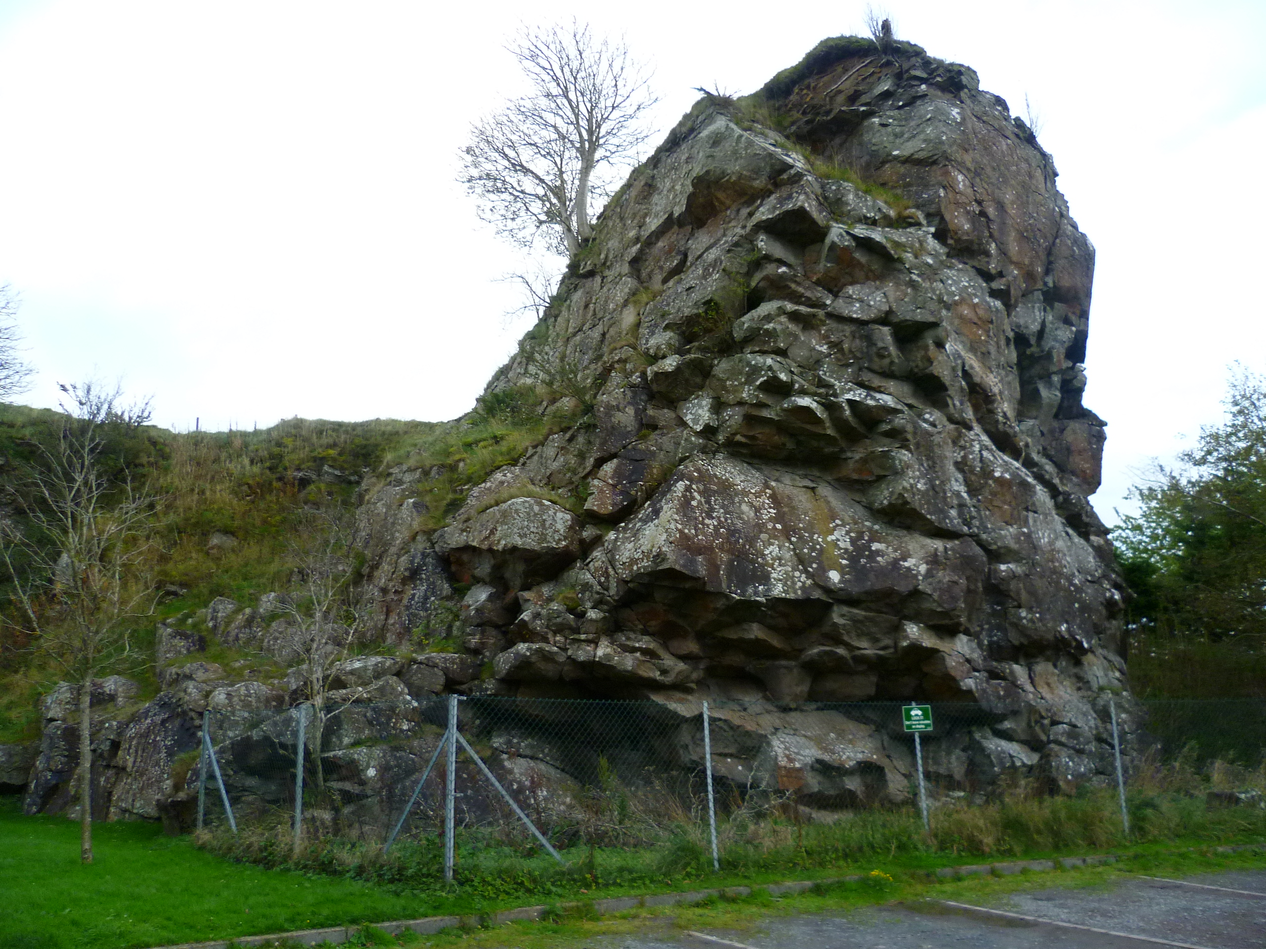
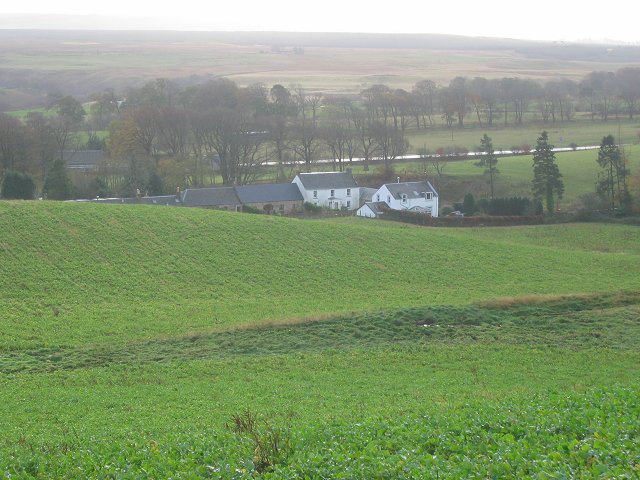
Fairliehope Hill Images

Images are sourced within 2km of 55.801283/-3.3589132 or Grid Reference NT1457. Thanks to Geograph Open Source API. All images are credited.

The Pentland Hills From Portmore Estate
The Pentland Hills
From Portmore Estate
Carlops Drinking Fountain A fine example of a mid 19th century well and drinking fountain, notable for its well-detailed carving with distinctive curved alcove flanked by swept, coped walls surmounted by finials. Prominently located beside the road, the structure adds considerably to the interest of the village streetscape. The structure was donated by the Browns of nearby Newhall House which is located nearby in Penicuik Parish.
Carlops Drinking Fountain
A fine example of a mid 19th century well and drinking fountain, notable for its well-detailed carving with distinctive curved alcove flanked by swept, coped walls surmounted by finials. Prominently located beside the road, the structure adds considerably to the interest of the village streetscape. The structure was donated by the Browns of nearby Newhall House which is located nearby in Penicuik Parish.
A702, Carlops View through the village to the now closed Alan Ramsay.
A702, Carlops
View through the village to the now closed Alan Ramsay.
North Esk, upstream of Carlops Deep cut glen leaving the Pentland Hills.
North Esk, upstream of Carlops
Deep cut glen leaving the Pentland Hills.
Bridge below Fairliehope Connects a path from the road to the North Esk Reservoir with paths on the Midlothian side of the burn. Cattle drink in the foreground.
Bridge below Fairliehope
Connects a path from the road to the North Esk Reservoir with paths on the Midlothian side of the burn. Cattle drink in the foreground.
Steadings, Fairliehope
Red Angus cattle, Fairliehope
Road to the North Esk Reservoir Rounding Fairliehope Hill
Road to the North Esk Reservoir
Rounding Fairliehope Hill
Young trees,  Fairleehope Hill There are numerous small young plantations in the upper North Esk catchment.
Young trees, Fairleehope Hill
There are numerous small young plantations in the upper North Esk catchment.
Road to North Esk Reservoir
Gate, North Esk Cottage Track to the dam.  Note that someone has kindly locked the side gate as well.
Gate, North Esk Cottage
Track to the dam. Note that someone has kindly locked the side gate as well.
North Esk Reservoir Built to ensure a water flow in the North Esk to power the paper mills.  Now the mills have gone, the water has been drawn down to a level needing less dam maintenance and the loch is managed as a nature reserve.
North Esk Reservoir
Built to ensure a water flow in the North Esk to power the paper mills. Now the mills have gone, the water has been drawn down to a level needing less dam maintenance and the loch is managed as a nature reserve.
North Esk Reservoir Track to the dam and a road on the other side which had appeared in the 14 years since my last visit. The dam was built to ensure a water flow in the North Esk to power the paper mills.  Now the mills have gone, the water has been drawn down to a level needing less dam maintenance and the loch is managed as a nature reserve.
North Esk Reservoir
Track to the dam and a road on the other side which had appeared in the 14 years since my last visit. The dam was built to ensure a water flow in the North Esk to power the paper mills. Now the mills have gone, the water has been drawn down to a level needing less dam maintenance and the loch is managed as a nature reserve.
North Esk Reservoir Built to ensure a water flow in the North Esk to power the paper mills.  Now the mills have gone, the water has been drawn down to a level needing less dam maintenance and the loch is managed as a nature reserve.
North Esk Reservoir
Built to ensure a water flow in the North Esk to power the paper mills. Now the mills have gone, the water has been drawn down to a level needing less dam maintenance and the loch is managed as a nature reserve.
Path beside North Esk Reservoir
North Esk Reservoir Built to ensure a water flow in the North Esk to power the paper mills.  Now the mills have gone, the water has been drawn down to a level needing less dam maintenance and the loch is managed as a nature reserve.
North Esk Reservoir
Built to ensure a water flow in the North Esk to power the paper mills. Now the mills have gone, the water has been drawn down to a level needing less dam maintenance and the loch is managed as a nature reserve.
Spittal Hill View from the North Esk Reservoir.
Spittal Hill
View from the North Esk Reservoir.
Path beside North Esk Reservoir Heading for the Boar Stane.
Path beside North Esk Reservoir
Heading for the Boar Stane.
Show me another place!

Fairliehope Hill is located at Grid Ref: NT1457 (Lat: 55.801283, Lng: -3.3589132)

Unitary Authority: The Scottish Borders

Police Authority: The Lothians and Scottish Borders

What 3 Words

///grub.guarding.papers. Near West Linton, Scottish Borders

Related Wikis

Pentland Hills

The Pentland Hills are a range of hills southwest of Edinburgh, Scotland. The range is around twenty miles (thirty kilometres) in length, and runs southwest...

Carlops

Carlops (Scottish Gaelic: Leum na Caillich) is a small village in the Pentland Hills, within the Scottish Borders area of Scotland, close to the boundary...

Baddinsgill Reservoir

Baddinsgill Reservoir is a small reservoir in the Scottish Borders area of Scotland close to Carlops, West Linton, and the boundary with Midlothian. It...

Nine Mile Burn

Nine Mile Burn is a hamlet in Midlothian, Scotland, the last in Midlothian when heading south on the A702 road. It is located at the foot of the Pentland...

Nearby Amenities

Located within 500m of 55.801283,-3.3589132
Fairliehope Hill
Natural: peak
Place: locality
Lat/Long: 55.8010619/-3.3580613
The data included in this document is from www.openstreetmap.org. The data is made available under ODbL.

Have you been to Fairliehope Hill?

Leave your review of Fairliehope Hill below (or comments, questions and feedback).