Faw Mount
Hill, Mountain in Peeblesshire
Scotland
Faw Mount

Faw Mount is a prominent hill located in Peeblesshire, Scotland. Rising to an elevation of 562 meters (1,844 feet), it is considered one of the notable peaks in the region. Situated near the town of Peebles, Faw Mount offers stunning panoramic views of the surrounding landscape.
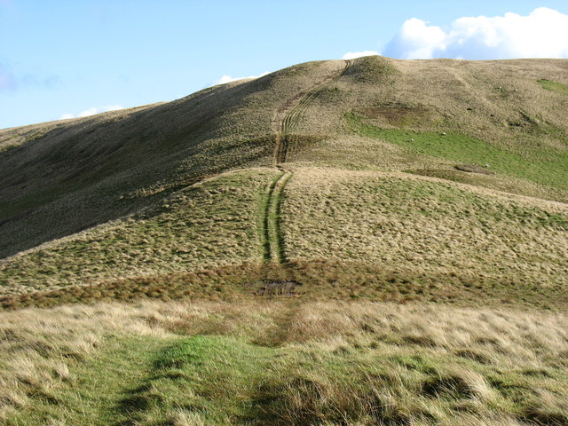
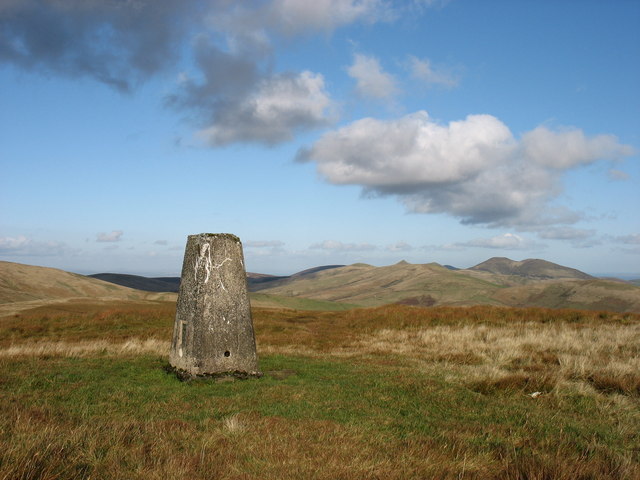
The hill is part of the Moorfoots range, a series of hills and mountains that stretch across the Scottish Borders. Faw Mount is particularly distinct due to its conical shape and its position as one of the highest points in the area. Its summit is marked by a trig point, providing a reference point for surveying and navigation purposes.
The terrain of Faw Mount is primarily comprised of heather moorland, with scattered patches of forestry and grassland. The hill is home to various species of flora and fauna, including heather, bilberry, and grouse. It is a popular destination for walkers and hikers, offering a range of trails and paths to explore.
The ascent of Faw Mount can be challenging, particularly in adverse weather conditions, but it rewards visitors with breathtaking views of the surrounding countryside. On clear days, the summit provides vistas of the rolling hills, picturesque valleys, and distant peaks of the Scottish Borders. The hill is also a great spot for birdwatching, with birds of prey often soaring overhead.
Faw Mount is easily accessible, with several routes leading to its summit. It offers visitors a chance to experience the natural beauty and tranquility of the Scottish countryside, making it a popular attraction for outdoor enthusiasts and nature lovers alike.
If you have any feedback on the listing, please let us know in the comments section below.
Faw Mount Images
Images are sourced within 2km of 55.776297/-3.3787057 or Grid Reference NT1354. Thanks to Geograph Open Source API. All images are credited.


Faw Mount is located at Grid Ref: NT1354 (Lat: 55.776297, Lng: -3.3787057)
Unitary Authority: The Scottish Borders
Police Authority: The Lothians and Scottish Borders
What 3 Words
///took.situates.gobbling. Near West Linton, Scottish Borders
Nearby Locations
Related Wikis

Baddinsgill
Baddinsgill is a hamlet in the Scottish Borders area of Scotland. The Baddinsgill Reservoir is a few hundred metres north of the hamlet. == See also... ==

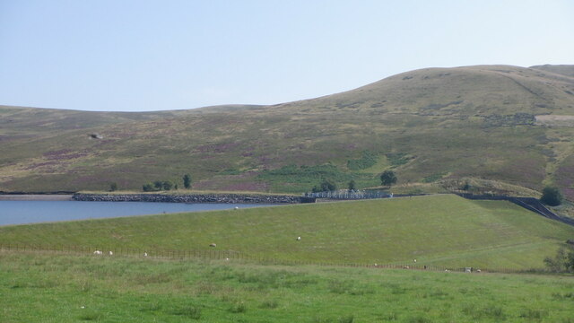
Baddinsgill Reservoir
Baddinsgill Reservoir is a small reservoir in the Scottish Borders area of Scotland close to Carlops, West Linton, and the boundary with Midlothian. It...
Carlops
Carlops (Scottish Gaelic: Leum na Caillich) is a small village in the Pentland Hills, within the Scottish Borders area of Scotland, close to the boundary...

West Water Reservoir
West Water Reservoir (sometimes Westwater Reservoir) is an artificial reservoir in the Pentland Hills, Scottish Borders, 3 kilometres (1.9 mi) west of...
Nearby Amenities
Located within 500m of 55.776297,-3.3787057Have you been to Faw Mount?
Leave your review of Faw Mount below (or comments, questions and feedback).