Grey Yade

Hill, Mountain in Peeblesshire

Scotland

Grey Yade

Track towards Clover Law In the Broughton Heights, a compact group of moorland hills of modest height in the north-western corner of the Scottish Borders.
Track towards Clover Law Credit: Alan O'Dowd

Grey Yade is a prominent hill located in Peeblesshire, a historic county in the southern region of Scotland. It is situated within the picturesque Scottish Borders, approximately 4 kilometers southeast of the town of Peebles. Rising to an elevation of 500 meters, Grey Yade is characterized by its distinctive rounded shape and abundant heather vegetation covering its slopes.

The hill offers breathtaking panoramic views of the surrounding landscape, including the lush Tweed Valley and the rolling hills of the Scottish Borders. On clear days, the summit provides an exceptional vantage point to appreciate the beauty of the countryside, with the distant peaks of the Southern Uplands visible to the south.

Grey Yade is a popular destination for outdoor enthusiasts, attracting hikers, walkers, and nature lovers alike. Several well-marked trails lead to the summit, catering to varying levels of difficulty and offering opportunities to spot local wildlife such as red grouse, mountain hares, and birds of prey.

One notable feature of Grey Yade is the ancient hill fort located near its summit. Dating back to the Iron Age, this archaeological site provides insight into the region's rich history and offers visitors a chance to explore the remains of the fort's defensive ditches and ramparts.

Overall, Grey Yade presents an ideal destination for those seeking an invigorating outdoor experience, with its stunning views, diverse flora and fauna, and historical significance making it a must-visit location in Peeblesshire.

If you have any feedback on the listing, please let us know in the comments section below.

Grey Yade Images

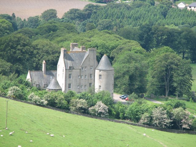
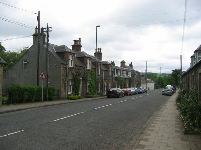
Images are sourced within 2km of 55.628365/-3.376619 or Grid Reference NT1338. Thanks to Geograph Open Source API. All images are credited.

Track towards Clover Law In the Broughton Heights, a compact group of moorland hills of modest height in the north-western corner of the Scottish Borders.
Track towards Clover Law
In the Broughton Heights, a compact group of moorland hills of modest height in the north-western corner of the Scottish Borders.
Cowiemuir Hass Looking into the valley of the Stirkfield Hope Burn with the flanks of Green Law on the right of the photo.

Hass is the Scottish Borders equivalent of the term hawse (found in the Lake District) meaning a pass or saddle between two hills.

A very similar view a couple of months earlier in the year can be found here: <a href="https://www.geograph.org.uk/photo/3196332">NT1239 : Cowiemuir Hass</a>
Cowiemuir Hass
Looking into the valley of the Stirkfield Hope Burn with the flanks of Green Law on the right of the photo. Hass is the Scottish Borders equivalent of the term hawse (found in the Lake District) meaning a pass or saddle between two hills. A very similar view a couple of months earlier in the year can be found here: NT1239 : Cowiemuir Hass
Track on the flank of Broomy Side In the Broughton Heights, a compact group of moorland hills of modest height in the south-western corner of the Scottish Borders.
Track on the flank of Broomy Side
In the Broughton Heights, a compact group of moorland hills of modest height in the south-western corner of the Scottish Borders.
Vehicle track on Broomy Side A view in December afternoon light.
Vehicle track on Broomy Side
A view in December afternoon light.
Between Cowiemuir Hass and Broomy Side A view towards the two rounded summits of Green Law and Broomy Side in the Broughton Heights, a compact group of moorland hills of a fairly modest height in the north-western corner of the Scottish Borders.
Between Cowiemuir Hass and Broomy Side
A view towards the two rounded summits of Green Law and Broomy Side in the Broughton Heights, a compact group of moorland hills of a fairly modest height in the north-western corner of the Scottish Borders.
Looking towards the Tweedsmuir Hills from Broughton Heights The higher Border hills still retain good snow cover from falls earlier in the week, whereas the lower Broughton Heights have lost most of their snow cover.
Looking towards the Tweedsmuir Hills from Broughton Heights
The higher Border hills still retain good snow cover from falls earlier in the week, whereas the lower Broughton Heights have lost most of their snow cover.
South-western spur of Clover Law Some remnants of the snowfall earlier in the week are clinging on. The village of Broughton is visible in the distance.
South-western spur of Clover Law
Some remnants of the snowfall earlier in the week are clinging on. The village of Broughton is visible in the distance.
Trahenna Hill A view across the Earn Cleuch, the upper reaches of which can be seen on the right-hand side of the distant hillside.
Trahenna Hill
A view across the Earn Cleuch, the upper reaches of which can be seen on the right-hand side of the distant hillside.
Gate on John Buchan Way between Broomy Side and Hammer Head The John Buchan Way is a thirteen mile-long path through the hills of Tweeddale, between Broughton and Peebles.  The area featured in many of Buchan's written works.
Gate on John Buchan Way between Broomy Side and Hammer Head
The John Buchan Way is a thirteen mile-long path through the hills of Tweeddale, between Broughton and Peebles. The area featured in many of Buchan's written works.
View from Hammer Head towards Broomy Side The John Buchan Way can be seen winding its way around the hillside.
View from Hammer Head towards Broomy Side
The John Buchan Way can be seen winding its way around the hillside.
Cairn on the summit of Hammer Head A summit 513 metres above sea level in the Broughton Heights, a compact group of hills of a fairly modest height in the north-west corner of the Scottish Borders. The view here is towards the distant hill of Tinto, in Lanarkshire.
Cairn on the summit of Hammer Head
A summit 513 metres above sea level in the Broughton Heights, a compact group of hills of a fairly modest height in the north-west corner of the Scottish Borders. The view here is towards the distant hill of Tinto, in Lanarkshire.
Summit of Hammer Head A summit 513 metres above sea level in the Broughton Heights, a compact group of hills of a fairly modest height in the north-west corner of the Scottish Borders.
Summit of Hammer Head
A summit 513 metres above sea level in the Broughton Heights, a compact group of hills of a fairly modest height in the north-west corner of the Scottish Borders.
View towards Hammer Head from Green Lairs Undulating moorland hills in the Broughton Heights, in the north-western corner of the Scottish Borders.
View towards Hammer Head from Green Lairs
Undulating moorland hills in the Broughton Heights, in the north-western corner of the Scottish Borders.
Not much snow left on the Broughton Heights A tiny remnant of the previous week's snowfall in what looks like a small quarry on the slopes of Green Lairs.
Not much snow left on the Broughton Heights
A tiny remnant of the previous week's snowfall in what looks like a small quarry on the slopes of Green Lairs.
Hammer Head and Green Lairs from Grey Yade Rolling moorland summits in the Broughton Heights, in the north-western corner of the Scottish Borders.
Hammer Head and Green Lairs from Grey Yade
Rolling moorland summits in the Broughton Heights, in the north-western corner of the Scottish Borders.
Fence junction on Trahenna Hill Modern fencing cutting across an old drystane dyke in the Broughton Heights.
Fence junction on Trahenna Hill
Modern fencing cutting across an old drystane dyke in the Broughton Heights.
Undulating moorland on Trahenna Hill Low winter sunlight on the Broughton Heights, in the north-western corner of the Scottish Borders.
Undulating moorland on Trahenna Hill
Low winter sunlight on the Broughton Heights, in the north-western corner of the Scottish Borders.
Trahenna Hill viewed from hillside above Dreva Hope Part of the Broughton Heights group of hills, Trahenna Hill rises to 549 metres above sea level.
Trahenna Hill viewed from hillside above Dreva Hope
Part of the Broughton Heights group of hills, Trahenna Hill rises to 549 metres above sea level.
Show me another place!

Grey Yade is located at Grid Ref: NT1338 (Lat: 55.628365, Lng: -3.376619)

Unitary Authority: The Scottish Borders

Police Authority: The Lothians and Scottish Borders

What 3 Words

///argued.graphic.braved. Near Biggar, South Lanarkshire

Related Wikis

Broughton Place, Scottish Borders

Broughton Place is a historic house in the village of Broughton, Scottish Borders. It was designed by Basil Spence in the style of a 17th-century Scottish...

Dreva on Tweed

Dreva on Tweed (or simply Dreva) is a hamlet in the Scottish Borders. It was historically in Peebles-shire. It is noted for the historical presence of...

Broughton, Scottish Borders

Broughton is a village in Tweeddale in the historical county of Peeblesshire in the Scottish Borders council area, in the south of Scotland, in the civil...

Biggar Water

Biggar Water is a river in Lanarkshire and Peeblesshire, in the Southern Uplands of Scotland. It forms part of the River Tweed system. It rises, as Biggar...

Nearby Amenities

Located within 500m of 55.628365,-3.376619
Gray Yade
Cairn: yes
Corbett: no
Donald: no
Ele: 537
Graham: no
Munro: no
Natural: peak
Lat/Long: 55.6304072/-3.3747976
Trahenna Hill
Natural: peak
Lat/Long: 55.6245439/-3.3792626
The data included in this document is from www.openstreetmap.org. The data is made available under ODbL.

Have you been to Grey Yade?

Leave your review of Grey Yade below (or comments, questions and feedback).