Bwlch-y-cefn Bank

Hill, Mountain in Radnorshire

Wales

Bwlch-y-cefn Bank

Stony hillside, Llandegley Rocks On the eastern side of the hills, with view to the higher Radnor Hills.
Stony hillside, Llandegley Rocks Credit: Andrew Hill

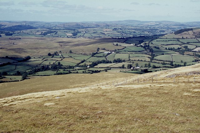
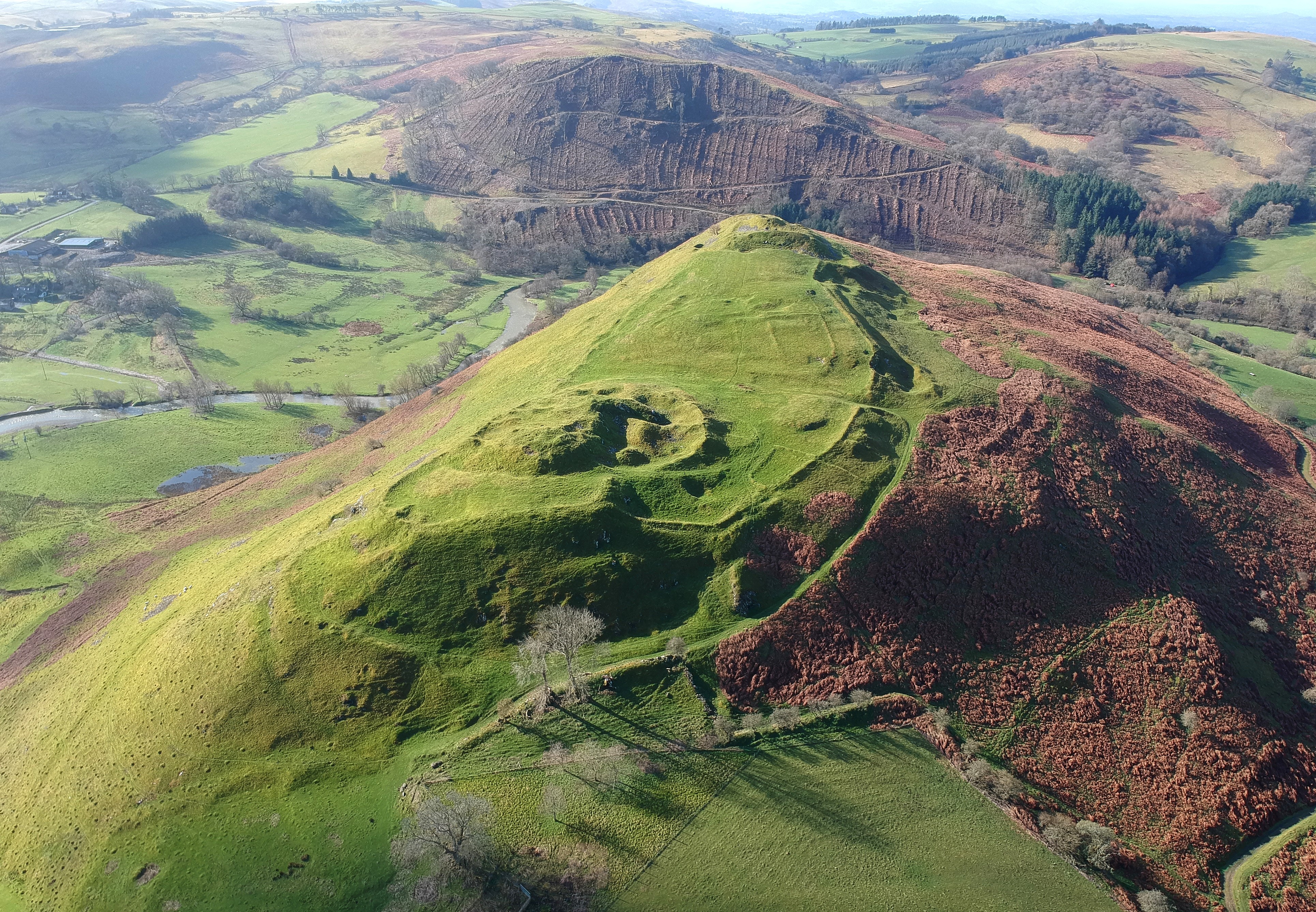
Bwlch-y-cefn Bank is a prominent hill located in the county of Radnorshire, Wales. Situated in the eastern part of the county, it is part of the Radnor Forest and covers an area of approximately 8 square kilometers. The hill reaches an elevation of 483 meters (1,585 feet) at its highest point.

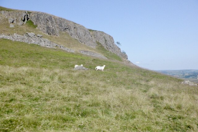
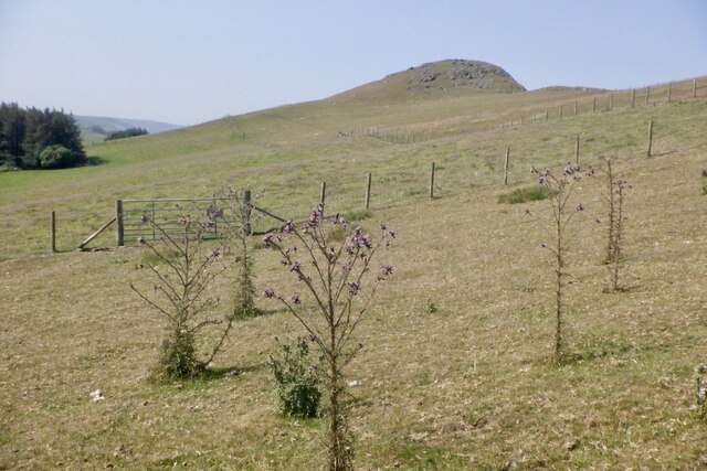
Bwlch-y-cefn Bank is characterized by its steep slopes, rugged terrain, and dense vegetation. The hill is covered in a mixture of grasses, heather, and bracken, creating a picturesque landscape particularly in the summer months when the heather blooms. The area is also home to a variety of wildlife, including birds such as red kites, buzzards, and ravens, as well as mammals like badgers and foxes.

The hill is a popular destination for outdoor enthusiasts and nature lovers who enjoy walking, hiking, and birdwatching. Several trails and footpaths traverse the area, providing visitors with stunning views of the surrounding countryside. The Offa's Dyke Path, a long-distance footpath that follows the English-Welsh border, passes through Bwlch-y-cefn Bank, attracting many walkers along its route.

Bwlch-y-cefn Bank offers a sense of tranquility and solitude, as it is relatively untouched by human development. Its remote location and natural beauty make it an ideal spot for those seeking a peaceful escape and a chance to reconnect with nature.

If you have any feedback on the listing, please let us know in the comments section below.

Bwlch-y-cefn Bank Images

Images are sourced within 2km of 52.239099/-3.2847508 or Grid Reference SO1260. Thanks to Geograph Open Source API. All images are credited.

Stony hillside, Llandegley Rocks On the eastern side of the hills, with view to the higher Radnor Hills.
Stony hillside, Llandegley Rocks
On the eastern side of the hills, with view to the higher Radnor Hills.
Hillside rocks with moss and lichen Steep eastern slopes at Llandegley Rocks
Hillside rocks with moss and lichen
Steep eastern slopes at Llandegley Rocks
Detail of moss and rock with lichen A very distinctive rocky slope on the eastern side of Llandegley Rocks.
Detail of moss and rock with lichen
A very distinctive rocky slope on the eastern side of Llandegley Rocks.
Track down to Llandegley village from the rocks Just on passing by the hillside property at Pearl Rock.
Track down to Llandegley village from the rocks
Just on passing by the hillside property at Pearl Rock.
Western slope of Llandegley Rocks
Path, Llandeglau The igneous crags of Llandegley Rocks ahead.
Path, Llandeglau
The igneous crags of Llandegley Rocks ahead.
Llandegley Rocks
Llandegley Rocks
Llandrindod Tuffs igneous exposure, Llandeglau Llandegley Rocks, a very striking craggy hill amongst the smooth mudstone hills of Radnorshire.
Llandrindod Tuffs igneous exposure, Llandeglau
Llandegley Rocks, a very striking craggy hill amongst the smooth mudstone hills of Radnorshire.
Llandegley Rocks A biggish buttress, the rock looks like a dolerite. Taken during a period of prolonged hot and dry weather.
Llandegley Rocks
A biggish buttress, the rock looks like a dolerite. Taken during a period of prolonged hot and dry weather.
Big thistles Llandegley Rocks, deep rooted thistles thriving amongst the burnt off grass.
Big thistles
Llandegley Rocks, deep rooted thistles thriving amongst the burnt off grass.
Windfarm construction, Llandeglau The older turbine is about to get some companions.
Windfarm construction, Llandeglau
The older turbine is about to get some companions.
Above Graig View from the ridge over haymaking and or silage cutting activities near Llandrindod.
Above Graig
View from the ridge over haymaking and or silage cutting activities near Llandrindod.
Llandegley Rocks Llandegley Rocks, a very striking craggy hill amongst the smooth mudstone hills of Radnorshire.
Llandegley Rocks
Llandegley Rocks, a very striking craggy hill amongst the smooth mudstone hills of Radnorshire.
Llandegley Rocks Outcropping igneous rock on a rugged ridge which contrasts with the usual smooth hills of Radnorshire.
Llandegley Rocks
Outcropping igneous rock on a rugged ridge which contrasts with the usual smooth hills of Radnorshire.
Bwlch-y-cefn Bank A rocky southward continuation of the igneous Llandegley Rocks ridge,
Bwlch-y-cefn Bank
A rocky southward continuation of the igneous Llandegley Rocks ridge,
Bwlch-y-cefn Bank Looking towards the rocky summit in a period of dry hot weather. The sheep were all in shady spots and I was finding the going hard.
Bwlch-y-cefn Bank
Looking towards the rocky summit in a period of dry hot weather. The sheep were all in shady spots and I was finding the going hard.
Bwlch-y-cefn Bank The summit, exposed igneous rock.
Bwlch-y-cefn Bank
The summit, exposed igneous rock.
Fields, Bwlch-y-cefn
Show me another place!

Bwlch-y-cefn Bank is located at Grid Ref: SO1260 (Lat: 52.239099, Lng: -3.2847508)

Unitary Authority: Powys

Police Authority: Dyfed Powys

What 3 Words

///culminate.husky.duplicate. Near Penybont, Powys

Nearby Locations

Bwlch-y-cefn Bank

Related Wikis

Llandegley

Llandegley (Welsh: Llandeglau), is a village near Llandrindod Wells, in the community of Penybont, in Powys, mid Wales, United Kingdom. It is the supposed...

Radnorshire

Until 1974, Radnorshire (Welsh: Sir Faesyfed) was an administrative county in mid Wales, later classed as one of the thirteen historic counties of Wales...

Penybont

Penybont (also sometimes spelled Pen-y-Bont) is a small village in Radnorshire, Powys, Wales. The population of the community at the 2011 census was 428...

Cefnllys Castle

Cefnllys Castle (Welsh: Castell Cefn-llys, pronounced [ˈkastɛɬ kɛvn ɬɨːs]) was a medieval spur castle in Radnorshire (now part of Powys), Wales. Two successive...

Nearby Amenities

Located within 500m of 52.239099,-3.2847508
Place: farm
Lat/Long: 52.2414182/-3.2899129
Power: pole
Lat/Long: 52.2425274/-3.2886592
Power: pole
Lat/Long: 52.2423368/-3.287589
Power: pole
Lat/Long: 52.2418868/-3.2851428
Power: pole
Lat/Long: 52.2413416/-3.2832384
Power: pole
Lat/Long: 52.2409835/-3.2822165
Power: pole
Lat/Long: 52.2404678/-3.2807681
Power: pole
Lat/Long: 52.2401623/-3.2794458
Power: pole
Lat/Long: 52.2398009/-3.2782093
The data included in this document is from www.openstreetmap.org. The data is made available under ODbL.

Have you been to Bwlch-y-cefn Bank?

Leave your review of Bwlch-y-cefn Bank below (or comments, questions and feedback).