The Bruach

Hill, Mountain in Banffshire

Scotland

The Bruach

Ford, Allt nam Broighleag On an estate track which goes up Glen Avon to Faindouran.
Ford, Allt nam Broighleag Credit: Dorothy Carse

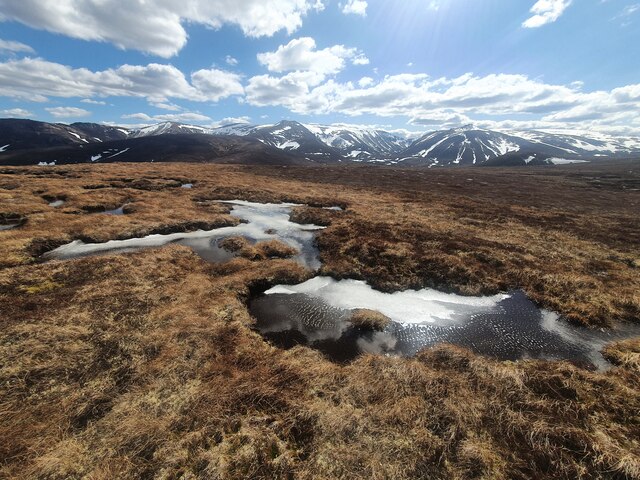
The Bruach, located in Banffshire, Scotland, is a prominent hill/mountain that offers breathtaking views and a range of outdoor activities for nature enthusiasts. Standing at an elevation of approximately 1,834 feet (559 meters), it dominates the surrounding landscape and forms part of the stunning Cairngorms National Park.

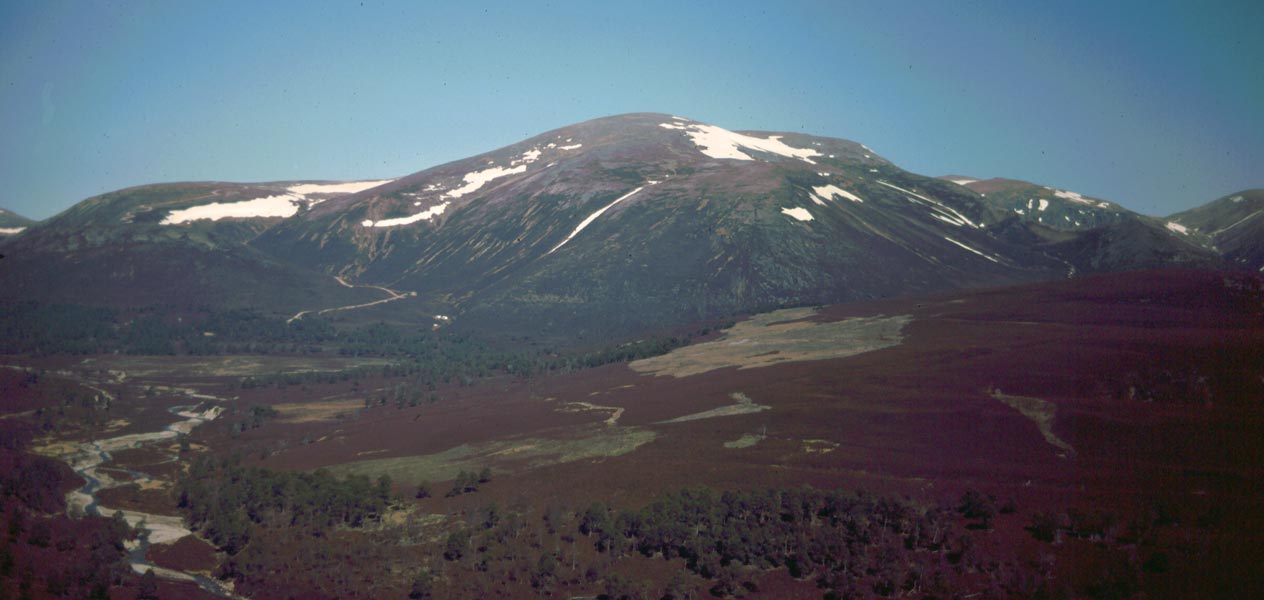
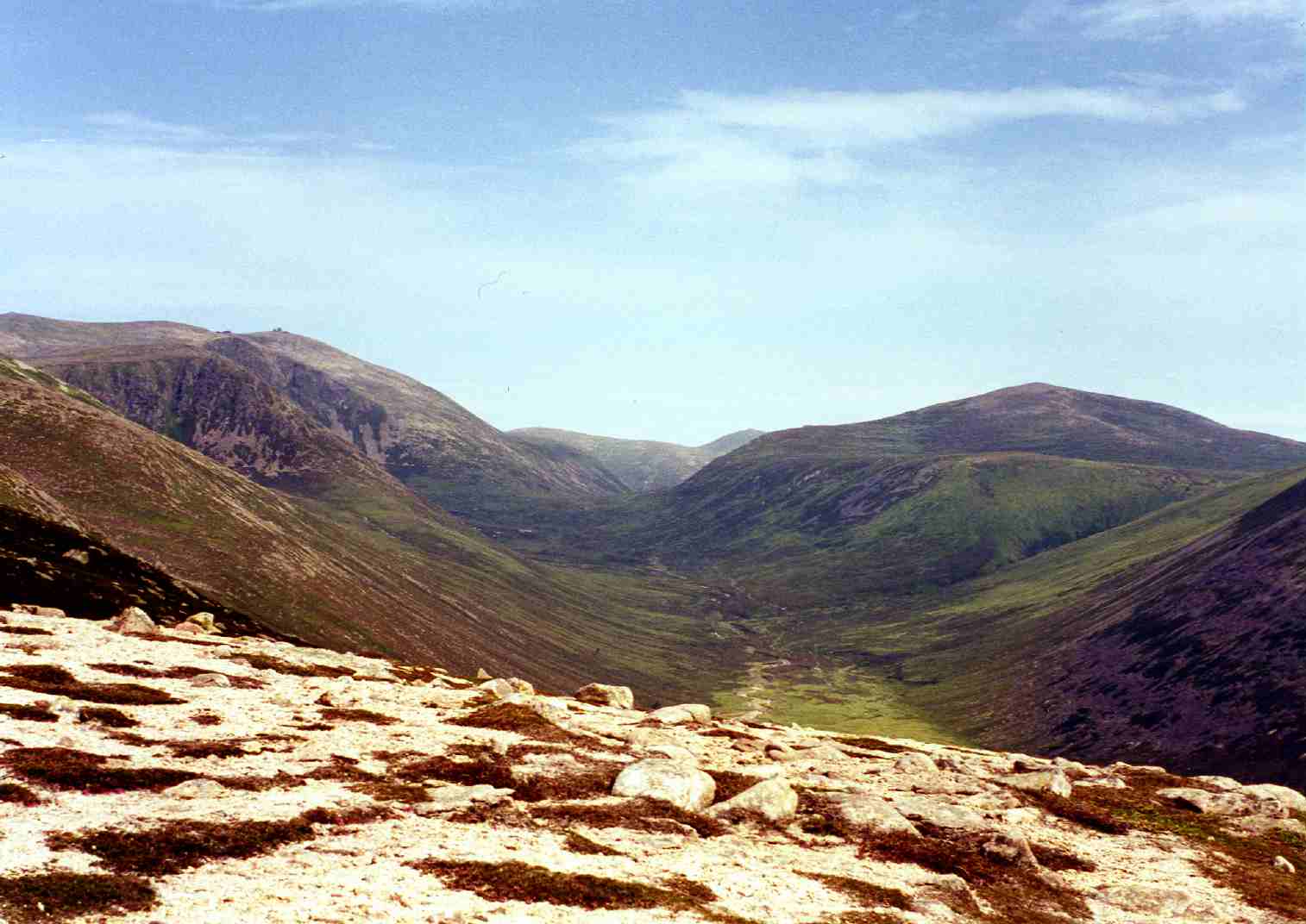
The Bruach is characterized by its distinctive rounded shape and lush green slopes, which are covered with heather and scattered with granite boulders. The summit provides panoramic vistas of the surrounding countryside, including the nearby Ben Rinnes and the Moray Firth coastline. On a clear day, one can even catch a glimpse of the Grampian Mountains to the west.

The ascent to the top of The Bruach is relatively moderate, making it accessible to hikers of various skill levels. The well-maintained trails wind through the picturesque countryside, offering opportunities to spot local wildlife such as red deer, mountain hares, and various bird species.

Outdoor enthusiasts can also enjoy other activities in the vicinity of The Bruach, including mountain biking, horseback riding, and rock climbing. The area is famous for its diverse flora and fauna, with rare alpine plants and wildflowers dotting the landscape.

Visitors to The Bruach are advised to come prepared with appropriate hiking gear, including sturdy footwear, waterproof clothing, and navigation tools. Additionally, it is essential to check weather conditions and be aware of potential hazards, such as sudden changes in visibility and challenging terrain.

If you have any feedback on the listing, please let us know in the comments section below.

The Bruach Images

Images are sourced within 2km of 57.132445/-3.4579459 or Grid Reference NJ1105. Thanks to Geograph Open Source API. All images are credited.

Ford, Allt nam Broighleag On an estate track which goes up Glen Avon to Faindouran.
Ford, Allt nam Broighleag
On an estate track which goes up Glen Avon to Faindouran.
Track in Glen Avon An estate track going up Glen Avon towards Faindouran.  Looking towards Beinn A' Bhuird.
Track in Glen Avon
An estate track going up Glen Avon towards Faindouran. Looking towards Beinn A' Bhuird.
River Avon north of The Bruach With Ben Avon in the distance.
River Avon north of The Bruach
With Ben Avon in the distance.
The Ponymen's Hut, Glen Avon A dilapidated shelter beside the River Avon.
The Ponymen's Hut, Glen Avon
A dilapidated shelter beside the River Avon.
Track in Glen Avon Passing below Leacann an Daimh on the way to Faindouran.
Track in Glen Avon
Passing below Leacann an Daimh on the way to Faindouran.
River Avon Passing below The Bruach on the right and Leacann an Daimh ahead on the left.
River Avon
Passing below The Bruach on the right and Leacann an Daimh ahead on the left.
Footbridge over the River Avon at the Ponymen's Hut A suspension bridge on a path towards Beinn A' Bhuird.
Footbridge over the River Avon at the Ponymen's Hut
A suspension bridge on a path towards Beinn A' Bhuird.
Moraine deposits in Glen Avon. Track down Glen Avon with glacial deposits visible beneath Ben Avon. Some of the Ben Avon tors can also be seen.
Moraine deposits in Glen Avon.
Track down Glen Avon with glacial deposits visible beneath Ben Avon. Some of the Ben Avon tors can also be seen.
Footbridge over the River Avon
Bridge over River Avon Wobbly bridge only suitable for pedestrians. Track and shed position slightly different to that shown on OS Map at time.
Bridge over River Avon
Wobbly bridge only suitable for pedestrians. Track and shed position slightly different to that shown on OS Map at time.
Icy pools Pools of water with the last remaining snow, near the 688m spot height
Icy pools
Pools of water with the last remaining snow, near the 688m spot height
Granite gravel patches The patches are caused by "wind and frost weakening and removing vegetation, leaving granite gravel patches" according to other Geograph submissions.
Granite gravel patches
The patches are caused by "wind and frost weakening and removing vegetation, leaving granite gravel patches" according to other Geograph submissions.
Pools of water on the plateau Looking towards Ben Avon
Pools of water on the plateau
Looking towards Ben Avon
Erratic boulders Looking towards Bynack Mor
Erratic boulders
Looking towards Bynack Mor
Bogwood root structure
Track cutting through granite gravel deposits The exposed fine granite gravel deposits, likely deposited as a result of water flow as opposed to glacial deposits, are clearly visible from higher up on the hillside and on aerial photographs
Track cutting through granite gravel deposits
The exposed fine granite gravel deposits, likely deposited as a result of water flow as opposed to glacial deposits, are clearly visible from higher up on the hillside and on aerial photographs
Track through deposited rocks and gravel
Ford over Allt an Daimh
Show me another place!

The Bruach is located at Grid Ref: NJ1105 (Lat: 57.132445, Lng: -3.4579459)

Unitary Authority: Moray

Police Authority: North East

What 3 Words

///peroxide.tradition.legal. Near Inverey, Aberdeenshire

Nearby Locations

The Bruach

Related Wikis

Ben Avon

Ben Avon (Scottish Gaelic: Beinn Athfhinn, 'mountain of the Avon') is a mountain in the Cairngorms of Scotland. It is a sprawling mountain with a broad...

Beinn a' Bhùird

Beinn a' Bhùird is a Munro in the Cairngorm mountain range of Scotland. In Watson (1975) the author suggests the mountain should be named Beinn Bòrd -...

Bynack More

Bynack More (Scottish Gaelic: A' Bheithneag Mhòr or Beinn Bheithneag) is a Scottish Mountain that is situated in the Cairngorms range, 16 kilometres east...

Beinn a' Chaorainn (Cairngorms)

Beinn a' Chaorainn is a Scottish mountain in the heart of the Cairngorms range. It is quite a remote hill, being located roughly 19 kilometres south east...

Nearby Amenities

Located within 500m of 57.132445,-3.4579459
The Bruach
Ele: 712
Natural: peak
Lat/Long: 57.1326998/-3.4578579
The data included in this document is from www.openstreetmap.org. The data is made available under ODbL.

Have you been to The Bruach?

Leave your review of The Bruach below (or comments, questions and feedback).