Burn Hill

Hill, Mountain in Somerset Somerset West and Taunton

England

Burn Hill

Milverton: Milverton Heath Looking south
Milverton: Milverton Heath Credit: Martin Bodman

Burn Hill is a prominent geographical feature located in Somerset, England. It is categorized as a hill rather than a mountain, as it falls short of the minimum elevation required to be classified as a mountain.

Situated in the picturesque Mendip Hills, Burn Hill stands at an elevation of approximately 312 meters (1,024 feet) above sea level. It offers breathtaking panoramic views of the surrounding countryside, making it a popular destination for hikers, nature enthusiasts, and photographers.

The hill is primarily composed of limestone, which is characteristic of the geological makeup of the Mendip Hills. The limestone formations give Burn Hill its distinctive appearance, with exposed cliffs and crags adding to its natural beauty.

Its location within the Mendip Hills Area of Outstanding Natural Beauty ensures that Burn Hill is well-preserved and protected. The hill is adorned with a diverse range of flora and fauna, including heather, gorse, and a variety of grasses. Wildlife such as rabbits, foxes, and various bird species can also be spotted in the area.

There are several walking trails that lead up to the summit of Burn Hill, allowing visitors to explore its natural wonders at their own pace. The ascent can be challenging in certain sections, but the rewarding views from the top make the effort worthwhile.

Overall, Burn Hill in Somerset offers a captivating natural experience, combining stunning vistas with geological interest and diverse wildlife. It continues to attract visitors from near and far, providing an opportunity to appreciate the beauty and tranquility of the British countryside.

If you have any feedback on the listing, please let us know in the comments section below.

Burn Hill Images

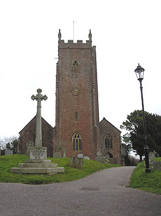
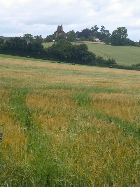
Images are sourced within 2km of 51.014362/-3.2634204 or Grid Reference ST1124. Thanks to Geograph Open Source API. All images are credited.

Milverton: Milverton Heath Looking south
Milverton: Milverton Heath
Looking south
Beeches near Spring Grove Cross A fine row of beeches towers above the road from Spring Grove Cross towards Milverton Heath.
Beeches near Spring Grove Cross
A fine row of beeches towers above the road from Spring Grove Cross towards Milverton Heath.
Leigh Farm <a href="https://www.geograph.org.uk/photo/1713641">ST0924 : Leigh Farm</a> seen from the further of the two gateways shown in <a href="https://www.geograph.org.uk/photo/1713705">ST0924 : Gates by the field path, Leigh Farm</a>. A pylon line makes its way eastwards between Leigh Furzes and Knappy Copse.
Leigh Farm
ST0924 : Leigh Farm seen from the further of the two gateways shown in ST0924 : Gates by the field path, Leigh Farm. A pylon line makes its way eastwards between Leigh Furzes and Knappy Copse.
Spring Grove Cross A crossroads where the lane from Bathealton to Milverton (straight ahead) crosses the road from Wiveliscombe (left) to Wellington.
Spring Grove Cross
A crossroads where the lane from Bathealton to Milverton (straight ahead) crosses the road from Wiveliscombe (left) to Wellington.
Spring Grove Cross Another view of <a href="https://www.geograph.org.uk/photo/1713903">ST0924 : Spring Grove Cross</a>, looking along the road to Wiveliscombe. Wilsombe Wood (private) on the right, appears on maps as Wiveliscombe Covert.
Spring Grove Cross
Another view of ST0924 : Spring Grove Cross, looking along the road to Wiveliscombe. Wilsombe Wood (private) on the right, appears on maps as Wiveliscombe Covert.
Field near Spring Grove Cross Looking to the right from the road shown in <a href="https://www.geograph.org.uk/photo/1700447">ST0925 : Beeches near Spring Grove Cross</a>. Beyond the confines of the field, the view passes into <a href="https://www.geograph.org.uk/gridref/ST1025">ST1025</a>.
Field near Spring Grove Cross
Looking to the right from the road shown in ST0925 : Beeches near Spring Grove Cross. Beyond the confines of the field, the view passes into ST1025.
Woodland track, Quarry Plantation A track leaving, though not really accessible from, the lane shown in <a href="https://www.geograph.org.uk/photo/1700447">ST0925 : Beeches near Spring Grove Cross</a>, and leading though woodland on Milverton Heath.
Woodland track, Quarry Plantation
A track leaving, though not really accessible from, the lane shown in ST0925 : Beeches near Spring Grove Cross, and leading though woodland on Milverton Heath.
Taunton Deane : Country Lane A small lane heading through the countryside.
Taunton Deane : Country Lane
A small lane heading through the countryside.
Taunton Deane : Country Lane Looking along a small country lane.
Taunton Deane : Country Lane
Looking along a small country lane.
Taunton Deane : Spring Grove Cross Looking along Stone Hill Lane from Spring Grove Cross.
Taunton Deane : Spring Grove Cross
Looking along Stone Hill Lane from Spring Grove Cross.
Taunton Deane : Spring Grove Cross Looking along the road from Spring Grove Cross.
Taunton Deane : Spring Grove Cross
Looking along the road from Spring Grove Cross.
Taunton Deane : Country Road A road heading through the countryside.
Taunton Deane : Country Road
A road heading through the countryside.
Autumn colour, Wiveliscombe Covert
Road to Milverton from Milverton Heath
Pylon south of Leigh Furzes
Road through Knappy Copse
Milverton: North Street Looking east down this largely Georgian street. Thomas Young, professor of physics at the Royal Institution was born here in 1733. He formulated the wave theory of light and was involved in the decryption of Egyptian hieroglyphs
Milverton: North Street
Looking east down this largely Georgian street. Thomas Young, professor of physics at the Royal Institution was born here in 1733. He formulated the wave theory of light and was involved in the decryption of Egyptian hieroglyphs
Milverton: Fore Street The Globe stands by the turning to Houndsmoor, on the right
Milverton: Fore Street
The Globe stands by the turning to Houndsmoor, on the right
Show me another place!

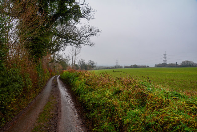
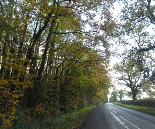
Burn Hill is located at Grid Ref: ST1124 (Lat: 51.014362, Lng: -3.2634204)

Administrative County: Somerset

District: Somerset West and Taunton

Police Authority: Avon and Somerset

What 3 Words

///scorched.punk.lamenting. Near Milverton, Somerset

Related Wikis

Milverton, Somerset

Milverton is a village and civil parish in Somerset, England, situated in the valley of the River Tone 5 miles (8.0 km) west of Taunton. The village has...

The Old House, Milverton

The Old House in Milverton in Somerset, England is a Grade II* listed building dating from the late 14th and early 15th century, although there may also...

Langford Budville

Langford Budville is a village and civil parish in Somerset, England, situated near the River Tone 2 miles (3.2 km) north-west of Wellington, 4.5 miles...

Langford Heathfield

Langford Heathfield (grid reference ST100235) is a 95.4 hectare (235.7 acre) biological Site of Special Scientific Interest at Langford Budville, 3 km...

Nearby Amenities

Located within 500m of 51.014362,-3.2634204
Power: tower
Source: bing
Lat/Long: 51.0103121/-3.2608695
Power: tower
Source: bing
Lat/Long: 51.01039/-3.2650229
Direction: forward
Maxspeed: 40 mph
Source Maxspeed: sign
Traffic Sign: maxspeed
Lat/Long: 51.0184723/-3.2617859
Power: pole
Lat/Long: 51.0177639/-3.2600507
Power: pole
Lat/Long: 51.0176154/-3.2618237
Power: pole
Lat/Long: 51.0176121/-3.2633069
Power: pole
Lat/Long: 51.0176475/-3.2647526
Power: pole
Lat/Long: 51.0176694/-3.2661957
Power: pole
Lat/Long: 51.0176745/-3.2676575
The data included in this document is from www.openstreetmap.org. The data is made available under ODbL.

Have you been to Burn Hill?

Leave your review of Burn Hill below (or comments, questions and feedback).