Cerrig Coediog

Hill, Mountain in Merionethshire

Wales

Cerrig Coediog

Heather moorland in spring East of the upper valley of Nant y Lladron.
Heather moorland in spring Credit: John H Darch

Cerrig Coediog is a prominent hill/mountain located in the historic county of Merionethshire, Wales. It is situated in the southern part of the country, near the town of Dolgellau. The hill stands at an elevation of approximately 1,540 feet (470 meters) above sea level, making it a notable feature in the landscape.

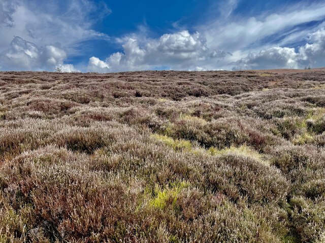
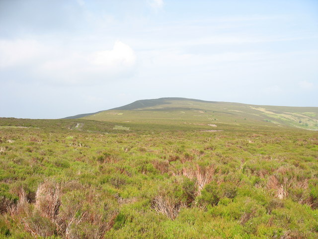
Cerrig Coediog is characterized by its rugged and rocky terrain, with the name itself translating to "stony hills" in English. The hill is composed of various types of rocks, including slate and quartzite, adding to its unique geological makeup. Its steep slopes and craggy peaks offer breathtaking panoramic views of the surrounding countryside.

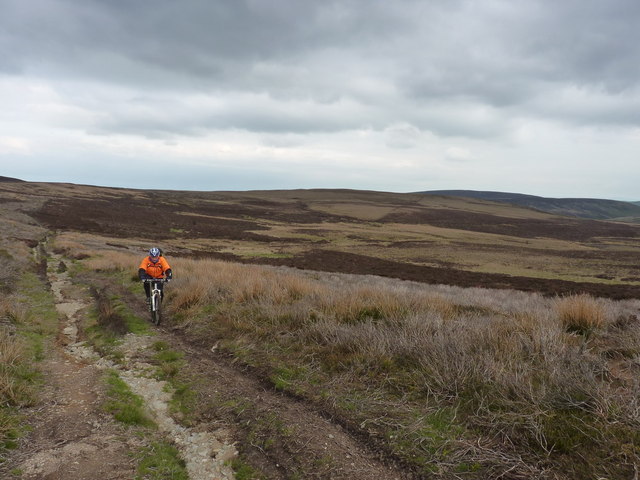
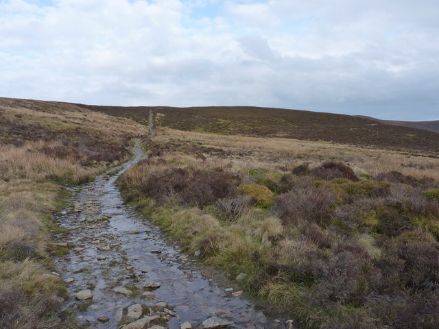
The hill is a popular destination for hikers and outdoor enthusiasts, who are drawn to its challenging trails and scenic beauty. There are several well-marked paths that lead to the summit, providing visitors with opportunities for exploration and adventure. The ascent can be demanding, but it is rewarded with stunning vistas of the nearby Snowdonia National Park and the Mawddach Estuary.

The area surrounding Cerrig Coediog is rich in biodiversity, with a variety of flora and fauna calling it home. The hill is covered in heather and grasses, and it is not uncommon to spot wildflowers and bird species along the way. The hillside also provides habitat for mammals such as foxes, rabbits, and occasionally, sheep.

Overall, Cerrig Coediog stands as a prominent natural landmark in Merionethshire, offering visitors a chance to immerse themselves in the beauty of the Welsh countryside and enjoy a rewarding outdoor experience.

If you have any feedback on the listing, please let us know in the comments section below.

Cerrig Coediog Images

Images are sourced within 2km of 52.937585/-3.321136 or Grid Reference SJ1138. Thanks to Geograph Open Source API. All images are credited.

Heather moorland in spring East of the upper valley of Nant y Lladron.
Heather moorland in spring
East of the upper valley of Nant y Lladron.
The Nant Croes-y-wernen Bronze Age stone circle A little-known, but quite distinct, stone circle just above the stream. 4 stones of the original 8 or 9 remain (3 including the main, westernmost one, are visible in this picture.) The original diameter of the circle would have been about 8 or 9 metres. Coflein report at <span class="nowrap"><a title="http://www.coflein.gov.uk/en/site/281135/details/NANT+CROES-Y-WERNEN%2C+STONE+CIRCLE/" rel="nofollow ugc noopener" href="http://www.coflein.gov.uk/en/site/281135/details/NANT+CROES-Y-WERNEN%2C+STONE+CIRCLE/">Link</a><img style="margin-left:2px;" alt="External link" title="External link - shift click to open in new window" src="https://s1.geograph.org.uk/img/external.png" width="10" height="10"/></span>
The Nant Croes-y-wernen Bronze Age stone circle
A little-known, but quite distinct, stone circle just above the stream. 4 stones of the original 8 or 9 remain (3 including the main, westernmost one, are visible in this picture.) The original diameter of the circle would have been about 8 or 9 metres. Coflein report at LinkExternal link
An unmarked cist burial? We found this stone-lined hole in a grassy 'field' while dropping down into the valley to camp. It is roughly 4'x 2', and nowadays about 12" deep, just about big enough for a crouching burial. The Coflein website makes no mention of it, but does record a number of other Bronze Age relics nearby, including the stone circle at <a href="https://www.geograph.org.uk/photo/2942460">SJ0939 : The Nant Croes-y-wernen Bronze Age stone circle</a>
An unmarked cist burial?
We found this stone-lined hole in a grassy 'field' while dropping down into the valley to camp. It is roughly 4'x 2', and nowadays about 12" deep, just about big enough for a crouching burial. The Coflein website makes no mention of it, but does record a number of other Bronze Age relics nearby, including the stone circle at SJ0939 : The Nant Croes-y-wernen Bronze Age stone circle
Wild camp by the Nant Croes-y-wernen A campsite in the gloom of the evening, an hour or so before rain set in for the night.
Wild camp by the Nant Croes-y-wernen
A campsite in the gloom of the evening, an hour or so before rain set in for the night.
Wild camp by the Nant Croes-y-wernen Making breakfast at a superb little campsite beside the stream - some sun to warm your back, and all's well with the world.
Wild camp by the Nant Croes-y-wernen
Making breakfast at a superb little campsite beside the stream - some sun to warm your back, and all's well with the world.
Surface Remains, Moel Fferna Slate Mine Extensive underground workings can only be accessed through an air shaft.
Surface Remains, Moel Fferna Slate Mine
Extensive underground workings can only be accessed through an air shaft.
Down into Dolydd Ceiriog From the track that climbs northwards, a view down to the rather marshy bogs of Dolydd Ceiriog. Bryn Du is the heathery hill in the background.
Down into Dolydd Ceiriog
From the track that climbs northwards, a view down to the rather marshy bogs of Dolydd Ceiriog. Bryn Du is the heathery hill in the background.
Riding out of Dolydd Ceiriog The track, theoretically, is a 4x4 road, but it's so rutted by the trailbikes in places that it's probably not negotiable in a vehicle. Good mountain bike country, though.
Riding out of Dolydd Ceiriog
The track, theoretically, is a 4x4 road, but it's so rutted by the trailbikes in places that it's probably not negotiable in a vehicle. Good mountain bike country, though.
A wet section on the flank of Cerrig-duon Most of this track is pretty dry, but just here it takes some drainage, and is a bit damper.
A wet section on the flank of Cerrig-duon
Most of this track is pretty dry, but just here it takes some drainage, and is a bit damper.
A short piece of stone wall The wall appears to form part of an older field boundary, which can be traced running up the hillside of Cerrig-duon just to the east.
A short piece of stone wall
The wall appears to form part of an older field boundary, which can be traced running up the hillside of Cerrig-duon just to the east.
Trailbike damage on the SE side of Moel Fferna Well, obviously, if you have an off-road trailbike, it'd never do to get it dirty or wet - so you go round the puddle, and make the track ever wider...
Trailbike damage on the SE side of Moel Fferna
Well, obviously, if you have an off-road trailbike, it'd never do to get it dirty or wet - so you go round the puddle, and make the track ever wider...
Riding up towards Bwlch Cynwyd Riding up the track from Dolydd Ceiriog, towards the saddle on the southern side of Moel Fferna, and an overnight camp in the valley of the Nant Croes-y-wernen.
Riding up towards Bwlch Cynwyd
Riding up the track from Dolydd Ceiriog, towards the saddle on the southern side of Moel Fferna, and an overnight camp in the valley of the Nant Croes-y-wernen.
Looking down Moel Fferna The trailbikes (apparently) have started to ride up and down here. That's not improving the vegetation at all.
Looking down Moel Fferna
The trailbikes (apparently) have started to ride up and down here. That's not improving the vegetation at all.
From the summit cairn to the Berwyns main ridge
The North Berwyn Way on the slopes of Moel Fferna A great mountain bike ride (downhill) - it'd be a flog going up.
The North Berwyn Way on the slopes of Moel Fferna
A great mountain bike ride (downhill) - it'd be a flog going up.
Nant Fawr sheepfold The ruins of a fairly recent (rather than pre-historic) sheepfold, built of quarried slabs, on the eastern bank of the Nant Fawr stream. Coflein report at <span class="nowrap"><a title="http://www.coflein.gov.uk/en/site/281003/details/NANT+FAWR%2C+SHEEP+FOLD/" rel="nofollow ugc noopener" href="http://www.coflein.gov.uk/en/site/281003/details/NANT+FAWR%2C+SHEEP+FOLD/">Link</a><img style="margin-left:2px;" alt="External link" title="External link - shift click to open in new window" src="https://s1.geograph.org.uk/img/external.png" width="10" height="10"/></span>
Nant Fawr sheepfold
The ruins of a fairly recent (rather than pre-historic) sheepfold, built of quarried slabs, on the eastern bank of the Nant Fawr stream. Coflein report at LinkExternal link
Nant Fach sheepfold I and shelter The remains of a shepherd's shelter (adjacent to a sheepfold) in the crook of the Nant Fach stream, just above its junction with the Nant Croes-y-wernen. A place of serenity and history - long may it remain this way.
It's called Sheepfold I by Coflein at <span class="nowrap"><a title="http://www.coflein.gov.uk/en/site/281005/details/NANT+FACH%2C+SHEEP+FOLD+I/," rel="nofollow ugc noopener" href="http://www.coflein.gov.uk/en/site/281005/details/NANT+FACH%2C+SHEEP+FOLD+I/,">Link</a><img style="margin-left:2px;" alt="External link" title="External link - shift click to open in new window" src="https://s1.geograph.org.uk/img/external.png" width="10" height="10"/></span> as there is another (yep, Sheepfold II) a little further up the valley.
Nant Fach sheepfold I and shelter
The remains of a shepherd's shelter (adjacent to a sheepfold) in the crook of the Nant Fach stream, just above its junction with the Nant Croes-y-wernen. A place of serenity and history - long may it remain this way. It's called Sheepfold I by Coflein at LinkExternal link as there is another (yep, Sheepfold II) a little further up the valley.
The confluence of streams The confluence of the Nant Fach (left) with the Nant Croes-y-wernen in the valley. A flat floor and the easy access to water would make this a cracking little campsite.
The confluence of streams
The confluence of the Nant Fach (left) with the Nant Croes-y-wernen in the valley. A flat floor and the easy access to water would make this a cracking little campsite.
Show me another place!

Cerrig Coediog is located at Grid Ref: SJ1138 (Lat: 52.937585, Lng: -3.321136)

Unitary Authority: Denbighshire

Police Authority: North Wales

What 3 Words

///composes.purified.banana. Near Llandrillo, Denbighshire

Nearby Locations

Cerrig Coediog

Related Wikis

Moel Fferna

Moel Fferna is a mountain in Denbighshire, Wales and forms part of the Berwyn range. It is the most northern outpost of the range. The summit is covered...

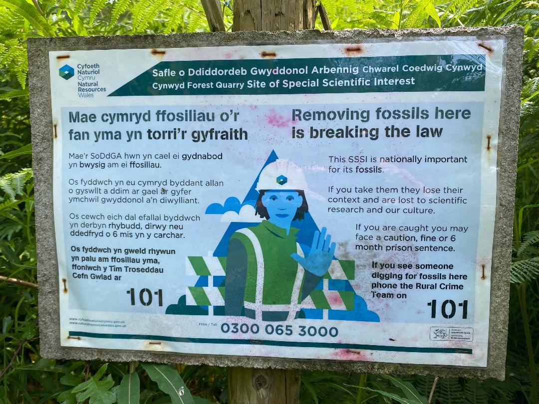
Cynwyd Forest Quarry

Sometimes referred to in literature as 'Bwlch y Gaseg' and in very close proximity to the area named as such on OS Map (six-inch to the mile) 1888-1913...

Deeside and Moelfferna quarries

The Deeside and Moelfferna quarries were neighbouring slate quarries, near Glyndyfrdwy in North Wales. They were both operated by the same company throughout...
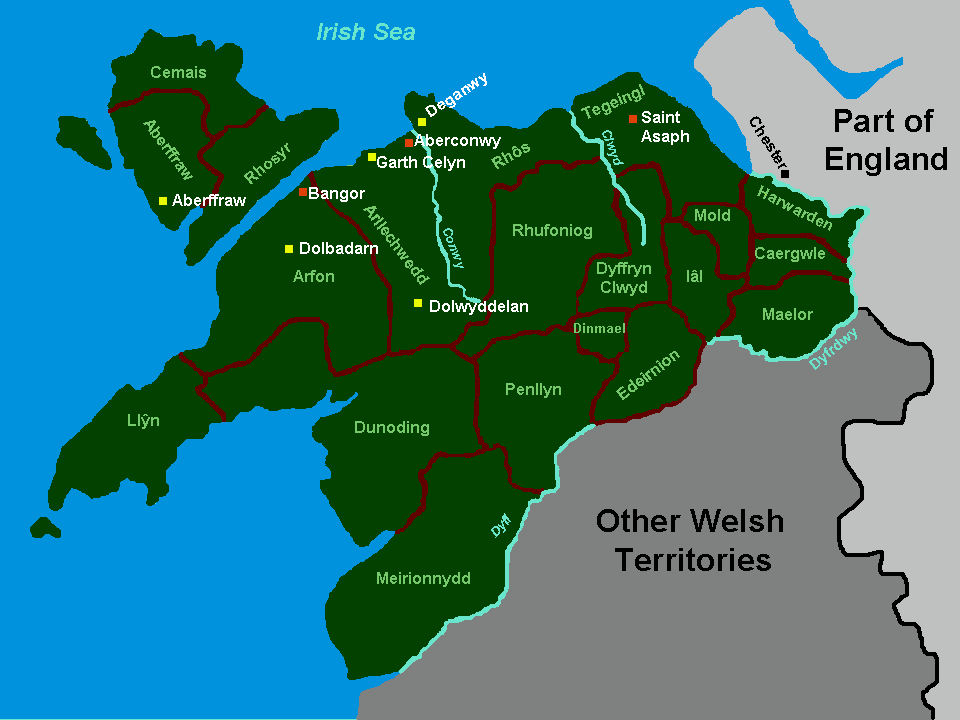
Rhufoniog

Rhufoniog was a small sub-kingdom of the Dark Ages Gwynedd, and later a cantref in medieval Wales. == Geography == The cantref Rhos lay between it and...

Nearby Amenities

Located within 500m of 52.937585,-3.321136
Cerrig Coediog
Ele: 593
Natural: peak
Source: NPE
Lat/Long: 52.9376081/-3.3201081
The data included in this document is from www.openstreetmap.org. The data is made available under ODbL.

Have you been to Cerrig Coediog?

Leave your review of Cerrig Coediog below (or comments, questions and feedback).