Inver Hill

Hill, Mountain in Caithness

Scotland

Inver Hill

Road on Inver Hill A loop of rough road between the sea and A9 road.
Road on Inver Hill Credit: Richard Webb

Inver Hill is a prominent hill located in the county of Caithness, in the northernmost part of mainland Scotland. Rising to an elevation of approximately 231 meters (758 feet), it is considered a significant landmark in the region. Situated near the village of Reay, Inver Hill offers breathtaking panoramic views of the surrounding countryside, including the North Sea to the north and the rolling hills and farmland to the south.

The hill is characterized by its gently sloping sides, covered in patches of heather, grasses, and occasional shrubs. Its summit is relatively flat and provides an ideal vantage point for visitors to admire the picturesque surroundings. On clear days, it is possible to spot several other prominent hills and mountains in the distance, adding to the allure of the landscape.

Inver Hill is a popular destination for hikers and nature enthusiasts, offering various walking trails that cater to different levels of fitness and experience. The ascent to the top is relatively moderate, making it accessible for most people. The hill also provides opportunities for birdwatching, as it is home to a variety of bird species, including kestrels and buzzards, which can often be seen soaring above.

The area surrounding Inver Hill is rich in history, with several ancient archaeological sites nearby, including brochs and standing stones. These remnants from the past add an additional layer of intrigue and fascination to the hill and its surroundings.

Overall, Inver Hill in Caithness offers visitors a chance to immerse themselves in the natural beauty and history of the region, providing a memorable experience for all who venture to its summit.

If you have any feedback on the listing, please let us know in the comments section below.
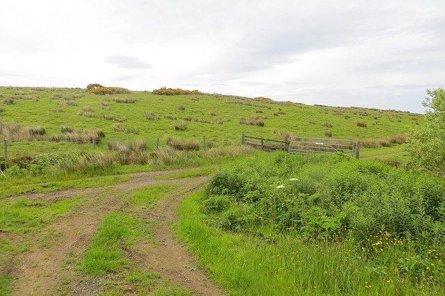
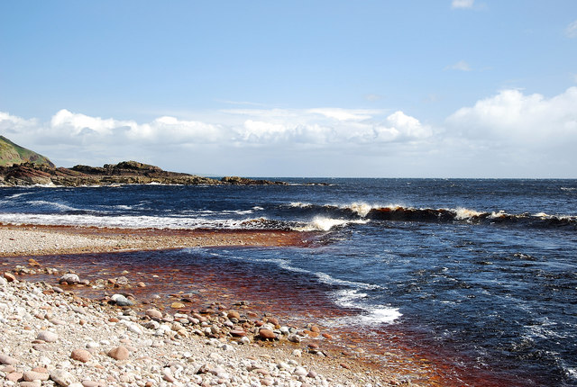
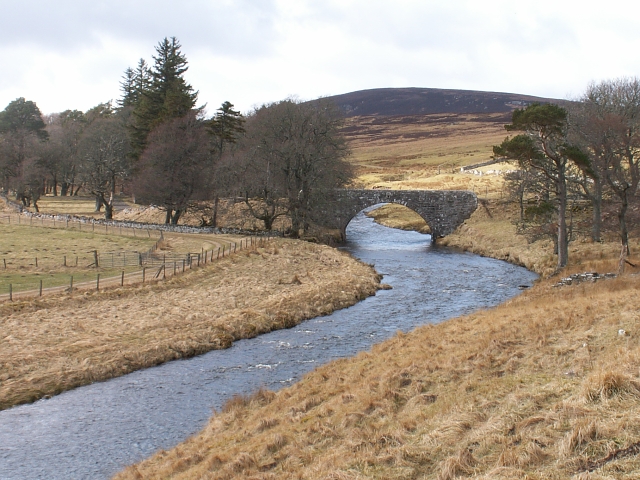
Inver Hill Images

Images are sourced within 2km of 58.1753/-3.5102897 or Grid Reference ND1121. Thanks to Geograph Open Source API. All images are credited.

Road on Inver Hill A loop of rough road between the sea and A9 road.
Road on Inver Hill
A loop of rough road between the sea and A9 road.
Gated track into woodland Off the A9.
Gated track into woodland
Off the A9.
A9 towards Dunbeath Heading east.
A9 towards Dunbeath
Heading east.
Heading east on the A9 Towards Dunbeath.
Heading east on the A9
Towards Dunbeath.
Lookout Post among felled trees above Langwell, Caithness This wooden platform would at one time have been hidden among the trees.  It has now been exposed by tree felling.
Lookout Post among felled trees above Langwell, Caithness
This wooden platform would at one time have been hidden among the trees. It has now been exposed by tree felling.
Track near Cnoc na Croiche, Caithness, Scotland  A path on the east coast of Caithness, just south of Berriedale Braes.
Track near Cnoc na Croiche, Caithness, Scotland
A path on the east coast of Caithness, just south of Berriedale Braes.
Burial ground amongst the whins Many graveyards in Northern Scotland overlook the sea or a loch. This one at Berriedale cuts a square out of the free flowering gorse (known as whins in this part of the world).
Burial ground amongst the whins
Many graveyards in Northern Scotland overlook the sea or a loch. This one at Berriedale cuts a square out of the free flowering gorse (known as whins in this part of the world).
Berriedale Beach Attractive stony beach where the peaty Waters of Langwell and Berriedale flow into the crystal clear sea waters.
Berriedale Beach
Attractive stony beach where the peaty Waters of Langwell and Berriedale flow into the crystal clear sea waters.
Woodland Walk Through the woods of Langwell to gain access to the open countryside.
Woodland Walk
Through the woods of Langwell to gain access to the open countryside.
Driveways at Langwell An abundance of bluebells graced the roads.
Driveways at Langwell
An abundance of bluebells graced the roads.
Berriedale quay This old quay at Berriedale is still used occasionally. The aerial ropeway behind provides access to the cottages on the beach.
Berriedale quay
This old quay at Berriedale is still used occasionally. The aerial ropeway behind provides access to the cottages on the beach.
Berriedale Braes For traffic heading north for the first time drivers may find it a hair raising experience if they descend too fast.
Berriedale Braes
For traffic heading north for the first time drivers may find it a hair raising experience if they descend too fast.
Berriedale war memorial
Inver Hill A9 The track on the hill, along with the hillside and distant North Sea come to that are now all almost hidden by the trees that appear to have just been planted when we took this photo.
Inver Hill A9
The track on the hill, along with the hillside and distant North Sea come to that are now all almost hidden by the trees that appear to have just been planted when we took this photo.
Berriedale Bridge, Highland The view from the approach on the A9 from the north.
Berriedale Bridge, Highland
The view from the approach on the A9 from the north.
Trees by the A9 lay-by before the drop into Berriedale
A9 through Berriedale
One of the Berriedale Navigation Beacon Towers Category B listed early 19th century beacon. These beacons appear to serve as navigation aids for safe entry into Berriedale shore when lined one against the other by boat at sea. They stand one behind the other on cliff top.
One of the Berriedale Navigation Beacon Towers
Category B listed early 19th century beacon. These beacons appear to serve as navigation aids for safe entry into Berriedale shore when lined one against the other by boat at sea. They stand one behind the other on cliff top.
Show me another place!

Inver Hill is located at Grid Ref: ND1121 (Lat: 58.1753, Lng: -3.5102897)

Unitary Authority: Highland

Police Authority: Highlands and Islands

What 3 Words

///spider.entertainer.crouches. Near Dunbeath, Highland

Related Wikis

Berriedale Castle

Berriedale Castle is a ruined castle located on a promontory on the south of the entrance to the Berriedale Water, Caithness in Scotland. == Structure... ==

Berriedale Water

Berriedale Water is a short river in Caithness in northern Scotland. It arises as the Feith Gaineimh Mhor, Feith Chaorunn Mhor and Feith Fhuaran come together...

Berriedale Church

Berriedale Church is a former church in the parish of Latheron, in Berriedale, Caithness, Scotland. Built in 1826, the T-plan building was closed as a...

Berriedale, Highland

Berriedale (Scottish Gaelic: Bearghdal) is a small estate village on the northern east coast of Caithness, Scotland, on the A9 road between Helmsdale and...

Nearby Amenities

Located within 500m of 58.1753,-3.5102897
The data included in this document is from www.openstreetmap.org. The data is made available under ODbL.

Have you been to Inver Hill?

Leave your review of Inver Hill below (or comments, questions and feedback).