Banc Gorddwr

Hill, Mountain in Radnorshire

Wales

Banc Gorddwr

B4355 road near Black Gate
B4355 road near Black Gate Credit: Richard Law

Banc Gorddwr, located in the county of Radnorshire in Wales, is a prominent hill/mountain that stands at an elevation of approximately 1,530 feet (466 meters). It is situated in the heart of the Cambrian Mountains, making it a popular destination for hikers, nature enthusiasts, and those seeking breathtaking panoramic views.

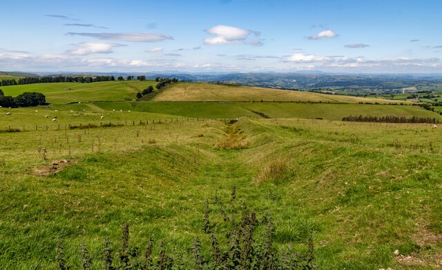
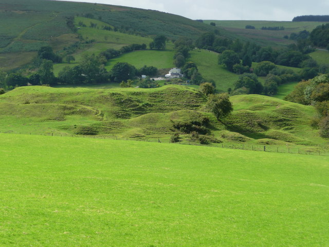
The hill/mountain is characterized by its rugged terrain and distinct geological features, including exposed rocky outcrops and steep slopes. It is predominantly covered in heather and grasses, creating a beautiful contrast of colors throughout the year. The area is also home to a variety of wildlife, such as red kites, buzzards, and mountain sheep, adding to the natural charm of the landscape.

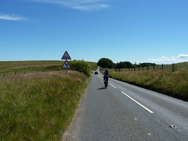
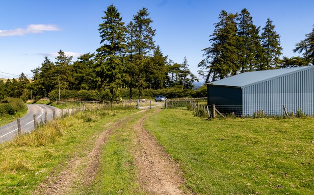
Access to Banc Gorddwr is typically achieved via footpaths and trails that wind their way through the surrounding moorland and forestry. These paths offer varying levels of difficulty, catering to both experienced hikers and those looking for a more leisurely stroll. At the summit, visitors are rewarded with breathtaking panoramic views of the surrounding countryside, including the neighboring peaks and valleys of the Cambrian Mountains.

Banc Gorddwr is not only a natural gem but also holds historical significance. The hill/mountain has witnessed human activity dating back centuries, with evidence of ancient settlements and prehistoric remains in the area. It has become an important site for archaeological research and exploration.

Overall, Banc Gorddwr is a captivating destination for outdoor enthusiasts, providing an opportunity to immerse oneself in the stunning natural beauty and rich history of Radnorshire.

If you have any feedback on the listing, please let us know in the comments section below.

Banc Gorddwr Images

Images are sourced within 2km of 52.442585/-3.3077748 or Grid Reference SO1183. Thanks to Geograph Open Source API. All images are credited.

B4355 road near Black Gate
B4355 near Ciderhouse Wood
Approaching the cattle grid and junction at Crugynnau
The minor road across Banc Gorddwr An unfenced section of the narrow lane across the moor.
The minor road across Banc Gorddwr
An unfenced section of the narrow lane across the moor.
Sweeping right-hander on the road across Banc Gorddwr
Tumulus on Banc Gorddwr (Windy Hall barrow) Barely recognisable unless you make a specific effort to find it, this probable Bronze Age burial mound is 21m across and roughly 1m high. It was investigated in the 1970s, but had long since been disturbed before then. The disturbance may have been caused by sheep, or rabbits burrowing.
Tumulus on Banc Gorddwr (Windy Hall barrow)
Barely recognisable unless you make a specific effort to find it, this probable Bronze Age burial mound is 21m across and roughly 1m high. It was investigated in the 1970s, but had long since been disturbed before then. The disturbance may have been caused by sheep, or rabbits burrowing.
A small pool on the moor above Blaen-nant-du
Approaching a cattle grid on the moorland road
Moorland road on the hill above Pant Glas
Two Tumps Viewpoint at Two Tumps.
Two Tumps
Viewpoint at Two Tumps.
Kerry Ridgeway From the <span class="nowrap"><a title="http://www.shropshiresgreatoutdoors.co.uk/" rel="nofollow ugc noopener" href="http://www.shropshiresgreatoutdoors.co.uk/">Link</a><img style="margin-left:2px;" alt="External link" title="External link - shift click to open in new window" src="https://s1.geograph.org.uk/img/external.png" width="10" height="10"/></span> website: This ancient path is 15 miles (24 km) long, journeying from Cider House Farm, near the village of Kerry, to Bishop's Castle. It holds a long tradition as a trade and drovers’ route from Wales to the lowland English markets.

The route follows a ridgetop overlooking Wales on the one side and England on the other. It never dips below 1000 ft (300 m)above sea level, resulting in remarkable views in all directions.  The ancient pathway forges a route through heather moors, woodlands and bilberry-rich heaths.  The Kerry Ridgeway is a mix of country road, trackway and bridleway across fields and is suitable for cycling and horse riding.

The Kerry Ridgeway is one of the oldest routes in Wales and was used by drovers to drive livestock out of Wales into England.  As the name suggests it maintains high ground for its duration offering wonderful views over the surrounding border countryside as it links Powys with Shropshire. Idyllic on a fine day however no doubt it was far from pleasant in wind and rain. On a clear day it is possible to see up to 70 miles.
Kerry Ridgeway
From the LinkExternal link website: This ancient path is 15 miles (24 km) long, journeying from Cider House Farm, near the village of Kerry, to Bishop's Castle. It holds a long tradition as a trade and drovers’ route from Wales to the lowland English markets. The route follows a ridgetop overlooking Wales on the one side and England on the other. It never dips below 1000 ft (300 m)above sea level, resulting in remarkable views in all directions. The ancient pathway forges a route through heather moors, woodlands and bilberry-rich heaths. The Kerry Ridgeway is a mix of country road, trackway and bridleway across fields and is suitable for cycling and horse riding. The Kerry Ridgeway is one of the oldest routes in Wales and was used by drovers to drive livestock out of Wales into England. As the name suggests it maintains high ground for its duration offering wonderful views over the surrounding border countryside as it links Powys with Shropshire. Idyllic on a fine day however no doubt it was far from pleasant in wind and rain. On a clear day it is possible to see up to 70 miles.
Cross Dyke Looking down the Cross Dyke earthwork from the Kerry Ridgeway.
Cross Dyke
Looking down the Cross Dyke earthwork from the Kerry Ridgeway.
Kerry Ridgeway The car park at the West end of the Kerry Ridgeway at Cider House Farm.
Kerry Ridgeway
The car park at the West end of the Kerry Ridgeway at Cider House Farm.
Crugynnau Sheep grazing at Crugynnau.
Crugynnau
Sheep grazing at Crugynnau.
Cider House Farm Fencing renewal on Cider House Farm.
Cider House Farm
Fencing renewal on Cider House Farm.
Source of the River Teme
Cilfaesty Hill Source of a tributary to the River Teme, beneath Cilfeasty Hill.
Cilfaesty Hill
Source of a tributary to the River Teme, beneath Cilfeasty Hill.
Bwlch-y-llyn Stream above Bwlch-y-llyn.
Bwlch-y-llyn
Stream above Bwlch-y-llyn.
Show me another place!

Banc Gorddwr is located at Grid Ref: SO1183 (Lat: 52.442585, Lng: -3.3077748)

Unitary Authority: Powys

Police Authority: Dyfed Powys

What 3 Words

///mason.boast.adjusting. Near Mochdre, Powys

Nearby Locations

Banc Gorddwr

Related Wikis

Mid Wales

Mid Wales (Welsh: Canolbarth Cymru or simply Y Canolbarth, meaning "the midlands") or Central Wales is a region of Wales, encompassing its midlands, in...

Dolfor

Dolfor is a small hamlet in the north of Powys, Wales. It is located about three miles to the south of Newtown, at the junction of the B4355 and A483 roads...

Bryn Amlwg Castle

Bryn Amlwg Castle (Welsh: Castell Bryn Amlwg, lit. 'castle on a prominent hill') was an enclosure castle near Anchor, Shropshire, abutting the England...

Llanbadarn Fynydd

Llanbadarn Fynydd (meaning Church of Padarn in the mountain) is a village and community in Radnorshire, Powys, Wales, and is 63 miles (101 km) from Cardiff...

Anchor, Shropshire

Anchor is a remote hamlet in southwest Shropshire, England. The hamlet is the most westerly place in Shropshire. == Geography == Anchor lies only 400 metres...

Mochdre, Powys

Mochdre () is a small village in the community of Mochdre with Penstrowed, in Montgomeryshire, Powys, Wales. == Geography == About 3 miles (4.8 km) southwest...

Mochdre with Penstrowed

Mochdre with Penstrowed (Welsh: Mochdre gyda Phenystrywaid), or just Mochdre, is a community in Montgomeryshire, Powys, Wales. The community includes Mochdre...

Garthmyl Hall, Berriew

Garthmyl Hall is a Grade II listed house in Berriew, in the historic county of Montgomeryshire, now Powys. The house stood close to the site of a large...

Nearby Amenities

Located within 500m of 52.442585,-3.3077748
Gorddwr Bank
Ele: 489
Natural: peak
Lat/Long: 52.4425379/-3.3054556
The data included in this document is from www.openstreetmap.org. The data is made available under ODbL.

Have you been to Banc Gorddwr?

Leave your review of Banc Gorddwr below (or comments, questions and feedback).