Byrehope Mount
Hill, Mountain in Peeblesshire
Scotland
Byrehope Mount

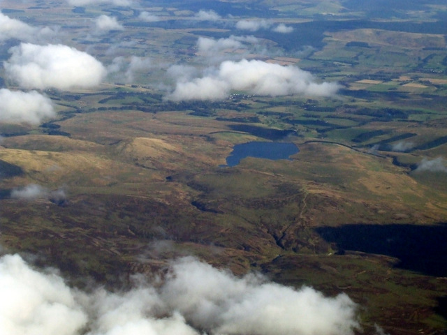
Byrehope Mount is a prominent hill located in Peeblesshire, in the southern part of Scotland. It is part of the wider Tweed Valley, which is known for its stunning landscape and natural beauty. Standing at an elevation of approximately 1,400 feet (427 meters), Byrehope Mount offers breathtaking panoramic views of the surrounding countryside.
The hill is primarily made up of rolling grassy slopes, with scattered areas of rocky outcrops and heather moorland. The terrain is relatively gentle, making it accessible for walkers and hikers of varying skill levels. Several well-marked trails lead to the summit, providing visitors with an opportunity to explore the diverse flora and fauna that inhabit the area.
From the top of Byrehope Mount, one can enjoy sweeping vistas of the lush valleys, meandering rivers, and dense woodlands that stretch out in all directions. On clear days, it is even possible to catch a glimpse of the distant hills of the Southern Uplands, adding to the allure of this picturesque spot.
The hill is a popular destination for outdoor enthusiasts, offering a peaceful and tranquil setting for activities such as walking, birdwatching, and photography. It is also a great place to observe wildlife, as the area is home to a variety of species, including red deer, mountain hares, and various bird species.
Overall, Byrehope Mount is a captivating hill in Peeblesshire, offering visitors a chance to immerse themselves in the natural beauty of the Scottish countryside and enjoy stunning views from its summit.
If you have any feedback on the listing, please let us know in the comments section below.
Byrehope Mount Images
Images are sourced within 2km of 55.777928/-3.4201695 or Grid Reference NT1154. Thanks to Geograph Open Source API. All images are credited.


Byrehope Mount is located at Grid Ref: NT1154 (Lat: 55.777928, Lng: -3.4201695)
Unitary Authority: The Scottish Borders
Police Authority: The Lothians and Scottish Borders
What 3 Words
///descended.garlic.recap. Near West Linton, Scottish Borders
Nearby Locations
Related Wikis

Baddinsgill
Baddinsgill is a hamlet in the Scottish Borders area of Scotland. The Baddinsgill Reservoir is a few hundred metres north of the hamlet. == See also... ==

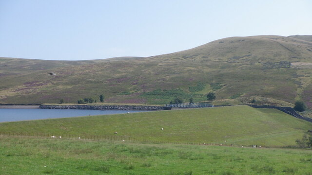
Baddinsgill Reservoir
Baddinsgill Reservoir is a small reservoir in the Scottish Borders area of Scotland close to Carlops, West Linton, and the boundary with Midlothian. It...

West Water Reservoir
West Water Reservoir (sometimes Westwater Reservoir) is an artificial reservoir in the Pentland Hills, Scottish Borders, 3 kilometres (1.9 mi) west of...

West Cairn Hill
West Cairn Hill is a hill in the Pentland Hills range of Scotland. With a height of 562 m (1,844 ft), it is the fifth highest elevation and lies on the...

Cauldstane Slap
Cauldstane Slap is a pass located in the Pentland Hills of Scotland. It marks the border between the neighboring council areas of West Lothian and Scottish...
Pentland Hills
The Pentland Hills are a range of hills southwest of Edinburgh, Scotland. The range is around twenty miles (thirty kilometres) in length, and runs southwest...

East Cairn Hill
East Cairn Hill is a hill in the Pentland Hills range of Scotland. With a height of 567 m (1,860 ft), it is the highest hill in Edinburgh and is located...
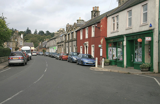
West Linton
West Linton (Scottish Gaelic: Liontan Ruairidh) is a village and civil parish in southern Scotland, on the A702. It was formerly in the county of Peeblesshire...
Nearby Amenities
Located within 500m of 55.777928,-3.4201695Have you been to Byrehope Mount?
Leave your review of Byrehope Mount below (or comments, questions and feedback).