Brawns Dod

Hill, Mountain in Peeblesshire

Scotland

Brawns Dod

Ruins of Over Menzion An old sheep farm surrounded by forest.
Ruins of Over Menzion Credit: wrobison

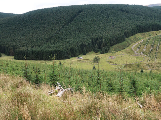
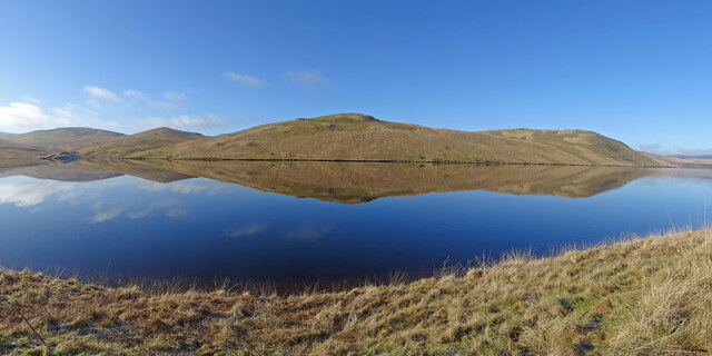
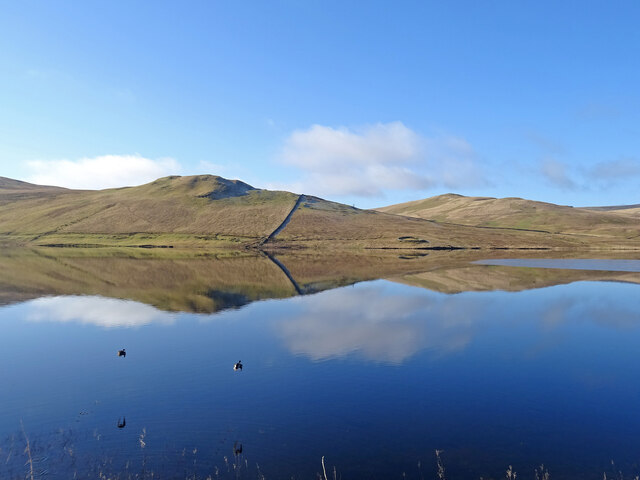
Brawns Dod is a prominent hill located in Peeblesshire, Scotland. Rising to a height of approximately 656 feet (200 meters), it forms part of the stunning landscape of the Scottish Borders region. Situated near the village of Broughton, Brawns Dod offers breathtaking panoramic views of the surrounding countryside.

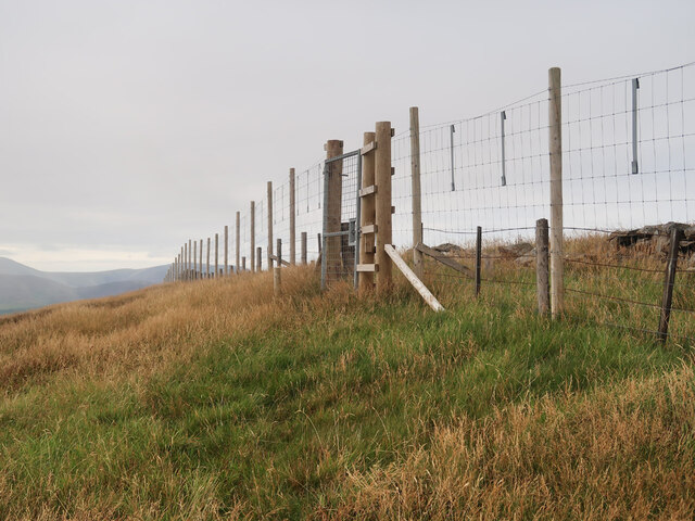
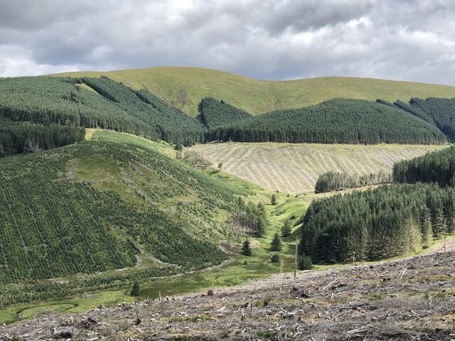
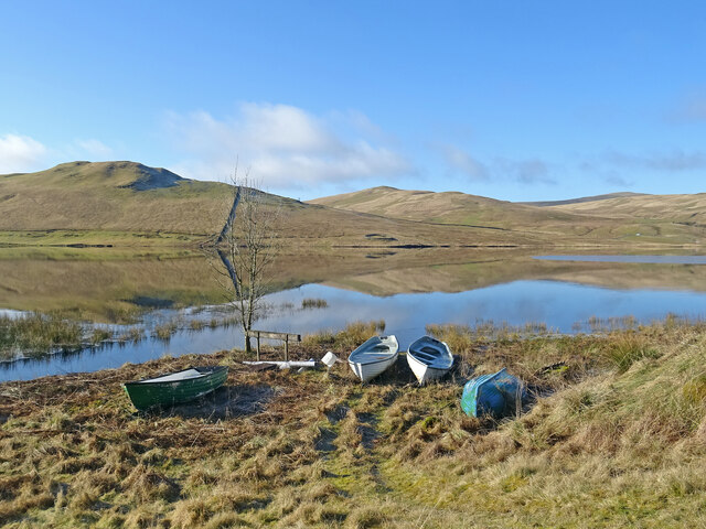
The hill is known for its distinctive conical shape, with a gentle slope leading up to its summit. The terrain is predominantly grassy, making it relatively easy to hike or climb. As a result, Brawns Dod is a popular destination for outdoor enthusiasts, providing an excellent opportunity for leisurely walks and picnics.

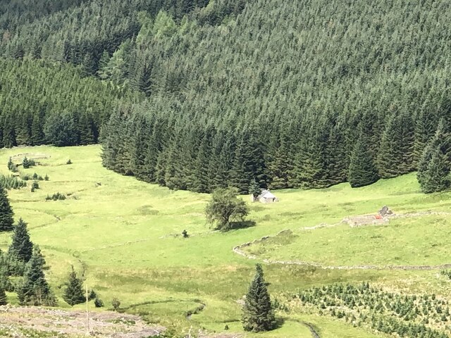
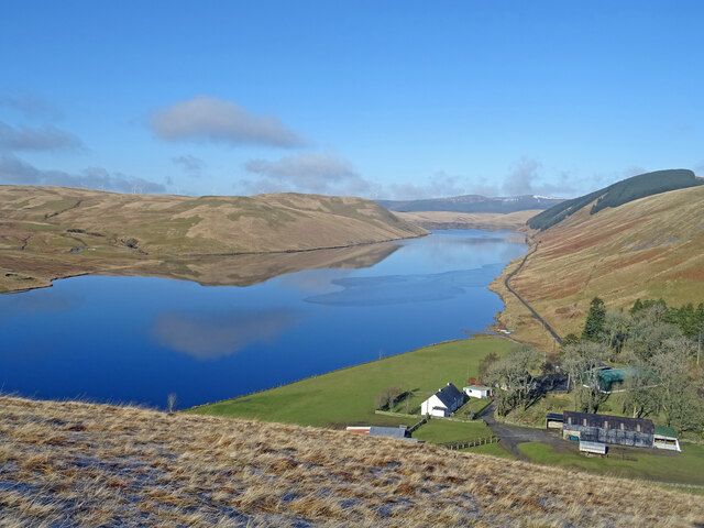
From the top of Brawns Dod, visitors can enjoy sweeping vistas of the rolling hills, lush farmland, and picturesque valleys that characterize the region. On clear days, it is even possible to catch a glimpse of the nearby Pentland Hills to the north.

The hill is also home to a diverse range of flora and fauna, with several species of birds and wildflowers thriving in its surroundings. It is not uncommon to spot red grouse, skylarks, and meadow pipits during a visit to Brawns Dod.

Overall, Brawns Dod offers a tranquil and scenic escape from the hustle and bustle of everyday life. Whether one is a nature lover, a keen hiker, or simply seeking a peaceful spot to unwind, this hill in Peeblesshire is a must-visit destination in the Scottish Borders.

If you have any feedback on the listing, please let us know in the comments section below.

Brawns Dod Images

Images are sourced within 2km of 55.459667/-3.4143373 or Grid Reference NT1019. Thanks to Geograph Open Source API. All images are credited.

Ruins of Over Menzion An old sheep farm surrounded by forest.
Ruins of Over Menzion
An old sheep farm surrounded by forest.
Young trees on Scaddow Knowes Looking across Laird's Cleuch from the Silver Jubilee Road.
Young trees on Scaddow Knowes
Looking across Laird's Cleuch from the Silver Jubilee Road.
Deer fence and gate near Garelet Hill trig point On the boundary of the Borders Forest Trust land
Deer fence and gate near Garelet Hill trig point
On the boundary of the Borders Forest Trust land
On the summit of Garelet Hill - Trig Point & view to Broad Law This trig point is severely eroded.
On the summit of Garelet Hill - Trig Point & view to Broad Law
This trig point is severely eroded.
Head of Glencotho Young trees on a  hillside above Talla Reservoir.
Head of Glencotho
Young trees on a hillside above Talla Reservoir.
Silver Jubilee Road The logging road loop at the col with Colin Hill and Garelet Hill.  The views over Talla Reservoir stop or start here.
Silver Jubilee Road
The logging road loop at the col with Colin Hill and Garelet Hill. The views over Talla Reservoir stop or start here.
Menzion Forest Across the headwaters of the Menzion Burn to a distant Hart Fell.
Menzion Forest
Across the headwaters of the Menzion Burn to a distant Hart Fell.
Above the Auchenmade Burn On the Silver Jubilee Road, Menzion.
Above the Auchenmade Burn
On the Silver Jubilee Road, Menzion.
Silver Jubilee Road, Laird's Cleuch Headwater of the Menzion Burn with the ridge above Gameshope in the background.
Silver Jubilee Road, Laird's Cleuch
Headwater of the Menzion Burn with the ridge above Gameshope in the background.
Silver Jubilee Road, Laird's Cleuch Across Lairds Cleuch to further along the loop road.
Silver Jubilee Road, Laird's Cleuch
Across Lairds Cleuch to further along the loop road.
Bike on the Silver Jubilee Road A great wee gravel ride, but do it soon.  Last time I was here I saw a lot of spruce.  This time the forestry cycle allowed some amazing views from high in the Tweedsmuir Hills and there were no forestry operations or hostile signage.
Bike on the Silver Jubilee Road
A great wee gravel ride, but do it soon. Last time I was here I saw a lot of spruce. This time the forestry cycle allowed some amazing views from high in the Tweedsmuir Hills and there were no forestry operations or hostile signage.
Over Menzion Ruin, a relic from sheep farming here.
Over Menzion
Ruin, a relic from sheep farming here.
Menzion Forest View towards Broad Law.
Menzion Forest
View towards Broad Law.
Mezion Burn and Garelet Hill Forestry, Menzion.
Mezion Burn and Garelet Hill
Forestry, Menzion.
Hills Reflected Fruid Reservoir acting like a mirror on the first day of meteorological spring.
Across the reservoir is Shiel Dod, while to the left are Macrule Hill and Ballaman Hill. A grand day to be out in Borders hills.
Hills Reflected
Fruid Reservoir acting like a mirror on the first day of meteorological spring. Across the reservoir is Shiel Dod, while to the left are Macrule Hill and Ballaman Hill. A grand day to be out in Borders hills.
Taking Flight Two geese have just taken flight after I surprised them at the edge of Fruid Reservoir. The hill to the left of the prominent wall is called Big Knock.
Taking Flight
Two geese have just taken flight after I surprised them at the edge of Fruid Reservoir. The hill to the left of the prominent wall is called Big Knock.
Boats by the Water Several dinghies are pulled up on the shores of Fruid Reservoir. The hills are reflected on the first day of spring.
Boats by the Water
Several dinghies are pulled up on the shores of Fruid Reservoir. The hills are reflected on the first day of spring.
Above Fruid Looking down the length of Fruid Reservoir from the lower slopes of Strawberry Hill with Fruid Farm at the bottom of the picture.
Above Fruid
Looking down the length of Fruid Reservoir from the lower slopes of Strawberry Hill with Fruid Farm at the bottom of the picture.
Show me another place!

Brawns Dod is located at Grid Ref: NT1019 (Lat: 55.459667, Lng: -3.4143373)

Unitary Authority: The Scottish Borders

Police Authority: The Lothians and Scottish Borders

What 3 Words

///landlords.middle.spirit. Near Moffat, Dumfries & Galloway

Nearby Locations

Brawns Dod

Related Wikis

Fruid Reservoir

Fruid is a small reservoir in the Scottish Borders area of Scotland, UK, near Menzion. It is formed by damming the Fruid Water, and supplements the contents...

Talla Reservoir

Talla Reservoir, located a mile from Tweedsmuir, Scottish Borders, Scotland, is an earth-work dam fed by Talla Water. The reservoir is supplemented by...

Talla Water

Talla Water is a river in the Scottish Borders area of Scotland, near Tweedsmuir. It feeds the Talla Reservoir, and is a tributary of the River Tweed....

Fruid Water

Fruid Water is a river in the Scottish Borders area of Scotland. The valley it occupies has been dammed to form the Fruid Reservoir. The river is a tributary...

Victoria Lodge railway station

Victoria Lodge railway station served the village of Tweedsmuir, Scottish Borders, Scotland from 1897 to 1905 on the Symington, Biggar and Broughton Railway...

Hawkshaw, Scottish Borders

Hawkshaw is a pair of semi-detached houses on the River Tweed, two miles southwest of Tweedsmuir in the Scottish Borders. Historically part of Peeblesshire...

Menzion

Menzion, sometimes Minzion is a small settlement in southern Scotland near Tweedsmuir in the Scottish Borders, in the valley of the River Tweed. ��2...

Moffat Hills

The Moffat Hills are a range of hills in the Southern Uplands of Scotland. They form a roughly triangular shape with a west facing side, a north facing...

Have you been to Brawns Dod?

Leave your review of Brawns Dod below (or comments, questions and feedback).