Blue Cairn

Hill, Mountain in Dumfriesshire

Scotland

Blue Cairn

Between  Blue Cairn and Greygill Head A gentle broad ridge with a contrast between grass on one side of the fence and dyke and heather on the eastern side. The heather soon gives way to Sitka spruce.
Between Blue Cairn and Greygill Head Credit: Richard Webb

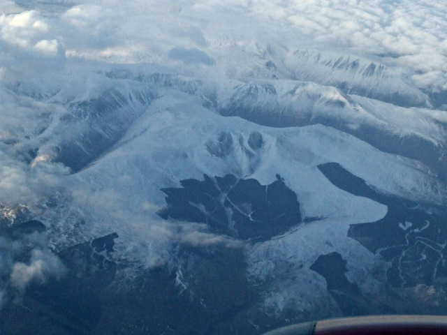
Blue Cairn is a prominent hill situated in Dumfriesshire, a county in the south-west of Scotland. Rising to an elevation of approximately 638 meters (2,093 feet), it is classified as a mountain rather than a hill according to the Scottish Mountaineering Club's criteria. The distinctive name "Blue Cairn" is derived from the blue-colored rock formations that can be found on its slopes, adding to its visual appeal.

Located within the Southern Uplands, Blue Cairn offers breathtaking views of the surrounding countryside. On clear days, visitors can enjoy panoramic vistas of the rolling hills, lush valleys, and distant peaks, providing ample opportunities for photographers and nature enthusiasts alike.

The hill is accessible via a well-marked trail that begins at a designated parking area. The path is relatively moderate, making it suitable for walkers of various fitness levels. As hikers ascend, they will encounter diverse flora and fauna, including heather, mosses, and various bird species.

Blue Cairn is also known for its historical significance. It is said to have served as a landmark for travelers in ancient times, guiding them through the region. Today, remnants of old cairns, or man-made piles of stones, can still be found at the summit, serving as a reminder of the hill's past.

Overall, Blue Cairn offers visitors an opportunity to immerse themselves in the natural beauty and rich history of Dumfriesshire. Whether it's for a challenging hike, a serene picnic spot, or simply to enjoy the stunning views, Blue Cairn is a destination that truly showcases the allure of the Scottish countryside.

If you have any feedback on the listing, please let us know in the comments section below.

Blue Cairn Images

Images are sourced within 2km of 55.382948/-3.414486 or Grid Reference NT1010. Thanks to Geograph Open Source API. All images are credited.

Between  Blue Cairn and Greygill Head A gentle broad ridge with a contrast between grass on one side of the fence and dyke and heather on the eastern side. The heather soon gives way to Sitka spruce.
Between Blue Cairn and Greygill Head
A gentle broad ridge with a contrast between grass on one side of the fence and dyke and heather on the eastern side. The heather soon gives way to Sitka spruce.
Quarry below Blue Cairn Beyond the grassed over quarry, Swatte Fell emerges from the clag.
Quarry below Blue Cairn
Beyond the grassed over quarry, Swatte Fell emerges from the clag.
Forestry, Birnock Water A 1980s  and therefore still uniform forestry plantation upstream of Moffat.  It is getting less common seeing a big block without felled areas now, as big plantations fell out of favour in the mid 1980s. They are being planted again though, very much back in favour.
Forestry, Birnock Water
A 1980s and therefore still uniform forestry plantation upstream of Moffat. It is getting less common seeing a big block without felled areas now, as big plantations fell out of favour in the mid 1980s. They are being planted again though, very much back in favour.
The road in the Birnock Water forest A wet dark afternoon with a bit of a feel of Winter about it.
The road in the Birnock Water forest
A wet dark afternoon with a bit of a feel of Winter about it.
Whitehope Knowe Looking North from Well Rig.
Whitehope Knowe
Looking North from Well Rig.
The new route to Hartfell Spa Just beyond the deer fence, a landslide has blocked the old path to the Spa.  This track continues much higher up the hillside before descending nearer to the Spa.
The new route to Hartfell Spa
Just beyond the deer fence, a landslide has blocked the old path to the Spa. This track continues much higher up the hillside before descending nearer to the Spa.
The new path descends towards the Auchencat Burn Just beyond the deer fence, a landslide has blocked the old path to the Spa. This new route continues much higher up the hillside before descending nearer to the Spa.
The new path descends towards the Auchencat Burn
Just beyond the deer fence, a landslide has blocked the old path to the Spa. This new route continues much higher up the hillside before descending nearer to the Spa.
The deep cleft of the Spa Well Burn In this cleft lies Hartfell Spa.
The deep cleft of the Spa Well Burn
In this cleft lies Hartfell Spa.
Disused fanks by the Auchencat Burn
Snowdrift remnant on Well Rig Sheep on top of the slope gives some idea of scale
Snowdrift remnant on Well Rig
Sheep on top of the slope gives some idea of scale
Swatte Fell from the air A snow covered Swatte Fell, just north of Moffat, viewed from a Glasgow bound flight from Luton. The long finger of Roundstonefoot plantation can be seen on the right.
Swatte Fell from the air
A snow covered Swatte Fell, just north of Moffat, viewed from a Glasgow bound flight from Luton. The long finger of Roundstonefoot plantation can be seen on the right.
Swatte Fell from the air A snow covered Swatte Fell, just north of Moffat, viewed from a Glasgow bound flight from Luton. The long finger of Roundstonefoot plantation can be seen in the lower right corner.
Swatte Fell from the air
A snow covered Swatte Fell, just north of Moffat, viewed from a Glasgow bound flight from Luton. The long finger of Roundstonefoot plantation can be seen in the lower right corner.
Looking towards my ski tracks between Newton Fell and Hartfell Spa
Hart Fell Exposures along the Spa Well Burn show up well.
Hart Fell
Exposures along the Spa Well Burn show up well.
Summit of Swatte Fell Small cairn on an area of peat hags marks the summit of the hill.
Summit of Swatte Fell
Small cairn on an area of peat hags marks the summit of the hill.
Fence junction on Swatte Fell Most of the flat summit area of the hill is covered in peat hags.
Fence junction on Swatte Fell
Most of the flat summit area of the hill is covered in peat hags.
Blue Cairn Gentle moorland on the east side of Swatte Fell. Quite a contrast to much of the hill which can be extremely steep.
Blue Cairn
Gentle moorland on the east side of Swatte Fell. Quite a contrast to much of the hill which can be extremely steep.
Quadbike track on Blue Cairn An easy way up or down Swatte Fell.
Quadbike track on Blue Cairn
An easy way up or down Swatte Fell.
Show me another place!

Blue Cairn is located at Grid Ref: NT1010 (Lat: 55.382948, Lng: -3.414486)

Unitary Authority: Dumfries and Galloway

Police Authority: Dumfries and Galloway

What 3 Words

///vanilla.dentures.rapport. Near Moffat, Dumfries & Galloway

Nearby Locations

Blue Cairn Nubbery Moss

Related Wikis

Hart Fell

Hart Fell is a hill in the Moffat Hills range, part of the Southern Uplands of Scotland. It lies north of the town of Moffat on the border with the Scottish...

Crown of Scotland (hill)

The Crown of Scotland is a hill in the Scottish Borders, Scotland. At a relatively small elevation from the surrounding peaks, it is situated to the north...

Devil's Beef Tub

The Devil's Beef Tub (Marquis of Annandale's Beef-Tub, Beef-Stand, MacCleran's Loup) is a deep, dramatic hollow in the hills north of the Scottish town...

Moffat Hills

The Moffat Hills are a range of hills in the Southern Uplands of Scotland. They form a roughly triangular shape with a west facing side, a north facing...

Annanhead Hill

Annanhead Hill is a 478-metre (1,568 ft) summit in the Moffat Hills of Scotland. It lies on the boundary between the Scottish Borders and Dumfries and...

Greenhillstairs

Greenhillstairs is the steep B719 road north of Moffat in Dumfries and Galloway, Scotland. The road, about 3 miles long, leaves the A701 Moffat to Edinburgh...
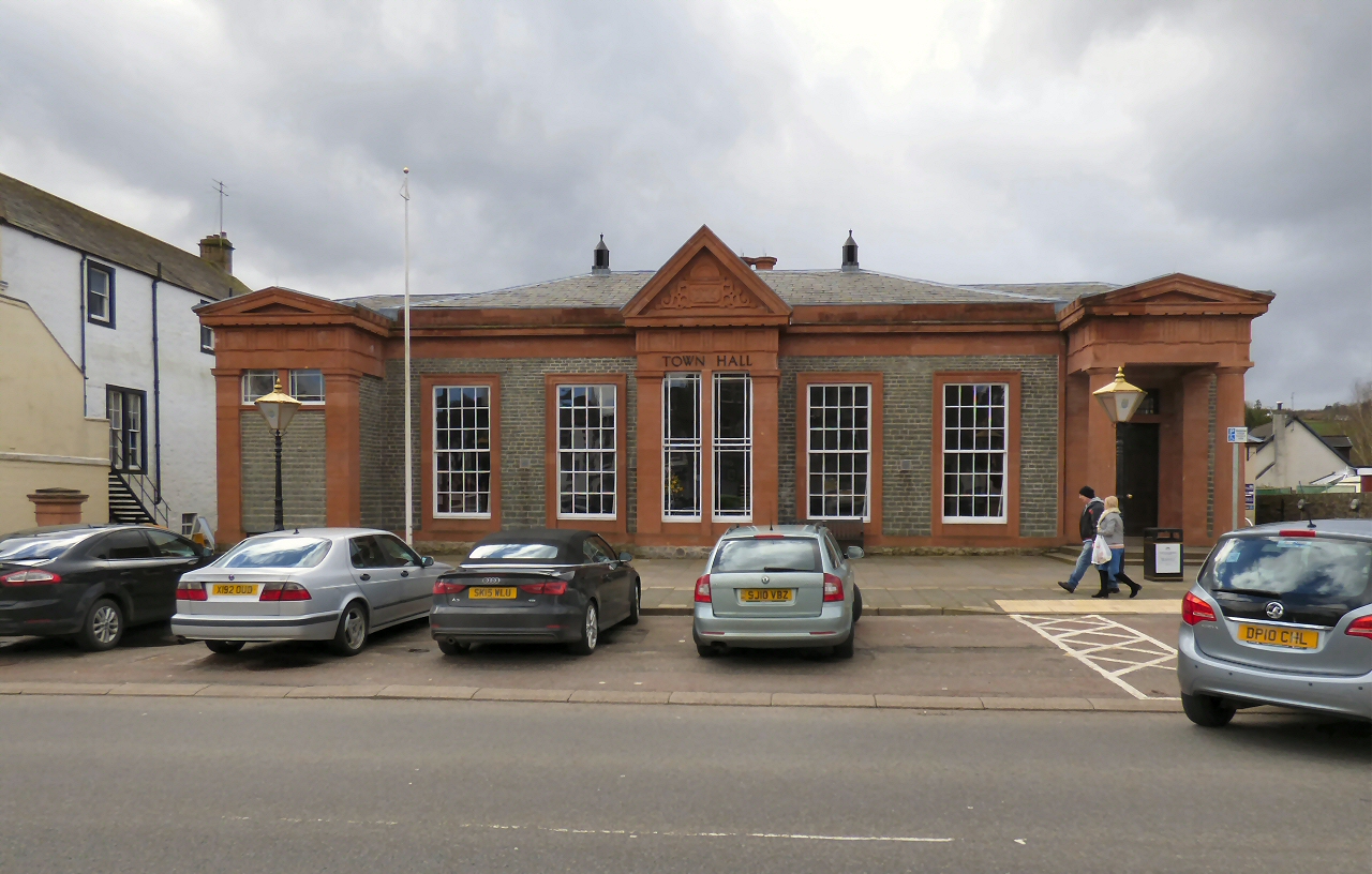
Moffat Town Hall

Moffat Town Hall is a municipal building in the High Street in Moffat, Dumfries and Galloway, Scotland. The structure, which is used as community events...

Moffat

Moffat (Scottish Gaelic: Mofad) is a burgh and parish in Dumfriesshire, now part of the Dumfries and Galloway local authority area in Scotland. It lies...

Have you been to Blue Cairn?

Leave your review of Blue Cairn below (or comments, questions and feedback).