Càrn na Feannaige

Hill, Mountain in Banffshire

Scotland

Càrn na Feannaige

Water of Caiplich Water of Caiplich looking upstream from the junction of the Allt Preas a’ Choin
Water of Caiplich Credit: Paul Atkinson

Càrn na Feannaige is a prominent hill located in Banffshire, Scotland. It is part of the Grampian Mountains range and stands at an elevation of approximately 790 meters (2,592 feet). The hill is situated near the town of Dufftown and is a popular destination for hikers and outdoor enthusiasts.

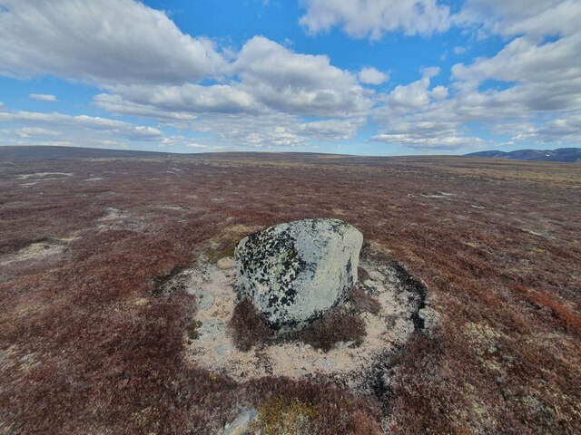
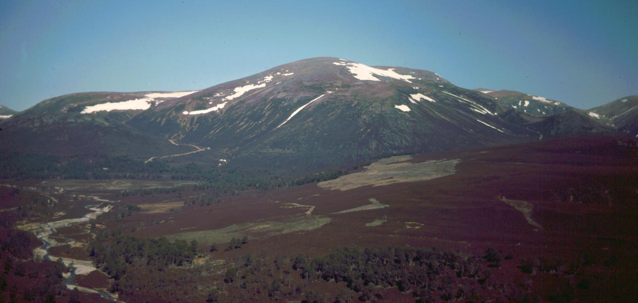
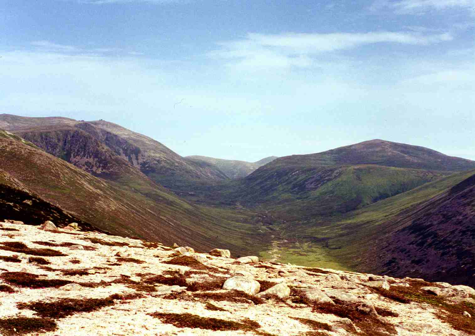
Càrn na Feannaige offers breathtaking views of the surrounding countryside, including the nearby Cairngorms National Park. Its distinct peak is easily recognizable, with its rocky terrain and rugged slopes. The hill is covered in heather and grass, providing a picturesque and serene setting for visitors.

Hiking to the summit of Càrn na Feannaige is a challenging but rewarding experience. The trail can be accessed from various points, with the most common starting point being the car park near Ben Rinnes. From there, hikers can follow a well-marked path that gradually ascends towards the summit.

As visitors make their way up, they can enjoy the diverse flora and fauna that inhabit the area. The hill is home to a variety of bird species, including ptarmigans and red grouse. On clear days, it is possible to spot other nearby peaks, such as Ben Rinnes and Ben Aigan.

Càrn na Feannaige is an ideal destination for nature lovers and those seeking an adventurous hike. Its stunning vistas, rich biodiversity, and challenging trails make it a must-visit location for anyone exploring the Banffshire region.

If you have any feedback on the listing, please let us know in the comments section below.

Càrn na Feannaige Images

Images are sourced within 2km of 57.157504/-3.4884271 or Grid Reference NJ1008. Thanks to Geograph Open Source API. All images are credited.

Water of Caiplich Water of Caiplich looking upstream from the junction of the Allt Preas a’ Choin
Water of Caiplich
Water of Caiplich looking upstream from the junction of the Allt Preas a’ Choin
Water of Caiplich Water of Caiplich looking down stream from the junction of the Allt Preas a’ Choin
Water of Caiplich
Water of Caiplich looking down stream from the junction of the Allt Preas a’ Choin
Looking towards the Feith Buidhe Looking down a gentle slope covered in low heather to the Feith Buidhe. Across the stream is Carn na Feannaige.
Looking towards the Feith Buidhe
Looking down a gentle slope covered in low heather to the Feith Buidhe. Across the stream is Carn na Feannaige.
Peat Hags above the Feith Buidhe Mercifully dry peat hags on the gentle slopes above the Feith Buidhe burn.
Peat Hags above the Feith Buidhe
Mercifully dry peat hags on the gentle slopes above the Feith Buidhe burn.
Feith Buidhe joining Water of Caiplich in Cairngorm National Park
Rocky promontory on Water of Caiplich in Cairngorm National Park
Water of Caiplich upstream of rocky promontory in Cairngorm National Park
Rocky scarp on north bank of Water of Caiplich in Cairngorm National Park
Pink boulders at bend in Water of Caiplich in Cairngorm National Park Pink rock in this geologic area is unremarkable but I was intrigued by their concentration at this point in the river. Probably most of the rocks for the length of the course are this colour but these ones have been more recently polished by violent water movement in this location.
Pink boulders at bend in Water of Caiplich in Cairngorm National Park
Pink rock in this geologic area is unremarkable but I was intrigued by their concentration at this point in the river. Probably most of the rocks for the length of the course are this colour but these ones have been more recently polished by violent water movement in this location.
Tiny tributary joining Water of Caiplich in Cairngorm National Park
Water of Caiplich in Cairngorm National Park
Feith an t-Sluichd joining Water of Caiplich in Cairngorm National Park
First or last trees on Water of Caiplich in Cairngorm National Park Their cliffside residence is key to their survival!
First or last trees on Water of Caiplich in Cairngorm National Park
Their cliffside residence is key to their survival!
Catchment of Feith Buidhe above Water of Caiplich west of Tomintoul
Boulder on western slopes of Carn na Feannaige near Tomintoul
Isolated rock This rock is quite likely the most distinctive feature within a 500m radius
Isolated rock
This rock is quite likely the most distinctive feature within a 500m radius
Isolated rock
Isolated rock
Isolated rock Looking north
Isolated rock
Looking north
Show me another place!

Càrn na Feannaige is located at Grid Ref: NJ1008 (Lat: 57.157504, Lng: -3.4884271)

Unitary Authority: Moray

Police Authority: North East

What 3 Words

///approve.tacky.jingles. Near Inverey, Aberdeenshire

Related Wikis

Bynack More

Bynack More (Scottish Gaelic: A' Bheithneag Mhòr or Beinn Bheithneag) is a Scottish Mountain that is situated in the Cairngorms range, 16 kilometres east...

Ben Avon

Ben Avon (Scottish Gaelic: Beinn Athfhinn, 'mountain of the Avon') is a mountain in the Cairngorms of Scotland. It is a sprawling mountain with a broad...

Beinn a' Bhùird

Beinn a' Bhùird is a Munro in the Cairngorm mountain range of Scotland. In Watson (1975) the author suggests the mountain should be named Beinn Bòrd -...

Beinn a' Chaorainn (Cairngorms)

Beinn a' Chaorainn is a Scottish mountain in the heart of the Cairngorms range. It is quite a remote hill, being located roughly 19 kilometres south east...

Nearby Amenities

Located within 500m of 57.157504,-3.4884271
Càrn na Feannaige
Ele: 729
Natural: peak
Lat/Long: 57.1574278/-3.4886711
The data included in this document is from www.openstreetmap.org. The data is made available under ODbL.

Have you been to Càrn na Feannaige?

Leave your review of Càrn na Feannaige below (or comments, questions and feedback).