Horsted Keynes

Settlement in Sussex Mid Sussex

England

Horsted Keynes

Horsted Keynes 'Clan Line', during the Bluebell Railway's 'Giants of Steam' weekend.
Horsted Keynes Credit: Peter Trimming

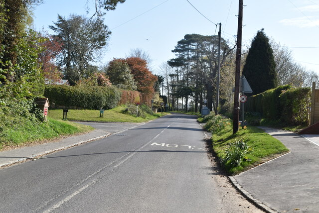
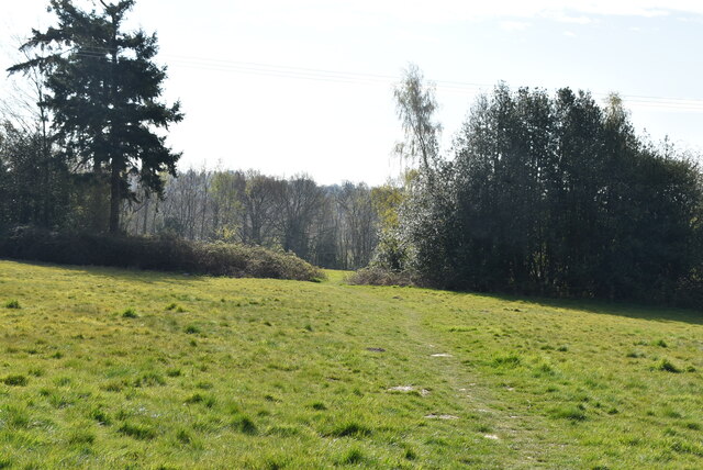
Horsted Keynes is a charming village located in the county of Sussex, England. Situated approximately 30 miles south of London, it forms part of the Mid Sussex District. The village is nestled amidst picturesque countryside, boasting rolling hills, verdant fields, and abundant woodlands.

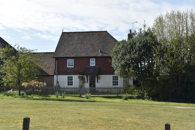
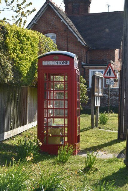
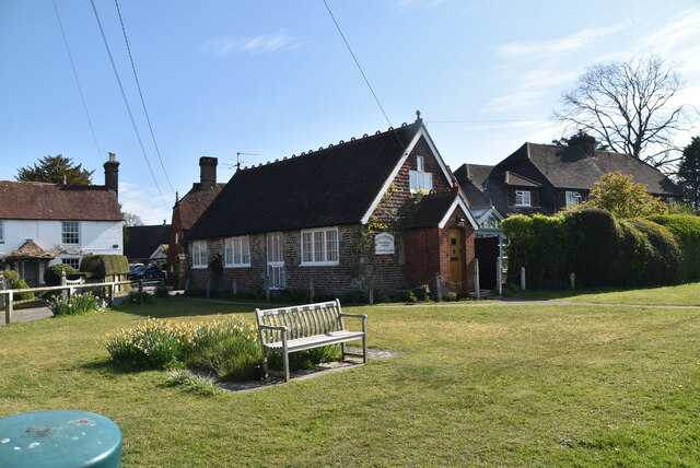
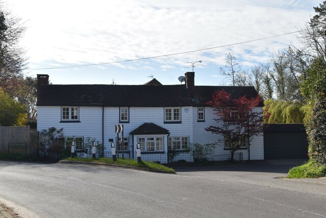
With a population of around 1,200 residents, Horsted Keynes exudes a tranquil and close-knit atmosphere. Its idyllic setting attracts visitors seeking a peaceful retreat from the nearby urban hustle and bustle. The village is renowned for its quintessential English charm, characterized by traditional thatched cottages, well-preserved historic buildings, and an unspoiled rural landscape.

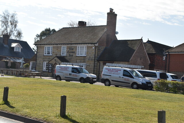
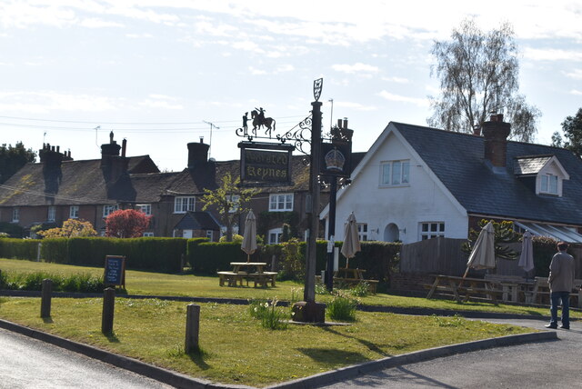
One of the notable landmarks in Horsted Keynes is the St. Giles Church, a stunning medieval structure dating back to the 12th century. The church's architectural beauty and historical significance make it a popular attraction for both locals and tourists. Additionally, the village is home to several quaint pubs and tea rooms, providing visitors with an opportunity to indulge in traditional English fare and hospitality.

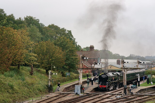
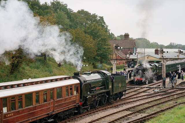
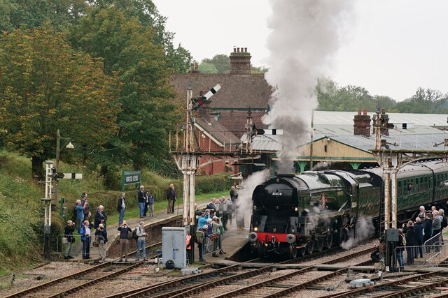
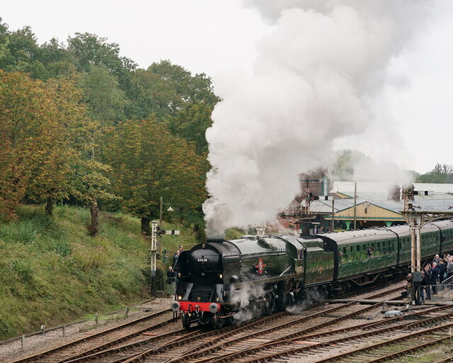
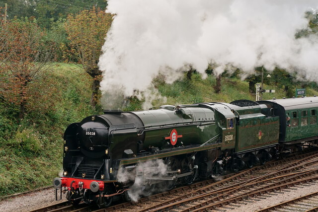
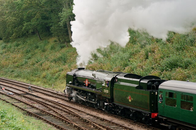
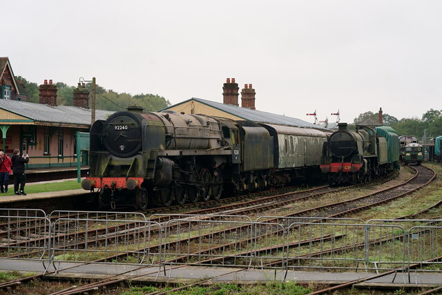
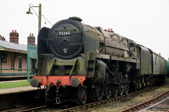
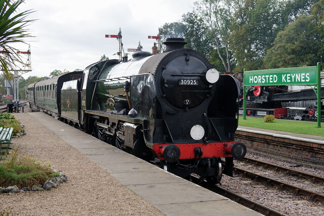
Horsted Keynes is also famous for its connection to the steam railway. The Bluebell Railway, a heritage line running from Sheffield Park to East Grinstead, passes through the village. The railway station in Horsted Keynes has been immaculately restored, giving visitors the chance to experience the nostalgia of a bygone era.

Overall, Horsted Keynes offers a peaceful retreat in the heart of the Sussex countryside, with its picturesque landscapes, rich history, and traditional English charm.

If you have any feedback on the listing, please let us know in the comments section below.

Horsted Keynes Images

Images are sourced within 2km of 51.036482/-0.027918 or Grid Reference TQ3828. Thanks to Geograph Open Source API. All images are credited.

Horsted Keynes 'Clan Line', during the Bluebell Railway's 'Giants of Steam' weekend.
Horsted Keynes
'Clan Line', during the Bluebell Railway's 'Giants of Steam' weekend.
Horsted Keynes 'Cheltenham' arrives with a train from East Grinstead, whilst 'Clan Line' stands at the platform, during the Bluebell Railway's 'Giants of Steam' weekend.
Horsted Keynes
'Cheltenham' arrives with a train from East Grinstead, whilst 'Clan Line' stands at the platform, during the Bluebell Railway's 'Giants of Steam' weekend.
Horsted Keynes 'Clan Line', preparing to depart for East Grinstead, during the Bluebell Railway's 'Giants of Steam' weekend.
Horsted Keynes
'Clan Line', preparing to depart for East Grinstead, during the Bluebell Railway's 'Giants of Steam' weekend.
Horsted Keynes 'Clan Line', departing for East Grinstead, during the Bluebell Railway's 'Giants of Steam' weekend.
Horsted Keynes
'Clan Line', departing for East Grinstead, during the Bluebell Railway's 'Giants of Steam' weekend.
Horsted Keynes 'Clan Line', departing for East Grinstead, during the Bluebell Railway's 'Giants of Steam' weekend.
Horsted Keynes
'Clan Line', departing for East Grinstead, during the Bluebell Railway's 'Giants of Steam' weekend.
Horsted Keynes 'Clan Line', departing for East Grinstead, during the Bluebell Railway's 'Giants of Steam' weekend.
Horsted Keynes
'Clan Line', departing for East Grinstead, during the Bluebell Railway's 'Giants of Steam' weekend.
Horsted Keynes 9F and U class locomotives, awaiting eventual overhaul and return to service.
Horsted Keynes
9F and U class locomotives, awaiting eventual overhaul and return to service.
Horsted Keynes 9F class locomotive, awaiting eventual overhaul and return to service.
Horsted Keynes
9F class locomotive, awaiting eventual overhaul and return to service.
Bluebell Railway No.30925 'Cheltenham', arriving at Horsted Keynes with a train for East Grinstead.
Bluebell Railway
No.30925 'Cheltenham', arriving at Horsted Keynes with a train for East Grinstead.
Yew Tree Cottage Listed buildings and structures are officially designated as being of special architectural, historical or cultural significance. There are over half a million listed structures in the United Kingdom, covered by around 375,000 listings.
Listed status is more commonly associated with buildings or groups of buildings, however it can cover many other structures, including bridges, headstones, steps, ponds, monuments, walls, phone boxes, wrecks, parks, and heritage sites, and in more recent times a road crossing (Abbey Road) and graffiti art (Banksy 'Spy-booth') have been included.

In England and Wales there are three main listing designations;
Grade I (2.5%) - exceptional interest, sometimes considered to be internationally important.
Grade II* (5.5%) - particularly important buildings of more than special interest. 
Grade II (92%) - nationally important and of special interest. 

There are also locally listed structures (at the discretion of local authorities) using A, B and C designations.

In Scotland three classifications are also used but the criteria are different. There are around 47,500 Listed buildings.
Category A (8%)- generally equivalent to Grade I and II* in England and Wales
Category B (51%)- this appears generally to cover the ground of Grade II, recognising national importance.
Category C (41%)- buildings of local importance, probably with some overlap with English Grade II.

In Northern Ireland the criteria are similar to Scotland, but the classifications are:
Grade A (2.3%)
Grade B+ (4.7%)
Grade B (93%)

Read more at Wikipedia <span class="nowrap"><a title="http://en.wikipedia.org/wiki/Listed_building" rel="nofollow ugc noopener" href="http://en.wikipedia.org/wiki/Listed_building">Link</a><img style="margin-left:2px;" alt="External link" title="External link - shift click to open in new window" src="https://s1.geograph.org.uk/img/external.png" width="10" height="10"/></span>
Yew Tree Cottage
Listed buildings and structures are officially designated as being of special architectural, historical or cultural significance. There are over half a million listed structures in the United Kingdom, covered by around 375,000 listings. Listed status is more commonly associated with buildings or groups of buildings, however it can cover many other structures, including bridges, headstones, steps, ponds, monuments, walls, phone boxes, wrecks, parks, and heritage sites, and in more recent times a road crossing (Abbey Road) and graffiti art (Banksy 'Spy-booth') have been included. In England and Wales there are three main listing designations; Grade I (2.5%) - exceptional interest, sometimes considered to be internationally important. Grade II* (5.5%) - particularly important buildings of more than special interest. Grade II (92%) - nationally important and of special interest. There are also locally listed structures (at the discretion of local authorities) using A, B and C designations. In Scotland three classifications are also used but the criteria are different. There are around 47,500 Listed buildings. Category A (8%)- generally equivalent to Grade I and II* in England and Wales Category B (51%)- this appears generally to cover the ground of Grade II, recognising national importance. Category C (41%)- buildings of local importance, probably with some overlap with English Grade II. In Northern Ireland the criteria are similar to Scotland, but the classifications are: Grade A (2.3%) Grade B+ (4.7%) Grade B (93%) Read more at Wikipedia LinkExternal link
The Green Man Listed buildings and structures are officially designated as being of special architectural, historical or cultural significance. There are over half a million listed structures in the United Kingdom, covered by around 375,000 listings.
Listed status is more commonly associated with buildings or groups of buildings, however it can cover many other structures, including bridges, headstones, steps, ponds, monuments, walls, phone boxes, wrecks, parks, and heritage sites, and in more recent times a road crossing (Abbey Road) and graffiti art (Banksy 'Spy-booth') have been included.

In England and Wales there are three main listing designations;
Grade I (2.5%) - exceptional interest, sometimes considered to be internationally important.
Grade II* (5.5%) - particularly important buildings of more than special interest. 
Grade II (92%) - nationally important and of special interest. 

There are also locally listed structures (at the discretion of local authorities) using A, B and C designations.

In Scotland three classifications are also used but the criteria are different. There are around 47,500 Listed buildings.
Category A (8%)- generally equivalent to Grade I and II* in England and Wales
Category B (51%)- this appears generally to cover the ground of Grade II, recognising national importance.
Category C (41%)- buildings of local importance, probably with some overlap with English Grade II.

In Northern Ireland the criteria are similar to Scotland, but the classifications are:
Grade A (2.3%)
Grade B+ (4.7%)
Grade B (93%)

Read more at Wikipedia <span class="nowrap"><a title="http://en.wikipedia.org/wiki/Listed_building" rel="nofollow ugc noopener" href="http://en.wikipedia.org/wiki/Listed_building">Link</a><img style="margin-left:2px;" alt="External link" title="External link - shift click to open in new window" src="https://s1.geograph.org.uk/img/external.png" width="10" height="10"/></span>
The Green Man
Listed buildings and structures are officially designated as being of special architectural, historical or cultural significance. There are over half a million listed structures in the United Kingdom, covered by around 375,000 listings. Listed status is more commonly associated with buildings or groups of buildings, however it can cover many other structures, including bridges, headstones, steps, ponds, monuments, walls, phone boxes, wrecks, parks, and heritage sites, and in more recent times a road crossing (Abbey Road) and graffiti art (Banksy 'Spy-booth') have been included. In England and Wales there are three main listing designations; Grade I (2.5%) - exceptional interest, sometimes considered to be internationally important. Grade II* (5.5%) - particularly important buildings of more than special interest. Grade II (92%) - nationally important and of special interest. There are also locally listed structures (at the discretion of local authorities) using A, B and C designations. In Scotland three classifications are also used but the criteria are different. There are around 47,500 Listed buildings. Category A (8%)- generally equivalent to Grade I and II* in England and Wales Category B (51%)- this appears generally to cover the ground of Grade II, recognising national importance. Category C (41%)- buildings of local importance, probably with some overlap with English Grade II. In Northern Ireland the criteria are similar to Scotland, but the classifications are: Grade A (2.3%) Grade B+ (4.7%) Grade B (93%) Read more at Wikipedia LinkExternal link
Telephone kiosk Horsted Keynes is a village in the Mid Sussex District of West Sussex. It has a village green, two pubs, post office, village store & village hall.
Wikipedia: <span class="nowrap"><a title="https://en.wikipedia.org/wiki/Horsted_Keynes" rel="nofollow ugc noopener" href="https://en.wikipedia.org/wiki/Horsted_Keynes">Link</a><img style="margin-left:2px;" alt="External link" title="External link - shift click to open in new window" src="https://s1.geograph.org.uk/img/external.png" width="10" height="10"/></span>
Telephone kiosk
Horsted Keynes is a village in the Mid Sussex District of West Sussex. It has a village green, two pubs, post office, village store & village hall. Wikipedia: LinkExternal link
The Crown Inn The most popular pub name in the UK. Representative of the King or Queen.
The Crown Inn
The most popular pub name in the UK. Representative of the King or Queen.
Village sign
Village sign
Mission Hall, Horsted Keynes Horsted Keynes is a village in the Mid Sussex District of West Sussex. It has a village green, two pubs, post office, village store & village hall.
Wikipedia: <span class="nowrap"><a title="https://en.wikipedia.org/wiki/Horsted_Keynes" rel="nofollow ugc noopener" href="https://en.wikipedia.org/wiki/Horsted_Keynes">Link</a><img style="margin-left:2px;" alt="External link" title="External link - shift click to open in new window" src="https://s1.geograph.org.uk/img/external.png" width="10" height="10"/></span>
Mission Hall, Horsted Keynes
Horsted Keynes is a village in the Mid Sussex District of West Sussex. It has a village green, two pubs, post office, village store & village hall. Wikipedia: LinkExternal link
Hope Cottages Horsted Keynes is a village in the Mid Sussex District of West Sussex. It has a village green, two pubs, post office, village store & village hall.
Wikipedia: <span class="nowrap"><a title="https://en.wikipedia.org/wiki/Horsted_Keynes" rel="nofollow ugc noopener" href="https://en.wikipedia.org/wiki/Horsted_Keynes">Link</a><img style="margin-left:2px;" alt="External link" title="External link - shift click to open in new window" src="https://s1.geograph.org.uk/img/external.png" width="10" height="10"/></span>
Hope Cottages
Horsted Keynes is a village in the Mid Sussex District of West Sussex. It has a village green, two pubs, post office, village store & village hall. Wikipedia: LinkExternal link
Birchgrove Rd
Birchgrove Rd
Footpath to Danehill Lane
Show me another place!

Horsted Keynes is located at Grid Ref: TQ3828 (Lat: 51.036482, Lng: -0.027918)

Administrative County: West Sussex

District: Mid Sussex

Police Authority: Sussex

What 3 Words

///rummage.punctured.panel. Near Horsted Keynes, West Sussex

Related Wikis

Horsted Keynes

Horsted Keynes KAYNZ is a village and civil parish in the Mid Sussex District of West Sussex, England. The village is about 5 miles (8 km) north east...

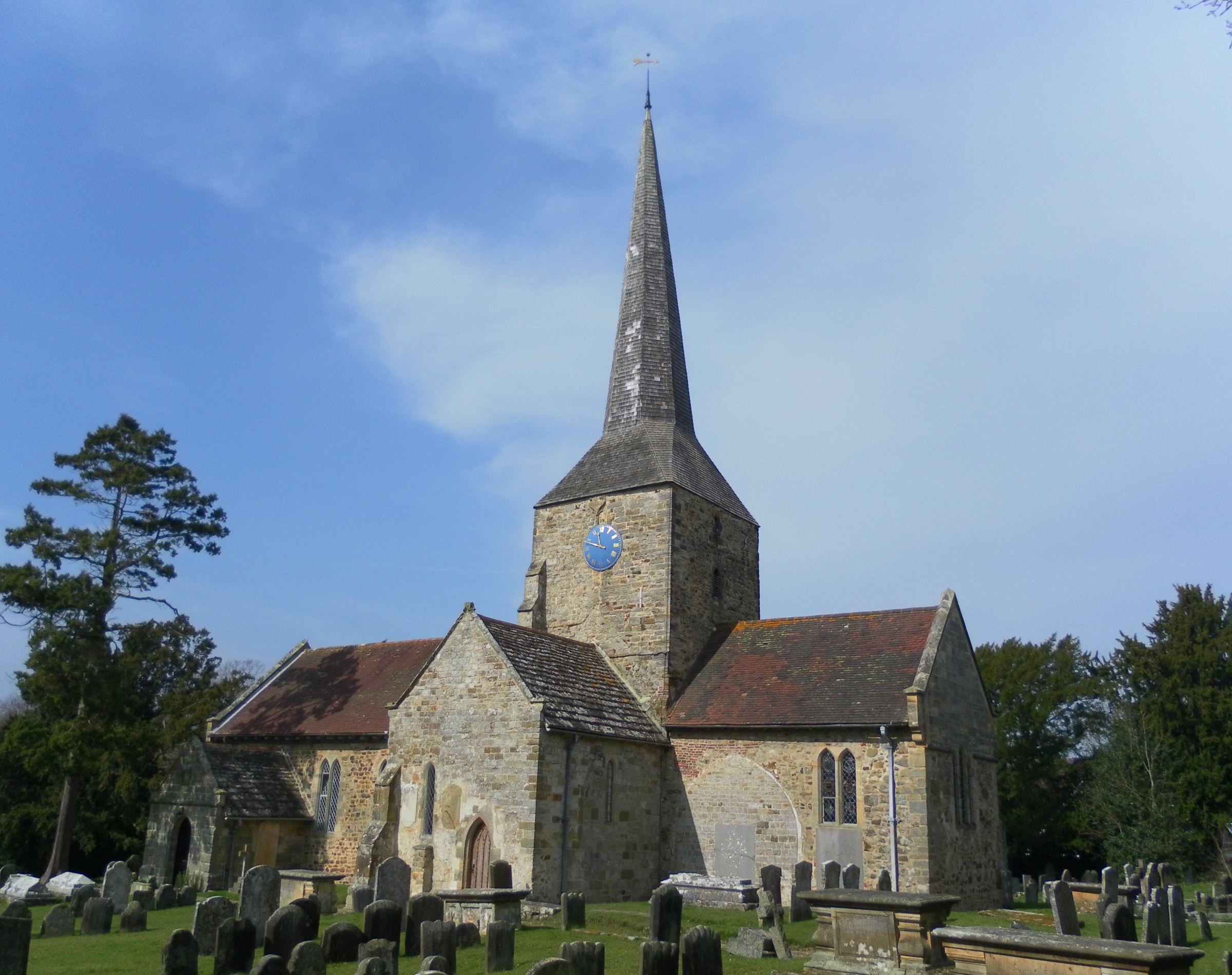
St Giles' Church, Horsted Keynes

St Giles' Church is an Anglican church in the village of Horsted Keynes in Mid Sussex, one of seven local government districts in the English county of...

Lindfield & High Weald (electoral division)

Lindfield & High Weald is an electoral division of West Sussex in the United Kingdom, and returns one member to sit on West Sussex County Council. ��2...

Bluebell Railway

The Bluebell Railway is an 11 mi (17.7 km) heritage line almost entirely in West Sussex in England, except for Sheffield Park which is in East Sussex....

Horsted Keynes railway station

Horsted Keynes railway station is a preserved railway station on the Bluebell Railway in Sussex. The station has been used as a shooting location in several...

Freshfield Lane

Freshfield Lane is a 17-hectare (42-acre) geological Site of Special Scientific Interest east of Haywards Heath in West Sussex. It is a Geological Conservation...

Danehill, East Sussex

Danehill is a village in East Sussex, England. == Religious sites == There are two Anglican churches in the parish: one at Danehill (dedicated to All Saints...

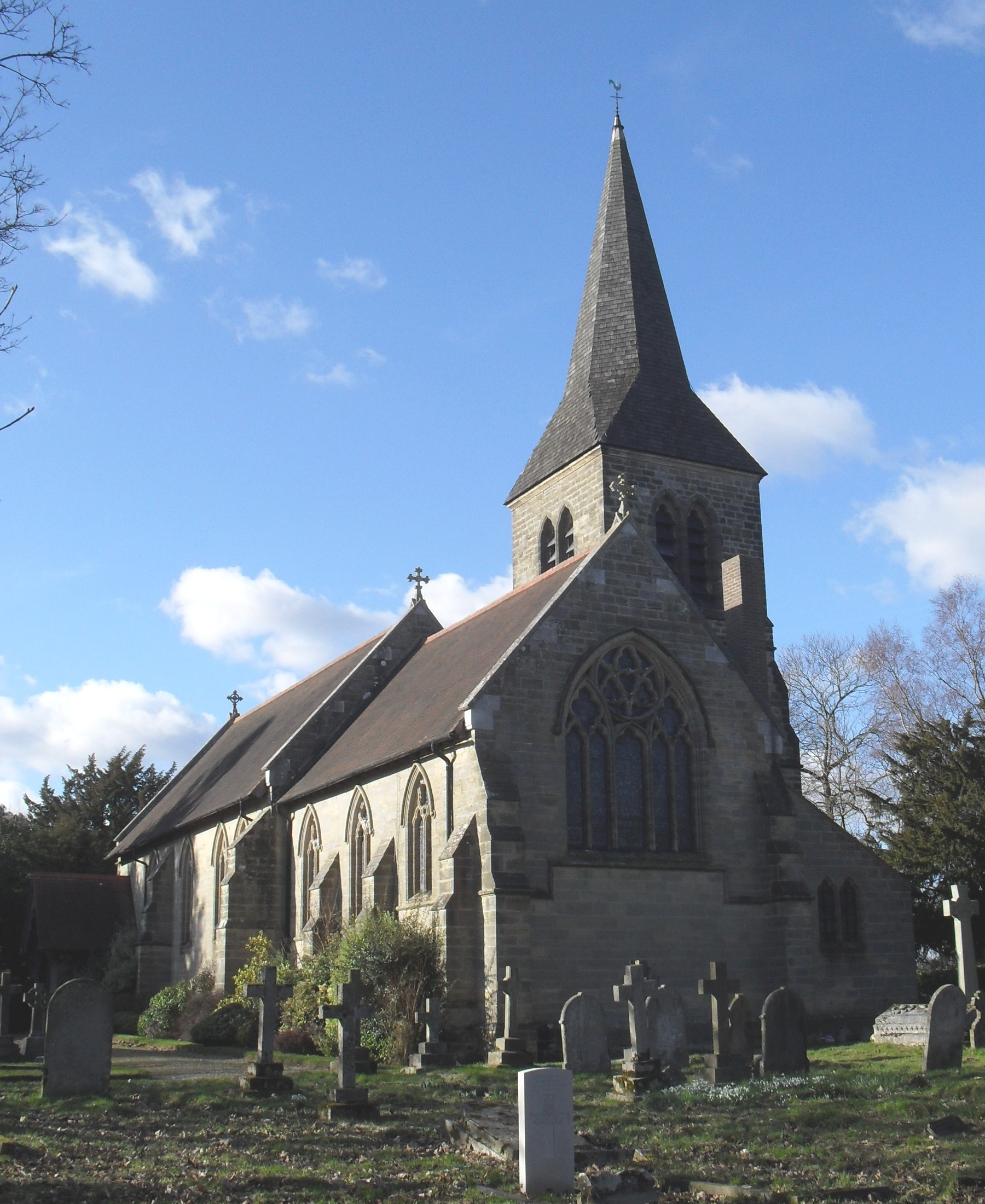
All Saints Church, Highbrook

All Saints Church is an Anglican church in the hamlet of Highbrook in Mid Sussex, one of seven local government districts in the English county of West...

Nearby Amenities

Located within 500m of 51.036482,-0.027918
Post Box
Collection Times: Mo-Fr 09:00; Sa 07:00
Operator: Royal Mail
Post Box Type: wall
Ref: RH17 88D
Royal Cypher: EIIR
Royal Cypher Wikidata: Q33102113
Lat/Long: 51.0333338/-0.0314319
Barrier: bollard
Motor Vehicle: no
Lat/Long: 51.0367075/-0.0277642
Post Box
Collection Times: Mo-Fr 09:00; Sa 07:00
Operator: Royal Mail
Post Box Type: wall
Ref: RH17 148D
Royal Cypher: EIIR
Royal Cypher Wikidata: Q33102113
Lat/Long: 51.0362832/-0.0224766
Bus Stop
Lucas
Naptan AtcoCode: 4400EG0010
Naptan Bearing: SW
Naptan CommonName: Lucas
Naptan Indicator: o/s Police House
Naptan Landmark: Lucas Farm
Naptan NaptanCode: wsxampaw
Naptan Street: Bonfire Lane
Naptan Verified: no
Public Transport: platform
Source: naptan_import
Lat/Long: 51.0363892/-0.0217571
Bus Stop
Church Lane
Bus: yes
Naptan AtcoCode: 4400EG0011
Naptan Bearing: E
Naptan BusStopType: CUS
Naptan CommonName: Lewes Road
Naptan Indicator: adj
Naptan Landmark: Lewes Road
Naptan NaptanCode: wsxampda
Naptan ShortCommonName: Horsted Keynes
Naptan Street: Station Road
Naptan Verified: no
Public Transport: platform
Source: naptan_import
Lat/Long: 51.036606/-0.0283392
Barrier: kissing_gate
Lat/Long: 51.0385929/-0.0280609
Barrier: kissing_gate
Lat/Long: 51.0395256/-0.0324622
Barrier: kissing_gate
Lat/Long: 51.0375148/-0.022148
Barrier: kissing_gate
Lat/Long: 51.0371837/-0.0236145
Bus Stop
Church Lane
Public Transport: platform
Lat/Long: 51.0367133/-0.0276492
Defibrillator
Defibrillator Location: In porch of Horsted Club hall (the chapel-like building)
Emergency: defibrillator
Indoor: no
Lat/Long: 51.0362557/-0.027596
Post Box
Brand: Royal Mail
Brand Wikidata: Q638098
Brand Wikipedia: en:Royal Mail
Collection Times: Mo-Fr 16:30; Sa 09:45
Operator: Royal Mail
Operator Wikidata: Q638098
Post Box Type: wall
Ref: RH17 90
Royal Cypher: GR
Royal Cypher Wikidata: Q33102273
Lat/Long: 51.0365235/-0.0274391
Barrier: kissing_gate
Lat/Long: 51.033979/-0.0241793
Bench
Lat/Long: 51.0365425/-0.0277734
Bench
Lat/Long: 51.0362729/-0.0279017
Bench
Lat/Long: 51.0358359/-0.0275381
Bench
Lat/Long: 51.0359044/-0.0277285
Bench
Lat/Long: 51.0364683/-0.0264965
Bench
Lat/Long: 51.0366425/-0.0250266
Bench
Lat/Long: 51.0347751/-0.0285247
Bench
Lat/Long: 51.0397233/-0.0275172
Bench
Lat/Long: 51.040002/-0.0271718
Bench
Lat/Long: 51.0402444/-0.0278958
Bench
Lat/Long: 51.0367539/-0.0276364
Bench
Lat/Long: 51.0404349/-0.0269743
Public Bookcase
Booth: K6
Disused Amenity: telephone
Man Made: telephone_box
Public Bookcase Type: phone_box
Lat/Long: 51.0367428/-0.0263096
Bench
Lat/Long: 51.0367276/-0.0262761
Advertising: board
Lat/Long: 51.0367445/-0.0262184
Horsted Keynes
Man Made: village_sign
Lat/Long: 51.0365606/-0.0257437
Power: pole
Lat/Long: 51.0341875/-0.0333257
Power: pole
Lat/Long: 51.0332469/-0.0318738
The data included in this document is from www.openstreetmap.org. The data is made available under ODbL.

Have you been to Horsted Keynes?

Leave your review of Horsted Keynes below (or comments, questions and feedback).